References
Municipalities and communities of Alleghany County, Virginia, United States | ||
|---|---|---|
| Towns | 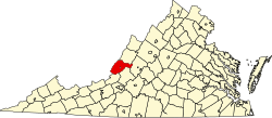 | |
| CDPs | ||
| Other communities |
| |
37°45′19″N79°54′59″W / 37.75528°N 79.91639°W
Rich Patch Mines is an unincorporated community in Alleghany County, Virginia, United States.
Municipalities and communities of Alleghany County, Virginia, United States | ||
|---|---|---|
| Towns | | |
| CDPs | ||
| Other communities |
| |
37°45′19″N79°54′59″W / 37.75528°N 79.91639°W