Related Research Articles
New Hill is an unincorporated community located in southwestern Wake County, North Carolina, United States, at the crossroads of old U.S. 1, New Hill Olive Chapel Road and New Hill Holleman Road. New Hill is located along the original alignment of the New Hope Valley Railway between Durham and Bonsal.
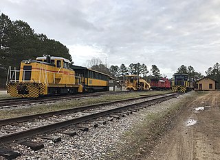
Bonsal is an unincorporated community in the New Hill, North Carolina postal district, in extreme southwestern Wake County, North Carolina. Bonsal was a railroad junction between the Durham & South Carolina Railroad (D&SC) and the Seaboard Air Line Railroad. The New Hope Valley Railroad route was abandoned in the late 1970s.

The Little Cacapon River is a 25.1-mile-long (40.4 km) free-flowing tributary of the Potomac River in the center of Hampshire County, West Virginia. Via the Potomac River, its waters are part of the Chesapeake Bay watershed, leading to the Atlantic Ocean. The Little Cacapon enters the Potomac at an elevation of 499 feet (152 m) near the community of Little Cacapon. For the majority of its course the Little Cacapon is a shallow non-navigable stream. It has been historically referred to as both Little Cacapehon and Little Capecaphon. The name is pronounced kə-KAY-pən or KAY-pən.
Carpenter is a small unincorporated community located in western Wake County, North Carolina. Carpenter is centered on the intersection of Carpenter-Upchurch Road and Morrisville-Carpenter Road just east of North Carolina Highway 55. Most of Carpenter has been annexed by the Town of Cary. The community was named for William Carpenter, the first settler in the area in 1865. Carpenter was a stop on the former Durham and Southern Railway. Part of the community also includes the Carpenter Historic District, which was created in 2000.
Stony Knoll is a small unincorporated community in the Rockford Township of Surry County, North Carolina.
Copeland is a small unincorporated community in the Rockford Township of Surry County, North Carolina.
Kennebec is a small unincorporated community in southern Wake County, North Carolina, United States, along the border of Harnett County. The community is situated along North Carolina Highway 55 and is the site of the Fuquay-Angier Airfield. Much of the area has been recently annexed by the Harnett County town of Angier. Kennebec was named for Kennebec County, Maine. The community was also a stop on the former Durham and Southern Railway.
Cape Fear is an unincorporated community located along North Carolina Highway 210 in the Neills Creek Township of Harnett County, North Carolina, United States, near the town of Lillington. It is a part of the Dunn Micropolitan Area, which is also a part of the greater Raleigh–Durham–Cary Combined Statistical Area (CSA) as defined by the United States Census Bureau.
Barclaysville is an unincorporated community located in Harnett County, North Carolina, United States, near the town of Angier. It is a part of the Dunn Micropolitan Area, which is also a part of the greater Raleigh–Durham–Cary Combined Statistical Area (CSA) as defined by the United States Census Bureau.
Kipling is an unincorporated community located along U.S. Route 401 in the Hectors Creek Township of Harnett County, North Carolina, United States, situated between the communities of Cape Fear and Chalybeate Springs north of Lillington. It is a part of the Dunn Micropolitan Area, which is also a part of the greater Raleigh–Durham–Cary Combined Statistical Area (CSA) as defined by the United States Census Bureau.
Duncan is an unincorporated community located in the Buckhorn Township of Harnett County, North Carolina, United States. It is a part of the Dunn Micropolitan Area, which is also a part of the greater Raleigh–Durham–Cary Combined Statistical Area (CSA) as defined by the United States Census Bureau.
Fonville is an unincorporated community located along U.S. Highway 401 in the Stewarts Creek Township of Harnett County, North Carolina between Bunnlevel and the Cumberland County town of Linden.
Riley Hill, North Carolina, United States, is an unincorporated community in mideastern Wake County. It is at the southern end of Broughton Road, on Riley Hill Road and is approximately six miles northeast of Knightdale, and approximately 3.8 miles north of the intersection of U.S. 64/264, and Business U.S. 64.
Chestnut Hills was an unincorporated community in Wake County, North Carolina and is now within the city limits of Raleigh. It lies at an elevation of 348 feet. It was begun in the early 1950s and was one of North Raleigh's original suburbs, preceding North Hills and North Hills Estates, although the total area is now referred to as North Hills, part of Midtown. This area is now undergoing changes as some of the original ranch and split-level homes are being torn down and replaced by homes with a minimum of 2,800 square feet (260 m2).
New Hope is an unincorporated community in southern Franklin County, North Carolina, United States. It is located west-northwest of Bunn, at an elevation of 364 feet. The primary cross roads where the community is located are N.C. Highway 98, Clifton Pond Road and Bethlehem Church Road.
Pearces is an unincorporated community in southern Franklin County, North Carolina, United States. It is located southwest of Bunn, at an elevation of 354 feet. The primary cross roads where the community is located are Pearces Road, Perry Road and Adna Pearce Road.
Riley is an unincorporated community in southern Franklin County, North Carolina, United States near the Wake County line. It is located west-southwest of Bunn, at an elevation of 387 feet. The primary cross roads where the community is located are Pilot-Riley Road, Bethlehem Church Road and Old Halifax Road.
Halls Crossroads is an unincorporated community in south central Franklin County, North Carolina, United States. It is located north of Bunn, at an elevation of 302 feet. The primary cross roads where the community is located are N.C. Highway 39, Pearces Road and Ferrells Bridge Road.
Five Points is an unincorporated community in southern Franklin County, North Carolina, United States. It is located west of Bunn, at an elevation of 282 feet. The primary cross roads where the community is located are N.C. Highway 98, Pearces Road and John Winstead Road.
New Light is an unincorporated community in New Light Township, Wake County, North Carolina, United States. It is located at the intersection of Purnell Rd, Stony Hill Rd, and Mangum Dairy Rd. It has an elevation of 413 ft. As of January 2019, New Light Township has a population of 8,687 and a median home value of $380,000.
References
Coordinates: 35°58′54″N78°36′43″W / 35.9815381°N 78.6119469°W
Municipalities and communities of Wake County, North Carolina, United States | ||
|---|---|---|
| Cities |  | |
| Towns | ||
| Townships | ||
| Unincorporated communities | ||
| Footnotes | ‡This populated place also has portions in an adjacent county or counties | |