Stony Brook is a hamlet and census-designated place (CDP) in the Town of Brookhaven in Suffolk County, New York, on the North Shore of Long Island. Begun in the colonial era as an agricultural enclave, the hamlet experienced growth first as a resort town and then to its current state as one of Long Island's major tourist towns and centers of education. Despite being referred to as a village by residents and tourists alike, Stony Brook has never been legally incorporated by the state. The population was 13,740 at the 2010 census.

The State University of New York at Stony Brook, commonly known as Stony Brook University (SBU) and SUNY Stony Brook, is a public sea-grant and space-grant research university in Stony Brook, New York. It is one of four university centers of the State University of New York system.

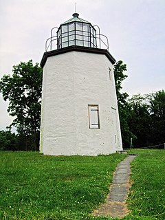
Stony Point is a triangle-shaped town in Rockland County, New York, United States. It is part of the New York City Metropolitan Area. The town is located north of the town of Haverstraw, east and south of Orange County, New York, and west of the Hudson River and Westchester County. The population was 15,059 at the 2010 census. The name of the town is derived from a prominent projection into the Hudson River.

Sussex County is a rural county located in the Commonwealth of Virginia. As of the 2010 census, the population was 12,087. Its county seat is Sussex. It was formed in 1754 from Surry County. The county is named after the county of Sussex, England.

State Route 150 is a state highway in the U.S. state of Virginia. Known as Chippenham Parkway, the state highway runs 15.19 miles (24.45 km) from Interstate 95 (I-95) and SR 895 in Bensley north to Parham Road and River Road near Tuckahoe in Henrico County. SR 150 is a four- to six-lane circumferential highway that connects the Chesterfield County suburbs of Richmond with western Henrico County and, via SR 895, eastern Henrico County and Richmond International Airport. The highway is a freeway except for a short stretch east of SR 147 in Richmond. SR 150 has junctions with all of the radial highways south of the James River, including I-95, U.S. Route 1, US 301, US 360, US 60, and SR 76.

Skyland Resort is a hotel and resort in Shenandoah National Park in Virginia.

The Cacapon River, located in the Appalachian Mountains of West Virginia's Eastern Panhandle region, is an 81.0-mile-long (130.4 km) river known for its fishing, boating, wildlife, and scenery. As part of the Potomac River watershed, it is an American Heritage River.

Mount Storm Lake – also known as New Stony River Reservoir – is a 1,200 acres (4.9 km2) reservoir created in 1965 on the Stony River in Grant County, West Virginia. It serves as a cooling pond for the Dominion 1.6 gigawatt Mount Storm Power Station, which provides electricity to more than two million customers in Northern Virginia. The reservoir stands at an altitude of 3,244 feet (989 m).

Largent is an unincorporated community village in Morgan County and partly Hampshire County in the U.S. state of West Virginia. Largent is located on the Cacapon River, about 18 miles southwest of Berkeley Springs along Cacapon Road. It is located by Old Enon Cemetery, Stony Creek, and the Cacapon River. Largent's original town name was Enon. It was most likely renamed when Postal Service found another town of Enon elsewhere in the state. The Enon name is found in local church and cemetery names. The Enon school is found on USGS maps from 1914 through 1923. The school has been open at least since the 1930s. The Baileys bought the building in 1958 and it has been a residence since.

Stony Bottom is an unincorporated community located in Pocahontas County, West Virginia, United States. In the early 19th century, the town was known as Seldom Seen. At some point, this was changed to Driftwood by loggers who would drift logs by on the Greenbrier River. By 1908, it took its present name because of all the stones and rocks present in the area. The town currently has seasonal residents, as well as full-time residents and a small church named Alexander Memorial Presbyterian Church. On Labor Day of every year, the small town accommodates hundreds of people for the annual Hunter Reunion, where local resident Homer Hunter invites the community to take part in traditional bluegrass music, food, and fellowship. The town is nestled between the Greenbrier River and the Greenbrier River Trail, suitable for biking, horseback riding, and more. Their Post Office has been closed.

The Nottoway River is in southern Virginia and northeastern North Carolina. It is part of the Chowan River system, which flows into Albemarle Sound in North Carolina.

Brushy Run is an unincorporated community located on U.S. Highway 220 in Pendleton County, West Virginia, United States. Brushy Run lies where North Mill Creek is formed at the confluence of Stony Creek and Brushy Run, from which the community takes its name.

Reddish Knob of Shenandoah Mountain is one of the highest points in Virginia, rising 4,397 feet (1,340 m). A narrow, paved road reaches the summit from Harrisonburg, Virginia.

State Route 40 is a primary state highway in the southern part of the U.S. state of Virginia. It runs from State Route 8 at Woolwine east to State Route 10 at Spring Grove, about half the width of Virginia. It is the longest state-numbered route in Virginia.

Stony Point is an unincorporated community in Albemarle County, Virginia. The region acknowledged as Stony Point includes the historical villages of Proffit and Rosena. The physical core of Stony Point is the Stony Point Volunteer Fire Company, Stony Point Elementary School, and several dozen surrounding homes. A general store is the sole public service. The nearest population centers of any size are Barboursville and Charlottesville, the county seat.

The Hughes River is a 14.0-mile-long (22.5 km) river in Madison, Rappahannock, and Culpeper counties in the U.S. state of Virginia. The river rises on the east slope of Stony Man mountain in Shenandoah National Park and flows southeast past the village of Nethers to join the Hazel River west of Boston, Virginia. Via the Hazel River and the Rappahannock River, the Hughes River is part of the Chesapeake Bay watershed.

DeWitt is an unincorporated community in Dinwiddie County, Virginia, United States. DeWitt is located on U.S. Route 1 6 miles (9.7 km) northeast of McKenney.
Stony Mill is an unincorporated community in Pittsylvania County, in the U.S. state of Virginia.
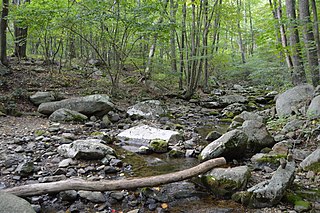
The Stony River is a 26.7-mile-long (43.0 km) tributary of the North Branch Potomac River in Grant County in West Virginia's Eastern Panhandle. The Stony River joins with the North Branch at the Mineral County border. Its source lies north of the Dolly Sods Wilderness on the Tucker County border in the Allegheny Front.
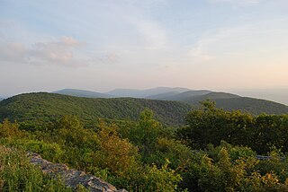
Stony Man Mountain, also known as Stony Man, is a mountain in Shenandoah National Park, Virginia and is the most northerly 4,000 foot peak in the Blue Ridge Mountains. Its maximum elevation is 4,011 feet or 1,223 meters above sea level with a clean prominence of 651 feet. The mountain is co-located in Madison and Page counties and is easily accessed from Skyline Drive by hiking trails. Along with Hawksbill Mountain, it is only one of two peaks in the park higher than 4,000 feet. The shortest route to the summit is from the Skyland Resort and gains less than 400 vertical feet in about 1 kilometer. A longer, more challenging, route is from the Skyline Drive trail head at about milepost 39 of the Skyline Drive and gains almost 800 feet. The peak sits just southeast of the Appalachian Trail (AT) but the summit is accessible from the AT by previously mentioned spur trails. On the upper slopes of Stony Man one can see a few red spruce and balsam fir trees which typically grow in more northerly latitudes. The mountain is composed of ancient basalt which was metamorphosed into Greenstone through heat and pressure.


