Related Research Articles

Pin Oak is an unincorporated community in Hampshire County in the U.S. state of West Virginia. Pin Oak is located along West Virginia Route 29 between Paw Paw and Forks of Cacapon. Pin Oak is roughly centered at the intersection of Pin Oak Road and Cabin Run Road with West Virginia Route 29. The old Pinoak School lies north of this intersection.
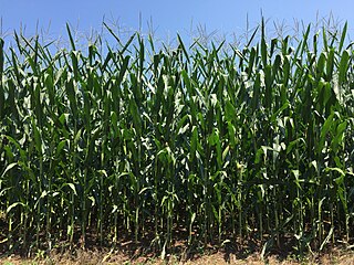
Buffalo Creek is a 4.1-mile-long (6.6 km) free-flowing tributary stream of the South Branch Potomac River, itself a tributary of the Potomac River, making it a part of the Chesapeake Bay watershed. Buffalo Creek is located in west-central Hampshire County in the U.S. state of West Virginia. Because the stream flows through several small farms, Buffalo Creek primarily serves agriculture purposes with segments used for livestock watering.

Lacy is an unincorporated community in Halbert Township, Martin County, in the U.S. state of Indiana.
Zion Crossroads is an unincorporated community in Louisa and Fluvanna counties, Virginia, at the intersections of James Madison Highway and Three Notch Road and Interstate 64 in Virginia. The population is unknown, but it will likely be revealed by 2030.
Madison Mills is an unincorporated community located in Madison County, Virginia, United States. It is located at the intersection of U.S. Route 15 and Virginia State Route 230.

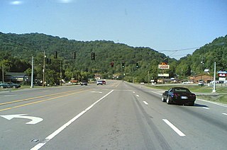
Ruckersville is a census-designated place (CDP) in Greene County, Virginia, United States, located in a rural area north of Charlottesville. The population as of the 2020 Estimate was 1,321, a 17.7% increase from the 2010 census with 1,141. The community lies amidst hills, mountain views, trees, and farmland. It is located at the intersection of two major highways, north–south U.S. Route 29 and east–west U.S. Route 33. It was founded in 1732, by the same family that established Ruckersville, Georgia.
The Middle River is a 70.6-mile-long (113.6 km) river in the U.S. state of Virginia. Flowing entirely within Augusta County, the Middle River joins the North River, which in turn meets the South River at Port Republic to form the South Fork Shenandoah River.
Berrytown is an unincorporated community in Rockingham County, Virginia, United States. Its elevation is 1,010 ft (308 m), and it is located at 38°22′06″N78°39′25″W.
Conicville is an unincorporated community in Shenandoah County, in the U.S. state of Virginia, at the intersection of State Route 42 - Senedo Road and County Road 703 - Conicville Road. Conicville was formerly known as Cabin Hill, as it was a cluster of approximately 22 homes, Christ Church and several, now closed, businesses, and is located at the northeast end of the Cabin Hill ridge that runs parallel to and just east of Swover Creek and State Route 42, from Hudson Crossroads, at SR 42 and CR 720 - Crooked Run Road. The US Geological Survey notes a Bench Mark elevation of 1256 feet, just south of the SR 42 / CR 703 intersection. Latitude 38.83 and longitude -78.69.
Simonson is an unincorporated community in Richmond County, in the U.S. state of Virginia.
Betsy Layne is a census-designated place (CDP) and coal town in Floyd County, Kentucky, United States. It was established in 1875 along the Levisa Fork. The post office opened on May 1, 1908, with Clayton S. Hitchins as postmaster. Its ZIP code is 41605. The 2010 census reported the population to be 688. Stage actress Bette Henritze is a native of Betsy Layne.
Dixie is an unincorporated community in Fluvanna County, in the Commonwealth of Virginia. Dixie is located at the eastern intersection of U.S. 15 and State Rt. 6.

Thorncross is a small hamlet in the South West of the Isle of Wight, England.. It is located near the hamlets of Yafford, Limerstone and the village of Brighstone.
Devils Fork was an unincorporated community located in Wyoming and Raleigh counties, West Virginia, United States.

Ugashik Bay Airport is a public use airport located 11 nautical miles south-southwest of the central business district of Pilot Point, near Ugashik Bay in the Lake and Peninsula Borough of the U.S. state of Alaska. It is owned by the Bureau of Land Management.
Egbert is an unincorporated community in Montgomery County, in the U.S. state of Missouri.
Mikes is a census-designated place (CDP) in Starr County, Texas, United States. This was a new CDP for the 2010 census with a population of 910.
Amos is an unincorporated community in northwest Vernon County, in the U.S. state of Missouri.
Chalybeate Springs is an unincorporated community in Meriwether County, in the U.S. state of Georgia.

Pond was an unincorporated community in western St. Louis County, Missouri, United States. It was located on Old Manchester Road, but has now been wholly incorporated into Wildwood. Pond was home to the Big Chief Hotel, now a historic landmark.
References
Municipalities and communities of Page County, Virginia, United States | ||
|---|---|---|
| Towns |  | |
| Unincorporated communities |
| |
Coordinates: 38°38′01″N78°34′49″W / 38.63361°N 78.58028°W
| | This Page County, Virginia state location article is a stub. You can help Wikipedia by expanding it. |