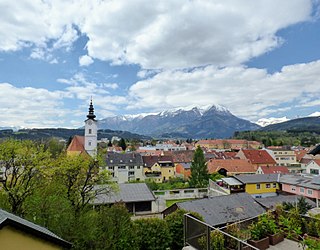
Trofaiach is a municipality in the Leoben district of the state of Styria in Austria, the site of a post World War II British sector displaced persons camp.

Krispl is a municipality in the Hallein district in the Austrian state of Salzburg.

Hallwang is a municipality in the district of Salzburg-Umgebung in the state of Salzburg in Austria and is a good village.

Sankt Georgen is a municipality in the district of Salzburg-Umgebung in the state of Salzburg in Austria.

Windigsteig is a municipality in the district of Waidhofen an der Thaya in the Austrian state of Lower Austria.

Rappottenstein is a municipality in the district of Zwettl in the Austrian state of Lower Austria.

Waldhausen is a municipality in the district of Zwettl in the Austrian state of Lower Austria.

Eggelsberg is a municipality in the district Braunau am Inn in Austrian state of Upper Austria.

Franking is a municipality in the district Braunau am Inn in the Austrian state of Upper Austria.

St. Pantaleon, also Sankt Pantaleon is a municipality in the district Braunau am Inn in Upper Austria, Austria. A monument was erected by the riverlet Moosach in memory of the slave workers engaged there in 1940/41 at the Weyer concentration camp.

Weng im Innkreis is a municipality in the district of Braunau am Inn in the Austrian state of Upper Austria.

Hart bei Graz is a municipality in the district of Graz-Umgebung in the Austrian state Styria.

Kalsdorf bei Graz is a municipality in the district Graz-Umgebung in Styria, Austria.

Wundschuh is a municipality in the district of Graz-Umgebung in the Austrian state of Styria.

Heimschuh is a municipality in the district of Leibnitz in the Austrian state of Styria.

Straß in Steiermark is a municipality in the district of Leibnitz in the Austrian state of Styria.

Wagna is a municipality in the district of Leibnitz in Austrian state of Styria. The ancient Roman town of Flavia Solva lies near what is today Wagna.

Kalwang is a municipality in the district of Leoben in the Austrian state of Styria.

Sankt Michael in Obersteiermark is a municipality in the district of Leoben in the Austrian state of Styria.

Traboch is a municipality in the district of Leoben in the Austrian state of Styria.


