Strata Florida railway station

Last updated

Strata Florida railway station
Station site at Ystrad Meurig - geograph.org.uk - 499020.jpg
Site of Strata Florida station
General information
Location Ystrad Meurig, Ceredigion
Wales
Coordinates 52°17′14″N3°53′28″W / 52.2872°N 3.8912°W / 52.2872; -3.8912
Grid reference SN7109567143
Platforms2
Other information
StatusDisused
History
Original company Manchester and Milford Railway
Pre-grouping Great Western Railway
Key dates
1 September 1866 [1] Opened
22 February 1965 [1] Closed

Strata Florida was a railway station in Wales, on the former Carmarthen to Aberystwyth Line; it served the villages of Ystrad Meurig, Pontrhydfendigaid and Ffair Rhos. The Manchester and Milford Railway (M&MR) opened from Pencader to Aberystwyth on 12 August 1867; [2] the line went into receivership from 1875 to 1900. The site is now part of the Ystwyth Trail, a shared-use rail trail between Aberystwyth and Tregaron.

Contents

History

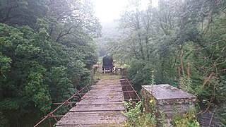
The Ystwyth Trail, near the old station. The Ystwyth Trail at Ystrad Meurig - geograph.org.uk - 1158428.jpg
The Ystwyth Trail, near the old station.

The railway

The M&MR's original plan was to build a line through the mountains. One scheme involved the building of a six-mile tunnel to Llangurig, whence it would proceed to Llanidloes, reaching Manchester over other companies' lines through Moat Lane, Newtown, Welshpool, Oswestry, Whitchurch and Crewe. The required finance was not forthcoming and the prospect of such a route never being economic became apparent; only the section from Llangurig to Llanidloes was actually built. A line towards Aberystwyth, via Llanilar, was opened instead in 1867; from Aberystwyth, access to Moat Lane and onwards could be achieved, after a reversal, by way of Machynlleth and Caersws.

The Great Western Railway (GWR) took over the service in 1906 and fully absorbed the line in 1911. The station, and GWR, passed on to British Railways on nationalisation in 1948.

Although proposed for closure in the Beeching Report, the line closed in December 1964; this was due to serious damage caused by flooding south of Aberystwyth, near Llanilar station, in December 1964. The cost of repairs was deemed unjustified and led to the withdrawal of passenger services in February 1965; however, milk trains continued to run from Carmarthen to nearby Pont Llanio until 1970. [3]

The station

The station was about three miles from the old abbey of Strata Florida; Lord Lisburne of Trawsgoed, an influential local landowner, had tried to have the station named Ystrad Meurig after the village of that name. [4] The station was built at a point where it could serve three local villages, but its location made railway access difficult. The station itself was positioned on a tight curve, although the line from the south took a straight course across the Cors Caron bog. On leaving the station, the branch line towards Aberystwyth climbed out of the Teifi valley at 1:43 for about a mile to the summit of the line, before falling for four miles at 1:41 into the Ystwyth valley and Trawscoed. [5]

The station had two platforms, basic buildings and a signal box. All have been demolished; there are a few artefacts remaining, including the stationmaster's house.

Preceding station Disused railways Following station
Alltddu Halt   Great Western Railway
Carmarthen to Aberystwyth Line
  Caradog Falls Halt
Manchester and Milford Railway
Aberystwyth
BSicon uKBHFa-L.svg
BSicon KBHFa-R.svg
BSicon uSTR2.svg
BSicon STRl.svg
BSicon uUWu3.svg
BSicon exSTR3.svg
BSicon ABZq+l.svg
BSicon CONTfq.svg
BSicon uUWu1.svg
BSicon exSTR+1.svg
BSicon uSTRl+4.svg
BSicon mKRZu.svg
BSicon uCONTfq.svg
Llanrhystyd Road
BSicon exHST.svg
BSicon LSTR.svg
Llanilar
BSicon exHST.svg
BSicon xABZgl+xl.svg
BSicon CONTfq.svg
Felindyffryn Halt
BSicon exHST.svg
BSicon exHST.svg
Llanidloes
Trawscoed
BSicon exHST.svg
BSicon exABZgl.svg
BSicon exCONTfq.svg
Caradog Falls Halt
BSicon exHST.svg
BSicon exSTR.svg
BSicon exSTR2.svg
BSicon exSTRc3.svg
BSicon exLSTRa.svg
BSicon exKHSTe.svg
Llangurig
BSicon exSTRc1.svg
BSicon exSTR2+4.svg
BSicon exSTRc3.svg
BSicon exLSTR.svg
unbuilt connection
15 miles (24 km)
Aberayron
BSicon exKHSTa.svg
BSicon exSTRc1.svg
BSicon exLSTRe.svg
BSicon exSTR+4.svg
Llanerch-Ayron Halt
BSicon exHST.svg
BSicon exHST.svg
Strata Florida
Crossways Halt
BSicon exHST.svg
BSicon exHST.svg
Alltddu Halt
Ciliau-Aeron Halt
BSicon exHST.svg
BSicon exHST.svg
Tregaron
Felin Fach
BSicon exHST.svg
BSicon exHST.svg
Pont Llanio
Talsarn Halt
BSicon exHST.svg
BSicon exHST.svg
Olmarch Halt
Blaenplwyf Halt
BSicon exHST2.svg
BSicon exSTRc3.svg
BSicon exHST.svg
Llangybi
Silian Halt
BSicon exSTRc1.svg
BSicon exHST2+4.svg
BSicon exSTRc3.svg
BSicon exHST.svg
Derry Ormond
Newcastle Emlyn
BSicon exKHSTa.svg
BSicon exSTRc1.svg
BSicon exABZg+4.svg
Pontgoch
BSicon uKHSTa.svg
BSicon exSTR.svg
BSicon exHST.svg
Lampeter
BSicon uLSTR.svg
BSicon lDAMPF.svg
BSicon exSTR.svg
Henllan
BSicon uKHSTe.svg
BSicon exSTR.svg
BSicon exHST.svg
Pencarreg Halt
Alltycefn Tunnel
BSicon exTUNNEL1.svg
BSicon exHST.svg
Llanybydder
Pentrecourt Platform
BSicon exHST.svg
BSicon exHST.svg
Maesycrugiau
Llandyssul
BSicon exHST2.svg
BSicon exSTRc23.svg
BSicon exHST3.svg
Bryn Teifi
Teifi Valley route
(Carmarthen & Cardigan Rly)
BSicon exSTRc1.svg
BSicon exlHST~F.svg
BSicon exABZ+14.svg
BSicon exSTRc4.svg
Pencader Junction
BSicon exlHST~G.svg
BSicon exl-HST.svg
BSicon exSTR.svg
Pencader
BSicon exTUNNEL1.svg
Pencader Tunnel
985 yd
901 m
BSicon exHST.svg
Llanpumpsaint
BSicon exHST.svg
Conwil
Danycoed Halt
BSicon KHSTxa.svg
Llwyfan Cerrig
BSicon HST.svg
BSicon lDAMPF.svg
Bronwydd Arms
BSicon HST.svg
Abergwili Junction
BSicon KHSTxe.svg
BSicon exABZg+l.svg
BSicon exCONTfq.svg
Carmarthen Town
BSicon exHST.svg
BSicon exhbKRZWae.svg
Carmarthen
BSicon KBHFxa.svg
BSicon CONTggq.svg
BSicon ABZqlr.svg
BSicon CONTf@Fq.svg

Today

Much of the route from Aberystwyth to Tregaron has now been turning into a walking and cycling route, the Ystwyth Trail. [6]

Related Research Articles

<span class="mw-page-title-main">Llangurig</span> Human settlement in Wales

Llangurig is both a village and a community in Montgomeryshire, Powys, Wales. The population was 723 in the 2011 UK Census. The community includes the hamlet of Cwmbelan.

<span class="mw-page-title-main">Pencader, Carmarthenshire</span> Village in Carmarthenshire, Wales

Pencader is a small village in Carmarthenshire, Wales, in the community of Llanfihangel-ar-Arth. It is located around 3 miles (5 km) south-east of Llandysul and 6.5 miles (10 km) south-west of Llanybydder, in the valley of the Gwen brook, shortly before the confluence with the River Talog, to form the River Tyweli.

<span class="mw-page-title-main">Ystrad Meurig</span> Village and community in Ceredigion, Wales

Ystrad Meurig is a village and community in Ceredigion, Wales. It lies on the B4340 road northwest of the town of Tregaron, on the edge of the Cambrian Mountains.
<span class="mw-page-title-main">Carmarthen–Aberystwyth line</span> Former railway line in Wales

The Carmarthen–Aberystwyth line was originally a standard-gauge branch line of the Great Western Railway (GWR) in Wales, connecting Carmarthen and Aberystwyth.

The Manchester and Milford Railway was a Welsh railway company, intended to connect Manchester and the industrial areas of North West England with a deep-water port on Milford Haven, giving an alternative to the Port of Liverpool.

<span class="mw-page-title-main">Llanidloes railway station</span> Former railway station in Wales

Llanidloes railway station is a former junction railway station in Llanidloes, Powys, Wales. The Cambrian Railways, which completed the building in 1864, designed it to be both the station for the town and its company headquarters. This dual purpose gave Llanidloes station an imposing appearance.

Tregaron was a railway station in Wales on the former Carmarthen to Aberystwyth Line serving Tregaron, Ceredigion, Wales.

The Llanidloes and Newtown Railway (L&NR) was a railway company between Llanidloes and Newtown in Montgomeryshire, Wales. It was promoted locally when plans for trunk railways passing through the locality were cancelled; local people saw that a railway connection was essential to the flannel industry in the district. The 17-mile (27 km) line opened in 1859, and at first was isolated from any other railway, but from 1861 it became connected to Oswestry by an allied railway company, and other companies also connected to it. From 1864 the company was incorporated into the new Cambrian Railways company.

Caradog Falls Halt railway station was one of five new halts on the Carmarthen to Aberystwyth Line, which were constructed during the 1930s.

<span class="mw-page-title-main">Llangurig branch</span> Railway line in the UK

The Llangurig branch was a part of a proposed scheme by the Manchester and Milford Railway (M&MR) to connect industrialised Northwest England with the West Wales deep water port of Milford Haven. After various financial and construction difficulties, the 1.5 miles (2.4 km) of the Llangurig branch is noted as being the shortest lived working branch line in the United Kingdom, receiving only one train.

<span class="mw-page-title-main">Llanybydder railway station</span> Former railway station in Wales

Llanybydder railway station also Llanybyther railway station served the town of Llanybydder on the Carmarthen Aberystwyth Line in the Welsh counties of Carmarthenshire and extending into Ceredigion.

<span class="mw-page-title-main">Derry Ormond railway station</span> Former railway station in Wales

Derry Ormond railway station served the hamlet and rural locale of Betws Bledrws near Llangybi, as well as the mansion and estate of Derry Ormond on the Carmarthen Aberystwyth Line in the Welsh county of Ceredigion. Opened in 1867 as Bettws, it was renamed in July 1874 in honour of the local estate, owned by the influential Jones, later Inglis-Jones, family.

Olmarch Halt railway station, previously served the hamlet and rural locale of Olmarch near Llanddewi-Brefi and Pont Llanio on the Carmarthen Aberystwyth Line in the Welsh county of Ceredigion.

Llangybi railway station, previously served the village and rural locale of Llangybi on the Carmarthen Aberystwyth Line in the Welsh county of Ceredigion.

<span class="mw-page-title-main">Llangurig railway station</span>

Llangurig railway station was intended to serve the village and rural locale of Llangurig in the Welsh county of Powys. The station, which was on the Llangurig branch, was built and operated by the Manchester and Milford Railway (M&MR). It was to be located in a shallow rock cutting just above the village.

Trawscoed railway station was located on the Carmarthen to Aberystwyth Line. The station had a signal box on the single platform, a weighing machine, several sidings, and a corrugated iron waiting room and ticket office combined. The estate of Trawsgoed is located nearby.

<span class="mw-page-title-main">Llanilar railway station</span> Former railway station in Wales

Llanilar railway station was on the Carmarthen to Aberystwyth Line.

<span class="mw-page-title-main">Llanrhystyd Road railway station</span> Former railway station in Wales

Llanrhystyd Road railway station was located on the Carmarthen to Aberystwyth Line, originally called the Manchester and Milford Railway, before being transferred to the GWR.

Felindyffryn Halt was located on the Carmarthen to Aberystwyth Line, originally called the Manchester and Milford Railway, before being transferred to the Great Western Railway (GWR).

<span class="mw-page-title-main">Pencarreg Halt railway station</span> Former railway station in Wales

Pencarreg Halt railway station served the hamlet and rural locale of Pencarreg from 1930 to 1965 on the old Carmarthen Aberystwyth Line in the Welsh county of Carmarthenshire.

References

  1. 1 2 Butt 1995, p. 222.
  2. "Manchester and Milford Railway (91660)". Coflein. RCAHMW . Retrieved 9 February 2012.
  3. "Olmarch Railway Halt, Olmarch (41352)". Coflein. RCAHMW . Retrieved 22 September 2012.
  4. History of Pontrhydfendigiad Archived 24 December 2012 at archive.today Retrieved : 2012-09-29
  5. D S M Barrie, revised Peter Baughan, A Regional History of the Railways of Great Britain: volume 12: South Wales, David St John Thomas, Nairn, 1994, ISBN   0 946537 69 0
  6. "Ystwyth Trail". Ceredigion.gov.uk. Retrieved 9 February 2012.

Sources