
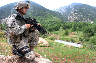
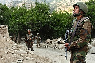
Afghanistan is divided into 34 provinces. The provinces of Afghanistan are the primary administrative divisions. Each province encompasses a number of districts or usually over 1,000 villages.

The Kabul River, the classical Cophen, is a 700-kilometre-long (430 mi) river that emerges in the Sanglakh Range of the Hindu Kush mountains in the northeastern part of Maidan Wardak Province, Afghanistan. It is separated from the watershed of the Helmand River by the Unai Pass. The Kabul River empties into the Indus River near Attock, Pakistan. It is the main river in eastern Afghanistan and the Khyber Pakhtunkhwa province of Pakistan.

The districts of Afghanistan, known as wuleswali, are secondary-level administrative units, one level below provinces. The Afghan government issued its first district map in 1973. It recognized 325 districts, counting wuleswalis (districts), alaqadaries (sub-districts), and markaz-e-wulaiyat. In the ensuing years, additional districts have been added through splits, and some eliminated through merges. In June 2005, the Afghan government issued a map of 398 districts. It was widely adopted by many information management systems, though usually with the addition of Sharak-e-Hayratan for 399 districts in total. It remains the de facto standard as of late 2018, despite a string of government announcements of the creation of new districts.

Asadabad district is one of 15 districts in the Kunar Province of Afghanistan. It includes the city of Asadabad - the district center, close the Kunar River. It is situated in the central part of the province. It has 12 big and small villages, which are surrounded by mountains so there is not enough land for farming.
Jalrez is a district in the west of Maidan Shar, Maidan Wardak Province, Afghanistan. The main town lies at Jalrez, which is 62.9 kilometres (39.1 mi) southwest of the centre of Kabul via the main Kabul-Behsud Highway. The district is a major producer of potatoes.
Day Mirdad is a district in the south of Wardak Province, Afghanistan. The capital of the district is Miran city. The district used to be known as Jilga.
Jaghatu is a district in Maidan Wardak province, Afghanistan, 20 km northwest of Ghazni. According to 2019 data, the population is 50,792. The district is within the heartland of the Wardak tribe of Pashtuns. Agriculture is the main source of income. The popular apples in Afghanistan is from this district. Drought has become a serious problem in the whole province. Health and education services are lacking although most of the people in this area have attempted to create schools and for students to attend with their own efforts.
Ghaziabad District is in the northern part of Kunar Province, Afghanistan. It was created in 2004 from the northern part of Bar Kunar District. It was named after the Khan of Ghaziabad, Amir Muhammad Ghazi Khan Shaheed. Its population is 7,500 (2004).

Khairkot District, also known as Katawaz (کټواز) or Zarghun Shar District, is a district of Paktika Province, Afghanistan. The district is within the heartland of the Sulaimankhel tribe of Ghilji Pashtuns. The district capital is Khairkot town.

Darqad District is a district of Takhar Province, Afghanistan. The district has 34 villages. Darqad did not change between the 325 and 398 district sets. Near the end of 2018, the district was considered to be Taliban-influenced, as opposed to the Afghan government. The district was Taliban-controlled by August 2021.
Parun District is a district of Nuristan Province in Afghanistan. The district centre is Parun, which is a small town.

Bargi Matal District is a district of Nuristan Province, Afghanistan. It was originally in Konarha Province and then was moved to the newly created Nuristan Province in 2001.
Nurgaram District is a district of Nuristan Province in Afghanistan. It was established in the 2004 Afghanistan administrative reorganization out of parts of Nuristan District and Wama District.
Wama District is a district of Nuristan Province in Afghanistan. In the 2004 Afghanistan administrative reorganization it lost territory to the newly created Nurgram and Parun districts.

Janikhel is a district in Paktia Province, Afghanistan. It is on the border with Khost Province, and is mostly inhabited by the Wazir and Mangal tribes of Pashtuns.
Mandol District is a district of Nuristan Province in eastern Afghanistan. It was originally in Laghman Province and then was moved to the newly created Nuristan Province in 2001.
Kamdesh District is a district of Nuristan Province in eastern Afghanistan, sharing a name with the town of Kamdesh. It was originally in Kunar Province and then was moved to the newly created Nuristan Province in 2001.
Kot-e Ashro is a small town in the western Paghman Mountains of Jalrez District, Maidan Wardak Province, Afghanistan. It was formerly the district capital until it was taken by the Taliban in 2006. The town lies along the Kabul–Behsud Highway, 14.6 kilometres (9.1 mi) by road northwest of Maidan Shar.
Takana, also Takānah-ye Bālā, is a subdistrict and village of Jalrez District, Maidan Wardak Province, Afghanistan. It lies along the Kabul–Behsud Highway, to the west of the town of Jalrez.
The Kabul–Behsud Highway, formally National Highway 13, NH13, is a highway connecting Kabul in Afghanistan to Behsud in the west, passing through Maidan Wardak Province. It is cited as a highly dangerous route, prone to hijackings, beheadings, kidnappings and robberies, particularly in the districts of Jalrez and Markazi Bihsud, and has obtained the moniker "Death Road" due to the frequency of Taliban killings along the route.
