Suguta Valley

Last updated
Suguta Valley
Suguta ali 2011010 lrg.jpg
Satellite view of the valley. Namarunu in lower left, Lake Logipi towards the upper right.
Kenya relief location map.jpg
Red pog.svg
Suguta Valley
Floor elevation300 m (980 ft) [1]
Geography
Coordinates 2°05′28″N36°30′49″E / 2.091058°N 36.513748°E / 2.091058; 36.513748

The Suguta Valley, also known as the Suguta Mud Flats, is an arid part of the Great Rift Valley in Kenya (Africa), directly south of Lake Turkana.

Contents

Location

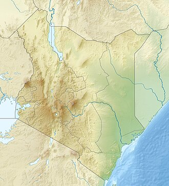
The Suguta valley today is one of the driest parts of Kenya, with annual rainfall below 300 millimetres (12 in). Lake Logipi seasonally fills a small part of the northern end of the valley. The valley has a relatively flat floor about 300 metres (980 ft) above sea level. It is bordered by land to the east and west rising to 1,000 metres (3,300 ft) and dotted with volcanic cinder cones. The Barrier Volcano, a broad volcanic complex, separates the valley from Lake Turkana. [1] Mount Ngiro rises to the east of the Suguta valley. [2] The Losiolo Escarpment, rising 2,000 metres (6,600 ft) above the valley floor on the east side near Maralal provides one of the most dramatic views of the Kenyan rift valley. [3] Namarunu, a volcano active in historic times, extends into the valley from the western wall.

The Suguta Valley lies along the axis of the Gregory Rift, which has been faulting in this area since the Pliocene along a belt 35 kilometres (22 mi) wide. The belt lies between the Ngiro basement uplift to the east and the Loriu Plateau to the west and is thicker in the eastern part. Exposed volcanic rocks include basalts, tuffs and ash formed between 4.2 and 3.8 million years ago, the products of trachytic volcanism from 3,8 to 2.6 million years ago and basaltic and alkali basaltic rocks created from that period until the present. In the early Pliocene the least horizontal stress direction - the direction of rift expansion - was NW-SE. [4]

Hydrology

Lake Suguta once filled the valley, at times overflowing into Lake Turkana. The lake level rose and fell several times in the last 18,000 years due to changes in rainfall during the African Humid Period that lasted from 14,800 to 5,500 years ago. The lake level began to drop about 8,000 years ago, falling by 250 metres (820 ft). [1]

The valley is drained by a seasonal stream, the Suguta River, which in the rainy season forms the temporary Lake Alablad, a playa lake that combines with Lake Logipi at the northern end of the valley. In the dry season saline hot springs help maintain water levels in Lake Logipi, which is about 3 metres (9.8 ft) to 5 metres (16 ft) at its greatest depth, about 6 kilometres (3.7 mi) wide and 3 kilometres (1.9 mi) wide. [5]

Ecology

The saline waters provide food for cyano-bacteria and other plankton, which in turn are food for flamingoes. [5] Due to the inaccessibility and harsh climate, with high temperatures, only the most determined tourists visit the site. [6]

The valley is used as a hide-out by Pokot and Turkana cattle rustlers. It is considered a "no go" region by the police due to the extremely harsh environment and familiarity of the rustlers with the terrain. [7]


November 2012 Police Killings

In November 2012 over 40 Kenya Police officers and reservists [8] were killed in the Suguta Valley near Baragoi while on a mission to recover stolen cattle.

Related Research Articles

<span class="mw-page-title-main">Lake Baringo</span> Freshwater lake in Kenya

Lake Baringo is, after Lake Turkana, the most northern of the Kenyan Rift Valley lakes, with a surface area of 130 square kilometres (50 sq mi) and an elevation of 970 metres (3,180 ft). The lake is fed by several rivers: the Molo, Perkerra and Ol Arabel. It has no obvious outlet; the waters are assumed to seep through lake sediments into the faulted volcanic bedrock. It is one of the two freshwater lakes in the Rift Valley in Kenya, the other being Lake Naivasha.

<span class="mw-page-title-main">Rift Valley Province</span> Province of Kenya

Rift Valley Province of Kenya, bordering Uganda, was one of Kenya's eight provinces, before the 2013 Kenyan general election. Rift Valley Province was the largest and one of the most economically important provinces in Kenya. It was dominated by the Kenya Rift Valley which passes through it and gives the province its name. According to the 2009 Census, the former province covered an area of 182,505.1 square kilometres and would have had a population of 10,006,805, making it the largest and most populous province in the country. The bulk of the provincial population inhabited a strip between former Nairobi and Nyanza Province. The capital was the town of Nakuru.

<span class="mw-page-title-main">Lake Turkana</span> Alkaline lake on the border of Ethiopia and Kenya

Lake Turkana is a saline lake in the Kenyan Rift Valley, in northern Kenya, with its far northern end crossing into Ethiopia. It is the world's largest permanent desert lake and the world's largest alkaline lake. By volume it is the world's fourth-largest salt lake after the Caspian Sea, Issyk-Kul, and Lake Van, and among all lakes it ranks 24th.

<span class="mw-page-title-main">Rift Valley lakes</span> Group of lakes in the East African Rift

The Rift Valley lakes are a series of lakes in the East African Rift valley that runs through eastern Africa from Ethiopia in the north to Malawi in the south, and includes the African Great Lakes in the south. These include some of the world's oldest lakes, deepest lakes, largest lakes by area, and largest lakes by volume. Many are freshwater ecoregions of great biodiversity, while others are alkaline "soda lakes" supporting highly specialised organisms.

<span class="mw-page-title-main">Lake Bogoria</span>

Lake Bogoria is a saline, alkaline lake that lies in a volcanic region in a half-graben basin south of Lake Baringo, Kenya, a little north of the equator. Lake Bogoria, like Lake Nakuru, Lake Elementeita, and Lake Magadi further south in the Rift Valley, and Lake Logipi to the north, is home at times to one of the world's largest populations of lesser flamingos. The lake is a Ramsar site and Lake Bogoria National Reserve has been a protected National Reserve since November 29, 1973. Lake Bogoria is shallow, and is about 34 km long by 3.5 km wide, with a drainage basin of 700 km2. It is Located in Baringo County.

Lake Logipi is a saline, alkaline lake that lies at the northern end of the arid Suguta Valley in the northern Kenya Rift. It is separated from Lake Turkana by the Barrier volcanic complex, a group of young volcanoes that last erupted during the late 19th century or early 20th century. Saline hot springs discharge on the northern shoreline of Lake Logipi and at Cathedral Rocks near its southern limit, and help to maintain water at times of extreme aridity. During the rainy season, the lake is also recharged from the Suguta River which flows northward along the Suguta Valley, periodically forming a temporary lake that unites with Logipi.

<span class="mw-page-title-main">Kapthurin Formation</span> Pleistocene geological formation in East Africa

The Kapthurin Formation is a series of Middle Pleistocene sediments associated with the East African Rift Valley. Part of the East African Rift System, it is also an important archaeological site in the study of early humans who occupied the area and left stone tools and animal bones behind. It outcrops in Kenya west of Lake Bogoria and northwest of Lake Baringo in the Kenya Rift Valley, exposed on the surface in a 150 km2 (58 sq mi) area. It also outcrops in portions of the Tugen Hills farther east. The ~125 metres (410 ft) of sediment that comprises the Kapthurin formation represents more than 600,000 years of depositional history. Clastic sediments, tuffs, and carbonate beds, in the Kapthurin give information on past river and lake environments. Additionally, intercalated tuffs and extrusive igneous rocks associated with Rift Valley volcanic activity have allowed for multiple argon–argon dating studies. The high resolution dating enables archaeological studies regarding changing hominin behavior. The Kapthurin Formation has been used to study the Acheulian-Middle Stone Age transition.

<span class="mw-page-title-main">Namarunu</span> Shield volcano in Kenya

Namarunu is a shield volcano located in the Great Rift Valley, Kenya.

The Barrier is an active shield volcano located in the north of Kenya. It is last known to have erupted in 1921.

Lokori is a Turkana settlement in Kenya's North Eastern Province, adjacent to the Kerio River. The settlement's inhabitants are traditionally pastoralists. Lokori is home to a number of prehistoric Namoratunga rock art and burial sites.

<span class="mw-page-title-main">Great Rift Valley, Kenya</span> Part of an intra-continental ridge system that runs through Kenya

The Great Rift Valley is part of an intra-continental ridge system that runs through Kenya from north to south. It is part of the Gregory Rift, the eastern branch of the East African Rift, which starts in Tanzania to the south and continues northward into Ethiopia. It was formed on the "Kenyan Dome" a geographical upwelling created by the interactions of three major tectonics: the Arabian, Nubian, and Somalian plates. In the past, it was seen as part of a "Great Rift Valley" that ran from Madagascar to Syria. Most of the valley falls within the former Rift Valley Province.

Mount Silali is a dormant volcano in the Gregory Rift Valley, near Kapedo, Kenya. Silali is south of the Suguta Valley, which reaches northward to Lake Turkana, and is about 70 kilometres (43 mi) north of Lake Baringo.

<span class="mw-page-title-main">Gregory Rift</span>

The Gregory Rift is the eastern branch of the East African Rift fracture system. The rift is being caused by the separation of the Somali plate from the Nubian plate, driven by a thermal plume. Although the term is sometimes used in the narrow sense of the Kenyan Rift, the larger definition of the Gregory Rift is the set of faults and grabens extending southward from the Gulf of Aden through Ethiopia and Kenya into Northern Tanzania, passing over the local uplifts of the Ethiopian and Kenyan domes. Ancient fossils of early hominins, the ancestors of humans, have been found in the southern part of the Gregory Rift.

The Losiolo Escarpment is an escarpment on the east side of the Great Rift Valley, Kenya. Rising 2,000 metres (6,600 ft) above the Suguta Valley floor on the east side near Maralal, the escarpment provides one of the most dramatic views of the Kenyan rift valley. The escarpment, which is also known as 'World's End', is the longest vertical drop in the Rift Valley.

<span class="mw-page-title-main">Turkana Basin</span> Large endorheic basin mainly in Kenya and Ethiopia

The greater Turkana Basin in East Africa determines a large endorheic basin, a drainage basin with no outflow centered around the north-southwards directed Gregory Rift system in Kenya and southern Ethiopia. The deepest point of the basin is the endorheic Lake Turkana, a brackish soda lake with a very high ecological productivity in the Gregory Rift.

The Suguta River is a seasonal river in the Great Rift Valley in Kenya (Africa), directly south of Lake Turkana. It flows northward through the Suguta Valley in the rainy season, forming the temporary Lake Alablad, a dry lake that combines with Lake Logipi at the northern end of the valley.

Loriu Plateau is an elevated Precambrian bedrock exposure at the southwest margin of Lake Turkana in Kenya. The plateau is only seasonally habitable due to aridity and was once home to fauna otherwise rare in Turkana. Loriu is west of and adjacent to the Barrier Volcano at the southernmost portion of Lake Turkana.

<span class="mw-page-title-main">Kanapoi</span>

Kanapoi is a paleontological site in the Kenyan Rift Valley, to the southwest of Lake Turkana. Fossils were first found at Kanapoi in the 1960s by a Harvard expedition, and later by expeditions from the National Museums of Kenya.

<span class="mw-page-title-main">Karsa, Kenya</span>

Karsa is a basalt geological formation, archaeological site, and watering hole in Turkana County, Kenya, on the southeast margin of Lake Turkana. Karsa volcanic flows lie at the base of important sedimentary formations in the Turkana Basin and are an example of columnar jointed basalt.

<span class="mw-page-title-main">Lake Suguta</span>

Lake Suguta is a former lake in Africa. It formed in the Suguta Valley, which is part of the East African Rift, south of Lake Turkana during the Holocene African humid period.

References

  1. 1 2 3 NASA Earth Observatory.
  2. Walking Jade Sea Journey.
  3. Trillo 2002, pp. 606–607.
  4. Bosworth & Maurin 1993, pp. 751–762.
  5. 1 2 Mathea 2009, p. 18.
  6. Sugutu Valley Crossing.
  7. Kiarie 2011.
  8. "How I survived raid that killed 42 policemen".

Sources