Loriu Plateau

Last updated
Loriu Plateau
Kenya relief location map.jpg
Red triangle with thick white border.svg
Loriu Plateau
Highest point
Peak1,463 m (4,800 ft)
Elevation 1,463 m (4,800 ft)  OOjs UI icon edit-ltr-progressive.svg
Coordinates 02°30′00″N36°20′00″E / 2.50000°N 36.33333°E / 2.50000; 36.33333
Geography
CountryKenya
StateTurkana
Geology
Orogeny Pliocene
Age of rock Precambrian

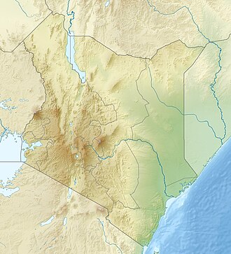
Loriu Plateau is an elevated Precambrian bedrock exposure at the southwest margin of Lake Turkana in Kenya. [1] The plateau is only seasonally habitable due to aridity and was once home to fauna otherwise rare in Turkana. [2] Loriu is west of and adjacent to the Barrier Volcano at the southernmost portion of Lake Turkana.

Contents

Location

Loriu is bounded by Lake Turkana to the east, Kapedo to the south, the Kerio River to the west, and Kerio River delta to the north. The plateau is 64 kilometers running from north to south, approximately 8 kilometers wide, and is capped by Tertiary volcanic lava flows. The western margin of Loriu rises gradually while the eastern margin is defined by a fault scarp more than 366 meters high in some locations. [1] The maximum altitude of the plateau is 1,463 meters. [2]

Animal and plant life

The Turkana basin was previously home to a great diversity and number of animal species, many of which became the basis for names of both places and people in the region. A number of wild animals no longer found in the wider Turkana Basin, including oryx, greater kudu and ostrich, were found in the Loriu Plateau during early expeditions by outsiders. [2]

Loriu includes a heterogeneous plant community with acacia trees, bush and sparse grassland. Portions of the plateau are too steep for vegetation. [2]

Geology

The Precambrian basement rock biotite-gneisses that form the underlying structure of Loriu were exposed during the plateau's formation through up faulting and tilting of the basement rock. These layers are clearly visible and form a major part of the stratigraphy of the Mugor scarp on the eastern edge of the plateau. Because of the gradual slope of the western plateau, Loriu is most likely not a horst. [1]

Lavas capping Loriu are dated to the Pliocene, according to the East African Geological Research Unit. These lavas are primarily aphyric basalts, are grayish in color, trachytic in texture and composed of olivine. Other basalts contain olivine and pyroxene phenocrysts. To the west are a few mafic porphyritic basalts and possibly older Miocene basalts cut by dykes and faults. Olivine nephelinite has been collected near these basalts. [1]

The southern margin of Loriu is also bounded by a major volcanic group around the Lomi caldera. [1]

See also

Related Research Articles

<span class="mw-page-title-main">Rift Valley Province</span> Province of Kenya

Rift Valley Province of Kenya, bordering Uganda, was one of Kenya's eight provinces, before the 2013 Kenyan general election. Rift Valley Province was the largest and one of the most economically important provinces in Kenya. It was dominated by the Kenya Rift Valley which passes through it and gives the province its name. According to the 2009 Census, the former province covered an area of 182,505.1 square kilometres and would have had a population of 10,006,805, making it the largest and most populous province in the country. The bulk of the provincial population inhabited a strip between former Nairobi and Nyanza Province. The capital was the town of Nakuru.

<span class="mw-page-title-main">Intermontane Plateaus</span> Physiographic region of the contiguous United States

In the context of physical geography, the Intermontane Plateaus is one of eight physiographic regions of the contiguous United States. The region consists mostly of plateaus and mountain ranges lying between the Rocky Mountains on the east and the Cascade and Sierra Nevada Mountains on the west. It is subdivided into three physiographic provinces: the Columbia Plateau in the north, the Basin and Range Province in the central and southwestern portions, and the Colorado Plateau in the southeast. In turn, each of these provinces are each subdivided into a number of physiographic sections.

<span class="mw-page-title-main">Geology of the United States</span> National geology

The richly textured landscape of the United States is a product of the dueling forces of plate tectonics, weathering and erosion. Over the 4.5 billion-year history of the Earth, tectonic upheavals and colliding plates have raised great mountain ranges while the forces of erosion and weathering worked to tear them down. Even after many millions of years, records of Earth's great upheavals remain imprinted as textural variations and surface patterns that define distinctive landscapes or provinces.

<span class="mw-page-title-main">Colorado Plateau</span> Plateau in southwestern United States

The Colorado Plateau, also known as the Colorado Plateau Province, is a physiographic and desert region of the Intermontane Plateaus, roughly centered on the Four Corners region of the southwestern United States. This province covers an area of 336,700 km2 (130,000 mi2) within western Colorado, northwestern New Mexico, southern and eastern Utah, northern Arizona, and a tiny fraction in the extreme southeast of Nevada. About 90% of the area is drained by the Colorado River and its main tributaries: the Green, San Juan, and Little Colorado. Most of the remainder of the plateau is drained by the Rio Grande and its tributaries.

<span class="mw-page-title-main">Flood basalt</span> Very large volume eruption of basalt lava

A flood basalt is the result of a giant volcanic eruption or series of eruptions that covers large stretches of land or the ocean floor with basalt lava. Many flood basalts have been attributed to the onset of a hotspot reaching the surface of the Earth via a mantle plume. Flood basalt provinces such as the Deccan Traps of India are often called traps, after the Swedish word trappa, due to the characteristic stairstep geomorphology of many associated landscapes.

<span class="mw-page-title-main">Boulder Park</span>

Boulder Park National Natural Landmark, of Douglas County, Washington, along with the nearby McNeil Canyon Haystack Rocks and Sims Corner Eskers and Kames natural landmarks, illustrate well-preserved examples of classic Pleistocene ice stagnation landforms that are found in Washington. These landforms include numerous glacial erratics and haystack rocks that occur near and on the Withrow Moraine, which is the terminal moraine of the Okanogan ice lobe.

<span class="mw-page-title-main">Geology of Tasmania</span> Overview of the geology of Tasmania

The geology of Tasmania is complex, with the world's biggest exposure of diabase, or dolerite. The rock record contains representatives of each period of the Neoproterozoic, Paleozoic, Mesozoic and Cenozoic eras. It is one of the few southern hemisphere areas that were glaciated during the Pleistocene with glacial landforms in the higher parts. The west coast region hosts significant mineralisation and numerous active and historic mines.

Lokitaung is a settlement in Kenya's Turkana County, a few miles inland of northwest Lake Turkana. Lokitaung is the site of the 36-million year old Lokitaung Basalt lava flows, which lay atop Cretaceous sediments including dinosaur bones. The basalts are over 1 kilometer thick, and approximately 100 kilometers wide.

Lokori is a Turkana settlement in Kenya's North Eastern Province, adjacent to the Kerio River. The settlement's inhabitants are traditionally pastoralists. Lokori is home to a number of prehistoric Namoratunga rock art and burial sites.

<span class="mw-page-title-main">Aden Crater</span> Volcano in New Mexico, United States

Aden Crater is a small shield volcano located in Doña Ana County, about 25 miles (40 km) southwest of Las Cruces, New Mexico. It is located in the northwest part of the Aden-Afton basalt field, which is part of the central area of the Potrillo volcanic field.

<span class="mw-page-title-main">Rajmahal Traps</span> Indian volcanic igneous province

The Rajmahal Traps is a volcanic igneous province in Eastern India, covering the parts of Jharkhand, West Bengal and Meghalaya. The Rajmahal Hills of Jharkhand is the type area of this province. Multiple layers of solidified lava made the 608-metre-thick (1,995 ft) Rajmahal Traps which are dipping 2–5° towards the north-east. Individual layers vary in thickness from less than one metre to more than 70 metres (230 ft).

<span class="mw-page-title-main">Cardenas Basalt</span> Rock formation in the Grand Canyon, Arizona

The Cardenas Basalt, also known as either the Cardenas Lava or Cardenas Lavas, is a rock formation that outcrops over an area of about 310 km2 (120 mi2) in the eastern Grand Canyon, Coconino County, Arizona. The lower part of the Cardenas Basalt forms granular talus slopes. Its upper part forms nearly continuous low cliffs that are parallel to the general course of the Colorado River. The most complete, readily accessible, and easily studied exposure of the Cardenas Basalt lies in Basalt Canyon. This is also its type locality.

<span class="mw-page-title-main">Tengchong volcanic field</span> Volcanic field in Yunnan, China

The Tengchong Volcanic Field (TVF) is a Cenozoic volcanic field located in the Southeastern margin of the Tibetan Plateau around 40 km from the Chinese border with Myanmar. The TVF is uniquely the only region affected by Quaternary volcanism that is part of the Himalayan Geothermal Belt caused by the Indo-Asian continent-continent collision. The TVF is characterized by hydrothermal activity and large-scale eruptions last recorded in 1609CE. Although the volcanoes themselves are considered extinct, several geothermal fields geographically linked to the TVF are still highly active. Evidence for geothermal activity can be linked to several prevalent active hot-springs located predominantly within the vicinity of the volcanoes in the TVF. Holocene eruptions occurred predominantly in the three largest volcanoes in the TVF named the Dayingshan, Maa'nshan and Heikongshan, the highest of which (Dayingshan) reaches 2865 meters above sea level. The volcanoes are distributed in a string-like pattern clustered from North to South in the middle on the Tengchong basin and are characterized by post-collisional high-Potassium (K) calc-alkaline series eruptions. The TVF provides unique geographical and geological knowledge as understanding the geological processes of creation provides insight into aspects such as the history of volcanism during the Quaternary Era in the region and as well as compositional information of its source and crustal assimilants. The TVF can be visited in the Tengchong Volcanic Geothermal National Geological Park.`

<span class="mw-page-title-main">Udokan Plateau</span> Volcanic field in Russia

The Udokan Plateau is a volcanic field in Transbaikalia, Russia. It covers a surface area of 3,000 square kilometres (1,200 sq mi) northeast of Lake Baikal in North Asia. Volcanism in the Udokan Plateau included both basaltic lava flows and later individual volcanic cones. Volcanism commenced in the Miocene and continued on into the Holocene.

The geology of Malawi formed on extremely ancient crystalline basement rock, which was metamorphosed and intruded by igneous rocks during several orogeny mountain building events in the past one billion years. The rocks of the Karoo Supergroup and newer sedimentary units deposited across much of Malawi in the last 251 million years, in connection with a large rift basin on the supercontinent Gondwana and the more recent rifting that has created the East African Rift, which holds Lake Malawi. The country has extensive mineral reserves, many of them poorly understood or not exploited, including coal, vermiculite, rare earth elements and bauxite.

<span class="mw-page-title-main">Geology of Tanzania</span>

The geology of Tanzania began to form in the Precambrian, in the Archean and Proterozoic eons, in some cases more than 2.5 billion years ago. Igneous and metamorphic crystalline basement rock forms the Archean Tanzania Craton, which is surrounded by the Proterozoic Ubendian belt, Mozambique Belt and Karagwe-Ankole Belt. The region experienced downwarping of the crust during the Paleozoic and Mesozoic, as the massive Karoo Supergroup deposited. Within the past 100 million years, Tanzania has experienced marine sedimentary rock deposition along the coast and rift formation inland, which has produced large rift lakes. Tanzania has extensive, but poorly explored and exploited natural resources, including coal, gold, diamonds, graphite and clays.

<span class="mw-page-title-main">Geology of New York (state)</span> Overview of the geology of the U.S. state of New York

The geology of the State of New York is made up of ancient Precambrian crystalline basement rock, forming the Adirondack Mountains and the bedrock of much of the state. These rocks experienced numerous deformations during mountain building events and much of the region was flooded by shallow seas depositing thick sequences of sedimentary rock during the Paleozoic. Fewer rocks have deposited since the Mesozoic as several kilometers of rock have eroded into the continental shelf and Atlantic coastal plain, although volcanic and sedimentary rocks in the Newark Basin are a prominent fossil-bearing feature near New York City from the Mesozoic rifting of the supercontinent Pangea.

<span class="mw-page-title-main">Markagunt Plateau</span> Plateau in Iron and Kane counties in Utah, United States

Markagunt Plateau is a volcanic field in southern Utah, United States. Formed in a region of older volcanics, it consists of several cinder cones and associated lava flows. Some of the lava flows feature lava tubes such as Mammoth Cave, while others have formed lava dams and lakes like Navajo Lake. Volcanism took place during the Pliocene and latest Pleistocene but may have continued into the Holocene; legends of the Southern Paiute may reflect past eruptions.

Pasto Ventura is an area in the Catamarca Province of Argentina. It features about 14 small Pleistocene volcanoes, mostly cinder cones with associated lava flows but also lava domes, tuff rings and two maars. The volcanoes are accompanied by pyroclastic deposits and their total volume reaches about 0.42 cubic kilometres (0.10 cu mi). Argon-argon dating has yielded ages ranging from 1.3 million years to about 270,000 years for volcanic rocks in the field.

<span class="mw-page-title-main">South Island (Kenya)</span> Volcanic island in Lake Turkana, Kenya

South Island, or Hohnel Island, is a fissure-formed volcanic island and the largest one out of 3 other major islands in Lake Turkana, Kenya. This volcano was discovered in 1888 while it was erupting by Count Teleki, a Hungarian explorer who led the first expedition into the region. It is a part of the Lake Turkana National Parks, which is a UNESCO World Heritage Site.

References

  1. 1 2 3 4 5 Rhemtulla, Sultan (March 1970). "orgThe South Turkana Expedition: Scientific Papers III. A Geological Reconnaissance of SouthTurkana". The Geographical Journal. 136 (1): 61–73. doi:10.2307/1795682. JSTOR   1795682.
  2. 1 2 3 4 Watson, R M (1969). "orgThe South Turkana Expedition Scientific Papers II: A Survey of the Large Mammal Population in South Turkana". The Geographical Journal. 135 (4): 529–546. doi:10.2307/1795097. JSTOR   1795097.