Ol Arabel

Last updated
Ol Arabel
Kenya relief location map.jpg
Red pog.svg
Ol Arabel
Location of Ol Arabel
Coordinates: 0°18′29″N36°12′42″E / 0.307959°N 36.211538°E / 0.307959; 36.211538 Coordinates: 0°18′29″N36°12′42″E / 0.307959°N 36.211538°E / 0.307959; 36.211538
Country Kenya

Ol Arabel (or Olarabel) is a river in the Great Rift Valley of Kenya that feeds Lake Baringo. It gives its name to a forest covering its headwaters and to a region.

Contents

River

The Ngusero and Ol Arabel rivers drain the northern end of the Aberdare Range. [1] The river forms a delta where it enters the southeast of Lake Baringo at 0°31′52″N36°06′57″E / 0.531113°N 36.115837°E / 0.531113; 36.115837 , and this forms a dense marsh during periods when the lake level is relatively high. [2] The river is seasonal and in the dry period of the early 2000s no longer reached the lake. [3]

Historical land use

In the past the region was used by Il Chamus herders. In the 1930s growing numbers of Tugen agropastoralists moved into the area, with some official encouragement. [4] In the 1940s squatters moved into the Ol Arabel Forest Reserve in Laikipia District and cultivated 84 acres of land, eventually being evicted in 1947. [5] In the 1970s the government operated a settlement scheme in Ol Arabel, but later attempted to convert the land back to forest. [6] The Harambee settlement scheme involved 6,000 hectares (15,000 acres) to be used for cattle raising and cultivation of maize. [7]

Forest reserve

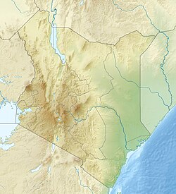
The Ol Arabel Forest Reserve is part of the Marmanet forests on the eastern escarpment of the Rift Valley, north of Nyahururu. The forest reserve, which is part of the upper catchment of the Ol Arabel River, once covered 9,629 hectares (23,790 acres), but 6,273 hectares (15,500 acres) were excised in 1993. No boundary plan was defined. [8] As a result, about 80% of the forest had been settled by the Mochongoi settlement scheme as of 2008. [9]

In May 2007 it was announced that the European Union was funding efforts to replant forests in the region, including the Ol Arabel forest. In the past ten years Lake Baringo had been silting up and shrinking in area due to increased agriculture and reduced forest cover in its watershed, with economically important fish stocks dropping significantly. [10] In September 2011 an officer of the Green Belt movement said the Ol Arabel forest was almost extinct due to illegal loggers and particularly to charcoal burners. The police were making no effort to prevent their activities. The rivers fed by the forest were about to dry up. [11]

Related Research Articles

Lake Baringo Freshwater lake in Kenya

Lake Baringo is, after Lake Turkana, the most northern of the Kenyan Rift Valley lakes, with a surface area of 130 square kilometres (50 sq mi) and an elevation of 970 metres (3,180 ft). The lake is fed by several rivers: the Molo, Perkerra and Ol Arabel. It has no obvious outlet; the waters are assumed to seep through lake sediments into the faulted volcanic bedrock. It is one of the two freshwater lakes in the Rift Valley in Kenya, the other being Lake Naivasha.

Mau Mau Uprising Kenyan insurgency, 1952–1960

The Mau Mau Uprising (1952–1960), also known as the Mau Mau Rebellion, the Kenya Emergency, and the Mau Mau Revolt, was a war in the British Kenya Colony (1920–1963) between the Kenya Land and Freedom Army (KLFA), also known as Mau Mau, and the British authorities.

Lake Bogoria meromictic lake

Lake Bogoria is a saline, alkaline lake that lies in a volcanic region in a half-graben basin south of Lake Baringo, Kenya, a little north of the equator. Lake Bogoria, like Lake Nakuru, Lake Elmenteita, and Lake Magadi further south in the Rift Valley, and Lake Logipi to the north, is home at times to one of the world's largest populations of lesser flamingos. The lake is a Ramsar site and Lake Bogoria National Reserve has been a protected National Reserve since November 29, 1973. Lake Bogoria is shallow, and is about 34 km long by 3.5 km wide, with a drainage basin of 700 km2.

Environmental issues in Kenya

Environmental issues in Kenya include deforestation, soil erosion, desertification, water shortage and degraded water quality, flooding, poaching, and domestic and industrial pollution.

Kuki Gallmann is an Italian-born Kenyan national, best-selling author, poet, environmental activist, and conservationist.

Baringo County County in Kenya

Baringo County is one of the 47 Counties of Kenya. It is located in the former Rift Valley Province. Its headquarters and largest town is Kabarnet. The county is home to Lake Baringo.

Mau Forest

Mau Forest is a forest complex in the Rift Valley of Kenya. It is the largest indigenous montane forest in East Africa. The Mau Forest complex has an area of 273,300 hectares.

Nakuru County Council is a defunct local authority in Kenya. It was one of the largest county councils in the country. It is home to a population of around 1.6 million, living on some 5,000 square kilometres in the central part of the country. The Nakuru area has a rich history, with human settlements dating back more than 3,000 years. The population is very diverse, with residents that have migratory background from different parts of the country. According to 2002 government statistics, on a population total of 1,312,555, the youth population up to age 25 years was 56%. The percentage of pre-primary and primary school going age residents was 31%, and the County’s total labour force population was 54%. The population growth rate is 3.4%.

Solio Ranch Place in Central Province, Kenya

Solio Ranch or Solio Game Reserve is a privately owned wildlife conservancy located in Kenya's Central Province.

Great Rift Valley, Kenya Part of an intra-continental ridge system that runs through Kenya

The Great Rift Valley is part of an intra-continental ridge system that runs through Kenya from north to south. It is part of the Gregory Rift, the eastern branch of the East African Rift, which starts in Tanzania to the south and continues northward into Ethiopia. It was formed on the "Kenyan Dome" a geographical upwelling created by the interactions of three major tectonics: the Arabian, Nubian, and Somalian plates. In the past, it was seen as part of a "Great Rift Valley" that ran from Madagascar to Syria. Most of the valley falls within the former Rift Valley Province.

Waseges River river in Kenya

The Waseges River is a river that rises on the slopes of the Nyandarua Plateau below the Aberdare Range in Kenya. The river flows north, then west and south to enter Lake Bogoria in the Great Rift Valley from the north after passing through a swamp. In 2002 rubies were found in the region of the Waseges River.

Kuresoi Constituency is one of the five constituencies that form Nakuru County, in the Rift valley province. Kenya. In the proposed Independent electoral and boundaries commission's report of 2012, Kuresoi district will be split into two constituencies; Kuresoi North and Kuresoi South. A large part of kuresoi is the East Mau forest, part of the largest water catchment in Kenya, Mau forest. Two major rivers, Mara River and Sondu Miriu have their sources in Kuresoi, Molo River which drains into Lake Baringo has one of its tributaries Ribeti starting in Kuresoi.

The Suguta River is a seasonal river in the Great Rift Valley in Kenya (Africa), directly south of Lake Turkana. It flows northward through the Suguta Valley in the rainy season, forming the temporary Lake Alablad, a dry lake that combines with Lake Logipi at the northern end of the valley.

Southern Ewaso Ngiro river in Kenya

The Southern Ewaso Ng'iro is a river in the Great Rift Valley in Kenya. It plays an important role in the ecology of Lake Natron, the main regular breeding site for near-threatened lesser flamingos. Changes to land use in the river's headwaters or in the marshes before the river enters the lake could have a serious impact on this species.

Perkerra River river in Kenya

The Perkerra River is a river in the Great Rift Valley in Kenya that feeds the freshwater Lake Baringo. It is the only perennial river in the arid and semi-arid lands of the Baringo County. The Perkerra river supplies water to the Perkerra Irrigation Scheme in the Jemps flats near Marigat Township, just south of the lake.

Mochongoi Place in Baringo County, Kenya

Mochongoi is a community and a division in Baringo County, Kenya. Mochongoi is also an electoral constituency. The town lies in the northern end of the Aberdare Range and is a relatively new settlement in what was the Ol Arabel forest reserve.

Elmenteitan

The Elmenteitan culture was a prehistoric lithic industry and pottery tradition with a distinct pattern of land use, hunting and pastoralism that appeared and developed on the western plains of Kenya, East Africa during the Pastoral Neolithic c.3300-1200 BP. It was named by archaeologist Louis Leakey after Lake Elmenteita, a soda lake located in the Great Rift Valley, about 120 km (75 mi) northwest of Nairobi.

The Masai Agreement of 1904 was a treaty signed between the British East Africa Protectorate government and leaders of the Maasai tribe between 10 and 15 August 1904. The Maasai tribe agreed to cede possession of the Rift Valley in return for exclusive rights to two territories, a southern reserve in Kajiado and a northern reserve in Laikipia.

Mutai is a term used by the Maa-speaking communities of Kenya to describe a period of wars, usually triggered by disease and/or drought affecting widespread areas of the Rift Valley region of Kenya. According to Samburu and Maasai tradition, two periods of Mutai occurred during the nineteenth century. The second Mutai lasted from the 1870s to the 1890s.

Northern Acacia-Commiphora bushlands and thickets Ecoregion (WWF)

The Northern Acacia-Commiphora bushlands and thickets are a tropical grasslands, savannas, and shrublands ecoregion in eastern Africa. The ecoregion is mostly located in Kenya, extending north into southeastern South Sudan, northeastern Uganda, and southwestern Ethiopia, and south into Tanzania along the Kenya-Tanzania border.

References

  1. R. H. Hughes, J. S. Hughes (1992). A Directory of African Wetlands. IUCN. p. 190. ISBN   2880329493.
  2. Gierlowski-Kordesch, Elizabeth; Kelts, K. R. (2000). Lake Basins Through Space and Time. AAPG. pp. 563–564. ISBN   0891810528.
  3. Eric Onyango Odada, Daniel O. Olago (2002). The East African Great Lakes: Limnology, Palaeolimnology, and Biodiversity. Springer. p. 338. ISBN   1402007728.
  4. Little, Peter D. (1992). The Elusive Granary: Herder, Farmer, and State in Northern Kenya. Cambridge University Press. p. 34. ISBN   0521405521.
  5. Tabitha M. Kanogo (1987). Squatters and the Roots of Mau Mau, 1905-63. East African Publishers. p. 102. ISBN   9966463267.
  6. "Banning of Forest Excisions". Kenya National Assembly Official Record (Hansard): 1311. 3 Jul 1996. Retrieved 2012-04-12.
  7. A. Nyanjom & J. K’Onyango. Peak Revision K.C.S.E Agriculture. East African Publishers. ISBN   9966254625.
  8. "Mau Complex and Marmanet forests" (PDF). UNEP. 20 May 2008. Retrieved 2012-04-12.
  9. Hilary Kiprop. "Forest Allocation in Kenya". SMS Network. Retrieved 2012-04-12.[ permanent dead link ]
  10. "Kenya: important investment in reforestation, environmental and community development projects". The Nation. May 24, 2007. Retrieved 2012-04-12.
  11. WANJOHI GAKIO (9 September 2011). "Kenya: Greenbelt Sounds Alarm Over Destruction of Two Laikipia Forests". The Star. Retrieved 2012-04-12.