Menengai

Last updated
Menengai
Menengai crater view from the edge.jpg
Menengai Crater - view from the edge
Highest point
Elevation 2,278 m (7,474 ft)
Coordinates 0°12′S36°04′E / 0.20°S 36.07°E / -0.20; 36.07
Geography
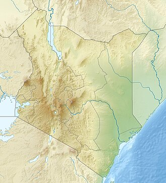
Kenya relief location map.jpg
Red triangle with thick white border.svg
Menengai
Location in Kenya
Location Kenya
Geology
Mountain type Shield volcano
Last eruption 6050 BCE (?)
Climbing
Easiest route via taking the north east route for bus

MenengaiCrater is a massive shield volcano with one of the biggest calderas in the world, in the Great Rift Valley, Kenya. It is the largest volcano caldera in Kenya and the second largest volcano caldera in Africa. [1] Volcanic formed rich loam soils enrich the adjacent farmland arounds its flanks. The crater is on the floor of the Rift Valley. The volcano formed about 200,000 years ago and the prominent 12 x 8 km caldera formed about 8000 years ago. The caldera floor is covered with numerous post caldera lava flows. The Menengai volcano is considered one of the best-preserved Krakatau-style calderas in the world. [2] Menengai has very little sediment in the caldera which is a thick mass of lava boulders and inaccessible ridges. [3] Volcanic activity continues [4] and a current project under the GDC is at an advanced stage towards geothermal power generation. [5]

Contents

Menengai is 10 km (6 mi) north of Nakuru, the fourth-biggest city in Kenya.
See also

See also

Related Research Articles

A caldera is a large cauldron-like hollow that forms shortly after the emptying of a magma chamber in a volcano eruption. When large volumes of magma are erupted over a short time, structural support for the rock above the magma chamber is gone. The ground surface then collapses into the emptied or partially emptied magma chamber, leaving a large depression at the surface. Although sometimes described as a crater, the feature is actually a type of sinkhole, as it is formed through subsidence and collapse rather than an explosion or impact. Compared to the thousands of volcanic eruptions that occur each century, the formation of a caldera is a rare event, occurring only a few times per century. Only seven caldera-forming collapses are known to have occurred between 1911 and 2016. More recently, a caldera collapse occurred at Kīlauea, Hawaii in 2018.

<span class="mw-page-title-main">Long Valley Caldera</span> Geologic depression near Mammoth Mountain, California, United States

Long Valley Caldera is a depression in eastern California that is adjacent to Mammoth Mountain. The valley is one of the Earth's largest calderas, measuring about 20 mi (32 km) long (east-west), 11 mi (18 km) wide (north-south), and up to 3,000 ft (910 m) deep.

<span class="mw-page-title-main">Shield volcano</span> Low-profile volcano usually formed almost entirely of fluid lava flows

A shield volcano is a type of volcano named for its low profile, resembling a shield lying on the ground. It is formed by the eruption of highly fluid lava, which travels farther and forms thinner flows than the more viscous lava erupted from a stratovolcano. Repeated eruptions result in the steady accumulation of broad sheets of lava, building up the shield volcano's distinctive form.

<span class="mw-page-title-main">Mono–Inyo Craters</span> Volcanic chain in eastern California, United States

The Mono–Inyo Craters are a volcanic chain of craters, domes and lava flows in Mono County, Eastern California. The chain stretches 25 miles (40 km) from the northwest shore of Mono Lake to the south of Mammoth Mountain. The Mono Lake Volcanic Field forms the northernmost part of the chain and consists of two volcanic islands in the lake and one cinder cone volcano on its northwest shore. Most of the Mono Craters, which make up the bulk of the northern part of the Mono–Inyo chain, are phreatic volcanoes that have since been either plugged or over-topped by rhyolite domes and lava flows. The Inyo volcanic chain form much of the southern part of the chain and consist of phreatic explosion pits, and rhyolitic lava flows and domes. The southernmost part of the chain consists of fumaroles and explosion pits on Mammoth Mountain and a set of cinder cones south of the mountain; the latter are called the Red Cones.

<span class="mw-page-title-main">Kīlauea</span> Active volcano in Hawaii

Kīlauea is an active shield volcano in the Hawaiian Islands. Located along the southeastern shore of Hawai'i Island, the volcano is between 210,000 and 280,000 years old and emerged above sea level about 100,000 years ago. Historically, it is the most active of the five volcanoes that together form the island of Hawaii. Kīlauea is also one of the most active volcanoes on Earth, with the most recent eruption occurring in September 2023 when multiple vents erupted lava for a week within the volcano's summit caldera inside Halemaʻumaʻu crater.

<span class="mw-page-title-main">Yellowstone Caldera</span> Volcanic caldera in Yellowstone National Park in the United states

The Yellowstone Caldera, sometimes referred to as the Yellowstone Supervolcano, is a volcanic caldera and supervolcano in Yellowstone National Park in the Western United States. The caldera and most of the park are located in the northwest corner of Wyoming. The caldera measures 43 by 28 miles, and postcaldera lavas spill out a significant distance beyond the caldera proper.

<span class="mw-page-title-main">Newberry Volcano</span> Shield volcano in Oregon, United States

Newberry Volcano is a large active shield-shaped stratovolcano located about 20 miles (32 km) south of Bend, Oregon, United States, 35 miles (56 km) east of the major crest of the Cascade Range, within the Newberry National Volcanic Monument. Its highest point is Paulina Peak. The largest volcano in the Cascade Volcanic Arc, Newberry has an area of 1,200 square miles (3,100 km2) when its lava flows are taken into account. From north to south, the volcano has a length of 75 miles (121 km), with a width of 27 miles (43 km) and a total volume of approximately 120 cubic miles (500 km3). It was named for the geologist and surgeon John Strong Newberry, who explored central Oregon for the Pacific Railroad Surveys in 1855.

<span class="mw-page-title-main">Mount Mazama</span> Complex volcano in the Cascade Range

Mount Mazama is a complex volcano in the western U.S. state of Oregon, in a segment of the Cascade Volcanic Arc and Cascade Range. Most of the mountain collapsed following a major eruption approximately 7,700 years ago. The volcano is in Klamath County, in the southern Cascades, 60 miles (97 km) north of the Oregon–California border. Its collapse, due to the eruption of magma emptying the underlying magma chamber, formed a caldera that holds Crater Lake. The mountain is in Crater Lake National Park. Mount Mazama originally had an elevation of 12,000 feet (3,700 m), but following its climactic eruption this was reduced to 8,157 feet (2,486 m). Crater Lake is 1,943 feet (592 m) deep, the deepest freshwater body in the U.S. and the second deepest in North America after Great Slave Lake in Canada.

<span class="mw-page-title-main">Kohala (mountain)</span> Volcano in Hawaii

Kohala is the oldest of five volcanoes that make up the island of Hawaii. Kohala is an estimated one million years old—so old that it experienced, and recorded, the reversal of Earth's magnetic field 780,000 years ago. It is believed to have breached sea level more than 500,000 years ago and to have last erupted 120,000 years ago. Kohala is 606 km2 (234 sq mi) in area and 14,000 km3 (3,400 cu mi) in volume, and thus constitutes just under 6% of the island of Hawaii.

<span class="mw-page-title-main">Masaya Volcano</span> Active complex volcano in Nicaragua

Masaya is a caldera located in Masaya, Nicaragua, 20 km (12 mi) south of the capital Managua. It is Nicaragua's first and largest national park, and one of 78 protected areas of Nicaragua. The complex volcano is composed of a nested set of calderas and craters, the largest of which is Las Sierras shield volcano and caldera. Within this caldera lies a sub-vent, which is Masaya Volcano sensu stricto. The vent is a shield type composing of basaltic lavas and tephras and includes a summit crater. This hosts Masaya caldera, formed 2,500 years ago by an 8 km3 (1.9 cu mi) basaltic ignimbrite eruption. Inside this caldera a new basaltic complex has grown from eruptions mainly on a semi-circular set of vents that include the Masaya and Nindiri cones. The latter host the pit craters of Masaya, Santiago, Nindiri and San Pedro. Observations in the walls of the pit craters indicate that there have been several episodes of cone and pit crater formation.

<span class="mw-page-title-main">Nakuru</span> City in Nakuru County, Kenya

Nakuru is a city in the Rift Valley region of Kenya. It is the capital of Nakuru County, and is the third largest city in Kenya. As of 2019, Nakuru has an urban population of 570,674, making it the largest urban centre in the Rift Valley, succeeding Eldoret, Uasin Gishu County. The city lies along the Nairobi–Nakuru Highway, 160 kilometres (99 mi) from Nairobi.

<span class="mw-page-title-main">Nakuru County</span> County in Kenya

Nakuru County is a county in Kenya. It is County number 32 out of the 47 Kenyan Counties. Nakuru County is a host to Kenya's Fourth City – Nakuru City. On 1 December 2021, President Uhuru Kenyatta awarded a City Charter status to Nakuru, ranking it with Nairobi, Mombasa, and Kisumu as the cities in Kenya. With a population of 2,162,202, it is the third most populous county in Kenya after Nairobi County and Kiambu County, in that order. With an area of 7,496.5 km2, it is Kenya's 19th largest county in size. Until 21 August 2010, it formed part of Rift Valley Province.

<span class="mw-page-title-main">Mount Longonot</span> Volcano in Kenya

Mount Longonot is a stratovolcano located southeast of Lake Naivasha in the Great Rift Valley of Kenya, Africa. It is thought to have last erupted in the 1860s. Its name is derived from the Maasai word Oloonong'ot, meaning "mountains of many spurs" or "steep ridges".

The Barrier is an active shield volcano located in the north of Kenya. It is last known to have erupted in 1921.

<span class="mw-page-title-main">Timeline of volcanism on Earth</span>

This timeline of volcanism on Earth includes a list of major volcanic eruptions of approximately at least magnitude 6 on the Volcanic explosivity index (VEI) or equivalent sulfur dioxide emission during the Quaternary period. Other volcanic eruptions are also listed.

<span class="mw-page-title-main">Great Rift Valley, Kenya</span> Part of an intra-continental ridge system that runs through Kenya

The Great Rift Valley is part of an intra-continental ridge system that runs through Kenya from north to south. It is part of the Gregory Rift, the eastern branch of the East African Rift, which starts in Tanzania to the south and continues northward into Ethiopia. It was formed on the "Kenyan Dome" a geographical upwelling created by the interactions of three major tectonics: the Arabian, Nubian, and Somalian plates. In the past, it was seen as part of a "Great Rift Valley" that ran from Madagascar to Syria. Most of the valley falls within the former Rift Valley Province.

<span class="mw-page-title-main">Ol Doinyo Eburru</span> Active complex of volcanoes in Kenya, East Africa

Ol Doinyo Eburru is an active complex of volcanoes in the Great Rift Valley, Kenya to the northwest of Lake Naivasha. It is being exploited for geothermal energy. Soysambu Conservancy is located to the north of the massif, between Lake Elmenteita to the east and Lake Nakuru to the west.

Nakuru District was a district in the Rift Valley Province, Kenya. The district capital was Nakuru. With a population of 1,187,039, following the Nairobi region. Nakuru District had an area of 7,242 km².

Menengai Forest is an urban forest situated within the town of Nakuru in Kenya. The Menengai Crater is within the forest. It was gazetted as a forest in the 1930s. It is surrounded by residential areas of Milimani Estate in the South, Ngachura and Bahati in the East, Solai in the North and Olo-Rongai in the West. Various Government of Kenya facilities have been hived off from the forest; these include the Kenya Broadcasting Corporation and the Nakuru G.K Prison. There is also a geothermal exploration project by the Geothermal Development Company inside the Menengai Crater floor.

<span class="mw-page-title-main">Volcanism on the Moon</span> Volcanic processes and landforms on the Moon

Volcanism on the Moon is represented by the presence of volcanoes, pyroclastic deposits and vast lava plains on the lunar surface. The volcanoes are typically in the form of small domes and cones that form large volcanic complexes and isolated edifices. Calderas, large-scale collapse features generally formed late in a volcanic eruptive episode, are exceptionally rare on the Moon. Lunar pyroclastic deposits are the result of lava fountain eruptions from volatile-laden basaltic magmas rapidly ascending from deep mantle sources and erupting as a spray of magma, forming tiny glass beads. However, pyroclastic deposits formed by less common non-basaltic explosive eruptions are also thought to exist on the Moon. Lunar lava plains cover large swaths of the Moon's surface and consist mainly of voluminous basaltic flows. They contain a number of volcanic features related to the cooling of lava, including lava tubes, rilles and wrinkle ridges.

References

  1. "Menengai Crater". Archived from the original on 22 February 2015. Retrieved 28 February 2015.
  2. Seach, John. "Menengai Volcano - John Seach". www.volcanolive.com. Retrieved 28 February 2015.
  3. "Menengai Crater". Archived from the original on 22 February 2015. Retrieved 28 February 2015.
  4. "Menengai Crater Kenya / Rift Valley / Nakuru /". wikimapia. wikimapia. Retrieved 28 February 2015.
  5. OBWOCHA, BEATRICE. "Menengai crater to become active again" . Retrieved 28 February 2015.