The Grossglockner, or just Glockner, is, at 3,798 metres above the Adriatic (12,461 ft), the highest mountain in Austria and the highest mountain in the Alps east of the Brenner Pass. It is part of the larger Glockner Group of the Hohe Tauern range, situated along the main ridge of the Central Eastern Alps and the Alpine divide. The Pasterze, Austria's most extended glacier, lies on the Grossglockner's eastern slope.

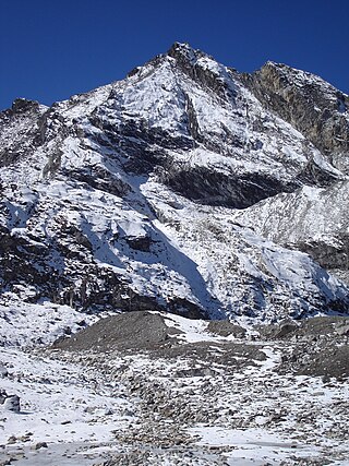
Pokalde Peak is a mountain peak of Nepal situated 12 km southwest of Mount Everest. Pokalde Peak is one of the shortest and easiest trekking peaks in the Everest Region. The majority of the 650 metres (2,130 ft) climb from base camp requires little more than walking with short sections of scrambling up rock.

Monte Rosa is a mountain massif in the eastern part of the Pennine Alps, on the border between Italy and Switzerland (Valais). The highest peak of the massif, amongst several peaks of over 4.000 m, is the Dufourspitze, the second highest mountain in the Alps and western Europe, after Mont Blanc. The east face of the Monte Rosa towards Italy has a height of about 2.400 meters and is the highest mountain wall of the Alps.

Kowloon Peak, also known as Fei Ngo Shan, is a 602 m (1,975 ft) tall mountain in the northeast corner of New Kowloon, Hong Kong, situated in Ma On Shan Country Park. It is the tallest mountain in Kowloon, and is crossed by both the Wilson Trail and the MacLehose Trail. On the lower slopes of Tung Yeung Shan about 1.1 miles to the north is the Gilwell Campsite, belonging to The Scout Association.
Rajrambha is the name of a Himalayan mountain peak, situated in the Pithoragarh district of Uttarakhand state of India. It means 'celestial nymph' (Apsara) in Hindi. This peak is situated south of the Kalabaland Glacier in eastern Kumaun in the Ralam valley. The summit of the peak is 6,537 m. The nearby peaks which form the north-south massif are Suitilla 6,373 m, Chaudhara 6,510 m, and Ngalaphu 6,410 m.
Chiring We is the Himalayan peak situated in eastern Kumaun of the Pithoragarh district of Uttarakhand state in India. The altitude of the peak is 6,559 m. Chiring We is the highest peak above the Kalabaland Glacier. Chiring We massif, which include peaks like Bamba Dhura (6,334 m), Suli Top (6,300 m), Trigal (5,983 m), Suitilla (6,373 m), separates Lassar Yankti valley from Kalabaland valley. The peak literally means 'Mountain of long life'. The route is through glaciers of Kalabaland, Sankalpa and Yankchar, icefall, crevasses, ice-pinnacles, ice walls and sharp ridges. First ascent to this peak was made in 1979 by an Indian team led by Harish Kapadia via northeast ridge.
Chaudhara is a Himalayan mountain peak, situated in the Pithoragarh district of Kumaon, India. The altitude of the peak is 6,510 m. The peak lies to the south of Ralam pass and north west of Panchchuli. The peak is so named due to the peak having four corners. The peak was climbed for the first time by an Indian team led by A.R.Chandekar and Sherpa Ajeeba in 1973. Rajrambha is its neighbouring peak. Chaudhara is situated at the south east end of Kalabaland Glacier-Sankalp Glacier-Yangchar Glacier group. Chaudhara is the part of Himalayan massif between Ralam and Lassar valley. The most popular route to the summit is via the west face.
Suj Tilla or Suitilla is a Himalayan peak located on the eastern side of Uttarakhand state in Pithoragarh District of India. The peak is located above the junction of Kalabaland, Sankalp and Yankchar glaciers. Ralam Dhura pass is situated to the south of this peak, which connects Ralam valley to Darma valley.
Bamba Dhura is a Himalayan mountain peak situated in the Pithoragarh district of Uttarakhand, India. With a summit altitude of 6,334 metres (20,781 ft), Bamba Dhura is situated on the north west ridge over the end of the Kalabaland Glacier in the eastern part of the district, left of the Milam Glacier. Kalabaland Dhura (6,105 m) is situated to the west of this peak and Chiring We (6,559 m) is on the same massif. Bamba Dhura massif is the part of divide between Kalabaland and Lassar valley. This peak was first climbed to the summit in 1977 from south by col between Bamba Dhura and Chiring We. The peak has since been climbed through the southeastern and western ridges between the two peaks.

Shispare also know as Fiak Ting فیاک ٹنگ or

Nun Kun is a mountain massif of the greater Himalayan range, located on the border of Jammu and Kashmir and Ladakh in northern India. It consists of two main peaks: Nun and Kun, separated from each other by a 4 km long snowy plateau, with a third peak of the massif, known as Pinnacle Peak, lying at its eastern end. Nun is the tallest peak of Jammu and Kashmir, while its sister peak Kun lies in Ladakh. It is about 250 km (160 mi) east of Srinagar. The Nun Kun massif is bounded to the north by the Suru valley and the Zanskar range, flanked to the east by the Pensi La (4400 m), which separates the Suru and Zanskar Valleys, while the Kishtwar National Park and the Krash Nai river lie to its south. The rocks predominantly are stratified sedimentary rocks composed of shale and sandstone. Metamorphic rocks and granite formations are also seen at places. The area is rich in minerals, especially garnets.

Cheam Peak or Mount Cheam.

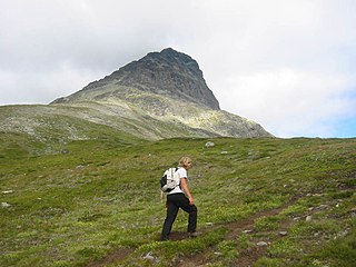
Torfinnstindene is a mountain in Vang Municipality in Innlandet county, Norway. The 2,118-metre (6,949 ft) tall mountain is located in the Jotunheimen mountains, about 25 kilometres (16 mi) north of the village of Vang i Valdres. The mountain is surrounded by several other notable mountains including Rasletinden and Kalvehøgde to the northeast, Nørdre Kalvehølotinden to the east, Galdeberget and Oksedalshøi to the west, and Langedalstinden to the northwest.

Stob Bàn is a Scottish mountain situated at the western end of the Mamores ridge, five and a half kilometres north-west of Kinlochleven. With a height of 999 metres it qualifies as a Munro. Stob Bàn is a distinctive sight when viewed from lower Glen Nevis with its sharp peak and capping of white quartzite rocks which are often mistaken for snow; its Gaelic name translates as White Peak or Light Coloured Peak.

Benbaun is a mountain in County Galway, Ireland. With a height of 729 metres (2,392 ft), it is the 72nd highest peak in Ireland on the Arderin scale, and the 88th highest peak on the Vandeleur-Lynam scale. Benbaun is situated at the centre of the core massif of the Twelve Bens mountain range in the Connemara National Park and is the tallest mountain of the Twelve Bens range, and the county top for Galway.

Rusk Mountain is a peak located in the towns of Jewett and Lexington in Greene County, New York, United States. At 3,680 feet (1,120 m) in elevation, it is the 20th-highest peak in the Catskill Mountains and considered a member of the Catskill High Peaks. While there is no maintained trail, a bushwhack to the summit is considered relatively easy, and required for membership in the Catskill Mountain 3500 Club.

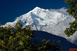
The Weisshorn is a major peak of Switzerland and the Alps, culminating at 4,506 metres above sea level. It is part of the Pennine Alps and is located between the valleys of Anniviers and Zermatt in the canton of Valais. In the latter valley, the Weisshorn is one of the many 4000ers surrounding Zermatt, with Monte Rosa and the Matterhorn.

Ben Lugmore at 803 metres (2,635 ft) is the 29th-highest peak in Ireland on the Arderin scale, and the 37th-highest peak on the Vandeleur-Lynam scale. It is in a horseshoe-shaped massif that includes the slightly higher peak of Mweelrea at 814 metres (2,671 ft), the highest mountain in the Irish province of Connacht. The massif is between Killary Harbour and Doo Lough, in Mayo.

The Hermit is a 12,328-foot-elevation (3,758-meter) mountain summit located west of the crest of the Sierra Nevada mountain range, in Fresno County of central California, United States. It is situated in northern Kings Canyon National Park, 2.5 miles (4.0 km) east of Emerald Peak, and 2.5 miles (4.0 km) west of Mount Darwin. Topographic relief is significant as the north aspect rises 2,500 feet above Evolution Valley in less than one mile. The John Muir Trail passes to the east and north of this landmark, providing an approach. This geographical feature was named by Sierra Club explorer Theodore Solomons in 1895 as he wrote: "The traveler will be greatly attracted by a very sharp peak or butte that rises on the south wall. From its isolated position as viewed from the valley we called it the Hermit."


