Sukma district

Last updated

Sukma district
Sukma in Chhattisgarh (India).svg
Location in Chhattisgarh
Sukma district
Sukma district
CountryFlag of India.svg  India
State Chhattisgarh
Division Bastar
Area
  Total5,897 km2 (2,277 sq mi)
Population
 (2011)
  Total250,159
  Density42/km2 (110/sq mi)
Time zone UTC+05:30 (IST)
Website sukma.gov.in

Sukma district is the southernmost district in the Indian state of Chhattisgarh. It is located in the Bastar region, known for its tribal culture. Sukma district borders with Odisha (Malkangiri district), Telangana (Bhadradri Kothagudem district) and Andhra Pradesh (Alluri Sitharama Raju district).

Contents

Located in the southern tip of Chhattisgarh, the district was carved out of Dantewada in 2012. It is covered with semitropical forest and is mainly inhabited by Gonds and other tribals. The district has nearly 85% of its population as STs, 65% of its area is covered with the forest and an extremely low population density of merely 45 persons per km2. It also has one of the lowest literacy rates in India, 29%. One major river that flows through the district is Sabari and the district receives decent rainfalls in the monsoon season.

The district is one of the least developed districts of India. The district is severely affected by Naxalism or Maoism.

History

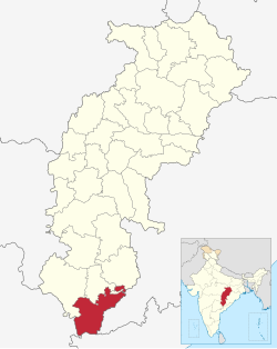
Sukma District is the southern part of Bastar and it is newly formed on 16 January 2012. It is a Sub-Tehsil in 1952 under Bastar region, later upgraded to Tehsil in 1956, After Konta Tehsil is formed in 1960 SDO office Konta at headquarter Sukma started in 1976. When Dantewada is divided from Bastar in 1998 Sukma came under Dantewada District. Sukma got its existence as a new district in the year 2012. This is the LWE affected district which is far from Development. Sukma 400 km away from state capital Raipur, well connected by NH-30. It is sharing the border with Odisha, Telangana and Andhra Pradesh states and districts Bastar, Bijapur and Dantewada.

This land known as Dandakaranya from the ancient times is a habitat for different types of Tribal communities. Tribes residing here had no exposure to the outer world, they used to feed themselves on the abundance of forest produces and by hunting the animal in the forest, they used to live a happy and most contained life.

Sukma has come into existence approximately in the year 1300. The predecessors of the Jameendars of Sukma who worked in this area under the kingship of the erstwhile Maharaja of Bastar were originated from Rajasthan and fled to Warangal. They have re-established themselves here and started leading their life however the curse of bad time did not stop worrying them even here, they were very often subjected to the highhandedness of the Maratha Rajas and Peshwas who used to impose different Taxes and Punishments. To avoid these atrocities the predecessors of the Jameendars have reached around Sukma through Bheji passing different forest areas and have started searching for a shelter to themselves. Among this group one family consisting of a father, mother and their boy had tried to cross the river Shabri to reach the other bank of the river but when they were in the middle of the river their boat had struck in the whirlpool of the river and an angel had appeared in front of them and had asked them to sacrifice one among them so as to ensure the safety of the remaining two. The father had readily accepted to offer himself in sacrifice but his boy contested and said that as you both are healthy you can still have children and hence let me sacrifice myself saying that the boy had jumped into the river. The place where the boy had jumped into the river is still known as Muniputta, which appears like an island in the middle of river at village Telavarti. At this place wooden chappal and the trident are visible. Devotees reach this place in scores of numbers during Shivratri and Makar Sankranti and perform Puja. It is believed that this island had never so far submerged in the river in any of the floods and it is also believed that if this island gets submerged in the river then there would be a big havoc. These couple settled at Mahadev Dongri for a brief period but due to threat from the wild animal they came and settled nearby Shabari river later. Mahadev Dongri is located at 3 km distance from Sukma and one ancient Shiva temple is located in this village which is believed to be installed by these couple. Lot of festivity can still be seen at this place during the Shivratri.

Later on, these couple have settled down at the present day's Rajwada area of Sukma, they felt very comfortable in this place. Even though they were living in the absence of necessary facilities such as education and comforts amidst the tribes they started feeling this area very comfortable far from the atrocities of Mughals and the Marathas thus they named this place as Sukma. It is also believed that the deity of the famous temple of Chitpitin Mata located at village Ramaram is also brought by these couple along with them and that the temple had been constructed by these couple. Even today when the Pujari chants during sacrifice at this temple certain words are revered which indicate that the deity is brought from Warangal. In due course of time Sukma had seen many changes and transformation into one among the new Districts is one among them.

Demographics

Religions in Sukma district (2011) [1]
ReligionPercent
Hinduism
95.61%
Other (Tribal religion)
2.31%
Islam
1.23%
Christianity
0.60%
Other or not stated
0.25%

The district has a population of 250,159, of which 28,202 (11.27%) live in urban areas. Sukma has a sex ratio of 1017 females per 1000 males and a literacy rate of 34.81%. Scheduled Castes and Scheduled Tribes make up 1.11% and 83.47% of the district's population respectively. [2]

Languages of Sukma district (2011) [3]

   Gondi (55.24%)
   Halbi (11.58%)
   Dorli (9.33%)
   Duruwa (7.82%)
   Hindi (5.52%)
   Madiya (4.00%)
   Telugu (1.86%)
   Chhattisgarhi (1.26%)
   Bengali (1.03%)
  Others (2.36%)

As per the 2011 census, 55.24% of the population spoke Gondi, 11.58% Halbi, 9.30% Dorli, 7.82% Dhurwa, 5.51% Hindi, 4.00% Muria, 1.86% Telugu and 1.03% Bengali as their first language. [3]

Health

Health has been a focal sector for the district administration in the past few years . Some proactive measures adopted by the Government have helped in filling the vacant para medical staff, doctors and specialist doctors posts considerably. Further to this improvising the health institutions through providing modern equipment, labs and other essential facilities is paying good dividends. Government hospitals are the only source of medical care in the district, hence fine tuning the health services is essential, which is being done relentlessly.

Education

District is very much underdeveloped in the area of Education. Main reason of this underdevelopment can be attributed to the disparity and lack of standard education in the schools. There is a greater amount of scarcity of specialized teachers at higher schooling levels such as Mathematics, Physics, Chemistry and English. Even though recruitment's are done, teachers tends to go other places as soon as they get offers outside.

Keeping in view of this aspect it is necessary to open Ashram Shalas (residential schools) in such well connected villages where children of nearby 4 to 5 remote and unconnected villages can be educated. POTA Cabin Ashrams are mainly conducted for the dropout students. Thus the arrangement of Ashrams for the regular students will be of useful.

A total of 143 ashrams, hostels and special residential schools are run by the Tribal Development Department in Sukma district. Whose numerical details are as follows - ST Ashram : 95 ST Hostel : 44 ST.Girls Education Complex: 01 Eklavya Model Residential School : 03

Transport

By Road: Buses are running daily between Sukma and state capital Raipur. Sukma has road connectivity to Raipur, Jagdalpur, Dantewada, Malkangiri, Hyderabad and Vijayawada. Interstate bus services are available daily to Hyderabad, Vijayawada and Rajahmundry. National Highway NH-30 passing through Sukma district, ensures smooth travel on road to Raipur and Hyderabad.

By Rail: Dantewada and Jagdalpur railway stations are nearest railway stations to Sukma. Bus services are available to reach Sukma from Dantewada and Jagdalpur.

By Air: Jagdalpur airport is the nearest airport, It is 100 km away from Sukma. Jagdalpur airport started its operation to Bhubaneswar and Visakhapatnam. Rajahmundry Airport is the second nearest airport, located at a distance of 200 km from Sukma. Interstate bus services available to reach Sukma from Rajahmundry.

Places of interest

Sukma District is part of Bastar, many outsiders used to visit here to study the Bastar Culture and tribal life of Adivasis. It is a place of rich Traditional Culture and people with innocence who are living Forest as their life.

1. Dudma tourist spot: Dudma Tourist Places is one of the most visited places near Sukma. It attracts tourism with its natural beauty and sights. Located around 28 km from District Headquarter Sukma

2. Tungal Dam: The citizens of the district have been dependent on entertainment or tourism in other districts or neighbouring places of tourist places. Government decided to develop this bandh as eco-tourism center. It is located around 3 km from District Headquarter Sukma, In this eco-tourism centre construction of basic infrastructures like motorboat, paddle boat arrangement, access road and hut site was constructed by the district administration and forest department. On 2 October 2015, the inauguration of Tugan Dam Eco Tourism Center was inaugurated by the Forest Minister of the state. Various activities in this eco-tourism centre were motivated to motivate the youth of the nearby village Tugal for the operation of motor operators, naka operations, maintenance of emu birds etc. In which 21 young people agreed, the Forest Department registered the group under self-help group Mutantonda Forest Range Sukma.

3. Dornapal bridge: Located around 37 km from District HQ Sukma. It is a crucial connectivity bridge between LWE affected area of Sukma in Chhattisgarh and Odisha State. Before this bridge construction, people have to travel 140 km to go to Odisha, Now it takes only 3 km.

Culture and heritage

Injeram is a village located around 70 km from Sukma towards Konta which comes 10 km before Konta on the National Highway. According to popular belief, Rishi Inji's ashram was located in this village during the Ramayana period. The name is believed to derive from the Gondi phrase "Inje Ram vathod" ("Ram came here"). Just 100 Meters to the right side from the main road we can still see ruins of many ancient sculptures of different deities.

This place can easily be a matter of research for the Archaeological department as there exists rare ancient sculptures in this area, one can see a sculpture on which Brahma, Vishnu and Mahesh the Trinity of Hindu faith can be seen on a single stone. Now with the elevation of this area into a new District people are hopeful that Archaeological department will start researching in this area and unveil the historical importance of the land to the outer world.

Dudma tourist spots

Dudma tourist places are some of the most visited places near Sukma. It attracts tourism with its natural beauty and sights. Located around 28 km from District Headquarter Sukma

Tungal Dam

The citizens of the district have been dependent on entertainment or tourism in other districts or neighbouring places of tourist places. Government decided to develop this bandh as eco-tourism center. It is located around 3 km from District Headquarter Sukma, In this eco-tourism centre construction of basic infrastructures like motorboat, paddle boat arrangement, access road and hut site was constructed by the district administration and forest department. On 2 October 2015, the inauguration of Tugan Dam Eco Tourism Center was inaugurated by the Forest Minister of the state. Various activities in this eco-tourism centre were motivated to motivate the youth of the nearby village Tugal for the operation of motor operators, naka operations, maintenance of emu birds etc. In which 21 young people agreed, the Forest Department registered the group under self-help group Mutantonda Forest Range Sukma.

Dornapal bridge

Located around 37 km from District HQ Sukma. It is a crucial connectivity bridge between LWE affected area of Sukma in Chhattisgarh and Odisha State. Before this bridge construction, people have to travel 140 km to go to Odisha, Now it takes only 3 km.

Transport

There isn't any railway station nearby. Road conditions are very poor, Roads here are one of the poorly developed roads of India. Sukma town is connected to Jagdalpur by National Highway 221 (New NH-30) and Chintoor in Andhra Pradesh state.

Related Research Articles

<span class="mw-page-title-main">Chhattisgarh</span> State in central India

Chhattisgarh is a landlocked state in Central India. It is the ninth largest state by area, and with a population of roughly 30 million, the seventeenth most populous. It borders seven states – Uttar Pradesh to the north, Madhya Pradesh to the northwest, Maharashtra to the southwest, Jharkhand to the northeast, Odisha to the east, Telangana and Andhra Pradesh to the south. Formerly a part of Madhya Pradesh, it was granted statehood on 1 November 2000 with Raipur as the designated state capital.

<span class="mw-page-title-main">Bastar district</span> District of Chhattisgarh in India

Bastar is a district in the state of Chhattisgarh in Central India. Jagdalpur is the district headquarters. Bastar is bounded on the northwest by Narayanpur District, on the north by Kondagaon district, on the east by Nabarangpur and Koraput Districts of Odisha State, on the south and southwest by Dantewada and Sukma. The district possesses a unique blend of tribal and Odia culture.

<span class="mw-page-title-main">Dantewada district</span> District of Chhattisgarh in India

Dantewada District, also known as Dantewara District or Dakshin Bastar District, is a district in the Indian state of Chhattisgarh. Dantewada is the district headquarters. The district is part of Bastar Division. Until 1998, Dantewada District was a tehsil of the larger Bastar District.

<span class="mw-page-title-main">Kanger Valley National Park</span> National Park near Jagdalpur

Kanger Valley National Park is a national park in the Bastar region of Chhattisgarh state in India. It came into existence in July 1982 and covers an area of approximately 200 square kilometres (77 sq mi). The park extends from the Teerathagarh waterfalls in the west to the Kolab river in the east, spanning an average length of 33.5 km (20.8 mi) and an average width of 6 km (3.7 mi) from north to south. It derives its name from the Kanger river, which flows centrally through it. Situated at a distance of 30 km (19 mi) southeast of Jagdalpur city, it is one of India's densest national parks and is known for its biodiversity, landscape, waterfalls, and subterranean geomorphologic limestone caves. It is also the home to the Bastar hill myna, the state bird of Chhattisgarh.

Indravati National Park is a national park located in Bijapur district of Chhattisgarh state in India. The park derives its name from the Indravati River, which flows from east to west and forms the northern boundary of the reserve with the Indian state of Maharashtra.

<span class="mw-page-title-main">Jagdalpur</span> City in Chhattisgarh, India

Jagdalpur is a city in Bastar district in the Indian state of Chhattisgarh. Jagdalpur hosts one of 52 shakti peeths called Danteswari Shakti Peeth and also has religiously significant shiv linga in Kotumsar Cave. Jagdalpur is the administrative headquarters of Bastar District and Bastar Division. It was earlier the capital of the former princely state of Bastar. Bastar district has multiple scenic waterfalls that is popular for tourists throughput India. It is the fourth largest city of Chhattisgarh.The city is one of the most important commercial, financial and political hub in Chhattisgarh.

Dantewada is a town and a municipality, or nagar palika. in the Dantewada district in the state of Chhattisgarh, India.It is the administrative headquarters of Dantewada District. It is the fourth largest city of Bastar division. The town is named after the goddess Danteshwari, the presiding deity of the Danteshwari Temple located in the town, 80 km from the Jagdalpur town. The goddess is worshipped as an incarnation of Shakti and the temple is held to be one of the fifty-two sacred Shakti Peethas. Dantewada Town is well connected by broad gauge railway line from Visakhapatnam. The Nearest Big city to Dantewada is Raipur and well connected with Bus services

<span class="mw-page-title-main">Bastar division</span> Administrative division of Chhattisgarh State, India

Bastar division is an administrative division of Chhattisgarh state in central India. It includes the districts of Bastar, Dantewada, Bijapur, Narayanpur, Sukma, Kondagaon and Kanker.

<span class="mw-page-title-main">Bade Bacheli</span> City in Chhattisgarh, India

Bade Bacheli is a town and a Nagar Palika in Dantewada district in the state of Chhattisgarh, India. It is now very well known as NMDC Township with nature all around to explore and witness. It is situated roughly 400 km from Raipur, capital of Chhattisgarh. The way to travel is by Road with frequent bus service from Raipur, Bhilai, Jagdalpur, and Hyderabad, Visakhapatnam or by train from Jagdalpur and Vishakhapatnam.

Geedam is a census town and tehsil in Dantewada district in the state of Chhattisgarh, India. It is situated in National highway number 63 about 75 km from Jagdalpur. It is a town between the Bijapur-Jagdalpur NH63 route. About 15 km away from Dantewara City. It has a railway station about 3 km from the proper town and a helipad just 1km away from the town. Bus connectivity for Raipur, Jagdalpur City, Vishakapatnam City, Hyderabad City, Dantewara, Bijapur, Sukma, Bhopalpatnam, Barsoor and Kirandul is available.

<span class="mw-page-title-main">Kirandul</span> Town in Chhattisgarh, India

Kirandul is a town and a municipality in Dantewada district in the Indian state of Chhattisgarh. It is located roughly 400 km south of Raipur, capital of Chhattisgarh and 41 km southwest of Dantewada-the district headquarters. The way to travel is by road with frequent bus service from Raipur, Bhilai and Jagdalpur or by train from Jagdalpur and Visakhapatnam.It has the world's largest iron ore mine according to 2021 survey

<span class="mw-page-title-main">Kondagaon</span> City in Chhattisgarh, India

Kondagaon a municipality about 70 kilometers from Jagdalpur city is the headquarter of Kondagaon district in the Indian state of Chhattisgarh. It is the third largest city of Bastar division. Kondagaon separated from Bastar district on 24 January 2012 and formed as 27th district of the Chhattisgarh state. It is mostly renowned for its bell metal craft and other art forms native to the tribal of Bastar. Also known as the Shilp sheher of Chhattisgarh owing to the variety of indigenous crafts produced in the area.

<span class="mw-page-title-main">Chitrakote Falls</span> Waterfall on the Indravati River in Chhattisgarh, India

The Chitrakote Falls is a natural waterfall on the Indravati River, located approximately 38 kilometres (24 mi) to the west of Jagdalpur, in Bastar district in the Indian state of Chhattisgarh.

Sukma is a town in Sukma district in Chhattisgarh, India.

<span class="mw-page-title-main">Danteshwari Temple</span> Hindu temple in Chhattisgarh, India

Danteshwari Temple is temple dedicated to Goddess Danteshwari, and is one of the 52 Shakti Peethas, shrines of Shakti, the divine feminine, spread across India. The temple built in the 14th century, is situated in Dantewada, a town situated 80 km from Jagdalpur Tehsil, Chhattisgarh. Dantewada is named after the Goddess Danteshwari, the presiding deity of the earlier Kakatiya rulers. Traditionally she is the Kuldevi of Bastar state,

<span class="mw-page-title-main">Bijapur district, Chhattisgarh</span> District of Chhattisgarh in India

Bijapur District, formerly known as Birjapur, is one of the 27 districts of the state of Chhattisgarh in central India. It is one of the two new districts created on May 11, 2007. As of 2011 it is the second least populous district of Chhattisgarh, after Narayanpur. It is the second-least literate district in India, with a literacy rate of at 41.58%, according to the 2011 census.

On 25 May 2013, Naxalite insurgents of the Communist Party of India (Maoist) attacked a convoy of Indian National Congress leaders in the Jhiram Ghati, Darbha Valley in the Sukma district of Chhattisgarh, India. The attack caused at least 27 deaths, including that of former state minister Mahendra Karma and Chhattisgarh Congress chief Nand Kumar Patel. Vidya Charan Shukla, a senior Congress leader, succumbed to his injuries on 11 June 2013.

<span class="mw-page-title-main">Tourism in Chhattisgarh</span>

Tourism in Chhattisgarh refers to tourism in Indian state of Chhattisgarh. It is India's 10th largest state and situated in the heart of India, is endowed with a rich cultural heritage and attractive natural diversity. The state has many ancient monuments, rare wildlife, exquisitely carved temples, Buddhist sites, palaces, water falls, caves, rock paintings and hill plateaus.

Alor or Allur is a village in Chhattisgarh, India.

The 2021 Sukma-Bijapur attack was an ambush carried out by the Naxalite-Maoist insurgents from the Communist Party of India (Maoist) against Indian security forces on 3 April 2021 at Sukma-Bijapur border near Jonaguda village which falls under Jagargunda police station area in Sukma district of Chhattisgarh, leading to the killing of 22 security personnel and 9 Naxalites. The death toll was the worst for Indian security forces fighting the Naxalites since 2017.

References

  1. "C-16 Population By Religion - Chhattisgarh". census.gov.in. Office of the Registrar General & Census Commissioner, India.
  2. "District Census Handbook: Dantewada" (PDF). censusindia.gov.in. Registrar General and Census Commissioner of India. 2011.
  3. 1 2 "Table C-16 Population by Mother Tongue: Chhattisgarh". www.censusindia.gov.in. Registrar General and Census Commissioner of India.

18°24′00″N81°40′00″E / 18.4000°N 81.6667°E / 18.4000; 81.6667