East Godavari district

Last updated

East Godavari district
Kovvur shivalayam 02.jpg
Golingeswara temple Biccavole east godavari.jpg
Godavari old and new bridges 2.jpg
Clockwise from top-left: Kovvur Shivalayam, Golingeshwara Temple near Biccavole, Godavari bridges near Rajamahendravaram
East Godavari in Andhra Pradesh (India).svg
Location in Andhra Pradesh
East Godavari district
Interactive map outlining district
Coordinates: 16°57′N82°15′E / 16.950°N 82.250°E / 16.950; 82.250
CountryFlag of India.svg  India
State Flag placeholder.svg Andhra Pradesh
Region Coastal Andhra
Headquarters Rajamahendravaram
Mandalas 19 [1]
Government
   District collector Dr K Madhavi Latha, IAS [2]
   Lok Sabha constituencies Rajamahendravaram
   Assembly constituencies 7
Area
  Total2,560.70 km2 (988.69 sq mi)
Population
 (2011) [3] [4]
  Total1,832,332
  Density720/km2 (1,900/sq mi)
Demographics
   Literacy 71.35%
  Sex ratio1005
Vehicle registration AP-05 (former)
AP–39 (from 30 January 2019) [5]
Major highways NH 16, NH 216, NH 516E, NH 216A, NH-365BB, NH-516D.
Website eastgodavari.ap.gov.in

East Godavari is a district in the Coastal Andhra region of Andhra Pradesh, India. Its district headquarters is at Rajamahendravaram.

Contents

In the Madras Presidency, the District of Rajamahendravaram was created in 1823. [6] It was reorganised in 1859 and was bifurcated into Godavari and Krishna districts. During British rule, Rajamahendravaram was the headquarters of Godavari District, which was further bifurcated into East Godavari and West Godavari districts in 1925. When the Godavari district was divided, Kakinada became the headquarters of East Godavari and Eluru became headquarters of West Godavari. [7] [8] In November 1956, Andhra Pradesh was formed by merging Andhra State with the Telugu-speaking areas of the Hyderabad State. In 1959, the Bhadrachalam revenue division, consisting of Bhadrachalam and Naguru Taluqs (2 Taluqas in 1959 but later subdivided into Wajedu, Venkatapruram, Charla, Dummugudem, Bhadrachalam, Nellipaka, Chinturu, Kunavaram, and Vara Rama Chandra Puram Mandals) of the East Godavari district were merged into the Khammam district. [9] After June 2014's reorganisation and division of Andhra Pradesh, the mandals of Bhadrachalam (with the exception of Bhadrachalam Temple), Nellipaka, Chinturu, Kunavaram and Vara Rama Chandra Puram were re-added back to the East Godavari district. [10]

Geography

This district is surrounded by:

History

East Godavari has many important Buddhist sites. Buddhist sites Map of Andhra Pradesh.png
East Godavari has many important Buddhist sites.

Early kingdoms

The district, like the rest of the Deccan, was under the Nandas and Mauryas in its early history. After the fall of the Mauryan Empire, the district was under the Satavahanas until the 3rd century under the famous poet king Haala. Coins found during excavations have revealed the rule of Gautamiputra Satakarni, Vaasisthi-puttra Pulumaavi and Yajna Sri Satakarni. Gupta emperor Samudragupta invaded during the rule of both Pishtapura and Avamukta in the district in 350 AD Samudragupta's invasion was followed by the rule of the Mathara dynasty from 375 to 500. The earliest known ruler of the dynasty was Saktivarman.

The district passed into the hands of Vishnukundinas during the rule of Vikramendra Varma I during the 5th century. The records indicate that their domain extended over Visakhapatnam, West Godavari, Krishna and Guntur districts in addition to East Godavari. Indra Bhattaraka defeated the rulers of Vasistha Kula and re-established Vihsnukundina authority, but was shortly defeated by Kalinga armies. Indra Bhattaraka was followed to the throne by a few others, including Madhava Varma III and Manchana Bhattaraka, who tried to restore their kingdom. Madhava Varma III was the last important ruler of this family.

Chalukyas and Cholas

The Pulakesi II of Badami Chalukyas and his brother Kubja Vishnu Vardhana acquired Pishtapura in the 7th century. The Eastern Chalukya dynasty, founded by Kubja Vishnu Vardhana, ruled at first form Pishtapura, then from Vengi, and later from Rajamahendravaram. Many rulers held sway over the kingdom and their history is at times largely a record of disputes over succession. Chalukya Bhima I of this dynasty built a Shiva temple at Draksha Ramam. Jata Choda Bhima of PedaKallu (Kurnool District) killed Daanaarnava of this dynasty and occupied Vengi in 973 AD Daanaarnava's two sons, Sakti Varma I and Vimala Aditya, fled from the kingdom and took refuge in the court of the Chola king Rajaraja Chola I. Rajaraja invaded Vengi on behalf of the sons of Daanaarnava and killed Jata Choda Bhima. Satya Raya of the Western Chalukyas of Kalyani did not like the Chola influence in Vengi and the area witnessed many wars between the Cholas and Chalukyas. After the death of Vijaya Aditya VII in 175 AD, the Eastern Chalukya dynasty came to an end.

Kulottunga Chola I (Rajendra Chalukya), a rival of Vijay Aditya VII, fought along the sides of Cholas and established the Chalukya Cholas province. The district along with the rest of the Vengi kingdom became part of their empire. Major portions of the district were under Velanati Chodas, trustworthy chieftains to his. Rulers of this dynasty included Gonka I, Rajendra Choda I, Gonka II and Rajendra Choda II. Vikram Aditya vii of Western Chalukyas occupied this region for a short period, but it was recovered by Chalukya Cholas and Velanati Chodas. Velanati chiefs also suppressed rebellions from Haihayas of Kona, Gonka II and Rudra of the Kakatiya dynasty.

Kakatiyas and Delhi Sultanate

Inscriptions at this region including the ones at Draksha Ramam in 13th-century throw light on their history. Prola II of the Kakatiya dynasty declared independence from the western Chalukyas and became a subject of Chalukya Cholas. His son Rudra obtained the Godavari delta as a gift from the Rajaraja II of Chalukya Cholas. Rudra's authority over the Godavari delta was challenged by the Velanadu Chodas. The Velanati king Rajendra Choda II sent an army under his minister Davana Preggada against Rudra. Rudra was succeeded by his younger brother Mahadeva who died in a conflict with the Yadavas of Devagiri. His son Ganapati succeeded to the Kakatiya throne. Ganapati defeated Kalinga armies on the north, Pandyas of Madura and Cholas with the help of Nellooru Chodas. The Kakatiya power remained undisturbed in the Godavari region throughout the reign of Ganapati and her daughter Rudrama devi. Pratapa Rudra ascended the throne in 1295 and faced many attacks from Sultans of Delhi. After his defeat by Muhammad bin Tughluq in 1323, the district came under the rule of the Delhi Sultanate. Muhammad-bin-Tughluq divided South India into five provinces and appointed governors.

Nayakas, Reddi, Telagas (Kapus) and other kingdoms

Delhi sultans faced rebellions from the confederacy of local chiefs under the authority of Prolaya of the Musunuri Nayaks clan. The Reddis of Addanki, Koppula Telagas of Pithapuram and the Recharla Velamas of Rachakonda actively helped him. Warangal was liberated and Telugu land enjoyed freedom for fifty years. Musunuri Kapaya Nayaka appointed his relatives Toyyeti Anavota Nayaka and Mummadi Nayaka (Korukonda) as governors in Godavari region. Mummadi Nayaka married the niece of Kapaya Nayaka. Mummadi Nayaka lived until 1388. He had three sons who ruled for a period of 40 years and later they were reduced to submission by the Reddis of Kondaveedu and their principality was merged in the kingdom of Kondaveedu. Subsequently, Narasimha Deva IV of Kalinga succeeded in conquering this region, but was repulsed by Anavota Reddi of Rajamahendravaram. He was succeeded by Anavema Reddi and Kumaragiri of the same dynasty.

Kumaragiri fought many wars with the Recharlas of Rachakonda and the Kalinga rulers. He sent his general Kataya Vema along with Prince Anavota to conquer the eastern region. This resulted in the annexation of a large tract in the north as far as Simhachalam. The newly acquired territory was annexed to the Reddi Kingdom and constituted into a separate province called the eastern kingdom. Prince Anavota ruled this province with Raja-Mahendra-Varam as his capital. He died a premature death around 1395 and Kataya Vema, the general and brother-in-law of Kumara Giri, was given Raja Mahendra Rajya in appreciation of the services rendered by him to the State. Kataya Vema's departure to Raja Mahendra Varam led to the seizure of the throne of Kondaveedu by force by Peda Komati Vema.

Peda Komati Vema's authority was defined by Kataya Vema. Kataya Vema was also involved in a conflict with Eruva chief Annadeva Choda, who managed to occupy a large portion of the Raja Mahendra Rajya. He was, however, defeated and driven back by Kataya Vema. Later, Kataya Vema died in a battle with Anna Deva Choda. After his death, Allada Reddi placed Kataya Vemas' son Komaragiri on the throne of Rajamahendravaram and ruled the kingdom as his regent. Komarigiri died a premature death. Allada Reddi ruled this region until his death in 1420. About 1423, the Vijayanagara ruler Deva Raya II defeated Veera Bhadra, who was then ruling this kingdom and reduced it to subjection.

After the death of Kapilendra Deva Gajapati in 1466, there was a fight between his sons Hamveera Deva and Purushottama Deva for succession. Hamveera succeeded in occupying the throne with the help of Bahmanis but he could not retain it for long. Purushottama overthrew Hamveera and tried to reconquer Rajamahendravaram and other places. But Muhammad Shah III led the forces to Rajamahendravaram. This battle, however, ended with the conclusion of a peace treaty. After the death of Muhammad Shah III, Purushottama Gajapati overran the whole of the Godavari-Krishna do-ab and drove the Bahmani forces as far south as Kondaveedu. Purushottama was succeeded by his son Pratapa Rudra. The Vijayanagar monarch Krishnadevaraya invaded his kingdom and brought Rajamahendravaram under subjugation. However, a treaty was concluded wherein Pratapa Rudra agreed to give his daughter in marriage to Krishna Deva Raya in return of the territory north of the Krishna conquered by Krishna Deva Raya.

Muslim kingdoms

Taking advantage of the disturbed conditions, the Qutab Shahi ruler of Golkonda, Sultan Quli Qutab Shah, invaded the coastal region and took possession of Rajamahendravaram and the neighboring kingdoms. Sultan Quli was murdered and he was succeeded to the throne by his son Jamshid Qutab Shah and then by his grandson Subhan Qutab Shah. During his reign, Ibrahim Qutab Shah had to ward off challenges from Shitab Khan and Vidyadhar. The last ruler of this dynasty was Abdul Hasan Tana Shah, who ruled from 1672 to 1687.

Aurangzeb conquered the sultanate of Golaconda in 1687, and Golaconda, including East Godavari, became one of the twenty-two provinces of the Mughal Empire. The Nizam-ul-Mulk (viceroy of Golaconda) looked after the administration through military officers called Fauzdars. Pusapati Ananda Gajapati Raju, the new Raja of Vizianagaram, invited the French to occupy the Northern Circars. The tussle that ensued between the French and the English ended with the French losing all possessions in Northern Circars except Yanam.

Salabat Jung was subsequently deposed by his brother Nizam Ali Khan, who leased out Rajamahendravaram and Chicacole to Hasan Ali Khan. Lord Robert Clive, entered into negotiations with the Mughal Emperor Shah Alam and obtained a firmana ceding the Northern Circars to the British East India Company in August 1765, but it was kept a secret until March 1766. The fort of Kondapalli was seized by the British, and General Cillaud was sent to Machilipatnam to undertake military operations, if necessary. The Nizam also made brisk preparations for war. War was prevented by the signing of a treaty on 12 November 1766 by which the company, in return for occupying the Circars, undertook to maintain troops for the Nizam's assistance.

British rule (1768–1947)

By a second treaty, signed on 1 March 1768 the Nizam acknowledged the validity of Shah Alam's grant and resigned the Circars to the company, receiving as a mark of friendship an annuity of 50,000. Finally, in 1823, the claims of the Nizam over the Northern Circars were bought outright by the company, and they became a British possession. In the Madras Presidency, the District of Rajamahendravaram was created in 1823. [6] It was reorganised in 1859 and was bifurcated into Godavari and Krishna districts. During British rule, Rajamahendravaram was the headquarters of Godavari district, which was further bifurcated into East Godavari and West Godavari districts in 1925. When the Godavari district was divided, Kakinada became the headquarters of East Godavari and Eluru became headquarters of West Godavari.[ citation needed ]

In 1839 during the British Raj, a colossal cyclone struck Coringa and toppled buildings, therefore over 300,000 people were killed. [11] [12] [13]

Post-independence

After India's independence in 1947, the former Madras Presidency of British India became India's Madras State. In 1953, the northern districts of Madras state, including the Godavari district, became the new state of Andhra. Yanam was relinquished by the French in 1954, but one condition of the cession treaty was the retention of the district's separate and distinct identity, which also applied to the other South Indian enclaves constituting today's Puducherry state.

Early history

The "Godavari district" was formed with its headquarters at Rajamundry later the district was divided into two East Godavari and West Godavari at its headquarters at Eluru but the district headquarters of East Godavari was shifted from Rajamundry to Kakinada.On 4 April 2022 the East Godavari again divided in two Kakinada and East Godavari,Kakinada remains the district headquarters of Kakinada district and again the district headquarters was shifted to Rajamundry.[ citation needed ]

Geography and climate

East Godavari occupies an area of 12,805 square kilometres (4,944 sq mi), [14] comparatively equivalent to Indonesia's Sumba Island. [15] The district is bounded on north by Visakhapatnam district, Malkangiri district of Orissa on the northwest by Khammam district and Sukma district of Chhattisgarh, on the east and south by the Bay of Bengal and on the west by West Godavari. It has a coastline of 144 km (89 mi). [16] The small enclave (30 km2 or 12 sq mi) of the Yanam district of Puducherry state lies within this district. The topography consists of hills in the north west and fertile plains in the central part and towards the east. The plains are drained by Godavari River and its landscape is filled with evergreen paddy fields all along the delta. It is the largest producer of Paddy in whole of Andhra Pradesh. Papikondalu part of Eastern Ghats is the hilly terrain in located the north western part of this district, it consists of hills running on both the sides of river Godavari until Bhadrachalam, Telangana. The temperature remains humid for most of the months as it is located in the coastal belt. This district is referred as the green belt of Andhra due to its greenery spread all around. There are abundant deciduous forests in the Northwest part near Maredumilli and to the east near Kakinada there are mangrove forests.[ citation needed ]

Demographics

According to the 2011 census East Godavari has a population of 5,154,296. [17] This gives it a ranking of 19th in India (out of a total of 640 districts) and 1st in the state. [17] The district has a population density of 477 inhabitants per square kilometre (1,240/sq mi). Its population growth rate over the decade 2001–2011 was 5.1%. East Godavari has a sex ratio of 1005 females for every 1000 males, and a literacy rate of 71.35%. [17]

East Godavari has a total population of 5,151,549; 2,569,419 and 2,582,130 male and female respectively. There was a change of 5.10 percent in the population compared to population as per 2001 census. The census data states a density of 477 in 2011 compared to 454 in 2001. [18] Average literacy rate of East Godavari in 2011 was 71.35% compared to 65.48% in 2001. On a gender basis, male and female literacy was 74.91% and 67.82% respectively. With regards to sex ratio in East Godavari, it stood at 1005 per 1000 males compared to the 2001 census figure of 993. The average national sex ratio in India is 940 as per the 2011 census. [17]

There were total 492,446 children under the age of 0–6 against 613,490 of 2001 census. Of total 492,446 male and female were 250,086 and 242,360 respectively. The child sex ratio as per census 2011 was 969 compared to 978 in 2001. In 2011, children under 0-6 formed 9.56% of East Godavari compared to 12.52% in 2001. [17]

Religions in East Godavari district (2011) [19]
ReligionPercent
Hinduism
95.62%
Islam
2.47%
Christianity
1.58%
Other or not stated
0.33%
Distribution of religions

After reorganization, the district had a population of 18,32,332, of which 560,349 (30.58%) lived in urban areas. East Godavari district had a sex ratio of 1010 females per 1000 males. Scheduled Castes and Scheduled Tribes made up 365,972 (19.97%) and 19,702 (1.08%) of the population respectively. [3] :81–85 [4] :85–90

Languages of East Godavari district (2011) [20]

   Telugu (97.36%)
   Urdu (1.84%)
  Others (0.80%)

At the time of the 2011 census, 97.36% of the population spoke Telugu and 1.84% Urdu as their first language. [20]

Household indicators

In 2007–2008 the International Institute for Population Sciences interviewed 1019 households in 38 villages across the district. [21] They found that 92.5% had access to electricity, 96.7% had drinking water, 50.4% toilet facilities, and 30.9% lived in a pucca (permanent) home. [21] 28.6% of girls wed before the legal age of 18 and 79% of interviewees carried a BPL card. [21]

Historical population
YearPop.±% p.a.
19011,339,029    
19111,511,222+1.22%
19211,536,868+0.17%
19311,756,747+1.35%
19411,976,743+1.19%
19512,301,822+1.53%
19612,608,375+1.26%
19713,087,262+1.70%
19813,701,040+1.83%
19914,541,222+2.07%
20014,901,420+0.77%
20115,154,296+0.50%
source: [22]

Administrative divisions

The district has two revenue divisions namely, Rajamahendravaram and Kovvur with 19 mandals. [23]

Parliament segment

Rajamahendravaram

Assembly segments

Rajamahendravaram Lok Sabha constituency presently comprises the following Legislative Assembly segments: [24]

Constituency numberNameReserved for
(SC/ST/None)
Parliament
40 Anaparthy None Rajamahendravaram
49 Rajanagaram None
50 Rajamahendravaram City None
51 Rajamahendravaram Rural None
54 Kovvur SC
55 Nidadavole None
66 Gopalapuram SC

Mandals

Satellite view of East Godavari District Mandals East Godavari.png
Satellite view of East Godavari District Mandals

East Godavari has the following mandals: [25]

# Rajamahendravaram Division Kovvur Division
1 Rajamahendravaram Urban Kovvur
2 Rajamahendravaram Rural Chagallu
3 Kadiam Tallapudi
4 Rajanagaram Nidadavole
5 Seethanagaram Undrajavaram
6 Korukonda Peravali
7 Gokavaram Devarapalle
8 Anaparthi Gopalapuram
9 Biccavolu Nallajerla
10 Rangampeta

Erstwhile Talukas

Before the formation of Mandals, administration was done through the Taluka system. The erstwhile Talukas in the district are given below.

In 1978, the number of Talukas in East Godavari district was increased from 14 to 19. Later, in 1985, these 19 Talukas were divided into 60 Mandals.

In 2014, as per the Polavaram Ordinance, 4 Mandals from Telangana were merged with East Godavari District. Thus, the number of Mandals increased to 64.

S.No.Talukas in

East Godavari in 1971

Newly formed talukas

in East Godavari in 1978

Newly formed mandals in 1985
1KakinadaKakinadaKakinada Urban, Kakinada Rural, Samarlakota, Pedapudi,
Tallarevu [15]Tallarevu, Karapa, Kajuluru,
2AmalapuramAmalapuramAmalapuram, Ambajipeta, Ainavilli, Uppalaguptam, Allavaram,
3MummidivaramMummidivaramMummidivaram, I.Polavaram, Katrenikona,
4RazoleRazoleRazole, Sakhinetipalli, Malikipuram
5KothapetaKothapetaKothapeta, Atreyapuram, Ravulapalem,
P. Gannavaram [16]P. Gannavaram, Mamidikuduru
6MANDAPETAMANDAPETAAlamur, Mandapeta, Kapileswarapuram,
7RamachandrapuramRamachandrapuramRamachandrapuram, Pamarru,
8RajamahendravaramRajamahendravaramRajamahendravaram Urban, Rajamahendravaram Rural, Rajanagaram, Kadiam
Korukonda [17]Korukonda, Seethanagaram, Gokavaram,
9RampachodavaramRampachodavaramRampachodavaram, Maredumilli, Devipatnam,
Rayavaram [18]Anaparthy, Rayavaram, Biccavolu,
10YellavaramYellavaramYellavaram, Addateegala, Y.Ramavaram, Rajavommangi, Gangavaram,
11PeddapuramPeddapuramPeddapuram, Kirlampudi,
Rangampeta [19]Rangampeta, Jaggampeta, Gandepalle,
12PrathipaduPrathipaduPrathipadu, Kotananduru, Shankavaram, Prathipadu, Yeleswaram
13TuniTuniTuni, Thondangi
14PithapuramPithapuramPithapuram, Gollaprolu, Kothapalle

Cities and towns


Largest cities or towns in East Godavari district
As per the 2011 Census
Rank Division Pop.
Rail Cum Road Bridge on Godavari at Rajahmundry.jpg
Rajamahendravaram
1 Rajamahendravaram Rajamahendravaram Division 476,873
2 Nidadavolu Kovvur division 43,809
3 Kovvur Kovvur Division 39,667
4 Anaparthi Rajamahendravaram Division 26,790
5 Nallajerla Kovvur Division 13,457
6 · · ·
7 · · ·
8 · · ·
9 · · ·
10 · · ·

Villages

Culture

The culture of East Godavari and West Godavari districts is a rich traditional one in all parts of the district and reflects the true culture of Andhra Pradesh. It is known for Veda-pandits, the Godavari River and the hospitality of the people. Rajamahendravaram city is known as the "Cultural Capital of Andhra Pradesh". Durga Cinetone is the first South Indian film studio constructed in the city of Rajamahendravaram. The government of Andhra Pradesh is constructing film studios in Kakinada and Rajamahendravaram cities on PPP mode.[ citation needed ] East Godavari has produced several stalwarts in an area of culture, music, art, and cinema. [26]

Economy

Agriculture and its allied activities is the backbone of East Godavari district's economy. Rajamahendravaram is a major business centre and Kakinada are the major industrial zone. It is the largest producer of paddy and tender coconuts in Andhra Pradesh. The gross district domestic product (GDDP) of East Godavari is 522.94 billion (US$6.5 billion) and it contributes 10% to the Gross State Domestic Product (GSDP). For the FY 2013–14, the per capita income at current prices was 78,255 (US$980). The primary, secondary and tertiary sectors of the district contribute 160.93 billion (US$2.0 billion), 108.57 billion (US$1.4 billion) and 253.43 billion (US$3.2 billion) respectively. [16] The major products contributing to the GVA of the district from agriculture and allied services are, paddy, sugarcane, betel leaves, coconut, milk, meat and fisheries. The GVA to the industrial and service sector is contributed from construction, electricity, manufacturing, unorganised trade and transport. [16]

Floriculture

East Godavari is also famous for flowers. Various varieties of flowers are cultivated here. Nurseries here are spread more than 1,400 hectares (3,500 acres) in Kadiam, Rajamahendravaram Rural Mandals in Rajamahendravaram. Floriculture is expanding to Mandapeta, Alamuru, Atreyapuram, and Ravulapalem mandals. Floriculture Institute and Research Centre is in construction at Vemagiri in Rajamahendravaram. The government is trying to export these flowers from Rajamahendravaram Airport through cargo planes.

Transport

Rajamahendravaram Railway station is a major station in the district Rajahmundry Railway station 01.JPG
Rajamahendravaram Railway station is a major station in the district

Roadways

The total road length of state highways in the district is 1,271 km (790 mi). [27] The total rail network of the district is 171.34 km (106.47 mi). [16] The National Highway 16 connecting Chennai and Howrah passes through Tuni, Rajamahendravaram. NH 216 connects Kakinada with Ongole via Yanam, Mummidivaram, Amalapuram, Razole, Narasapuram. The National Highway NH-516E connects Rajamahendravaram with Vizianagaram via Rampachodavaram, Addateegala, Rajavommangi. The National Highway NH-216A connects Rajamahendravaram with Gundugolanu near Eluru via Ravulapalem, Tanuku, Tadepalligudem. National Highways NH-365BB, NH-516D connects Rajamahendravaram with Suryapet in Telangana via Jangareddygudem, Aswaraopeta, Khammam. ADB (Asian Development Bank) Road and SH-40 (Canal Road) connect Rajamahendravaram and Kakinada. Rajamahendravaram–Kakinada Canal Road is being developed on PPP (Public Private Partnership) mode. NHAI is constructing Kakinada-Annavaram Highway along the coast under Sagaramala Project. SH-41 connects Rajamahendravaram with Chinturu, Bhadrachalam, Malkangiri, Jagdalpur.[ citation needed ]

Railways

Rajamahendravaram, Dwarapudi, Anaparti, Samalkot Junction, Pithapuram, Annavaram, Tuni, and Kakinada Town are the Major Railway stations in the district. The Chennai to Howrah rail line also passes through this district. Pithapuram-Kakinada, Kotipalli-Narsapur, 2nd lane on Godavari Arch Bridge, Kovvur-Bhadrachalam, Rajamahendravaram–Raipur railway lines are important railway projects in district. Indian Railway Department is developing Kakinada, Rajamahendravaram Railway Stations commercially like construction of malls, multiplexes, hotels, lounges, parks, new platforms.

Airways

Rajamahendravaram Airport, situated at Rajamahendravaram. The airport's runway is the biggest runway in the state. People here are requesting to develop this airport as an international airport. The state government is very keen in developing the airport as an international airport. The government is constructing IAF base in this airport. This airport plays a crucial role in the economy of the Godavari districts. The government of Andhra Pradesh is keen in exporting flowers through this airport from nurseries in Kadiam mandal in Rajamahendravaram and agricultural products from the district. Heli tourism has been introduced in the airport to see tourist places in both the Godavari districts. This airport is used by Oil Companies like ONGC, GAIL, IOCL, Reliance etc. It is playing major role in industrialisation of Godavari districts. [28]

Waterways

National Waterway 4 was declared on 24 November 2008, which connects the Indian states of Andhra Pradesh, Tamil Nadu, and the union territory of Puducherry. It passes through Kakinada, Rajamahendravaram, Tadepalligudem, Eluru, Puducherry and also part of Krishna and Godavari rivers. [29] It is being developed by Inland Waterways Authority of India. APTDC and other private agencies's boats and launches are available daily from Pushakar Ghat to Papikondalu and Bhadrachalam. [30] Kakinada Port is a major port. GMR is constructing new commercial port at Kona area in Thondangi mandal of Kakinada which consists of 1200acre land.[ citation needed ]

Education

The primary and secondary school education is imparted by government, aided and private schools, under the School Education Department of the state. [31] [32] As per the school information report for the academic year 2015–16, there are a total of 5,986 schools. They include, 29 government, 3,452 mandal and zilla parishads, 1 residential, 1688 private, 2 model, 12 Kasturba Gandhi Balika Vidyalaya (KGBV), 285 municipal and 517 other types of schools. [33] The total number of students enrolled in primary, upper primary and high schools of the district are 722,123. [34]

The district has universities located at Rajamahendravaram such as Adikavi Nannaya University, Potti Sreeramulu Telugu University, Acharya N. G. Ranga Agricultural University. There are numerous educational institutes with Jawaharlal Nehru Technological University in Kakinada, District Institute of Education and Training (DIET) in Rajamahendravaram, established in 1989 for the benefit of teacher trainees and in-service teachers. There are many educational institutions that provide education in different fields such as Engineering, Medical, Law, Pharmacy, Polytechnic and Postgraduate colleges etc. Some of the notable universities, colleges are Rangaraya Medical College in Kakinada and Government Pithapuram Rajah College, Kakinada.[ citation needed ]

National Center for Disease Control (NCDC), Central Tobacco Research Institute (CTRI), National Academy of Constructions are established in Rajamahendravaram.[ citation needed ]

Central Floriculture Research Centre and Institute is in construction at Vemagiri in Rajamahendravaram. Science City is being established at Kakinada, Rajamahendravaram.[ citation needed ]

After the Reorganization of Andhra Pradesh State the following institutes are sanctioned for district:[ citation needed ]

  1. Indian Institute of Foreign Trade (IIFT), Kakinada
  2. Indian Institute of Packaging (IIP), Kakinada
  3. National Institute of Drama (NID), Rajamahendravaram
  4. National Civil Aviation Academy, Rajamahendravaram
  5. AP State Forest Academy, Rajamahendravaram

Tourism

Vakalapudi beach at Kakinada Vakalapudi beach.JPG
Vakalapudi beach at Kakinada

East Godavari has many places worth visiting, such as temples and nurseries.[ citation needed ]

are located in Kakinada.

are located at Rajamahendravaram.

People from East Godavari district

See also

Related Research Articles

<span class="mw-page-title-main">Krishna district</span> District in Andhra Pradesh, India

Krishna district is a district in the coastal Andhra Region in Indian state of Andhra Pradesh, with Machilipatnam as its administrative headquarters. It is surrounded on the East by Bay of Bengal, West by Guntur, Bapatla and North by Eluru and NTR districts and South again by Bay of Bengal.

<span class="mw-page-title-main">Bhadrachalam</span> Temple town in Telangana, India

Bhadrachalam is a census town in Bhadradri Kothagudem district in the Indian state of Telangana. It is an important Hindu pilgrimage town with the Bhadrachalam Temple of Rama, situated on the banks of Godavari River. It is located 312 kilometres (194 mi) east of state capital, Hyderabad,115 kilometres (71 mi) from Khammam,178 kilometres (111 mi) from Suryapet,180 kilometres (112 mi) from Warangal,187 kilometres (116 mi) from Vijayawada,220 kilometres (137 mi) and 350 kilometres (217 mi) from Visakhapatnam.

<span class="mw-page-title-main">Coastal Andhra</span> Geographic region of Andhra Pradesh, India

Coastal Andhra or Kosta Andhra is a geographic region in the States and union territories of India of Andhra Pradesh. Vijayawada is the largest city in this region. Region share borders with Uttarandhra, Rayalaseema and Telangana. It was part of Madras State before 1953 and Andhra State from 1953 to 1956. According to the 2011 census, it has an area of 91,915 square kilometres (35,489 sq mi) which is 57.99% of the total state area and a population of 34,193,868 which is 69.20% of Andhra Pradesh state population. This area includes the coastal districts of Andhra Pradesh on the Circar Coast between the Eastern Ghats and the Bay of Bengal, from the northern border with Odisha to Rayalaseema in the south.

<span class="mw-page-title-main">Rajahmundry</span> District Headquarter in Andhra Pradesh, India

Rajahmundry, officially Rajamahendravaram, is a city in the Indian state of Andhra Pradesh and district headquarters of East Godavari district. It is the seventh most populated city in the state. During British rule, the district of Rajahmundry was created in the Madras Presidency in 1823. It was reorganised in 1859 and bifurcated into the Godavari and Krishna districts. Rajahmundry was the headquarters of Godavari district, which was further bifurcated into East Godavari and West Godavari districts in 1925. It is administered under Rajahmundry revenue division of the East Godavari district. The city is known for its floriculture, history, culture, agriculture, economy, tourism, and its heritage. It is known as the "Cultural Capital of Andhra Pradesh".

<span class="mw-page-title-main">West Godavari district</span> District of Andhra Pradesh in India

The West Godavari district is a coastal district in the Indian state of Andhra Pradesh with an administrative headquarters in Bhimavaram. As of the 2011 Census of India, the district has an area of 2,178 km2 (841 sq mi) and a population of 1,779,935. It is bounded by the Krishna district and Bay of Bengal to the south, East Godavari district to the east, and Eluru district, Kolleru Lake and Upputeru Drain to the northwest.

<span class="mw-page-title-main">Eluru</span> City in Andhra Pradesh, India

Eluru is a city and the district headquarters of Eluru district in the Indian state of Andhra Pradesh. It is one of the 14 municipal corporations in the state and the mandal headquarters of Eluru mandal in the Eluru revenue division. The city is on the Tammileru river. The city is well known for its wool-pile carpets and hand woven products. As of 2011 Census of India, the city had a population of 214,414. Its history dates back to the second century CE.

The Reddi kingdom or Kondavidu Reddi kingdom was established in southern India by Prolaya Vema Reddi. Most of the region that was ruled by the Reddi dynasty is now part of modern-day coastal and central Andhra Pradesh. They helped the Bahmani Sultanate and defeated the Vijayanagar empire in the War of the Goldsmith's Daughter.

<span class="mw-page-title-main">Dwaraka Tirumala</span> Census town in Andhra Pradesh, India

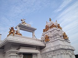
Dwaraka Tirumala is a census town in Eluru district of the Indian state of Andhra Pradesh. It is located in Dwaraka Tirumala mandal of Jangareddygudem revenue division. The Venkateswara Temple is a pilgrimage center for hindus, which is the abode of Lord Venkateswara. This is often referred by the locals as Chinna Tirupati, meaning mini Tirupati.

<span class="mw-page-title-main">Musunuri Nayakas</span> Medieval ruling dynasty in South India

The Musunuri Nayakas were a ruling family of 14th-century South India who were briefly significant in the region of Telangana and Andhra Pradesh. Musunuri Kapaya Nayaka is said to have taken a leadership role among the Andhra chieftains and driven out the Delhi Sultanate from Warangal. But his rise was soon challenged by the Bahmani Sultanate and he was defeated along with the Vijayanagar in the Bahmani–Vijayanagar War. The Recherla Nayakas wrested power from him in 1368.

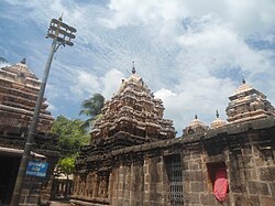
Vengi or Venginadu is an Indian region in modern-day Andhra Pradesh spread over the Godavari and Krishna river deltas. The capital city of Vengi is located at Pedavegi near Eluru. Vengi was the most prominent city in Ancient Andhra for nearly seven centuries. Vengi served as the capital for Andhra dynasty like Salankayanas This region was part of Ashoka's Mauryan Empire in the mid-3rd century BCE. After the Mauryan Empire collapsed in 185 BC, the region was dominated by the Satavahanas, who were succeeded in Vengi by the Andhra Ikshvakus. Around 300 CE, the Andhra Ikshvakus were replaced by the Salankayanas. In the late 5th century, the Salankayanas were annexed by the Vishnukundinas.

<span class="mw-page-title-main">Pithapuram</span> City in Andhra Pradesh, India

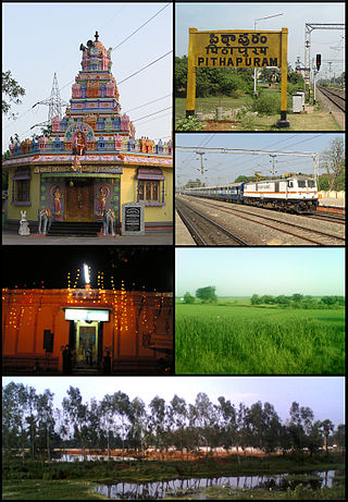
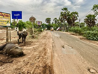
Pithapuram or Pitapuram is a city and a municipality in the Kakinada district of Andhra Pradesh, India. The city also forms a part of Godavari Urban Development Authority. Pitapuram is home to one of the eighteen Maha Sakthi Peethas, which are significant shrines and pilgrimage destinations in Shaktism. Sripada Sri Vallabha, a prominent Hindu saint of 14th century born and lived in Pitapuram.

Telaga is a community found in Coastal Andhra region of India. Telaga is a subcaste of Kapu and both terms are often used synonymously. They are classified as a Forward caste. They are a land-owning agrarian community. Historically, they were a warrior caste known for their honour and bravery.

<span class="mw-page-title-main">History of Andhra Pradesh</span>

The recorded history of Andhra Pradesh, one of the 28 states of 21st-century India, begins in the Vedic period. It is mentioned in Sanskrit epics such as the Aitareya Brahmana. Its sixth-century BCE incarnation Assaka lay between the Godavari and Krishna Rivers, one of sixteen mahajanapadas. The Satavahanas succeeded them, built Amaravati, and reached a zenith under Gautamiputra Satakarni.

<span class="mw-page-title-main">Pedavegi</span> Village in Andhra Pradesh, India

Pedavegi is a village in Eluru district in the state of Andhra Pradesh in India, 10 km north of Eluru. It is administered under Eluru revenue division. Pedavegi also serves as the mandal headquarters of Pedavegi mandal. The nearest railway station is Denduluru (DEL) located at a distance of 9.15 km.

Chandole is a village in Bapatla district of the Indian state of Andhra Pradesh. It is located in Pittalavanipalem mandal of Bapatla revenue division.

<span class="mw-page-title-main">Kakinada district</span> District in Andhra Pradesh in India

Kakinada district is a district in the Coastal Andhra Region in the Indian state of Andhra Pradesh. With Kakinada as its administrative headquarters, it was proposed on 26 January 2022 to become one of the resultant twenty six districts in the state after the final notification has been issued on 4 April 2022 by the government of Andhra Pradesh. The district was formed from Kakinada and Peddapuram revenue divisions from East Godavari district. Incidentally, during earlier times, the region comprising towns Pithapuram, Kakinada and Peddapuram were referred as Polnaud or Prolunadu, which now roughly corresponds to the areas in this district.

Rajahmundry Circar or Rajahmundry Sarkar was one of the five Northern Circars in the Golconda Sultanate, Deccan subah of Mughal empire and later in the Nizam's dominion of Hyderabad. The Northern Circars were the most prominent ones in the Deccan subah. Eastern Ghats near Pentakota village were considered the northern limit of the Rajahmundry Circar while the southern limit was demarcated by the Godavari river.

Rudra-deva was a Kakatiya king, who ruled parts of the present-day Telangana and Andhra Pradesh in southern India. He was the first sovereign ruler of his dynasty.

<span class="mw-page-title-main">Ganapati (Kakatiya dynasty)</span> Sakala-desha-pratishthapanacharya

Ganapati-deva was the longest reigning monarch of the Kakatiya dynasty of southern India. He brought most of the Telugu-speaking region in present-day Andhra Pradesh and Telangana under the Kakatiya influence by war or diplomacy.

References

  1. "District – East Godavari". Andhra Pradesh Online Portal. Archived from the original on 18 June 2015. Retrieved 23 August 2014.
  2. "Collectors, SPs appointed for new districts in Andhra Pradesh". The Hindu. 30 April 2022. Retrieved 30 April 2022.
  3. 1 2 "District Census Hand Book – West Godavari" (PDF). Census of India . Registrar General and Census Commissioner of India.
  4. 1 2 "District Census Hand Book – East Godavari" (PDF). Census of India . Registrar General and Census Commissioner of India.
  5. "New 'AP 39&40' code to register vehicles in Andhra Pradesh launched". The New Indian Express. Vijayawada. 31 January 2019. Archived from the original on 3 February 2019. Retrieved 9 June 2019.
  6. 1 2 Bhaskar, B. v s (8 June 2014). "Nyapathi Subbarao carved an identity for Telugus". The Hindu via www.thehindu.com.
  7. "District Profile". East Godavari District Webportal. National Informatics Centre. Archived from the original on 30 April 2015. Retrieved 8 May 2015.
  8. Knipe, David M. (2015). Vedic Voices: Intimate Narratives of a Living Andhra Tradition. Oxford University Press. ISBN   9780199397709 . Retrieved 8 May 2015.
  9. Narayana Rao, K. V. (1972). Telangana. Minerva Associates. ISBN   9780883861189.
  10. "Post division, who will get Bhadrachalam?". The Times of India. 21 August 2013.
  11. Reid, William (1849). The progress of the development of the law of storms... J. Weale. p. 105.
  12. Balfour, Edward (1885). The cyclopaedia of India and of eastern and southern Asia. Vol. 2. B. Quaritch. p. 125.
  13. Chambers, William (1851). Chambers's Papers for the people. p. 15.
  14. Srivastava, Dayawanti; et al., eds. (2010). "States and Union Territories: Andhra Pradesh: Government". India 2010: A Reference Annual (54th ed.). New Delhi, India: Additional Director General, Publications Division, Ministry of Information and Broadcasting (India), Government of India. pp. 1111–1112. ISBN   978-81-230-1617-7.
  15. "Island Directory Tables: Islands by Land Area". United Nations Environment Program. 18 February 1998. Archived from the original on 1 December 2015. Retrieved 11 October 2011. Sumba 10,711
  16. 1 2 3 4 "Economy of East Godavari District". Andhra Pradesh Economic Development Board. Retrieved 25 April 2017.
  17. 1 2 3 4 5 "District Census 2011". Census2011.co.in. 2011. Retrieved 30 September 2011.
  18. "Indian Districts by Population, Growth Rate, Sex Ratio 2011 Census". Census2011.co.in. Retrieved 25 August 2012.
  19. "Population by Religion - Andhra Pradesh". censusindia.gov.in. Registrar General and Census Commissioner of India. 2011.
  20. 1 2 "Table C-16 Population by Mother Tongue: Andhra Pradesh". Census of India . Registrar General and Census Commissioner of India.
  21. 1 2 3 "District Level Household and Facility Survey (DLHS-3), 2007-08: India. Andhra Pradesh" (PDF). International Institute for Population Sciences and Ministry of Health and Family Welfare. 2010. Retrieved 3 October 2011.
  22. Decadal Variation In Population Since 1901
  23. "6 new districts carved out from Godavari districts". The Hans India. 4 April 2022. Retrieved 1 May 2022.
  24. "Delimitation of Parliamentary and Assembly Constituencies Order, 2008" (PDF). The Election Commission of India. p. 30.
  25. "Here's How the New AP Map Looks Like After Districts Reorganization". Sakshi. 3 April 2022. Retrieved 3 April 2022.
  26. Augustine, Seline (13 April 2017). "She blazed a trail". The Hindu.
  27. "Existing State Highways" (PDF). Andhra Pradesh Road Development Corporation. Government of Andhra Pradesh. p. 1. Archived from the original (PDF) on 20 September 2018. Retrieved 11 May 2019.
  28. "Rajamahendravaram airport terminal operational". The Hindu Business Line. 17 May 2012. Retrieved 24 June 2014.
  29. Ministry of Shipping (Government of India). "National waterways Declaration". Archived from the original on 10 April 2009. Retrieved 5 August 2010.
  30. Press Information Bureau, Government of India (2 August 2010). "Development Authority for Inland Waterways in India" . Retrieved 5 August 2010.
  31. "School Education Department" (PDF). School Education Department, Government of Andhra Pradesh. Archived from the original (PDF) on 27 December 2015. Retrieved 7 November 2016.
  32. "The Department of School Education – Official AP State Government Portal". www.ap.gov.in. Archived from the original on 7 November 2016. Retrieved 7 November 2016.
  33. "School Information Report". Commissionerate of School Education. Government of Andhra Pradesh. Archived from the original on 8 November 2016. Retrieved 8 November 2016.
  34. "Student Information Report". Commissionerate of School Education. Child info 2015–16, District School Education – Andhra Pradesh. Archived from the original on 22 May 2015. Retrieved 8 November 2016.
  35. "Tourist Places". East Godavari District Webportal. Retrieved 16 July 2014.