Palakollu is a city[6][7] and the administrative headquarters of Palakollu Mandal in Narasapuram revenue division in West Godavari district of the Indian state of Andhra Pradesh. Palakollu is situated in Coastal Andhra region of the state.[8] It occupies 4.685 square kilometres (1.809sqmi).[9]As of 2011[update]census, it had a population of about 61,284 and a Metro population of about 81,199. Palakollu Municipality merged five Grama panchayats of Seven village's (Kontheru, Adavipalem, Palakollu Rural, Bhaggeswaram, Poolapalli, Varidhanam And Ullamparru) on 7 January 2020. The Seven Villages' had a population of 42,932 as of 2011 Census. It around occupies 20.08 square kilometres (7.75sqmi) and after merged palakollu municipality, It around occupies 24.68 square kilometres (9.53sqmi) with 35 election wards it is total population of 1,04,216 (as 2011 Census)[3][10][clarification needed] and making it the third most populous urban area in West Godavari District in Andhra Pradesh.[11] It is a part of Eluru Urban Development Authority.
In 2018, as per the Swachh Bharat mission of the Ministry of Urban Development, Under Swachh Survekshan - 2018 Palakollu Municipality was ranked 43rd in the South Zone out of 1113 With Zonal Avg Marks 1438.96 And State Rank 20th Out of 79 With State Avg Marks 1916.2 Palakollu ULB Census Coad 802966.[clarification needed][12]
Palakollu was also known as "Upamanyapuram" or "Ksheerapuri" or "Palakolanu" or "palacole", named after the lord Ksheera Ramalingeswara Swamy.[14] Gradually it changed into "Upamanyapuram" or "Ksheerapuri" or "Palakolanu"and now to Palakollu. Dugdhopavanapuram and Upamanyapuram are palakollu names for palakollu. The name of Upamanyapuram and the palakollu is derived from the place where the great devotee Upamanyudu attained mammal.[clarification needed] The name Palakollu In the affairs of the became the palakollu of the masses. There is also in the dealing of the ksheera ramam as a Sanskritization of the name of palakollu.[15]
History
Palakol or Palakollu was originally known as Kshiraramam, Kshirapuram, Palakolanu or Upamanyapuram. [16]
In 1613, the Dutch built their first Indian factory at Palakollu, which was temporarily abandoned in 1730. Part of Dutch Coromandel, it was a trading post for textiles, lamp oil, wood, roof tiles, and bricks.
Under the 1783 Treaty of Paris, the town was ceded to the British, but the Dutch continued to rent it from them until 1804. In 1818 it was formerly restored to the Dutch only to be ceded again to the British in 1824.[17]
Palakollu is also known as Trilinga Desam, the region bounded by three lingas (Srisailam, Draksharamam and Kaleswaram)
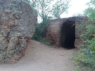
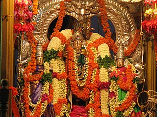
The most famous Ksheerarama is one of the five Pancharama Kshetras, and is located in Palakollu. Lord Shiva is known locally as Ksheera Ramalingeswara Swamy. The Sivalinga was established by Lord Vishnu.
The famous Sri Lakshmi Ganapathi Navagraha Subrahmanya Aalayam, temple located at Brodipeta 2nd Lane in Palakollu. The presiding deity is Lord Ganapathi in the divine form of Lakshmi Ganapathi, along with the Navagrahalu and Subrahmanya Swamy deities. [18]
Under the Qutb Shahi reign
Textile Industry Center
During the reign of Golkonda Qutub Shahi in the 16th and 17th centuries, the textile industry was flourishing in the Palakollu region. Made of cotton, calico, lingerie and blankets. Textiles made of colored dye were also made in palakollu. All of these garments reached the port of Machilipatnam and from there shipped to various parts of the country by ship.[19] In 1770, agriculture and business were disrupted by a major drought that hit the Krishna and Godavari deltas. The drought has had an adverse effect on the textile industry, which is home to the palakollu industry. The Dutch industry reports that the textile industry in the palakollu in region had slowed down in the late 18th century. The rise of textile imports from England in the 19th century, along with other Coromandel coastal textile centers, has also severely damaged Palakollu textile. In the case of the markets where textile products are sold, England's milling of local garments has begun in the region. This has caused the palakollu industry to become the center of the textile industry.[20]
Fabric industry
Under the rule of the Qutb Shahi, the iron-making industry in Palakollu was elastic. The Narasapuram Shipbuilding industry is nearby . In India, iron ships were generally made of wood in other areas. Due to the lack of iron in the Godavari Delta region, Narasapur was only used for making nails and other iron tools. These conditions have given rise to the iron nail industry in palakollu.[21]
Geography
Palakollu is located at 16°31′00″N81°43′48″E / 16.5167°N 81.7300°E / 16.5167; 81.7300.[22] It is in the southern part of Andhra Pradesh in southeastern India. The town occupies an area of 19.49 square kilometres (7.53sqmi) under the administration of Palakollu Municipality (PMC). There is one major Rajamahendravaram - Narsapuram Canal that supplies water to the town: New Water Lake and old water lake apart from the Godavari River. Small canals are used only for agricultural and industrial purposes. Palakollu is a flat country with a slight eastern slope along the canals of the town flow. The canals in Palakollu generally flow from west to east.
The town has an average elevation of 1.5 metres (4.9ft). It is bounded by Penugonda Village on the north, Narasapuram on the south. The Godavari River separates East Godavari district on east and Bhimavaram on the west.
Palakollu has a tropical climate. When compared with winter, the summers have much more rainfall. The climate here is classified as Aw by the Köppen-Geiger system. In Palakollu, the average annual temperature is 27.9°C. In a year, the average rainfall is 1208mm. The driest month is January, with 1mm of rainfall. In October, the precipitation reaches its peak, with an average of 286mm. The warmest month of the year is May, with an average temperature of 32.4°C. At 23.4°C on average, January is the coldest month of the year. The difference in precipitation between the driest month and the wettest month is 285mm. The variation in annual temperature is around 9.0°C. The weather is hot and humid, with a tropical climate and, thereby, no distinct seasons. The coolest months are December and January There is heavy monsoon rain at the end of summer, with depressions in the Bay of Bengal.
Source: India Meteorological Department (climate data)[23]
Culture
Palakollu near Konaseema
The town is known in the state for its cultural history whose residents are more often referred as 'Palakollu'.[clarification needed] There are many religions, languages, traditions and festivals. Shiva Puja and a special Maha Shivaratri Karthika Masam in Karthikai Deepam are important events of the Hindu festival of Makar Sankranti in the town, mainly due to the existence of the self manifested Ksheerarama Temple.
Allu Rama Lingaiah, commonly known as Allu, was an Indian Telugu language comedic actor from Palakollu, who appeared in over one thousand Tollywood films.
Anantha Sriram Chegondi is an Indian lyricist, mainly writing lyrics for songs in Telugu language films. He is one of the most sought after lyricists in the Telugu film Industry.
Dasari Narayana Rao is an Indian film actor, director and producer in Telugu cinema. He has directed about 140 films, produced three films, and worked as a dialogue writer and as a lyricist. Actor Chiranjeevi contested the 2009 Lok sabha elections from his hometown and lost.
The Palakollu Municipal Council (PMC) is the municipal governing body of the town. It was constituted as a municipality on 1 April 1919. The jurisdiction of the civic body is spread over an area of 19.49km2 (7.53sqmi) and has 32 municipal wards. Each ward is represented by a councilor, elected by popular vote. The Council Members democratically elected headed by a municipal chairman, who is the titular head of PMC; executive powers rest with the municipal commissioner, appointed by the state government. The PMC carries out the town's infrastructural work such as building and maintenance of roads and drains, town planning including construction regulation, maintenance of municipal markets and parks, solid waste management, the issuing of birth and death certificates, the issuing of trade licenses, collection of property tax, and community welfare services such as mother and child healthcare, and pre-school and non-formal education.[24]
The municipality was constituted in 1919 and upgraded as a third grade municipality in 1952. The Palakollu Municipality was upgraded to first grade in August 1965. Its constituents include the municipality of Palakollu, and the outgrowths of Poolapalli, Ullamparru, and Palakollu (rural). Now Palakollu municipality 1 January 2019: Eluru Urban Development Authority (EUDA) created.[clarification needed] Palakollu became a part of EUDA along with places in West Godavari District.
Palakollu (Assembly constituency) is a legislative assembly constituency in Andhra Pradesh. Sri Chodisetty Surya Rao was its longest serving municipal chairman, from 1956 to 1986. Many colleges ASNM, Dasari Women's degree college, Coco Junior govt college, 34 acres of drinking water tanks developed with 20 year vision, government hospital, and lorry stand are all developed under his regime. As gratitude people of Palakol erected a bronze statue in center of the town.[25]
E-governance services
For providing facilities to the people the Government of Andhra Pradesh started MeeSeva[26] (at your service) centres all around the town and the state. The main purpose of this facility was to bring public services closer to home. MeeSeva provides online signed digital certificates like income certificates, residence certificates, land records and other registration records. These records are further stored in an online database.[27]
Healthcare
Palakollu is becoming one of the major healthcare centers in West Godavari District. Government General Hospital is one of the major government hospitals in the West Godavari District, also serving patients from the cities and neighbouring mandals of Poduru, Yelamanchili and Penugonda. The town has about 50 hospitals including surgeons, orthopedics, gynecologists, dental specialists, ENTs, eye specialists, RMPs and PMPs.
As of the 2011 census of India, the town had a population of 81,199. The total population constitutes 40,103 males and 41,096 females—a sex ratio of 1024 females per 1000 males. 7,318 children are in the age group of 0–6 years, of whom 3,743 are boys and 3,575 are girls—a ratio of 955 girls per 1000 boys. The average literacy rate stands at 76.95%, significantly higher than the state average of 73.00%.[32][33][34][11]
Language and religion
Referred to as "Palakolian", the residents of Palakollu are predominantly Telugu, with a minority Gujarati (including Memon). Telugu is the official language. Hindus are in the majority. Muslims and Christians form a very small minority of the people in Palakollu. According to the 2011 census, the religious makeup of Palakollu town was: Hindus (95.64%), Muslims (2.11%), Christians (1.97%), Jains (40 people), Sikhs (10 people) and Buddhists (3 people); 143 people did not state any religion.[35]
Agriculture-based businesses like food processing and rice mills are the chief sources of the town's revenue. It serves as a distribution centre as well as commercial centre to its hinterland. The town is the regional centre for higher education and is known for its specialized health services
Industries Handmade crochet lace-work is one of the most common form of industry in the town.[37]
There are many industries and rice mills industries in and around the town.[38]
Aquaculture
Fishery is one of the main occupations that generates good amounts of revenues for the fishermen. It involves cultivation of a variety of estuarine fish called Pulasa.[39]
Cityscape
Neighbourhoods
Palavelli Boutique Resorts lake view
Palavelli Boutique Resorts is located at a distance of 12.9km from the town. the resorts Nestled on the banks of the Vashista, a tributary of the River Godavari at Yalamnachalli Lanka, the Palavelli Boutique Resorts reflects the rich culture and tradition of the Konaseema region in Andhra Pradesh.[40]
Landmarks
The Perupalem Beach is located at a distance of 26km from the town and Dindi Resorts is located at a distance of 15km from the town.[41] Palakollu has become a key landmark destination for foreigners due to monkey tourism.[citation needed]
The town was once famed for its traffic problems with the railway gates at Bhimavaram Road (P.P Road) area. When the National Highway passed through the town, the traffic hurried to pass over the railway gate in the town and outskirts, which made traffic worse.
To avoid the traffic congestion, the government of India constructed a mini bypass road connecting Narsapur Road and Poolapalli on both ends of the town. Even then, the traffic problem were not resolved. The main bypass road (which was constructed under R&B which was completed in the late 2014s) had only 10,000 vehicles pass through the bypass road; now it has almost doubled.
Traffic in the town of narrow lanes was growing by the day. Even though officials planning to construct an underbridge at Bhimavaram Road (P.P Road) railway overbridge it is already approved from South Central railway at Palakollu town But still Pending in the project. and in the town all National Roads and R&B Roads still single lines only thay try to Since 1950 extend Roads making the one way but This is also Still Pending. 2018 year the traffic has doubled, without giving any relief to citizens. There are 25 traffic centres identified in the town.
Sri Potti Sriramulu bus station Located in palakollu town APSRTC operates buses from Palakollu to major cities like Hyderabad, Rajamahendravaram, Kakinada, Vizag, Vijayawada, and Tirupati. Ten express trains service the town, which is on the Narsapur–Vijayawada railway route.[42] A bridge was built on Vasista Godavari near Chinchinada 8km away from Palakollu connecting East Godavari and West Godavari Districts of Andhra Pradesh, which makes it a part of National Highway 216. Palakollu railway station is classified as a B–category station in South Central Railway zone.[43]
The town has a total road length of 78.80km (48.96mi).[44]
Rajahmundry Airport is the airport serving to Palakollu 70km away.[49] A new terminal building was inaugurated on 16 May 2012. The runway is expanded from the 1,749m to 3,165m to facilitate the landing and takeoff of bigger aircraft.[50] The state government is developing the airport as an international airport. Heli tourism is introduced in the airport.[51]
Education
Palakollu plays a major role in education for urban and rural students from nearby villages.[52] It has an average literacy rate of 83.90% with, according to the 2011 census, a total number of 63,097 who are literate. This includes 32,397 men (88.13%) and 30,700 women (79.82%).
Primary and secondary school education is provided by government, aided, and private schools, under the School Education Department of Andhra Pradesh.[53] According to the school information report for the academic year 2016–17, the urban area has around 160 schools. These include government, residential, private, municipal, and other types of schools. There are more than 100 private schools and 49 municipal schools.[54] There are more than 30,000 students in these schools.[55]
There are numerous higher educational institutions in and around Palakollu town.[56] Some of the renowned institutions are Jogaiah Institute of Technology and Sciences,[57] D.N.R Educational Institutions,[58] Jogaiah Institute of agricultural engineering, A.S.N.M degree and P.G college, B.R.R & G.K.R Chambers Degree & PG College, Jogaiah institute of Technology and Sciences, College of Pharmacy.[59]
Coastal Andhra or Kosta Andhra is a geographic region in the States and union territories of India of Andhra Pradesh. Vijayawada is the largest city in this region. Region share borders with Uttarandhra, Rayalaseema and Telangana. It was part of Madras State before 1953 and Andhra State from 1953 to 1956. According to the 2011 census, it has an area of 91,915 square kilometres (35,489 sq mi) which is 57.99% of the total state area and a population of 34,193,868 which is 69.20% of Andhra Pradesh state population. This area includes the coastal districts of Andhra Pradesh on the Circar Coast between the Eastern Ghats and the Bay of Bengal, from the northern border with Odisha to Rayalaseema in the south.
Rajahmundry, officially Rajamahendravaram, is a city in the Indian state of Andhra Pradesh and district headquarters of East Godavari district. It is the seventh most populated city in the state. During British rule, the district of Rajahmundry was created in the Madras Presidency in 1823. It was reorganised in 1859 and bifurcated into the Godavari and Krishna districts. Rajahmundry was the headquarters of Godavari district, which was further bifurcated into East Godavari and West Godavari districts in 1925. It is administered under Rajahmundry revenue division of the East Godavari district. The city is known for its floriculture, history, culture, agriculture, economy, tourism, and its heritage. It is known as the "Cultural Capital of Andhra Pradesh".
The West Godavari district is a coastal district in the Indian state of Andhra Pradesh with an administrative headquarters in Bhimavaram. As of the 2011 Census of India, the district has an area of 2,178 km2 (841 sq mi) and a population of 1,779,935. It is bounded by the Krishna district and Bay of Bengal to the south, East Godavari district to the east, and Eluru district, Kolleru Lake and Upputeru Drain to the northwest.
Machilipatnam, also known as Masulipatnam and Bandar, is a city in Krishna district of the Indian state of Andhra Pradesh. It is a municipal corporation and the administrative headquarters of Krishna district. It is also the mandal headquarters of Machilipatnam mandal in Machilipatnam revenue division of the district. The ancient port town served as the settlement of European traders from the 16th century, and it was a major trading port for the Portuguese, British, Dutch and French in the 17th century.
Kakinada is the sixth largest city of the Indian state of Andhra Pradesh and serves as the district headquarters of the Kakinada District. It lies on the coast of the Bay of Bengal. J.N.T.U. College of Engineering Kakinada, established in 1946, is the oldest and popular Government college in the state of Andhra Pradesh. The First Polytechnic college of Andhra Pradesh, Andhra Polytechnic was established here in 1946. It was also the origin point of Buckingham Canal where goods used to be transported by boats during the British rule. It was once home for Asia's largest sea port. Many people from the city migrated from this sea port to countries like Burma, Mauritius, Fiji and various southeast Asian countries to work there as workers where they were called as Coringas.
Eluru is a city and the district headquarters of Eluru district in the Indian state of Andhra Pradesh. It is one of the 14 municipal corporations in the state and the mandal headquarters of Eluru mandal in the Eluru revenue division. The city is on the Tammileru river. The city is well known for its wool-pile carpets and hand woven products. As of 2011 Census of India, the city had a population of 214,414. Its history dates back to the second century CE.
Kovvur is a town in the East Godavari district of the Indian state of Andhra Pradesh. It is a municipality and the mandal headquarters of Kovvur mandal in Kovvur revenue division.
Bhimavaram is a city and headquarters of West Godavari district of the Andhra Pradesh state of India. It is the administrative headquarters of Bhimavaram mandal in Bhimavaram revenue division. It is a part of Eluru Urban Development Authority. As of 2011 census, it is the most populous urban area in the district with a population of 163,875. It is one of the major pilgrimage centers in the state, which is home to Somaramam, one of the five great Pancharama Kshetras.
Tanuku is a Town in West Godavari district of the Indian state of Andhra Pradesh. It is the mandal headquarters of Tanuku mandal. Tanuku is 4th largest town in the West Godavari District after Bhimavaram,Tadepalligudem and Palakollu in terms of population. Tanuku is the Textile Hub of both West Godavari district and East Godavari district. There are a Significant number of Large scale and Small scale Spinning Mills
Tadepalligudem is a city in West Godavari district of the Indian state of Andhra Pradesh. It is a Selection Grade municipality and the mandal headquarters of Tadepalligudem mandal and Tadepalligudem Revenue Division. Tadepalligudem is one of the biggest City in West Godavari district
Peddapuram is a town in the Kakinada district of Andhra Pradesh in South India. The town also forms a part of Godavari Urban Development Authority.
Pithapuram or Pitapuram is a city and a municipality in the Kakinada district of Andhra Pradesh, India. The city also forms a part of Godavari Urban Development Authority. Pitapuram is home to one of the eighteen Maha Sakthi Peethas, which are significant shrines and pilgrimage destinations in Shaktism. Sripada Sri Vallabha, a prominent Hindu saint of 14th century born and lived in Pitapuram.
Jangareddygudem (JRG) is a municipality in newly formed Eluru district which is previously in West Godavari district of the Indian state of Andhra Pradesh.
Mandapeta was originally called "Mandavyapuram", which came from Sage Mandukya. Mandapeta is a second-grade municipality established on October 1, 1958 in Dr. B.R. Ambedkar Konaseema district in the Indian state of Andhra Pradesh. It is located at mean elevation of about 15.48 msl at 16.520 N, 81.560 E.
Nidadavolu is a town in East Godavari district of the Indian state of Andhra Pradesh. It is a municipality and the mandal headquarters of Nidadavolu mandal in Kovvur revenue division.
Samarlakota is a town in Kakinada district of the Indian state of Andhra Pradesh. The town forms a part of Godavari Urban Development Authority. It was previously known as Chamarlakota, which dates back to a local kaifiyat that was written in the mid-eighteenth century.
Narasapuram is a town in West Godavari district of the Indian state of Andhra Pradesh. It is a municipality and mandal headquarters of Narasapuram mandal in Narasapuram revenue division. The city is situated on the banks of the Vasista Godavari River. The lace industry is prevalent in the city and its surroundings.
Kaikaluru is a town in Eluru district of the Indian state of Andhra Pradesh. Kaikalur is home to Kolleru Lake, one of the largest freshwater lakes in India, covering about 90,100 hectares and is a tourist attraction.
Penugonda is a town in West Godavari district of the Indian state of Andhra Pradesh.
Palakollu mandal is one of the 46 mandals in the West Godavari district of the Indian state of Andhra Pradesh. The headquarters is located at Palakollu City. The mandal is bordered by Yelamanchili mandal in the north, Narasapuram mandal in the east, Poduru mandal in the south and Veeravasaram mandal in the west.
↑ "Palakollu 2011 Census india". Census of india gov. 2011 census of india & Municipal Administration and Urban Development Department, Government of Andhra Pradesh. Retrieved 10 June 2018.
↑ "Sub-national HDI – Area Database". Global Data Lab. Institute for Management Research, Radboud University. Archived from the original on 23 September 2018. Retrieved 25 September 2018.
1 2 3 "Palakollu 2011 Census india". Census of india gov. 2011 census of india & Municipal Administration and Urban Development Department, Government of Andhra Pradesh. Retrieved 19 August 2014.
↑ Joshi, P. M. (1941). "Textile Industry and Trade of the Kingdom of Golkonda". Proceedings of the Indian History Congress. 5: 609–617. ISSN2249-1937. JSTOR44304839.
↑ Subrahmanyam, Sanjay (1990). "Rural Industry and Commercial Agriculture in Late Seventeenth-Century South-Eastern India". Past & Present. 126 (126): 76–114. doi:10.1093/past/126.1.76. ISSN0031-2746. JSTOR650810.
↑ Subrahmanyam, Sanjay (1988). "A Note on Narsapur Peta: A "Syncretic" Shipbuilding Centre in South India, 1570-1700". Journal of the Economic and Social History of the Orient. 31 (3): 305–311. doi:10.2307/3632014. ISSN0022-4995. JSTOR3632014.
↑ "Palakollu Population". Government of India, Ministry of Home Affairs. Retrieved 17 April 2018.On this page, select "Andhra Pradesh" from the download menu In Town Amenities. Data for Palacole (M + OG)" is at row 234 of the downloaded excel file.
↑ "West Godavari febsus Handbook Census india"(PDF). Census of India District Census Handbook. 2011 census of india & Municipal Administration and Urban Development Department, Government of Andhra Pradesh. p.54,55. Retrieved 10 June 2018.
1 2 "C-1 Population By Religious Community". Government of India, Ministry of Home Affairs. Archived from the original on 13 September 2015. Retrieved 11 May 2016.On this page, select "Andhra Pradesh" from the download menu. Data for Palacole (M + OG)" is at row 2393 of the downloaded excel file.
↑ "Details of Roads in each ULB of Andhra Pradesh". Commissioner and Directorate of Municipal Administration. Municipal Administration and Urban Development Department - Government of Andhra Pradesh. Archived from the original on 1 August 2016. Retrieved 28 March 2017.
↑ "School Education Department"(PDF). Rashtriya Madhyamik Shiksha Abhiyan (RMSA). School Education Department, Government of Andhra Pradesh. Archived from the original(PDF) on 21 October 2016. Retrieved 1 April 2017.
This page is based on this Wikipedia article Text is available under the CC BY-SA 4.0 license; additional terms may apply. Images, videos and audio are available under their respective licenses.


