Summer Haven, Florida | |
|---|---|
Unincorporated community | |
 | |
 | |
| Coordinates: 29°41′57″N81°13′24″W / 29.69917°N 81.22333°W | |
| Country | United States |
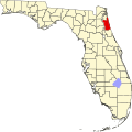
| State | Florida |
| County | St. Johns |
| Elevation | 0 ft (0 m) |
| GNIS feature ID | 308140 [1] |
Summer Haven is an unincorporated community in southeast St. Johns County, Florida, United States, located just south of the Matanzas Inlet, on a narrow strip of land between a shallow marsh and the Atlantic Ocean. [2]
Contents
Summer Haven is a small beach resort which began with cottages used by farmers. It consists of approximately 60 structures, mostly single family homes. [2] [3]
Around 1890, Thomas A. Mellon started vacationing in Summer Haven. Eventually the community attracted other well known people, including Cornelius Vanderbilt Whitney, Owen D. Young, and author Marjorie Kinnan Rawlings. [3] [4]
After severe nor’easters in 1962, Summer Haven was declared a disaster area, and the U.S. Army Corps of Engineers constructed an 1,800-foot granite revetment along the northern portion. After Hurricane Dora in 1964, the existing revetment, which fronts the majority of the upland development in the reach, was extended by an additional 1,070 linear feet. South of the revetment, development is limited to one row of single-family residences. When possible, St. Johns County has been purchasing structures and lands in this southern area and not allowing further development. [2]
Hurricane Matthew in 2016, destroyed the existing revetment. FEMA and St Johns County decided to rebuild and extend the revetment. Construction began in the Summer of 2020 and finished in June 2025.