Sweetwater, Oklahoma

Last updated

Sweetwater, Oklahoma
Town
Sweetwater, Oklahoma.JPG
Looking east on Oklahoma State Highway 152
Beckham County Oklahoma incorporated and unincorporated areas Sweetwater highlighted.svg
Location in Beckham and Roger Mills counties and the state of Oklahoma
Coordinates: 35°25′20″N99°54′42″W / 35.42222°N 99.91167°W / 35.42222; -99.91167
Country United States
State Oklahoma
County Beckham, Roger Mills
Area
[1]
  Total15.87 sq mi (41.11 km2)
  Land15.86 sq mi (41.07 km2)
  Water0.02 sq mi (0.04 km2)
Elevation
[2]
2,172 ft (662 m)
Population
 (2020)
  Total102
  Density6.43/sq mi (2.48/km2)
Time zone UTC-6 (Central (CST))
  Summer (DST) UTC-5 (CDT)
ZIP codes
73666
FIPS code 40-71900
GNIS feature ID2413357 [2]

Sweetwater is a town in Beckham and Roger Mills Counties in the U.S. state of Oklahoma. It was incorporated in 1998. [3] The population was 102 at the time of the 2020 census, [4] an increase of 17.2% over the 87 reported in the 2010 census. [5]

Contents

History

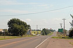
Named for nearby Sweetwater Creek, the town is at the junction of State Highway 30 and State Highway 152. Sweetwater originated around the time of the Cheyenne-Arapaho land opening in 1892. A post office for Sweetwater was established September 27, 1894 (current zip code 73666). By 1910, the community had an estimated population of 50, two general stores, a dry goods–grocery store, a cotton gin, and a fuel company. The residents expected the construction of a railroad through the area, but none was built, which limited further growth. The town did expand to about 100 people around the time of World War I, based on being an agricultural service center for the surrounding township, and the postmaster estimated 150 in the 1930s. However, the population started a decline even before World War II, as improved roads and automobile transportation carried business south to Erick or east to Elk City. [6]

On May 5, 2007, a tornado, rated EF3 on the enhanced Fujita scale, traveled on a path around 100 to 150 yards (91 to 137 m) wide and 7.5 miles (12.1 km) long. It began about 2.5 miles (4.0 km) south of Sweetwater and ended roughly 5 miles (8 km) north of Sweetwater, following State Highway 30. EF3 wind speeds range from 136 to 165 miles per hour (219 to 266 km/h). It severely damaged several buildings in the town, including the church and high school, and destroyed eight homes. [7] [8]


Education

The Sweetwater Public School District is one of the smallest public school districts in Oklahoma. For 2007, it tied with Boley for the smallest high school with 15 students. For a combined district, K-12, Sweetwater finished third behind Boley (51) and Clarita (58), with 60 students. [9]

Transportation

Oklahoma State Highway 6 and 152 run concurrently east-west through the town. [10] Oklahoma State Highway 30 runs north-south through town. [10] The Texas border is just to the west. [10]

Hobart Regional Airport (KHBR, or FAA ID: HBR) is about 74 miles southeast. [11] [12] It features two paved runways, the largest 5507’ by 100’. [11]

The nearest major airport to Sweetwater with commercial connections is Rick Husband Amarillo International Airport, about 125 miles to the west. [13]

Related Research Articles

<span class="mw-page-title-main">Pottawatomie County, Oklahoma</span> County in Oklahoma, United States

Pottawatomie County is a county located in the U.S. state of Oklahoma. As of the 2020 census, the population was 72,454. Its county seat is Shawnee.

<span class="mw-page-title-main">Adel, Georgia</span> City in Georgia, United States

Adel is a city in and the county seat of Cook County, Georgia, United States, located fifty-two miles (84 km) southeast of Albany. As of the 2020 census, the city had a population of 5,571.

<span class="mw-page-title-main">El Reno, Oklahoma</span> City in Oklahoma, United States

El Reno is a city in and county seat of Canadian County, Oklahoma, United States. As of the 2020 census, the city population was 16,989, marking a change of 1.55% from 16,729, recorded in the 2010 census. The city was begun shortly after the 1889 land rush and named for the nearby Fort Reno. It is located in Central Oklahoma, about 25 miles (40 km) west of downtown Oklahoma City.

<span class="mw-page-title-main">Union City, Oklahoma</span> Town in Oklahoma, United States

Union City is a town in Canadian County, Oklahoma, United States. The population was 1,645 at the 2010 census, a 19.6 percent increase from 1,375 in 2000. It is part of the Oklahoma City metropolitan statistical area.

<span class="mw-page-title-main">Ardmore, Oklahoma</span> City in Oklahoma, United States

Ardmore is the county seat of Carter County, Oklahoma, United States. The population was 24,725 at the time of the 2020 census, a 1.8% increase over the 2010 census figure of 24,283. The Ardmore micropolitan statistical area had an estimated population of 48,491 in 2013. Ardmore is 90 miles (140 km) from both Oklahoma City and Dallas/Fort Worth, Texas, at the junction of Interstate 35 and U.S. Highway 70, and is generally considered the hub of the 13-county region of South Central Oklahoma, also known by state tourism pamphlets as "Chickasaw Country" and previously "Lake and Trail Country". It is also a part of the Texoma region. Ardmore is situated about 9 miles (14 km) south of the Arbuckle Mountains and is located at the eastern margin of the Healdton Basin, one of the most oil-rich regions of the United States.

<span class="mw-page-title-main">Ketchum, Oklahoma</span> Town in Oklahoma, United States

Ketchum is a town in Craig and Mayes counties, Oklahoma, United States. The population was 442 at the 2010 census, a 27 percent gain from 286 at the 2000 census.

<span class="mw-page-title-main">Altus, Oklahoma</span> City in Oklahoma, United States

Altus is a city in and the county seat of Jackson County, Oklahoma, United States. The population was 18,729 at the 2020 census.

<span class="mw-page-title-main">Wilburton, Oklahoma</span> City in Oklahoma, United States

Wilburton is a city in Latimer County, Oklahoma, United States. It is the county seat of Latimer County. The city had a population of 2,285 as of the 2020 Census. Robbers Cave State Park is 5 miles (8.0 km) north of Wilburton.

<span class="mw-page-title-main">Idabel, Oklahoma</span> City in Oklahoma, United States

Idabel is a city in and the county seat of McCurtain County, Oklahoma, United States. The population was 7,010 at the 2010 census. It is in Oklahoma's southeast corner, a tourist area known as Choctaw Country.

<span class="mw-page-title-main">Sulphur, Oklahoma</span> City in Oklahoma, United States

Sulphur is a city in and county seat of Murray County, Oklahoma, United States. The population was 5,065 at the 2020 census, a 2.8 percent gain over the figure of 4,929 in 2010. The area around Sulphur has been noted for its mineral springs, since well before the city was founded late in the 19th century. The city received its name from the presence of sulfur in the water.

<span class="mw-page-title-main">Boley, Oklahoma</span> Town in Oklahoma, United States

Boley is a town in Okfuskee County, Oklahoma, United States. The population was 1,091 at the 2020 Census. Boley was incorporated in 1905 as a predominantly Black pioneer town with persons having Native American ancestry among its citizens. Boley is currently home to barbeque equipment maker, Smokaroma, Inc, and the John Lilley Correctional Center.

<span class="mw-page-title-main">Miami, Oklahoma</span> City in Oklahoma, United States

Miami is a city in and the county seat of Ottawa County, Oklahoma, United States, founded in 1891. Lead and zinc mining were established by 1918, causing the area's economy to boom.

<span class="mw-page-title-main">Clarendon, Texas</span> City in Texas, United States

Clarendon is a city in Donley County, Texas, United States. Its population was 2,026 at the 2010 census. The county seat of Donley County, Clarendon is located on U.S. Highway 287 in the Texas Panhandle, 60 miles (97 km) east of Amarillo.

<span class="mw-page-title-main">Sherman, Texas</span> City in Texas, United States

Sherman is a city in and the county seat of Grayson County, Texas, United States. The city's population in 2020 was 43,645. It is one of the two principal cities in the Sherman–Denison metropolitan statistical area, and is the largest city in the Texoma region of North Texas and southern Oklahoma.

<span class="mw-page-title-main">Sweetwater, Texas</span> City in Texas, United States

Sweetwater is a municipality in and the seat of Nolan County, Texas, United States. It is 123 miles southeast of Lubbock and 40 miles west of Abilene. Its population was 10,906 at the 2010 census.

<span class="mw-page-title-main">Mobeetie, Texas</span> City in Texas, United States

Mobeetie is a city in northwestern Wheeler County, Texas, United States, located on Sweetwater Creek and State Highway 152. Its population was 101 at the 2010 census, six below the 2000 figure.

<span class="mw-page-title-main">Clinton, Oklahoma</span> City in Oklahoma, United States

Clinton is a city in Custer and Washita counties in the U.S. state of Oklahoma. The population was 8,521 at the time of the 2020 census.

<span class="mw-page-title-main">Bartlesville, Oklahoma</span> City in Oklahoma, United States

Bartlesville is a city mostly in Washington County and Osage County, Oklahoma. The population was 37,290 at the 2020 census. Bartlesville is 47 miles (76 km) north of Tulsa and 18 miles (29 km) south of the Kansas border. It is the county seat of Washington County. The Caney River runs through Bartlesville.

Clarita is a small unincorporated community in Coal County, Oklahoma, United States. The post office was established January 19, 1910.

Bridge Creek is a town in Grady County, Oklahoma, United States. As of the 2020 census, the town population was 336, a 0% change from 2010.

References

  1. "ArcGIS REST Services Directory". United States Census Bureau. Retrieved September 20, 2022.
  2. 1 2 U.S. Geological Survey Geographic Names Information System: Sweetwater, Oklahoma
  3. "Boundary Changes". Geographic Change Notes: Oklahoma. Population Division, United States Census Bureau. May 19, 2006. Archived from the original on August 6, 2010. Retrieved July 2, 2008.
  4. "Sweetwater (town), Oklahoma". United States Census Bureau. Retrieved August 29, 2023.
  5. "Geographic Identifiers: 2010 Demographic Profile Data (G001): Sweetwater town, Oklahoma". U.S. Census Bureau, American Factfinder. Archived from the original on February 12, 2020. Retrieved February 24, 2014.
  6. "Sweetwater". Oklahoma Historical Society. Retrieved March 6, 2020.
  7. May 5, 2007 Sweetwater, Oklahoma Tornado Rated As EF3 at the National Weather Center (NOAA)
  8. Second wave of tornadoes rakes Plains - CNN
  9. School District Database at the Oklahoma State Department of Education (OSDE) Archived August 2, 2007, at the Wayback Machine
  10. 1 2 3 "Sweetwater, OK". Google Maps. Retrieved October 21, 2021.
  11. 1 2 "Hobart Regional Airport". AirNav.com. Retrieved October 21, 2021.
  12. "Hobart Regional Airport to Sweetwater, Oklahoma". Google Maps. Retrieved October 21, 2021.
  13. "Major airports near Sweetwater, Oklahoma". travelmath.com. Retrieved October 21, 2021.