Tangipahoa, Louisiana

Last updated

Tangipahoa, Louisiana
Village of Tangipahoa
Tangipahoa Parish Louisiana Incorporated and Unincorporated areas Tangipahoa Highlighted.svg
Location of Tangipahoa in Tangipahoa Parish, Louisiana.
Louisiana in United States (US48).svg
Location of Louisiana in the United States
Coordinates: 30°52′32″N90°30′45″W / 30.87556°N 90.51250°W / 30.87556; -90.51250
CountryFlag of the United States.svg  United States
StateFlag of Louisiana.svg  Louisiana
Parish Tangipahoa
Foundedc. 1853 (1853)
Incorporated 1866 (1866)
Government
  MayorBrenda V. Nevels
Area
[1]
  Total1.00 sq mi (2.60 km2)
  Land1.00 sq mi (2.60 km2)
  Water0.00 sq mi (0.00 km2)
Elevation
177 ft (54 m)
Population
 (2020)
  Total425
  Density422.89/sq mi (163.32/km2)
Time zone UTC-6 (CST)
  Summer (DST) UTC-5 (CDT)
Area code 985
FIPS code 22-74760

Tangipahoa is a village in Tangipahoa Parish, Louisiana, United States. The population was 425 at the 2020 census. It was named after the Tangipahoa Native American tribe. Tangipahoa is part of the Hammond Micropolitan Statistical Area.

Contents

Etymology

The name Tangipahoa is derived from the Muskogean words (tonche pahoha) which translates to "corncob people" or "people of the corn" or "corncob". [2] It is from this Native American tribe that the modern Tangipahoa Parish gets its name, as well as the Tangipahoa River.

Geography

Tangipahoa is located at 30°52′32″N90°30′45″W / 30.87556°N 90.51250°W / 30.87556; -90.51250 (30.875453, -90.512546). [3]

According to the United States Census Bureau, the village has a total area of 0.9 square miles (2.3 km2), all land.

Demographics

Historical population
CensusPop.Note
1870 236
1880 2599.7%
1900 297
1910 39432.7%
1920 252−36.0%
1930 30420.6%
1940 3194.9%
1950 35210.3%
1960 46532.1%
1970 4690.9%
1980 4935.1%
1990 56915.4%
2000 74731.3%
2010 7480.1%
2020 425−43.2%
U.S. Decennial Census [4]

2020 census

Tangipahoa racial composition [5]
RaceNumberPercentage
White (non-Hispanic)348.0%
Black or African American (non-Hispanic)36285.18%
Native American 10.24%
Asian 10.24%
Other/Mixed 184.24%
Hispanic or Latino 92.12%

As of the 2020 United States census, there were 425 people, 190 households, and 119 families residing in the village.

2000 census

As of the census [6] of 2000, there were 747 people, 235 households, and 171 families residing in the village. The population density was 791.5 inhabitants per square mile (305.6/km2). There were 266 housing units at an average density of 281.8 per square mile (108.8/km2). The racial makeup of the village was 8.43% White and 91.57% African American. Hispanic or Latino of any race were 0.13% of the population.

There were 235 households, out of which 47.2% had children under the age of 18 living with them, 25.5% were married couples living together, 40.0% had a female householder with no husband present, and 27.2% were non-families. 22.1% of all households were made up of individuals, and 7.2% had someone living alone who was 65 years of age or older. The average household size was 3.18 and the average family size was 3.76.

In the village, the population was spread out, with 41.8% under the age of 18, 11.2% from 18 to 24, 23.2% from 25 to 44, 15.7% from 45 to 64, and 8.2% who were 65 years of age or older. The median age was 22 years. For every 100 females, there were 79.6 males. For every 100 females age 18 and over, there were 71.9 males.

The median income for a household in the village was $13,438, and the median income for a family was $14,226. Males had a median income of $21,875 versus $12,500 for females. The per capita income for the village was $6,775. About 45.7% of families and 50.1% of the population were below the poverty line, including 62.7% of those under age 18 and 41.8% of those age 65 or over.

Notable person

See also

Related Research Articles

<span class="mw-page-title-main">Ferry Pass, Florida</span> Census-designated place in Florida, United States

Ferry Pass is a census-designated place (CDP) in Escambia County, Florida. It is a principal community in the Pensacola—Ferry Pass—Brent, Florida Metropolitan Statistical Area, and is located north of Pensacola city limits. The population was 29,921 at the 2020 United States Census, up from 28,921 at the 2010 United States Census. The University of West Florida, located in Ferry Pass, is the only university located in the Pensacola metropolitan area.

<span class="mw-page-title-main">Bardolph, Illinois</span> Village in Illinois, United States

Bardolph is a village in McDonough County, Illinois, United States. The population was 210 at the 2020 census, down from 251 in 2010.

<span class="mw-page-title-main">Pleasant Hill, Illinois</span> Village in Illinois, United States

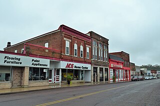
Pleasant Hill is a village in Pike County, Illinois, United States. The population was 966 at the 2010 census.

<span class="mw-page-title-main">Madrid, Iowa</span> City in Iowa, United States

Madrid is a city in Douglas Township, Boone County, Iowa, United States. The population was 2,802 at the time of the 2020 census. It is part of the Boone, Iowa Micropolitan Statistical Area, which is a part of the larger Ames-Boone, Iowa Combined Statistical Area.

<span class="mw-page-title-main">Natalbany, Louisiana</span> CDP in Louisiana, United States

Natalbany is a census-designated place (CDP) in Tangipahoa Parish, Louisiana, United States. The population was 1,739 at the 2000 census. It is part of the Hammond Micropolitan Statistical Area.

<span class="mw-page-title-main">Roseland, Louisiana</span> Town in Louisiana, United States

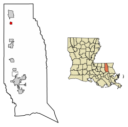
Roseland is a town in Tangipahoa Parish, Louisiana, United States. The population was 1,123 at the 2010 census. It is the birthplace of Cajun chef and storyteller Justin Wilson.

<span class="mw-page-title-main">Tickfaw, Louisiana</span> Village in Louisiana, United States

Tickfaw was founded in 1852 and is a village in Tangipahoa Parish, Louisiana, United States. The population was 694 at the 2010 census. Tickfaw is part of the Hammond Micropolitan Statistical Area. It was originally inhabited by Italian-American immigrants and continues to have a distinct Italian-American heritage.

<span class="mw-page-title-main">Waltham, Minnesota</span> City in Minnesota, United States

Waltham is a city in Mower County, Minnesota, United States. The population was 164 at the 2020 census.

<span class="mw-page-title-main">Hanley Hills, Missouri</span> Village in Missouri, United States

Hanley Hills is a village in St. Louis County, Missouri, United States. The population was 2,101 at the 2010 census.

<span class="mw-page-title-main">North Robinson, Ohio</span> Village in Ohio, United States

North Robinson is a village in Crawford County, Ohio, United States. The population was 219 at the 2020 census.

<span class="mw-page-title-main">Berkey, Ohio</span> Village in the United States

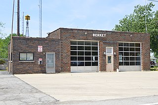
Berkey is a village in Lucas County, Ohio, United States. The population was 275 at the 2020 census.

<span class="mw-page-title-main">Mount Sterling, Wisconsin</span> Village in Wisconsin, United States

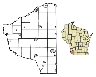
Mount Sterling is a village in Crawford County, Wisconsin, United States. The population was 211 at the 2010 census.

<span class="mw-page-title-main">Blue River, Wisconsin</span> Village in Wisconsin, United States

Blue River is a village in Grant County, Wisconsin, United States. The population was 434 at the 2010 census.

<span class="mw-page-title-main">Tennyson, Wisconsin</span> Village in Wisconsin, United States

Tennyson is a village in Grant County, Wisconsin, United States, originally called Dutch Hollow. The population was 355 at the 2010 census.

<span class="mw-page-title-main">Union Center, Wisconsin</span> Village in Wisconsin, United States

Union Center is a village in Juneau County, Wisconsin, United States, along the Baraboo River. The population was 200 at the 2010 census.

<span class="mw-page-title-main">Ontario, Wisconsin</span> Village in Wisconsin, United States

Ontario is a village in Vernon County, Wisconsin, United States. The population was 554 at the 2010 census.

<span class="mw-page-title-main">Webster (CDP), Massachusetts</span> CDP in Massachusetts, United States

Webster is a census-designated place (CDP) in the town of Webster in Worcester County, Massachusetts, United States. The population was 11,412 at the 2010 census.

<span class="mw-page-title-main">Bloomington, Wisconsin</span> Village in Wisconsin, United States

Bloomington is a village in Grant County, Wisconsin, United States. The population was 735 as of the 2010 census. The village is located within the Town of Bloomington.

<span class="mw-page-title-main">Necedah, Wisconsin</span> Village in Wisconsin, United States

Necedah is a village in Juneau County, Wisconsin, United States. The population was 916 at the 2020 census. The village is located within the Town of Necedah.

<span class="mw-page-title-main">Ironton, Wisconsin</span> Village in Wisconsin, United States

Ironton is a village in Sauk County, Wisconsin, United States, along the Little Baraboo River. The population was 253 at the 2010 census. The village is located within the Town of Ironton.

References

  1. "2020 U.S. Gazetteer Files". United States Census Bureau. Retrieved March 20, 2022.
  2. Bulletin - Smithsonian Institution. Bureau of American Ethnology. U.S. Government Printing Office. 1909. p. 2.
  3. "US Gazetteer files: 2010, 2000, and 1990". United States Census Bureau. February 12, 2011. Retrieved April 23, 2011.
  4. "Census of Population and Housing". Census.gov. Retrieved June 4, 2015.
  5. "Explore Census Data". data.census.gov. Retrieved December 28, 2021.
  6. "U.S. Census website". United States Census Bureau . Retrieved January 31, 2008.