Yogi Bear Jellystone Park is a resort encampment near the Robert (LA 445) interchange on Interstate 12.[8]
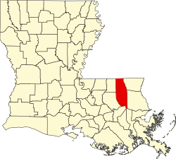
Florida Parishes Juvenile Detention Center, a rehabilitation institution for wayward youths, is physically located within Tangipahoa Parish along its boundary with Saint Tammany Parish east of Robert.[9]
Louisiana Renaissance Festival attracts thousands of tourists who pass through Robert annually in November en route to the festival grounds on LA 1064 (Tangipahoa River Road).[10]
In elections during the 2000s (decade), Robert demonstrated an unusually homogeneous voting behavior. In the 2008 Democratic presidential primary, Barack Obama’s Louisiana vote was 57.40 percent; in Tangipahoa Parish, Obama won a plurality of 39.81 percent; but in Robert (Tangipahoa Parish Precinct 122) Hillary Clinton beat Obama 45 to 9 (a 5:1 ratio) among 64 votes cast.[12] With comparable pluralitiesMike Huckabee carried the state and the parish over John McCain on the Republican side; but, in Robert, Huckabee won with a 59.96 percent majority (among 79 votes cast).[13]
In the 2008 presidential election, McCain and running-mate Sarah Palin carried Louisiana and Tangipahoa Parish by comparable majorities but trounced Obama and Joe Biden in Robert with 87.54 percent.[14]
Bombing range
During World War II a 15,216-acre (61.58km2) tract northeast of Robert served as the Hammond Bombing and Gunnery Range. As late as 2009 the 300 property owners in the tract were still under legal obligation to disclose the potential for unexploded ordnance. "[R]esidents cannot do as they wish with their properties . . . [but] have a moral obligation to reveal that it was a bombing range during a sale" according to Bruce Harrell CPA.[15]
↑In the November presidential election the Obama (Democratic) vote Louisiana-wide was 39.93%; Archived 2008-11-27 at the Wayback Machine Obama’s Tangipahoa Parish vote was 33.82%; but in Robert (Tangipahoa Precinct 122) Obama received just 10.77% (sic).
This page is based on this Wikipedia article Text is available under the CC BY-SA 4.0 license; additional terms may apply. Images, videos and audio are available under their respective licenses.