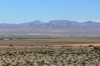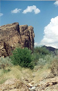
The Mohave Valley is a valley located mostly on the east shore of the south-flowing Colorado River in northwest Arizona. The valley extends into California's San Bernardino County; the northern side of the valley extends into extreme southeast Clark County, Nevada. The main part of the valley lies in southwest Mohave County, Arizona and is at the intersection of the southeast Mojave and northwest Sonoran deserts.

The La Posa Plain is a wide, generally flat plain in western Arizona near the Colorado River and is on the west and northwest border of the Kofa National Wildlife Refuge. The plain lies to the east of the Colorado River Indian Reservation and east of the Dome Rock and Trigo Mountains. Quartzsite, Arizona, lies on the western part of the plain, which crosses both Interstate 10 and U.S. Route 95.

The Kofa National Wildlife Refuge is located in Arizona in the southwestern United States, northeast of Yuma and southeast of Quartzsite. The refuge, established in 1939 to protect desert bighorn sheep, encompasses over 665,400 acres (2,693 km2) of the Yuma Desert region of the Sonoran Desert. Broad, gently sloping foothills as well as the sharp, needlepoint peaks of the Kofa Mountains are found in the rugged refuge. The small, widely scattered waterholes attract a surprising number of water birds for a desert area. A wide variety of plant life is also found throughout the refuge.

The Cerbat Mountains is a mountain range in Mohave County in northwest Arizona immediately north of Kingman. The Cerbat Mountains and the White Hills (Arizona) adjacent north, are the dividing ranges between the Detrital Valley west, and the Hualapai Valley east.

The Kofa Mountains of Yuma and La Paz counties in Arizona is the central mountain range of the Kofa National Wildlife Refuge. The range lies about 60 miles northeast of Yuma in the southwestern part of the state. Kofa Wilderness takes up 547,719 acres of the refuge, making it the second largest wilderness area in Arizona. The equally extensive Castle Dome Mountains comprise the southern refuge border; the western end of the Tank Mountains are in the southeast of the wildlife refuge, and the New Water Wilderness in the New Water Mountains ends the extension of the Kofa National Wildlife Refuge to the north. Scenic "King Valley" is south of the Kofa Mountains between the Castle Dome Mountains.
The Copper Mountains is a minor north–south trending mountain range, only 8 miles long in southwestern Arizona in the southwestern Sonoran Desert.

The Muggins Mountains is a mountain range in southwest Arizona east of Yuma, Arizona, northeast of the Gila Mountains, and east of the Laguna Mountains. The Castle Dome Mountains lie to the northeast across the broad Castle Dome Plain. The Muggins Mountains Wilderness occupies the southwest portion of the range.
Black Dome is the second highest point on the west end of the Tank Mountains, located in the northwestern Sonoran Desert in northeastern Yuma County, Arizona and 57 miles (92 km) east northeast of the city of Yuma.
Mohawk is a populated place in Yuma County, Arizona, United States. It is part of the Yuma Metropolitan Statistical Area.

The Gila Mountains of Yuma County are a 26-mile (42 km) long mountain range in southwestern Arizona in the northwest Sonoran Desert.
The Hyder Valley is a 20-mile (32 km) long valley section of the Gila River Valley west of Hyder on the Gila River. The valley is located north of Gila River in southwest Arizona in the northwestern Sonoran Desert. The Park Valley, which crosses the Gila borders to the southwest; the Hyder Valley is the access route to the Dendora Valley northeast which is on the western border of the Painted Rock Dam and Reservoir.

The Growler Mountains is a 23-mile, (37-km) long north-south trending mountain range of far western Pima County, Arizona that lies 12 miles (19 km) west of Ajo, Arizona. This desert region of southern Arizona lies in the north and central Sonoran Desert, and is one of the drier desert areas of North America.
The Dome Rock Mountains are a mountain range in southern La Paz County, Arizona. The range borders the Colorado River on the west and the Colorado River Indian Reservation on the northwest located in the Lower Colorado River Valley. Quartzsite, Arizona lies on the eastern foothills of the range.

Tyson Wash is one of the larger eastern-bank dry washes that enter the Colorado River in western Arizona. It drains the La Posa Plain south-to-north and is also coincident with the Plain,.

The Little Ajo Mountains is a mountain range in southern Arizona, in extreme western Pima County, Arizona. The city of Ajo sits on the northeast of this small mountain range. Both the mountain range and city take their name from the Spanish word for garlic.

The Altar Valley is a 45-mile (72 km) long north–south valley, trending slightly northeast from Sasabe, Arizona on the Mexico border to the Avra Valley west of the Tucson Mountains. It is delimited by Arizona State Route 86, from east-to-west on the north separating it from the Avra Valley which then trends northwesterly, merging into the plains and drainage of the Santa Cruz River.

The Buckskin Mountains is a mountain range in La Paz County, Arizona, United States. The range lies just east of the north–south Colorado River, and borders south of the east–west, west-flowing Bill Williams River.
The Tonopah Desert is a small desert plains region of the Sonoran Desert, located west of Phoenix, Arizona. It is adjacent north of Interstate 10 and lies at the southwest intersection of the Hassayampa River with the Gila River. The Tonopah Desert is also just north of the Gila Bend Mountains massif which create the Gila Bend of the river.


