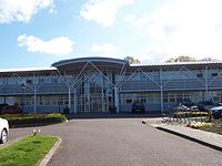
Staveley is a town and civil parish in the Borough of Chesterfield, Derbyshire, England. Located along the banks of the River Rother. It is northeast of Chesterfield, west of Clowne, northwest of Bolsover, southwest of Worksop and southeast of Sheffield.

Chesterfield is a market and industrial town in the ceremonial county of Derbyshire, England. It is 24 miles (39 km) north of Derby and 11 miles (18 km) south of Sheffield at the confluence of the Rivers Rother and Hipper. In 2011, the built-up-area subdivision had a population of 88,483, making it the second-largest settlement in Derbyshire, after Derby. The wider Borough of Chesterfield had a population of 103,569 in the 2021 Census. In 2021, the town itself had a population of 76,402.

Bretby is a village and civil parish in the south of Derbyshire, England, north of Swadlincote and east of Burton upon Trent, on the border between Derbyshire and Staffordshire. The population of the civil parish as of the 2011 census was 893. The name means "dwelling place of Britons". On the A511 road, there is a secondary settlement, Stanhope Bretby, which was the site of Bretby Colliery.

Tapton House, in Tapton, Derbyshire, England, was once the home of engineer George Stephenson, who built the first public railway line in the world to use steam locomotives. Tapton has been a gentleman's residence, a ladies' boarding school and a co-educational school.

Ashover is a village and civil parish in the English county of Derbyshire. It is in the North East Derbyshire district of the county. The population of the civil parish taken at the 2011 Census was 1,905, increasing to 1,959 for the 2021 census. It sits in a valley, not far from the town of Matlock and the Peak District national park.

Brizlincote is a civil parish in Burton upon Trent in East Staffordshire, England. Formerly farmland and a manor lying in Derbyshire, it was added to the municipal borough of Burton by the Local Government Act 1888 and formally transferred to Staffordshire in 1894. It was developed for housing in the late 20th and early 21st centuries. The area of the parish was previously considered part of the (unparished) adjoining areas of Stapenhill and Winshill. All three areas are now separate parishes. Brizlincote has a population of around 5,000 and has the highest average household income of any parish in Burton.
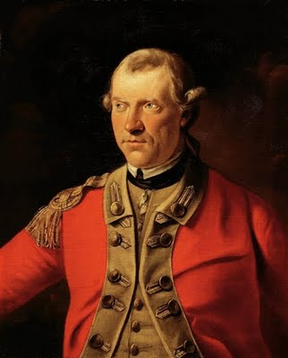
Major-General Henry Gladwin was a British army officer in colonial America and the British commander at the Siege of Fort Detroit during Pontiac's Rebellion in 1763. He served in the disastrous campaign of Edward Braddock and in other actions in the French and Indian War but is best remembered for his defense of Detroit in Pontiac's Rebellion.

Tupton is a village and civil parish in North East Derbyshire, Derbyshire, England, 5 miles (8 km) south of Chesterfield. The population of the civil parish including Egstow and Old Tupton was at the 2011 Census 3,428. It lies just north of Clay Cross on the A61 which runs from Chesterfield to Alfreton. It comprises the areas of Old Tupton and New Tupton. However, it is generally referred to as Tupton. A similarly named area, Tapton, is a few miles away, being part of Chesterfield.

Brimington is a large village and civil parish in the Borough of Chesterfield in Derbyshire, England. The population of the parish taken at the 2011 census was 8,788. The town of Staveley is to the east, and Hollingwood is nearby. The parish includes Brimington Common along the Calow Road, and New Brimington, a late 19th-century extension towards the Staveley Iron Works.

Newbold is a village north of Chesterfield, Derbyshire, England, which in 2001 had a population of just under 8,000.
Alsop en le Dale is a village in Derbyshire, England about 5 miles (8.0 km) north of Ashbourne close to the Staffordshire border, and a mile from Dovedale, a popular tourist location within the Peak District national park. It is within the civil parish of Eaton and Alsop.
Old Whittington is a village in the Borough of Chesterfield in Derbyshire, England. Old Whittington is 2 miles (3.2 km) north of Chesterfield and 10 miles (16 km) south-east of Sheffield. The population of the Old Whittington ward at the 2011 Census was 4,181. The village lies on the River Rother.
Thomas Gladwin of Tupton Hall, in the parish of Wingerworth near Chesterfield, Derbyshire, was Sheriff of Derbyshire in 1668.

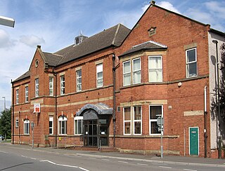
The Borough of Chesterfield is a non-metropolitan district with borough status in Derbyshire, England. It is named after the town of Chesterfield, its largest settlement, and also contains the town of Staveley and the large village of Brimington.

Offcote and Underwood is a civil parish within the Derbyshire Dales district, in the county of Derbyshire, England. Largely rural, in 2011 the parish had a population of 526. It is 125 miles (201 km) north west of London, 13 miles (21 km) north west of the county city of Derby, and 1 mile north east of the market town of Ashbourne. Offcote and Underwood borders the Peak District, and touches the parishes of Ashbourne, Bradley, Clifton and Compton, Fenny Bentley, Kniveton, Mapleton and Okeover. There are 12 listed buildings in Offcote and Underwood.

Brampton is a civil parish in North East Derbyshire, England, with a population of 1,201 in 2011. Lying 130 miles (210 km) north west of London, 20 miles (32 km) north of Derby, and 2 miles (3.2 km) west of the market town of Chesterfield, Brampton encompasses part of the Peak District national park to the west, and shares a border with the Borough of Chesterfield, Barlow, Baslow and Bubnell, Beeley, and Holymoorside and Walton. The parish contains a number of settlements including the village it was named after, but does not include the nearby built-up suburb of Brampton which is now within the Chesterfield unparished area.

Holymoorside and Walton is a civil parish within the North East Derbyshire district, which is in the county of Derbyshire, England. Named for its main settlements, with a mix of a number of villages and hamlets amongst a large rural area, it had a population of 2,138 residents in 2021. The parish is 130 miles (210 km) north west of London, 20 miles (32 km) north of the county city of Derby, and 2 miles (3.2 km) south west of the nearest market town of Chesterfield. It is adjacent with the Peak District national park to the west, and shares a border with the district of Chesterfield, along with the parishes of Ashover, Beeley, Brampton as well as Wingerworth. The parish paradoxically does not include the majority of the nearby built-up suburb of Walton, Chesterfield which is now within an adjacent unparished area of the borough.

Grassmoor, Hasland and Winsick is a civil parish within the North East Derbyshire district, which is in the county of Derbyshire, England. Named for local settlements, with a mix of a number of villages and hamlets amongst a semi-rural area, it had a population of 3,360 residents in 2011. The parish is 130 miles (210 km) north west of London, 20 miles (32 km) north of the county city of Derby, and 2 miles (3.2 km) south east of the nearest market town of Chesterfield. It shares a boundary with the borough of Chesterfield, along with the parishes of Calow, North Wingfield, Temple Normanton, Tupton as well as Wingerworth. The parish paradoxically does not include the majority of the nearby built-up suburb of Hasland which is now within an adjacent unparished area of Chesterfield.
Brimington is a civil parish in the Borough of Chesterfield, Derbyshire, England. The parish contains 14 listed buildings that are recorded in the National Heritage List for England. Of these, one is listed at Grade II*, the middle of the three grades, and the others are at Grade II, the lowest grade. The parish contains the village of Brimington and the surrounding area, and the listed buildings consist of houses and associated structures, a church, part of a school, and a set of war memorial gates.