Taylorsville, California

Last updated
Taylorsville
Plumas County California Incorporated and Unincorporated areas Taylorsville Highlighted.svg
Location in Plumas County and the state of California
Usa edcp location map.svg
Red pog.svg
Taylorsville
Location in the United States
Coordinates: 40°4′25″N120°50′17″W / 40.07361°N 120.83806°W / 40.07361; -120.83806 Coordinates: 40°4′25″N120°50′17″W / 40.07361°N 120.83806°W / 40.07361; -120.83806
Country Flag of the United States.svg  United States
State Flag of California.svg  California
County Plumas
Area
[1]
  Total3.248 sq mi (8.412 km2)
  Land3.248 sq mi (8.412 km2)
  Water0 sq mi (0 km2)  0%
Elevation
3,547 ft (1,081 m)
Population
 (2010)
  Total140
  Density43/sq mi (17/km2)
Time zone UTC-8 (Pacific (PST))
  Summer (DST) UTC-7 (PDT)
ZIP code
95983
Area code(s) 530
FIPS code 06-78008
GNIS feature ID1659961

Taylorsville is a census-designated place (CDP) in Plumas County, California, United States. The population was 150 at the 2010 census, down from 154 at the 2000 census. The annual Stone Ranch Reunion is held in Taylorsville.

Contents

Geography

Taylorsville is located at 40°4′25″N120°50′17″W / 40.07361°N 120.83806°W / 40.07361; -120.83806 (40.073685, -120.838180). [2]

According to the United States Census Bureau, the CDP has a total area of 3.2 square miles (8.3 km2), all of it land.

Demographics

2010

The 2010 United States Census [3] reported that Taylorsville had a population of 140. The population density was 43.1 inhabitants per square mile (16.6/km2). The racial makeup of Taylorsville was 131 (93.6%) White, 0 (0.0%) African American, 3 (2.1%) Native American, 0 (0.0%) Asian, 0 (0.0%) Pacific Islander, 0 (0.0%) from other races, and 6 (4.3%) from two or more races. Hispanic or Latino of any race were 1 persons (0.7%).

The Census reported that 140 people (100% of the population) lived in households, 0 (0%) lived in non-institutionalized group quarters, and 0 (0%) were institutionalized.

There were 71 households, out of which 12 (16.9%) had children under the age of 18 living in them, 28 (39.4%) were opposite-sex married couples living together, 5 (7.0%) had a female householder with no husband present, 4 (5.6%) had a male householder with no wife present. There were 6 (8.5%) unmarried opposite-sex partnerships, and 0 (0%) same-sex married couples or partnerships. 30 households (42.3%) were made up of individuals, and 8 (11.3%) had someone living alone who was 65 years of age or older. The average household size was 1.97. There were 37 families (52.1% of all households); the average family size was 2.62.

The population was spread out, with 25 people (17.9%) under the age of 18, 9 people (6.4%) aged 18 to 24, 25 people (17.9%) aged 25 to 44, 54 people (38.6%) aged 45 to 64, and 27 people (19.3%) who were 65 years of age or older. The median age was 50.3 years. For every 100 females, there were 105.9 males. For every 100 females age 18 and over, there were 105.4 males.

There were 88 housing units at an average density of 27.1 per square mile (10.5/km2), of which 50 (70.4%) were owner-occupied, and 21 (29.6%) were occupied by renters. The homeowner vacancy rate was 0%; the rental vacancy rate was 4.5%. 92 people (65.7% of the population) lived in owner-occupied housing units and 48 people (34.3%) lived in rental housing units.

2000

As of the census [4] of 2000, there were 154 people, 75 households, and 45 families residing in the CDP. The population density was 47.9 inhabitants per square mile (18.5/km2). There were 102 housing units at an average density of 31.7 per square mile (12.2/km2). The racial makeup of the CDP was 92.21% White, 0.65% Native American, 0.65% Asian, 0.65% from other races, and 5.84% from two or more races. Hispanic or Latino of any race were 1.95% of the population.

There were 75 households, out of which 21.3% had children under the age of 18 living with them, 50.7% were married couples living together, 6.7% had a female householder with no husband present, and 40.0% were non-families. 34.7% of all households were made up of individuals, and 16.0% had someone living alone who was 65 years of age or older. The average household size was 2.05 and the average family size was 2.62.

In the CDP, the population was spread out, with 17.5% under the age of 18, 7.8% from 18 to 24, 18.8% from 25 to 44, 33.8% from 45 to 64, and 22.1% who were 65 years of age or older. The median age was 47 years. For every 100 females, there were 77.0 males. For every 100 females age 18 and over, there were 84.1 males.

The median income for a household in the CDP was $23,194, and the median income for a family was $55,781. Males had a median income of $31,250 versus $25,577 for females. The per capita income for the CDP was $17,733. None of the families and 19.4% of the population were living below the poverty line, including no under eighteens and 41.5% of those over 64.

Politics

In the state legislature, Taylorsville is in the 1st Senate District , represented by Republican Brian Dahle, [5] and the 1st Assembly District , represented by Republican Megan Dahle. [6]

Federally, Taylorsville is in California's 1st congressional district , represented by Republican Doug LaMalfa. [7]

Related Research Articles

<span class="mw-page-title-main">Riverdale, California</span> Census-designated place in California, United States

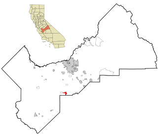
Riverdale is a census-designated place (CDP) in Fresno County, California, United States. The population was 3,153 at the 2010 census, up from 2,416 at the 2000 census. Riverdale is located 23 miles (37 km) south of Fresno, at an elevation of 223 ft (68 m).

<span class="mw-page-title-main">West Bishop, California</span> Census-designated place in California, United States

West Bishop is a census-designated place (CDP) in Inyo County, California, United States. The population was 2,607 at the 2010 census, down from 2,807 at the 2000 census.

<span class="mw-page-title-main">Wilkerson, California</span> Census-designated place in California, United States

Wilkerson is a census-designated place (CDP) in Inyo County, California, United States. The population was 563 at the 2010 census, up from 562 at the 2000 census.

Golden Hills, California Census-designated place in California, United States

Golden Hills is a census-designated place (CDP) in the Tehachapi Mountains, in Kern County, California, United States. The population was 8,656 at the 2010 census, up from 7,434 at the 2000 census. Golden Hills adjoins the city of Tehachapi on the west.

<span class="mw-page-title-main">Rosedale, California</span> Census-designated place in California, United States

Rosedale is a Census-designated place (CDP) in Kern County, California, United States. The population was 14,058 at the 2010 census, up from 8,445 at the 2000 census. Formerly a country town 10 miles (16 km) west of Bakersfield, it is now surrounded by suburban housing and currently has the highest household income in Kern County, according to Census estimates.

<span class="mw-page-title-main">Tamalpais-Homestead Valley, California</span> Census-designated place in California, United States

Tamalpais-Homestead Valley is a census-designated place (CDP) in Marin County, California, United States. The population was 11,492 at the 2020 census.

Lake Wildwood, California Census-designated place in California, United States

Lake Wildwood is a census-designated place (CDP) in Nevada County, California, United States. The population was 4,991 at the 2010 census, up from 4,868 at the 2000 census.

Clio, California Census-designated place in California, United States

Clio is a census-designated place in Plumas County, California, United States. Clio is located 23 miles (37.0 km) southeast of Quincy. The population was 66 at the 2010 census, down from 90 at the 2000 census.

<span class="mw-page-title-main">Keddie, California</span> Census-designated place in California, United States

Keddie is a census-designated place in Plumas County, California, United States. The population was 66 at the 2010 census.

Lake Almanor West, California Census-designated place in California, United States

Lake Almanor West is a census-designated place (CDP) in Plumas County, California, United States. The population was 270 at the 2010 census, down from 329 at the 2000 census.

<span class="mw-page-title-main">Toro Canyon, California</span> Census-designated place in California, United States

Toro Canyon is a census-designated place (CDP) in Santa Barbara County, California, United States. The population was 1,835 at the 2020 census, up from 1,508 at the 2010 census.

Lakehead-Lakeshore, California Unincorporated community in California, United States

Lakehead-Lakeshore is an unincorporated community and a former census-designated place (CDP) in Shasta County, California, United States. The population was 549 at the 2000 census. It is a very seasonal town with many Shasta Lake services, including a small grocery store, Subway restaurant inside the Chevron gas station, and low-cost lodging for Shasta Lake visitors. It also has several campgrounds.

<span class="mw-page-title-main">Tennant, California</span> Census-designated place in California

Tennant is a census-designated place (CDP) in Siskiyou County, California, United States. Its population is 63 as of the 2020 census, up from 41 from the 2010 census.

<span class="mw-page-title-main">Traver, California</span> Census-designated place in California, United States

Traver is a census-designated place (CDP) in Tulare County, California, United States. The population was 713 at the 2010 census, down from 732 at the 2000 census.

June Park, Florida Census-designated place in Florida

June Park is a census-designated place (CDP) in Brevard County, Florida. The population was 4,094 at the 2010 United States Census. It is part of the Palm Bay–Melbourne–Titusville Metropolitan Statistical Area.

Taylorsville, Indiana CDP in Indiana, United States

Taylorsville is a census-designated place (CDP) in German Township, Bartholomew County, in the U.S. state of Indiana. The population was 919 at the 2010 census. It is part of the Columbus, Indiana metropolitan statistical area.

Victory Lakes, New Jersey Census-designated place in New Jersey, United States

Victory Lakes is an unincorporated community and census-designated place (CDP) located within Monroe Township, in Gloucester County, New Jersey, United States. As of the 2010 United States Census, the CDP's population was 2,111.

Brownville, New Jersey Census-designated place in New Jersey, United States

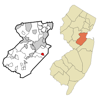
Brownville is an unincorporated community and census-designated place (CDP) located within Old Bridge Township, in Middlesex County, New Jersey, United States. As of the 2010 United States Census, the CDP's population was 2,383.

Lincolnville, Pennsylvania Census-designated place in Pennsylvania, United States

Lincolnville is a census-designated place in Crawford County, Pennsylvania, United States. The population was 96 at the 2010 census.

Bruni, Texas CDP in Texas, United States

Bruni is a census-designated place (CDP) in Webb County, Texas, United States. The population was 379 at the 2010 census.

References

  1. U.S. Census Archived 2012-01-25 at the Wayback Machine
  2. "US Gazetteer files: 2010, 2000, and 1990". United States Census Bureau. 2011-02-12. Retrieved 2011-04-23.
  3. "2010 Census Interactive Population Search: CA - Taylorsville CDP". U.S. Census Bureau. Archived from the original on July 15, 2014. Retrieved July 12, 2014.
  4. "U.S. Census website". United States Census Bureau . Retrieved 2008-01-31.
  5. "Senators". State of California. Retrieved March 10, 2013.
  6. "Members Assembly". State of California. Retrieved March 2, 2013.
  7. "California's 1st Congressional District - Representatives & District Map". Civic Impulse, LLC. Retrieved March 3, 2013.