Tazewell, Georgia

Last updated
Tazewell, Georgia
Old Marion County Courthouse (NRHP) Tazewell, GA.JPG
The Old Marion County Courthouse is located in Tazewell. It was built in 1848 and added to the National Register of Historic Places in 1980.
USA Georgia location map.svg
Red pog.svg
Tazewell
Usa edcp location map.svg
Red pog.svg
Tazewell
Coordinates: 32°22′50″N84°26′27″W / 32.38056°N 84.44083°W / 32.38056; -84.44083
CountryUnited States
State Georgia
County Marion
Area
[1]
  Total1.59 sq mi (4.1 km2)
  Land1.59 sq mi (4.1 km2)
  Water0.01 sq mi (0.03 km2)
Elevation
487 ft (148 m)
Population
 (2020) [2]
  Total93
  Density58.6/sq mi (22.6/km2)
Time zone UTC−6 (Central (CST))
  Summer (DST) UTC−5 (CDT)
ZIP Code
31803
FIPS code 13-75692
GNIS feature ID356586

Tazewell is an unincorporated community and census-designated place (CDP) in Marion County, in the U.S. state of Georgia. [3]

Contents

The 2020 census, listed a population of 93. [2]

History

A post office called Tazewell was established in 1837, and remained in operation until 1985. [4] The community was named after Henry Tazewell, a United States senator from Virginia, state legislator and judge. [5] Tazewell was named the county seat of Marion County in 1838. [6] The Old Marion County Courthouse still stands at Tazewell and was added to the National Register of Historic Places on September 18, 1980. [7]

A variant spelling was "Tazwell" (without the E). [3] The Georgia General Assembly incorporated the place as the "Town of Tazwell" in 1854. [8] Tazewell today is an unincorporated area. [3]

Geography

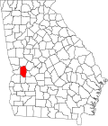
Tazewell is in eastern Marion County, in the valley of Shoal Creek. State Routes 137 and 24 cross in the center of town. SR 137 leads southwest 6 miles (10 km) to Buena Vista, the county seat, and northeast 18 miles (29 km) to Butler, while SR 240 leads east 26 miles (42 km) to Oglethorpe and north 18 miles (29 km) to Geneva.

According to the U.S. Census Bureau, the Tazewell CDP has a total area of 1.6 square miles (4.1 km2), of which 0.01 square miles (6.4 acres), or 0.50%, are water. [1] Shoal Creek and Gin Creek join at the southern edge of the community to form Buck Creek, which flows east to the Flint River at Oglethorpe.

Demographics

Historical population
CensusPop.Note
2020 93
U.S. Decennial Census [9]
2020 [10]

Tazewell was first listed as a census designated place in the 2020 U.S. Census. [10]

Tazewell CDP, Georgia – Racial and ethnic composition
Note: the US Census treats Hispanic/Latino as an ethnic category. This table excludes Latinos from the racial categories and assigns them to a separate category. Hispanics/Latinos may be of any race.
Race / Ethnicity (NH = Non-Hispanic)Pop 2020 [10] % 2020
White alone (NH)8793.55%
Black or African American alone (NH)00.00%
Native American or Alaska Native alone (NH)00.00%
Asian alone (NH)00.00%
Pacific Islander alone (NH)00.00%
Some Other Race alone (NH)00.00%
Mixed Race or Multi-Racial (NH)11.08%
Hispanic or Latino (any race)55.38%
Total93100.00%

Related Research Articles

<span class="mw-page-title-main">Hardwick, Baldwin County, Georgia</span> Place in Georgia, United States

Hardwick is an unincorporated community and census-designated place (CDP) in Baldwin County, Georgia, United States. The population was 3,513 at the 2020 census, down from 5,135 in 2000, at which time it was listed as Midway-Hardwick. It is laid out around Central State Hospital. It is part of the Milledgeville Micropolitan Statistical Area. The zip code for Hardwick is 31034. Hardwick was home to Oglethorpe University during the 19th century.

<span class="mw-page-title-main">Montgomery, Georgia</span> Place in Georgia, United States

Montgomery is an unincorporated community and census-designated place (CDP) in Chatham County, Georgia, United States. The population was 4,443 at the 2020 United States census, down slightly from 4,523 in 2010. It is a suburb of Savannah and is part of the Savannah metropolitan area.

<span class="mw-page-title-main">Skidaway Island, Georgia</span> Place in Georgia, United States

Skidaway Island is an unincorporated community and census-designated place (CDP) in Chatham County, Georgia, and lies on a barrier island of the same name. Located south of Savannah, Skidaway Island is known for its waterfront properties and golf courses within The Landings, one of the largest gated communities in the country. The population was 9,310 at the 2020 census. For statistical purposes, the United States Census Bureau has defined Skidaway Island as a census-designated place (CDP). A separate area of the island hosts the Skidaway Institute of Oceanography, a research institution operated by the University of Georgia. It receives scholars and researchers from several other Georgia universities as well, including Georgia Tech, Savannah State University, and the College of Coastal Georgia. Skidaway Island is part of the Savannah Metropolitan Statistical Area.

<span class="mw-page-title-main">Evans, Georgia</span> Place in Georgia, United States

Evans is an unincorporated community and census-designated place (CDP) in Columbia County, Georgia, United States. It is a suburb of Augusta and is part of the Augusta metropolitan area. The population was 29,011 at the 2010 census, up from 17,727 at the 2000 census.

<span class="mw-page-title-main">Martinez, Georgia</span> Place in Georgia, United States

Martinez is an unincorporated community and census-designated place (CDP) in Columbia County, Georgia, United States. It is a northwestern suburb of Augusta and is part of the Augusta, Georgia metropolitan area. The population was 34,535 at the 2020 census.

<span class="mw-page-title-main">Gresham Park, Georgia</span> Place in Georgia, United States

Gresham Park is an unincorporated community and census-designated place (CDP) in DeKalb County, Georgia, United States. The population was 7,700 at the 2020 census.

<span class="mw-page-title-main">Oglethorpe, Georgia</span> City in Georgia, United States

Oglethorpe is a city in Macon County, Georgia, United States. The population was 995 at the 2020 census, down from 1,328 in 2010. The city is the county seat of Macon County. It was named for Georgia's founder, James Oglethorpe.

<span class="mw-page-title-main">Georgetown, Quitman County, Georgia</span> City in Georgia, United States

Georgetown is a city in Quitman County, Georgia, United States. It is on the Alabama-Georgia state line next to Walter F. George Lake and across the Chattahoochee River from Eufaula, Alabama. Per the 2020 census, the population was 2,235. In 2006, Georgetown and Quitman County voted to consolidate their governments, becoming the smallest such consolidated entity in the Lower 48 states.

<span class="mw-page-title-main">Eulonia, Georgia</span> Place in Georgia, United States

Eulonia is an unincorporated community and census-designated place (CDP) in McIntosh County in the U.S. state of Georgia. Part of the Brunswick, Georgia Metropolitan Statistical Area, it is in the Low Country between Savannah and Brunswick near Interstate 95.

<span class="mw-page-title-main">Boykin, Georgia</span> Place in Georgia, United States

Boykin is an unincorporated community and census-designated place (CDP) in Miller County, Georgia, United States. The 2020 census listed a population of 151.

University is a census-designated place (CDP) and unincorporated community in Orange County, Florida, United States, east of Orlando. The community is centered around the University of Central Florida and includes a location on its south side known as University Park. It is part of the Orlando–Kissimmee–Sanford, Florida Metropolitan Statistical Area. As of 2020, the CDP had a population of 45,284.

Smarr is an unincorporated community and census-designated place (CDP) in Monroe County, in the U.S. state of Georgia. The 2020 census listed a population of 218.

Kokomo is a census-designated place and unincorporated community in Marion County, Mississippi, United States. As of the 2020 census, the first year it was listed as a census-designated place, it had a population of 150.

Perkins is a census-designated place and unincorporated community in Jenkins County, Georgia, United States. As of the 2010 census it had a population of 91.

<span class="mw-page-title-main">New Blaine, Arkansas</span> Census-designated place in Arkansas, United States

New Blaine is an unincorporated community and census-designated place (CDP) in Logan County, Arkansas, United States. Per the 2020 census, the population was 173.

Midway is a census-designated place in Baxter County, Arkansas, United States. Midway is 5.5 miles (8.9 km) northwest of Mountain Home. Per the 2020 census, the population was 1,036. Midway has a post office with ZIP code 72651. Long home to a rural trading post, Midway became a boomtown during the construction of the Bull Shoals Dam, and later evolved to serve tourists and retirees attracted to the lake.

Oakland is an unincorporated community and census-designated place (CDP) in northeastern Marion County, Arkansas, United States. Oakland, located on Arkansas Highway 202, is 20 miles (32 km) by road northwest of Mountain Home. Oakland has a post office with ZIP code 72661. The Oakland Campground on Bull Shoals Lake lies about three miles to the west at the end of Route 202. It was first listed as a CDP in the 2020 census, with a population of 72.

Mount Pleasant is a census-designated place and unincorporated community in Marshall County, Mississippi, United States, located along U.S. Highway 72 at State Highway 311. The community has a volunteer fire department on Boswell Road, and a K-12 school located off Highway 72.

Georgetown is an unincorporated community and census-designated place in western Kent County, Maryland, United States. Per the 2020 census, the population was 117. It should not be confused with the community of the same name 22 miles (35 km) to the northeast on the Kent/Cecil County border.

Cateechee is an unincorporated community and census-designated place (CDP) in Pickens County, South Carolina, United States. It was first listed as a CDP prior to the 2020 census. The population as of 2020 was 321.

References

  1. 1 2 "2022 U.S. Gazetteer Files: Georgia". United States Census Bureau. Retrieved January 23, 2023.
  2. 1 2 "P1. Race – Tazewell CDP, Georgia: 2020 DEC Redistricting Data (PL 94-171)". U.S. Census Bureau. Retrieved January 23, 2023.
  3. 1 2 3 U.S. Geological Survey Geographic Names Information System: Tazewell
  4. "Post Offices". Jim Forte Postal History. Retrieved 21 June 2019.
  5. Krakow, Kenneth K. (1975). Georgia Place-Names: Their History and Origins (PDF). Macon, GA: Winship Press. p. 223. ISBN   0-915430-00-2.
  6. "Marion County". GeorgiaInfo. Retrieved 21 June 2019.
  7. "Marion County". nationalregisterofhistoricplaces.com. Retrieved 21 June 2019.
  8. Acts and Resolutions of the General Assembly. 1854. pp. 272–.
  9. "Decennial Census of Population and Housing by Decades". US Census Bureau.
  10. 1 2 3 "P2 Hispanic or Latino, and Not Hispanic or Latino by Race – 2020: DEC Redistricting Data (PL 94-171) – Tazewell CDP, Georgia". United States Census Bureau .