
Oaxaca, officially the Free and Sovereign State of Oaxaca, is one of the 32 states that compose the Federative Entities of Mexico. It is divided into 570 municipalities, of which 418 are governed by the system of usos y costumbres with recognized local forms of self-governance. Its capital city is Oaxaca de Juárez.

Coatzacoalcos is a major port city in the southern part of the Mexican state of Veracruz, mostly on the western side of the Coatzacoalcos River estuary, on the Bay of Campeche, on the southern Gulf of Mexico coast. The city serves as the municipal seat of the municipality of the same name. It is the state's third largest city, after Veracruz City and Xalapa.

The Isthmus of Tehuantepec is an isthmus in Mexico. It represents the shortest distance between the Gulf of Mexico and the Pacific Ocean. Before the opening of the Panama Canal, it was a major overland transport route known simply as the Tehuantepec Route. The name is taken from the town of Santo Domingo Tehuantepec in the state of Oaxaca; this was derived from the Nahuatl term Tēcuāntepēc.

Tehuantepec is a city and municipality in the southeast of the Mexican state of Oaxaca. It is part of the Tehuantepec District in the west of the Istmo Region. The area was important in pre Hispanic period as part of a trade route that connected Central America with what is now the center of Mexico. Later it became a secondary capital of the Zapotec dominion, before it was conquered by the Spanish in the early 16th century.

Juchitán de Zaragoza is an indigenous town in the southeast of the Mexican state of Oaxaca. It is part of the Juchitán District in the west of the Istmo de Tehuantepec region. With a 2005 census population of 74,714 inhabitants, it is the fourth-largest city in the state. The majority of the indigenous inhabitants are Zapotecs and Huaves. The town also serves as the municipal seat for the surrounding municipality, with which it shares a name. The municipality has an area of 414.64 km² and a population of 85,869, the state's third-largest in population.

Salina Cruz is a major seaport on the Pacific coast of the Mexican state of Oaxaca. It is the state's third-largest city and is the municipal seat of the municipality of the same name. It is part of the Tehuantepec District in the west of the Istmo Region. The city had a 2005 census population of 71,314, while its municipality, with an area of 113.55 km2 (43.84 sq mi) had a population of 76,219, the state's fourth-largest municipality in population.

The Tehuantepec jackrabbit is a jackrabbit endemic to Mexico.

San Pedro Pochutla is a city and municipality located in the south of Oaxaca state, Mexico next to the Pacific Ocean. It is an important commercial, transportation and administrative hub for the Pochutla District in the east of the Costa Region. Pochutla is located at the junction of coastal Highway 200 and Highway 175 to Oaxaca, with 175 functioning as the town's main thoroughfare. Its name means "place of kapok trees ", and most of the city is built on a lakebed which was drained during the colonial period. The municipality is best known as being the home of the oceanside communities of Puerto Ángel and Zipolite.

The Sierra Madre de Oaxaca pine–oak forests is a tropical and subtropical coniferous forests ecoregion in Southern Mexico.

The Sierra Madre de Oaxaca is a mountain range in southern Mexico. It is primarily in the state of Oaxaca, and extends north into the states of Puebla and Veracruz.

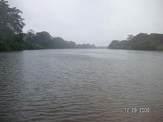
The Coatzacoalcos is a large river that feeds mainly the south part of the state of Veracruz; it originates in the Sierra de Niltepec and crosses the state of Oaxaca in the region of the Isthmus of Tehuantepec, flowing for 325 kilometres toward the Gulf of Mexico. Tributaries include El Corte, Sarabia, Jaltepec, Chalchijalpa, El Chiquito, Uxpanapa, and Calzadas. The merging of all these rivers creates one of the largest current flows in the entire region. Two-thirds of the streams are navigable.
San Dionisio del Mar is a town and municipality in Oaxaca in south-western Mexico. It is part of the Juchitán District in the east of the Istmo de Tehuantepec region. The town is named after its patron saint.
The Atoyac River is a river in Oaxaca, Mexico. The Atoyac flows into the Rio Verde which empties into the Pacific near Laguna Chacahua, in Lagunas de Chacahua National Park, 90 km west of Puerto Escondido. The mountainous terrain of the region it occupies allows for no navigable rivers; instead, there are a large number of smaller ones, which often change name from area to area. The continental divide passes through the state, meaning that there is drainage towards both the Gulf of Mexico and the Pacific Ocean. Most of the drainage towards the Gulf is represented by the Papaloapan and Coatzacoalcos Rivers and their tributaries such as the Grande and Salado Rivers. Three rivers account for most of the water headed for the Pacific: the Mixteco River, Tehuantepec River, and the Atoyac, with their tributaries.
The Mixteco River is a river of Mexico. The mountainous terrain of the region it occupies allows for no navigable rivers; instead, there are a large number of smaller ones, which often change name from area to area. The continental divide passes through the state, meaning that there is drainage towards both the Gulf of Mexico and the Pacific Ocean. Most of the drainage towards the Gulf is represented by the Papaloapan and Coatzacoalcos Rivers and their tributaries such as the Grande and Salado Rivers. Three rivers account for most of the water headed for the Pacific: the Atoyac River, Tehuantepec River, and the Mixteco River, with their tributaries.
El Corte River is the primary tributary of the Coatzacoalcos River, flowing through the Mexican states of Oaxaca and Veracruz to the Gulf of Mexico.

Istmo de Tehuantepec is the largest region of the state of Oaxaca, located in southwestern Mexico.
Juchitán District is located in the east of the Istmo de Tehuantepec region of the State of Oaxaca, Mexico, covering the southern part of a low-lying corridor through the mountains that separates the Gulf of Mexico from the Pacific ocean. The district has an area of 13,300 km2 and a population as of 2005 of 339,445.
The Sierra Atravesada or Sierra de Niltepec is a mountain range in the state of Oaxaca, Mexico, in the region of the Isthmus of Tehuantepec.

Potential Tropical Cyclone Seventeen-E was a tropical disturbance that caused damaging floods in Southern Mexico, Guatemala, and El Salvador in mid-October 2019. A tropical wave entered the Eastern Pacific Ocean during October 13–14, and a low-pressure area developed by October 14 to the west of Nicaragua. Convection, also known as thunderstorm activity, associated with the system increased in both intensity and extent during October 15, while the system was south of Guatemala. The National Hurricane Center initiated advisories on the system as Potential Tropical Cyclone Seventeen-E on October 16, anticipating that the system would become a tropical cyclone before reaching the southern coast of Mexico. During its existence as a potential tropical cyclone, Seventeen-E had winds of 35 mph and a pressure of 1,005 mbar (29.68 inHg). As the storm tracked northwestward towards the coast, its structure decayed, and the chance of tropical cyclogenesis decreased markedly. The disturbance made landfall between Bahias de Huatulco and Salina Cruz, Oaxaca, during mid-day October 16 and dissipated a few hours later.

