Related Research Articles
Mauriceville is a census-designated place (CDP) in Orange County, Texas, United States. The population was 2,983 at the 2020 census. It is part of the Beaumont–Port Arthur Metropolitan Statistical Area.

Henry Jacob Lutcher was a sawmiller and business partner of the Lutcher and Moore Lumber Company. His business ventures would help establish Orange, Texas, as the timber-processing capital of the South in the late 19th and early 20th centuries.
Holopaw is an unincorporated community in Osceola County, Florida, United States. It is located at the eastern end of the multiplex of highways US 192 and US 441. It has a population of fewer than 5,000 people and is part of the Orlando-Kissimmee Metropolitan Statistical Area.

Randle Thomas Moore, Sr., was a figure in the development of northwestern Louisiana during the latter part of the 19th century and the first half of the 20th century. Moore is best known to Louisiana history, of which he was a keen student, for a physical confrontation that he had on the streets of downtown Shreveport with the legendary Huey Pierce Long, Jr.
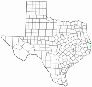
Wiergate is a small unincorporated community in Newton County, Texas, United States, in the far eastern part of the state. It lies approximately 70 miles (110 km) northeast of Beaumont near State Highways 63 and 87. Its population today hovers at approximately 450.
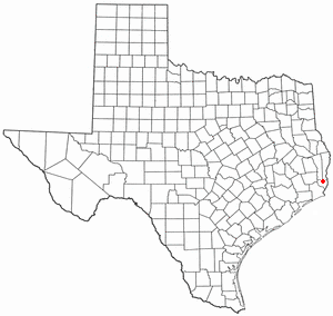
Lemonville is a ghost town that was the site of the Lemon Lumber Company in northern Orange County, Texas, United States, in the southeastern part of the state. Sometimes referred to as Lemon, it is located north of Orange and just east of Mauriceville. The town plat was filed in 1901 by a man named William Manuel, with the location chosen for its proximity to the tracks of the Kansas City Southern Railroad. In 1902, when the population was about 300, a post office was established, with Cornelius P. Ryan as first postmaster.
Village Mills is an unincorporated community in north central Hardin County, Texas, United States. It is part of the Beaumont–Port Arthur Metropolitan Statistical Area.
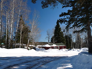
Pequaming is an unincorporated community in L'Anse Township of Baraga County in the U.S. state of Michigan. It is located on a narrow point of land that juts into Keweenaw Bay. Although still partially inhabited, Pequaming is one of the largest ghost towns in the Upper Peninsula of Michigan.
Bon Wier is an unincorporated community in eastern Newton County, Texas, United States, and is located along U.S. Route 190. The ZIP Code for Bon Wier is 75928.

Bridal Veil is a virtual ghost town located in Multnomah County, Oregon, United States. It was established in the 1880s during a logging boom by a logging company as it harvested timber on nearby Larch Mountain to be a company mill town around a sawmill. It had a close relationship with the logging town of Palmer for the first 50 years of its history. As of November 2011, all that remains of the town is a post office and a cemetery. The site is located near the west end of the Columbia River Gorge.
The Wier Longleaf Lumber Company was a lumber and milling operation established by Robert Withrow Wier (1873–1945) in East Texas that ran from 1918 until 1942. During that period, the company clearcut more than 86,000 acres (350 km²) of virgin pine forest in Newton, Jasper and Sabine counties. Because the city fathers of nearby Burkeville did not appreciate the rough workers Wier's company brought in, Wier established two new towns, Wiergate and Bon Wier, four miles away to house the company's employees. In its heyday, the mill could process approximately 200,000 feet of longleaf yellow pine every 10 hours. Wier also established a railroad to connect the mill and town to Newton. Towards the end of the Second World War, Wier sold his operation and closed down the mill, leading to the decline of Wiergate and Bon Wier.
Porter's Mills, also called Porterville, was a logging boomtown in Eau Claire County, Wisconsin, United States, between Brunswick and Eau Claire, at 44° 46' 15" N 91° 34' 01" W. at an elevation of 771 feet.
Morse is an unincorporated community located in the town of Gordon, Ashland County, Wisconsin, United States. Morse is located along the Bad River 7.5 miles (12.1 km) south-southeast of Mellen.
Manning is a ghost town in Angelina County, Texas in East Texas, United States. It is located within the Lufkin, Texas micropolitan area.
Peason is a small populated community and sawmill ghost town located on Louisiana highway 118 approximately 8.7 miles (14.0 km) east of Hornbeck, and the sawmill ghost town of Sandel, in Sabine Parish, Louisiana.
Bon Ami is a ghost town that was located in what is currently Beauregard Parish, approximately 2 miles south of Deridder, Louisiana, United States. The site of the town itself is located at coordinates 30°48'12.03"N 93°17'40.08"W, and is abandoned. United States Geological Survey maps from 1947 show the location of the town, where the Kansas City Southern and the Louisiana & Pacific railways are parallel.
Durant is a ghost town in Angelina County, in the U.S. state of Texas. It is located within the Lufkin, Texas micropolitan area.
Ewing is a ghost town in Angelina County, Texas, United States. It is located within the Lufkin, Texas, micropolitan area.
Monterey is a ghost town in Angelina County, in the U.S. state of Texas. It is located within the Lufkin, Texas micropolitan area.

Millwood was a lumber boomtown located in present-day Sequoia National Forest near Converse Basin Grove in California. It was established in 1891 by the Kings River Lumber Company and was connected to the Sequoia Railroad, which brought logs to the town to be turned into rough lumber. The lumber was then transported by log flume to Sanger, a journey of 54 miles. At its peak, Millwood had a population of over 2,000 people and featured two hotels, a summer school, and a post office. However, today there are no remaining structures or buildings at the Millwood site.
References
- ↑ Schmidt, Walter G. (1993) An Encyclopaedia of Texas Post Offices, p. 56, Chicago, Illinois: The Collectors' Club of Chicago.
- ↑ TSHA Online – Texas State Historical Association
- ↑ TXGenWeb – Orange County History – Sawmills
- ↑ ibid
- ↑ TFM – sawmill database detail Archived 2006-05-26 at the Wayback Machine
