Thames, New Zealand

Last updated

Thames
Pārāwai (Māori)
Thames, New Zealand
Coordinates: 37°8′18″S175°32′15″E / 37.13833°S 175.53750°E / -37.13833; 175.53750
Country New Zealand
Region Waikato Region
District Thames-Coromandel District
WardThames ward
Community BoardThames Community
Electorates
Government
  Council Thames-Coromandel District Council
Area
[1]
  Total15.55 km2 (6.00 sq mi)
Population
 (June 2023) [2]
  Total7,630
  Density490/km2 (1,300/sq mi)
Postcode(s)
3500, 3540

Thames ( /tɛmz/ ) (Māori : Pārāwai) is a town at the southwestern end of the Coromandel Peninsula in New Zealand's North Island. It is located on the Firth of Thames close to the mouth of the Waihou River. The town is the seat of the Thames-Coromandel District Council. The Māori iwi are Ngāti Maru, who are descendants of Marutuahu's son Te Ngako. Ngāti Maru is part of the Ngati Marutuahu confederation of tribes or better known as Hauraki Iwi.

Contents

Thames had an estimated population of 15,000 in 1870, but this declined to 4,500 in 1881, and it has increased modestly since. It is still the biggest town on the Coromandel Peninsula. Until 2016, a historical oak tree that was planted by Governor George Grey stood on the corner of Grey and Rolleston streets. [3]

Demographics

Thames covers 15.55 km2 (6.00 sq mi) [1] and had an estimated population of 7,690 as of June 2022, [4] with a population density of 495 people per km2.

Historical population
YearPop.±% p.a.
20066,930    
20136,951+0.04%
20187,293+0.97%
Source: [5]

Thames had a population of 7,293 at the 2018 New Zealand census, an increase of 342 people (4.9%) since the 2013 census, and an increase of 363 people (5.2%) since the 2006 census. There were 3,045 households, comprising 3,420 males and 3,870 females, giving a sex ratio of 0.88 males per female, with 1,149 people (15.8%) aged under 15 years, 930 (12.8%) aged 15 to 29, 2,886 (39.6%) aged 30 to 64, and 2,337 (32.0%) aged 65 or older.

Ethnicities were 82.2% European/Pākehā, 22.1% Māori, 2.7% Pacific peoples, 6.3% Asian, and 1.8% other ethnicities. People may identify with more than one ethnicity.

The percentage of people born overseas was 16.7, compared with 27.1% nationally.

Although some people chose not to answer the census's question about religious affiliation, 47.9% had no religion, 38.1% were Christian, 1.2% had Māori religious beliefs, 1.0% were Hindu, 0.2% were Muslim, 1.5% were Buddhist and 2.4% had other religions.

Of those at least 15 years old, 825 (13.4%) people had a bachelor's or higher degree, and 1,644 (26.8%) people had no formal qualifications. 555 people (9.0%) earned over $70,000 compared to 17.2% nationally. The employment status of those at least 15 was that 2,175 (35.4%) people were employed full-time, 873 (14.2%) were part-time, and 180 (2.9%) were unemployed. [5]

Individual statistical areas
NameArea
(km2)
PopulationDensity
(per km2)
HouseholdsMedian ageMedian
income
Thames North2.621,99576193058.2 years$23,800 [6]
Thames Central1.271,04482247155.3 years$21,900 [7]
Thames South3.283,3871,0331,31148.3 years$23,900 [8]
Totora-Kopu 8.3986713633348.2 years$29,300 [9]
New Zealand37.4 years$31,800

History and culture

Poupou (wall post) from Hotunui Poumatua2.jpg
Poupou (wall post) from Hotunui

Māori history

In the early 19th century the area was populated by Ngāti Maru and other members of the Marutūāhu collective. Ngāti Maru built a large fortified between the Kauaeranga River and Waihou River, known as Te Tōtara. [10] In December 1821, this pā was attacked by a Te Tai Tokerau Māori taua (war party) during the Musket Wars. After a frontal assault was unsuccessful, the taua took the pā by stealth. [10]

European settlement

Thames was formed from two historic towns, Grahamstown and Shortland, of which many original buildings still stand. Shortland was to the south of Thames and was founded on 27 July 1867 when James Mackay, civil commissioner for the Hauraki District, concluded an agreement with local Māori. The land was rented for mining purposes for the sum of £5,000 per year, a colossal sum in the mid 19th century. This agreement secured the rights to local mineral deposits leading to the proclamation of the Thames Goldfield on 1 August. The leasing of the land for such a huge income was a source of great envy by other Maori iwi and hapu. [11]

Grahamstown was founded the following year at the northern end of present Thames, approximately one mile from Shortland. The two towns merged in 1874 after it emerged the heart of the Goldfield was in Grahamstown. Shortland waned in importance until the turn of the century when the Hauraki Plains were developed for farming and the Shortland railway station was opened.

Gold rush

The town was initially built during a gold rush, with the first major discovery of gold being made on 10 August 1867 by William Hunt, in the Kuranui Stream at the north end of Thames. [12] The subsequent mine produced more than 102,353oz bullion and was known as the Shotover. The era from 1868 to 1871 were the bonanza years for the town with gold production topping one million pounds sterling at its peak. Official figures for production of the Thames Mines recorded a yield of 2,327,619oz bullion with the value at $845 million. The three richest fields were the Manukau / Golden Crown / Caledonian mines but many others yielded near equivalent amounts. Thames had an estimated population of 15,000 in 1870 [13] which would make it one of the largest cities in New Zealand at the time, but the population had declined to 11,950 (not including Māori) in the 1871 census. [14] The Māori population was 1,428 in 1859. [15] After the gold began to diminish, so did Thames' population, dropping to 5,420 in 1878 and 4,563 in 1881. [16] Thames also benefited from a period of extensive Kauri logging in the surrounding ranges around the same time.

The land involved in goldmining in Thames was Māori-owned; important parts of the goldfield were owned by the Ngāti Maru rangatira (chief) Rapana Maunganoa and the Taipari family. In 1878, when Wiremu Hōterene Taipari married a woman of the Ngāti Awa tribe of Whakatāne, Ngāti Awa carvers arrived at Thames and built a meeting house at Pārāwai. It is incorrectly said to have been a wedding gift for the couple when actually Wiremu's father had paid money for another whare (meeting house), which was sold to the governor general at the time. When Wiremu's father returned to collect the whare the Ngati Awa chief apologised and said he would have another one built which would signify the marriage between Wiremu Taipari and his daughter. The house, named Hotunui [17] in honour of an important Ngāti Maru ancestor, now stands in the Auckland War Memorial Museum.

Recent history

The Carters - Kopu sawmill, 9 km south of Thames, closed in 2008 with the loss of 145 jobs. [18] [19] In 2012, mayor of Thames-Coromandel called NZTA safety procedures into question when a sink hole on State Highway 25 north of Thames, opened above an old mine shaft. [20]

Marae

The Mātai Whetū Marae is located in Kopu. It is a meeting ground for Ngāti Maru and features Te Rama o Hauraki meeting house. [21] [22]

Treasury

Operating since 2009, The Treasury is an archive and research centre located in the town. [23] The book True Tales of Thames was launched at The Treasury by The Coromandel Heritage Trust. [24]

Steampunk

People parading in costume at the Thames steampunk festival Thames steampunk parade.jpg
People parading in costume at the Thames steampunk festival

Steampunk has been a community-supported festival in Thames since 2015. [25]

Local government

The area was initially controlled by the Auckland Provincial Council. In late 1871, a public meeting in Grahamstown resolved: [26]

That in the opinion of the meeting it is desirable that a Municipal Corporation should be established for the Thames.

This resulted in the forming of a Thames Municipality Committee in early 1872. The Borough of Thames was gazetted in November 1873. The first Borough Council was elected in March 1874. As was practice at the time, the councillors voted one from their midst to be the mayor. William Davies was the only person proposed and voted into the role unanimously in April 1874. [26]

During the 1870s, Governor George Grey represented Thames in the New Zealand Parliament. [3]

In total, there were 24 Mayors of Thames Borough. [27] In 1975, Thames Borough amalgamated with Coromandel County, out of which Thames-Coromandel District arose. [26] Hence, the role was succeeded by that of the Mayor of Thames-Coromandel.

Economy

Junction Hotel, one of several historic buildings remaining intact in Thames Junction Hotel.jpg
Junction Hotel, one of several historic buildings remaining intact in Thames

Thames Hospital is the oldest still operating in New Zealand, having been built in the 1860s. The Māori owned land was donated by the Ngāti Maru rangatira Rapana Maunganoa. A new clinical centre and other improvements were completed in 2008, and a new maternity facility opened on 5 September 2011. [28] The Thames Jockey Club was one of the earliest to be established in New Zealand. [29]

The Thames Aerodrome is 3 km south of the town. Regular flights to Auckland are operated by Great Barrier Airlines. A major employer is the Toyota New Zealand plant, which assembled CKD cars until 1998, and now refurbishes imported used cars. Another is the precision engineering works and foundry of A & G Price, established 1868, who built 123 steam locomotives for New Zealand Railways Department. The Brian Boru Hotel, built in 1868, is the oldest Irish pub in New Zealand. [30] Goldfields Shopping Centre is a major shopping mall in Thames. [31] Many residents work in tourism and locally owned businesses servicing the local farming community. Thames has also been used as a filming location for movies including Falling Inn Love and Bridge to Terabithia . [32]

Retail

Most shops are located on Pollen Street.

The Goldfields Shopping Centre, located east of Pollen Street on the western side of the town centre, features about 15 shops including Pak'nSave, The Warehouse and Warehouse Stationery. [33]

Northern Steamship's PS Terranora at Thames Wharf about 1898 The Terranora (Ship) at Thames Wharf (21587012475).jpg
Northern Steamship's PS Terranora at Thames Wharf about 1898

Transport

Port

Initially the main access to Thames was by sea, with goods and passengers landed on the beach. Shortland Wharf was built in 1868 and remains in use. [34] Thames Harbour Board controlled the port from 1876 [35] until it was merged with the Town Council in 1936. [36] By then competition, following the opening of the railway in 1898 and then the Hauraki (now Kopu) Bridge in 1928, [37] had reduced the profitability of the wharves [36] and a commissioner had been appointed, as the town couldn't meet its debts. [38]

Ships which have served Thames have included SS Go Ahead and Northern Steamship Co's Terranora (1898), Kapui (1911) [39] and Waipu (1928). [40]

Railway

The Thames branch railway connecting the town with Hamilton was opened in 1898 and was closed in 1991 and the tracks were taken up, though Thames railway station remains. The branch now provides part of the course for the Hauraki Rail Trail.

Road

Thames is on SH25.

Bus

Thames Connector buses run 5 times a day between Tararu and Parawai. [41] Go Kiwi operate a shuttle bus from the east coast of Coromandel, via Thames, to Auckland. [42] InterCity run twice a day between Auckland and Tauranga via Thames. [43]

Education

Thames High School is a secondary (years 9–13) school with a decile rating of 5 and a roll of 408. [44] The school was established in 1880 and is the second oldest secondary school in the Auckland Province. [45]

Moanataiari School, Parawai and Thames South are full primary (years 1–8) schools with decile ratings of 5, 6 and 3 and rolls of 149, 228 and 77, respectively. [46] [47] [48]

St Francis School is a full primary (years 1–8) school with a decile rating of 7 and a roll of 75. [49] It is a state integrated Catholic school. [50]

All these schools are coeducational. Rolls are as of April 2023. [51]

A former local institution of learning was the Thames School of Mines.

Another former school, Thames North, was at Tararu. It is now Thames Art Gallery. [52]

Notable people from Thames

Related Research Articles

<span class="mw-page-title-main">Waikato</span> Region of New Zealand

Waikato is a region of the upper North Island of New Zealand. It covers the Waikato District, Waipa District, Matamata-Piako District, South Waikato District and Hamilton City, as well as Hauraki, Coromandel Peninsula, the northern King Country, much of the Taupō District, and parts of the Rotorua Lakes District. It is governed by the Waikato Regional Council.

<span class="mw-page-title-main">Coromandel, New Zealand</span> Town in Waikato, New Zealand

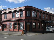
Coromandel, also called Coromandel Town to distinguish it from the wider district, is a town on the Coromandel Harbour, on the western side of the Coromandel Peninsula, which is in the North Island of New Zealand. It is 75 kilometres east of the city of Auckland, although the road between them, which winds around the Firth of Thames and Hauraki Gulf coasts, is 190 km long. The population was 1,930 as of June 2023.

<span class="mw-page-title-main">Te Awamutu</span> Town in Waikato, New Zealand

Te Awamutu is a town in the Waikato region in the North Island of New Zealand. It is the council seat of the Waipa District and serves as a service town for the farming communities which surround it. Te Awamutu is located some 30 kilometres (19 mi) south of Hamilton on State Highway 3, one of the two main routes south from Auckland and Hamilton.

Paeroa is a town in the Hauraki District of the Waikato Region in the North Island of New Zealand. Located at the base of the Coromandel Peninsula, it is close to the junction of the Waihou River and Ohinemuri River, and is approximately 20 kilometres south of the Firth of Thames.

<span class="mw-page-title-main">Tīrau</span> Settlement in Waikato, New Zealand

Tīrau is a small town in the Waikato region of the North Island of New Zealand, 50 kilometres southeast of Hamilton. The town has a population of 804. In the Māori language, "Tīrau" means "place of many cabbage trees."

<span class="mw-page-title-main">Waihou River</span> River in Waikato, New Zealand

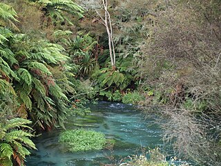
The Waihou River is located in the northern North Island of New Zealand. Its former name, Thames River, was bestowed by Captain James Cook in November 1769, when he explored 14 mi (23 km) of the river from the mouth. An older Māori name was "Wai Kahou Rounga". A 1947 Geographic Board enquiry ruled that the official name would be Waihou.

<span class="mw-page-title-main">Te Kauwhata</span> Town in Waikato, New Zealand

Te Kauwhata is a small town in the north of the Waikato region of New Zealand, situated close to the western shore of Lake Waikare, some 40 km north of Hamilton and approximately 58 km south of Manukau City.

<span class="mw-page-title-main">Puriri, New Zealand</span> Place in Waikato, New Zealand

Puriri is a small locality on the Hauraki Plains of New Zealand. It lies approximately 14 km south-east of Thames, New Zealand.

<span class="mw-page-title-main">Hikutaia</span> Place in Waikato, New Zealand

Hikutaia is a locality on the Hauraki Plains of New Zealand. It lies on State Highway 26, south east of Thames and north of Paeroa. The Hikutaia River runs from the Coromandel Range through the area to join the Waihou River.

<span class="mw-page-title-main">Matatoki</span> Place in Waikato, New Zealand

Matatoki is a locality on the Hauraki Plains of New Zealand. It lies on State Highway 26, south east of Thames and north of Paeroa. The Matatoki Stream runs from the Coromandel Range through the area to join the Waihou River.

<span class="mw-page-title-main">Ngāti Pāoa</span> Māori iwi in New Zealand

Ngāti Pāoa is a Māori iwi (tribe) that has extensive links to the Hauraki and Waikato tribes of New Zealand. Its traditional lands stretch from the western side of the Hauraki Plains to Auckland. They also settled on Hauraki Gulf islands such as Waiheke.

<span class="mw-page-title-main">Ngāti Tamaterā</span> Māori iwi in New Zealand

Ngāti Tamaterā is a Māori iwi (tribe) of the Hauraki region of New Zealand, descended from Tamaterā, the second son of Marutūāhu. It is a major tribe within the Marutūāhu confederation and its leaders have been prominent in Hauraki history and Marutūāhu tribal affairs. It is one of five tribes of the Marutūāhu confederation, the others being Ngāti Maru, Ngāti Paoa, Ngāti Rongoū and Ngāti Whanaunga. The Marutūāhu tribes are all descended from Marutūāhu, a son of Hotunui, who is said to have arrived in New Zealand on the Tainui canoe. The Marutūāhu tribes are therefore part of the Tainui group of tribes. The Marutūāhu confederation is also part of the Hauraki collective of tribes.

<span class="mw-page-title-main">Ngāti Whanaunga</span> Māori iwi in New Zealand

Ngāti Whanaunga is a Māori iwi (tribe) of the Coromandel Peninsula in New Zealand, descended from Whanaunga, the third son of Marutūāhu.

<span class="mw-page-title-main">Thames Branch</span>

The Thames Branch railway line connected Thames, New Zealand, with Hamilton and was originally part of the East Coast Main Trunk railway. Part of the line between Morrinsville and Waitoa remains open and is in use as the Waitoa Branch line, connecting to the Fonterra Dairy Factory at Waitoa.

<span class="mw-page-title-main">James Mackay (New Zealand politician, born 1831)</span>

James Mackay was a New Zealand farmer, explorer, public servant, administrator, land purchaser, interpreter, advocate and politician.

<span class="mw-page-title-main">Ngāti Rongoū</span> Māori iwi in New Zealand

Ngāti Rongoū is a Māori iwi (tribe) of the Coromandel Peninsula in New Zealand.

Tirohia is a rural community in the Hauraki District and Waikato region of New Zealand's North Island. It was one of the main areas used by Ngāti Hako, including Te Rae o te Papa pā. A bridge was built over the Waihou River in 1919.

<span class="mw-page-title-main">Tararu</span> Place in Waikato, New Zealand

Tararu is a former gold-mining village on the west coast of the Coromandel Peninsula of New Zealand. State Highway 25 runs through it; Te Puru being about 7 km (4.3 mi) to the north, and Thames about 2 km (1.2 mi) to the south.

<span class="mw-page-title-main">Kauaeranga Valley</span> Place in Waikato, New Zealand

Kauaeranga Valley is a valley created by the Kauaeranga River, which flows from the Coromandel Range southwest to the Firth of Thames at Thames, New Zealand in the North Island. It contains the settlement of Kauaeranga on the Coromandel Peninsula. It is located near Thames, in the Thames-Coromandel District in the Waikato region. It covers a land area of 180.51 km2.

<span class="mw-page-title-main">Whakatīwai</span> Coastal settlement in Hauraki District, New Zealand

Whakatīwai is a locality on the Seabird Coast on the western shore of the Firth of Thames, in the Hauraki District, New Zealand. Whakatīwai is the location of Wharekawa Marae, which holds importance for Ngāti Paoa and Ngāti Whanaunga. Whakatīwai Regional Park is just north of Whakatīwai. Until 2010, Whakatīwai was a part of the Franklin District. Because it was previously considered a part of the Auckland region, the Whakatīwai Regional Park continues to be owned and operated by the Auckland Council.

References

  1. 1 2 "ArcGIS Web Application". statsnz.maps.arcgis.com. Retrieved 2 September 2022.
  2. "Subnational population estimates (RC, SA2), by age and sex, at 30 June 1996-2023 (2023 boundaries)". Statistics New Zealand . Retrieved 25 October 2023. (regional councils); "Subnational population estimates (TA, SA2), by age and sex, at 30 June 1996-2023 (2023 boundaries)". Statistics New Zealand . Retrieved 25 October 2023. (territorial authorities); "Subnational population estimates (urban rural), by age and sex, at 30 June 1996-2023 (2023 boundaries)". Statistics New Zealand . Retrieved 25 October 2023. (urban areas)
  3. 1 2 KELSEY WILKIE (November 2016). "High winds cause havoc in Thames". Stuff.
  4. "Population estimate tables - NZ.Stat". Statistics New Zealand . Retrieved 25 October 2022.
  5. 1 2 "Statistical area 1 dataset for 2018 Census". Statistics New Zealand. March 2020. Thames North (167600), Thames Central (167700), Thames South (167800) and Totora-Kopu (168000).
  6. 2018 Census place summary: Thames North
  7. 2018 Census place summary: Thames Central
  8. 2018 Census place summary: Thames South
  9. 2018 Census place summary: Totora-Kopu
  10. 1 2 Ballara, Angela (2003). "Tāmaki-makau-rau (Auckland isthmus)". Taua: 'musket wars', 'land wars' or tikanga?: warfare in Maori society in the early nineteenth century. Auckland: Penguin. p. 220. ISBN   9780143018896.
  11. Kennedy, David (1876). Kennedy's Colonial Travel. Cambridge, Mass.: Cambridge University Press Digital Republished 2011. ISBN   978-1-108-03991-8.
  12. "Our Heritage". Archived from the original on 8 February 2013. Retrieved 10 February 2013.
  13. "Untitled". Daily Southern Cross . 12 March 1870. p. 3. Thus, the total goldfield population, exclusive of Coromandel, Kennedy's Bay, Ohinemuri, and the various sawing stations, appears to be 12,496 ; but we think that at least 15,000 may be set down as the gross total.
  14. "Results of a Census of New Zealand". February 1871. Chapter 6.
  15. "Observations on the State of the Aboriginal Inhabitants of New Zealand, 1859". 1859.
  16. "Census of New Zealand 1881". 1881. Table XIV. Showing, according to the Censuses of 1878 and 1881, the Population (exclusive of Maoris) of certain Cities, Boroughs, and Townships.
  17. "Hotunui, Whare Runanga". Auckland War Memorial Museum. Retrieved 19 November 2015.
  18. "Kopu mill to close, 145 jobs to be lost". The New Zealand Herald . 6 May 2008.
  19. Gay, Edward (14 October 2008). "Small town 'devastated' at mass job losses". The New Zealand Herald .
  20. Huge sink hole opened up on Thames highway
  21. "Te Kāhui Māngai directory". tkm.govt.nz. Te Puni Kōkiri.
  22. "Māori Maps". maorimaps.com. Te Potiki National Trust.
  23. Teresa Ramsey (16 May 2018). "First employee hired at The Treasury". Stuff . Retrieved 5 November 2019.
  24. Ramsey, Teresa (26 July 2017). "True tales of Thames told in The Treasury's new book". Stuff . Retrieved 5 November 2019.
  25. Ramsey, Teresa (1 November 2016). "Full steam ahead for Steampunk the Thames Festival". Stuff . Retrieved 7 November 2019.
  26. 1 2 3 "Council History". Thames-Coromandel District Council. Retrieved 18 May 2012.
  27. "Mayors and Councillors of Thames". The Treasury. Retrieved 18 May 2012.
  28. "New primary birthing unit opens in Thames" . Retrieved 24 November 2011.
  29. Johnny Williams (1987). Racing For Gold. Williams Publishers. ISBN   0-473-00441-0 . Retrieved 25 February 2013.
  30. Ghost Hunt: True New Zealand Ghost Stories ISBN   0-7900-1012-7
  31. GOLDFIELDS SHOPPING CENTRE
  32. O'Sullivan, Kelly (31 August 2019). "Netflix's New Movie 'Falling Inn Love' Was Filmed in the Most Charming Real-Life Town". Country Living. Retrieved 9 September 2019.
  33. "Goldfields Shops - Store Directory". goldfieldsshops.co.nz. Ganson Management.
  34. "The last wharf standing in Thames". Stuff. 25 January 2015. Retrieved 10 May 2021.
  35. "Thames Harbour Board Act 1876 (40 Victoriae 1876 No 87)". www.nzlii.org. Retrieved 10 May 2021.
  36. 1 2 "HAIL! AND FAREWELL! THAMES STAR". paperspast.natlib.govt.nz. 1 December 1936. Retrieved 10 May 2021.
  37. "Kopu Bridge". www.heritage.org.nz. Retrieved 10 May 2021.
  38. "THAMES BOROUGH. WAIKATO TIMES". paperspast.natlib.govt.nz. 10 May 1932. Retrieved 10 May 2021.
  39. "NEW ZEALAND HERALD". paperspast.natlib.govt.nz. 17 January 1911. Retrieved 10 May 2021.
  40. "NEW ZEALAND HERALD". paperspast.natlib.govt.nz. 10 November 1928. Retrieved 10 May 2021.
  41. "Thames Connector". busit.co.nz. Retrieved 10 May 2021.
  42. "Times & Stops". Go Kiwi Shuttles. Retrieved 10 May 2021.
  43. "Book Bus Tickets Online". www.intercity.co.nz. Retrieved 10 May 2021.
  44. Education Counts: Thames High School
  45. "About us". Thames High School.
  46. Education Counts: Moanataiari School
  47. Education Counts: Parawai School
  48. Education Counts: Thames South School
  49. Education Counts: St Francis School
  50. "Thames Parish". Coromandel Catholic Parishes.
  51. "New Zealand Schools Directory". New Zealand Ministry of Education. Retrieved 12 December 2022.
  52. "Thames Art Gallery". Thamesartgallery. Retrieved 2 August 2020.