Related Research Articles

Waikato is a local government region of the upper North Island of New Zealand. It covers the Waikato District, Waipa District, Matamata-Piako District, South Waikato District and Hamilton City, as well as Hauraki, Coromandel Peninsula, the northern King Country, much of the Taupō District, and parts of Rotorua District. It is governed by the Waikato Regional Council.

The Thames-Coromandel District is a territorial authority district in the North Island of New Zealand, covering all the Coromandel Peninsula and extending south to Hikutaia.

Hauraki District is a territorial authority within the Hauraki region of New Zealand. The seat of the council is at Paeroa.

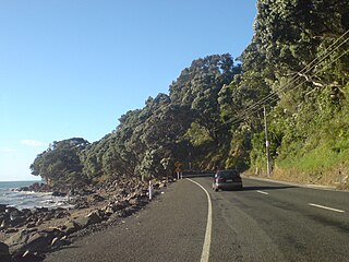
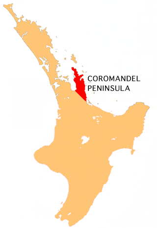
The Coromandel Peninsula on the North Island of New Zealand extends 85 kilometres (53 mi) north from the western end of the Bay of Plenty, forming a natural barrier protecting the Hauraki Gulf and the Firth of Thames in the west from the Pacific Ocean to the east. It is 40 kilometres (25 mi) wide at its broadest point. Almost its entire population lives on the narrow coastal strips fronting the Hauraki Gulf and the Bay of Plenty. In clear weather the peninsula is clearly visible from Auckland, the country's biggest city, which lies on the far shore of the Hauraki Gulf, 55 kilometres (34 mi) to the west. The peninsula is part of the Thames-Coromandel District of the Waikato region.
Thames is a town at the southwestern end of the Coromandel Peninsula in New Zealand's North Island. It is located on the Firth of Thames close to the mouth of the Waihou River. The town is the seat of the Thames-Coromandel District Council. The Māori iwi are Ngāti Maru, who are descendants of Marutuahu's son Te Ngako. Ngāti Maru is part of the Ngati Marutuahu confederation of tribes or better known as Hauraki Iwi.
Sandra Anne Goudie is a New Zealand politician. She was the Mayor of Thames-Coromandel from 2016 to 2022 when she resigned. She was the Member of Parliament for the Coromandel electorate from 2002 to 2011, representing the National Party. During the COVID-19 pandemic she was criticised for her anti-vaccination stance.
Cape Colville is the northernmost point of the Coromandel Peninsula in New Zealand's North Island. It lies 85 kilometres north of Thames, and 70 kilometres northeast of the city of Auckland, on the other side of the Hauraki Gulf. The small settlements of Port Jackson and Fletcher Bay lie immediately to the west and east respectively of the cape.
South Waikato District Council is the territorial authority for the South Waikato District of New Zealand.
Southland District Council is the territorial authority for the Southland District of New Zealand.
The Moehau Range is the northernmost range on the Coromandel Peninsula, extending from the settlement of Colville, New Zealand northwards to the tip of the peninsula. Mount Moehau is the highest point of the range, at 892m above sea level.

Auckland Council is the local government council for the Auckland Region in New Zealand. It is a territorial authority that has the responsibilities, duties and powers of a regional council and so is a unitary authority, according to the Local Government Act 2009, which established the council. The governing body consists of a mayor and 20 councillors, elected from 13 wards. There are also 149 members of 21 local boards who make decisions on matters local to their communities. It is the largest council in Oceania, with a $3 billion annual budget, $29 billion of ratepayer equity, and 9,870 full-time staff as of 30 June 2016. The council began operating on 1 November 2010, combining the functions of the previous regional council and the region's seven city and district councils into one "super council" or "super city".

Waikato District Council is the territorial authority for the Waikato District of New Zealand.

The Mayor of Thames officiated over the Thames Borough of New Zealand, which was administered by the Thames Borough Council. The office existed from 1874 until 1975, when Thames Borough and Coromandel County were amalgamated to form Thames-Coromandel District. There were 24 holders of the office.
Central Otago District Council is the territorial authority for the Central Otago District of New Zealand.
Matamata-Piako District Council is the territorial authority for the Matamata-Piako District of New Zealand.
Clutha District Council is the territorial authority for the Clutha District of New Zealand.
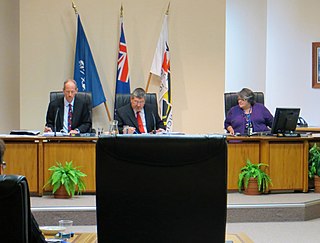
The Mayor of Thames-Coromandel officiates over the Thames-Coromandel District of New Zealand, which is administered by a district council. The office has existed since 1975, when the Thames Borough and the Coromandel County were amalgamated.
Ruapehu District Council is the territorial authority for the Ruapehu District of New Zealand.
Ōtorohanga District Council is the territorial authority for the Ōtorohanga District of New Zealand.

Onemana is a 1970s beach village on the eastern side of the Coromandel Peninsula of New Zealand, with a beach, a surf club, fire station and dairy. It lies 3 km (1.9 mi) to the east of State Highway 25, south of Pauanui and north of Whangamatā. The Wharekawa River and Opoutere are just to the north and west.