Related Research Articles

Homersfield, also known as St Mary, South Elmham, is a village and civil parish in the north of the English county of Suffolk. It is in the East Suffolk district, 4 miles (6.4 km) south-west of the market town of Bungay and 3 miles (4.8 km) north-east of Harleston. The official name of the civil parish is St Mary, South Elmham otherwise Homersfield. It is one of the parishes around Bungay known as The Saints.

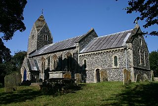
All Saints and St Nicholas, South Elmham is a civil parish in the north of the English county of Suffolk. It is 5 miles (8.0 km) south of the market town of Bungay and the same distance north-west of Halesworth and east of Harleston. The parish is in the East Suffolk district and is one of the parishes that make up the area around Bungay known as The Saints. It includes the settlements of All Saints, South Elmham and St Nicholas, South Elmham.

Barsham is a village and civil parish in the East Suffolk district of the English county of Suffolk. It is about 2 miles (3.2 km) west of Beccles, south of the River Waveney on the edge of The Broads National Park. It is spread either side of the B1062 Beccles to Bungay road.

Ilketshall St Margaret is a village and civil parish in the north of the English county of Suffolk. It is 3 miles (4.8 km) south of the market town of Bungay in the East Suffolk district. The parish is part of the area known as the Saints and had a population of 160 at the 2011 United Kingdom census.

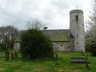
Ilketshall St Andrew is a village and civil parish in the north of the English county of Suffolk. It is 3 miles (4.8 km) south-east of Bungay and the same distance south-west of Beccles in the East Suffolk district. St Andrew's church is one of around 40 round-tower churches in Suffolk.

All Saints' South Elmham is a village and former civil parish in the north of the English county of Suffolk. The parish was combined with St Nicholas South Elmham in 1737 to form the parish of All Saints and St. Nicholas, South Elmham. It is 5 miles (8.0 km) south of the market town of Bungay in the East Suffolk district. It is one of the villages that make up the area around Bungay known as The Saints.

Mettingham is a village and civil parish in the north of the English county of Suffolk. It is 2 miles (3.2 km) east of the market town of Bungay in the East Suffolk district. It had a population of 211 at the 2011 United Kingdom census.

Rumburgh is a village and civil parish in the English county of Suffolk. It is 3.5 miles (5.6 km) north-west of the market town of Halesworth in the East Suffolk District. The population of the parish at the 2011 United Kingdom census was 327.

Flixton is a village and civil parish located in the north of the English county of Suffolk. It is around 2 miles (3.2 km) south-west of Bungay in the East Suffolk district and is one of the villages around Bungay which make up the area known as The Saints. The A143 road runs just to the north of the parish border linking Bungay with Harleston and Diss.

Shipmeadow is a village and civil parish located in the north of the English county of Suffolk. It is in the East Suffolk district, 2.5 miles (4.0 km) east of Bungay and the same distance west of Beccles on the B1062 road. Norwich is 15 miles (24 km) to the north-west.
Wangford was a hundred of Suffolk, England, consisting of 34,679 acres (140.34 km2).

St Cross South Elmham is a village and civil parish in the north of the English county of Suffolk. It is in the East Suffolk district, close to the border with Norfolk and is 3 miles (4.8 km) east of Harleston and 4.25 miles (6.84 km) south-west of Bungay. It is one of the villages around Bungay known as the Saints.

St James South Elmham is a village and civil parish in the north of the English county of Suffolk. It is 4.5 miles (7.2 km) north-west of the market town of Halesworth and 5.5 miles (8.9 km) south-west of Bungay in the East Suffolk district. It is one of the parishes around Bungay known as the Saints.

Ilketshall St Lawrence is a village and civil parish in the East Suffolk district of the English county of Suffolk. It is 3 miles (4.8 km) south-east of the market town of Bungay and is part of a group of parishes with similar names known collectively as the Saints.

St Margaret South Elmham is a village and civil parish in the north of the English county of Suffolk. It is 4 miles (6.4 km) south-west of the market town of Bungay in the East Suffolk district. It is one of the parishes surrounding Bungay which are known as The Saints.

St Michael South Elmham is a village and civil parish in the north of the English county of Suffolk. It is 4 miles (6.4 km) south of the market town of Bungay in the East Suffolk district. It is one of the villages surrounding Bungay which make up the area known as The Saints.

St Peter South Elmham is a village and civil parish in the north of the English county of Suffolk. It is around 3 miles (4.8 km) south of the market town of Bungay in the East Suffolk district. It is one of the villages surrounding Bungay which make up the area known as The Saints.

St Nicholas South Elmham is a place and former civil parish in the north of the English county of Suffolk. The parish was combined with All Saints' South Elmham in 1737 to form the parish of All Saints and St. Nicholas, South Elmham. It is 5 miles (8.0 km) south of the market town of Bungay in the East Suffolk district. It is part of the area around Bungay known as The Saints.

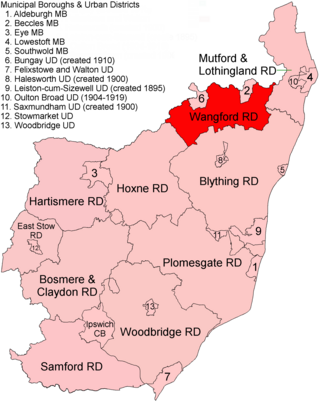
Wangford Rural District was a rural district within the administrative county of East Suffolk between 1894 and 1934. It was created out of the earlier Wangford rural sanitary district. It was named after the historic hundred of Wangford, whose boundaries it closely matched. It contained the group of small villages collectively known as The Saints.

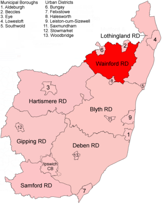
Wainford Rural District was a rural district in East Suffolk, England, between 1934 and 1974. It was created by a merger of the disbanded Wangford Rural District and parts of Blything Rural District, and contained the group of small villages collectively known as The Saints. The name Wainford is linked to that of Wangford, a historic hundred of Suffolk.