Tidewater glacier cycle

Last updated
The Taku Glacier. Taku Icefield.jpg
The Taku Glacier.

The tidewater glacier cycle is the typically centuries-long behavior of tidewater glaciers that consists of recurring periods of advance alternating with rapid retreat and punctuated by periods of stability. During portions of its cycle, a tidewater glacier is relatively insensitive to climate change.

Contents

Calving rate of tidewater glaciers

Iceberg calving from several tidewater glaciers, Cape York, Greenland Icebergs cape york 4.jpg
Iceberg calving from several tidewater glaciers, Cape York, Greenland

While climate is the main factor affecting the behavior of all glaciers, additional factors affect calving (iceberg-producing) tidewater glaciers. These glaciers terminate abruptly at the ocean interface, with large pieces of the glacier fracturing and separating, or calving, from the ice front as icebergs.

Climate change causes a shift in the equilibrium line altitude (ELA) of a glacier. This is the imaginary line on a glacier, above which snow accumulates faster than it ablates, and below which, the reverse is the case. This altitude shift, in turn, prompts a retreat or advance of the terminus toward a new steady-state position. However, this change in terminus behavior for calving glaciers is also a function of resulting changes in fjord geometry, and calving rate at the glacier terminus as it changes position. [1] [2]

Calving glaciers are different from land terminating glaciers in the variation in velocity along their length. Land terminating glacier velocities decline as the terminus is approached. Calving glaciers accelerate at the terminus. A declining velocity near the terminus slows the glacier response to climate. An accelerating velocity at the front enhances the speed of the glaciers response to climate or glacier dynamic changes. This is observed in Svalbard, Patagonia and Alaska. [3] [4] [5] A calving glacier requires more accumulation area than a land terminating glacier to offset this higher loss from calving.

The calving rate is largely controlled by the depth of the water and the glacier velocity at the calving front. The process of calving provides an imbalance in forces at the front of the glaciers, that raises velocity. [6] The depth of the water at the glacier front is a simple measure that allows estimation of calving rate, but is the amount of flotation of the glacier at the front that is the specific physical characteristic that is important. [3] [4]

Water depth at the glacier terminus is the key variable in predicting calving of a tidewater glacier. [7] [8] Debris flux and sediment recycling at the glacier grounding-line, particularly rapid in the temperate glaciers of Alaska, can alter this depth, acting as a second-order control on terminus fluctuations. [9] This effect contributes to the insensitivity of a glacier to climate when its terminus is either retreating or advancing in deep water.

Austin Post was one of the first to propose that water depth at the calving margin strongly affects the rate of iceberg calving. [2] Glaciers that terminate on a morainal shoal are generally stable, but once a glacier retreats into water that deepens as the ice front recedes, calving rate increases rapidly and results in drastic retreat of the terminus. Using data collected from 13 Alaskan tidewater calving glaciers, Brown et al. (1982) derived the following relationship between calving speed and water depth: , where is the mean calving speed (ma −1), is a calving coefficient (27.1±2 a−1), is the mean water depth at glacier front (m) and is a constant (0 m⋅a−1). Pelto and Warren (1991) found a similar calving relationship with tidewater glaciers observed over longer time periods, with slightly reduced calving rate to the mainly summer rates noted by Brown et al. (1982). [7] [8]

Calving is an important form of ablation for glaciers that terminate in freshwater, also. Funk and Röthlisberger determined a relationship between calving speed and water depth based on analysis of six glaciers that calve into lakes. [10] They found that the same basic calving relationship developed for tidewater calving glaciers was true for freshwater calving glaciers, only the calving coefficients lead to calving rates 10% of that for tidewater glaciers.

Tidewater glacier phases

Observations of Alaskan tidewater calving glaciers prompted Austin Post [2] to describe the tidewater calving glacier advance/retreat cycle: (1) advancing, (2) stable-extended, (3) drastically retreating, or (4) stable-retracted. The following is a detailed review of the tidewater glacier cycle derived by Post, with numerous cited examples, the cycle is based on observations of temperate tidewater glaciers in Alaska, not outlet glaciers from large ice sheets or polar glaciers.

The accumulation area ratio of a glacier, AAR, is the percentage of a glacier that is a snow-covered accumulation zone at the end of the summer melt season. This percentage for large Alaskan glaciers is between 60 and 70 for non-calving glaciers, 70-80 for moderately calving glaciers and up to 90 for very high calving rate glaciers. [11] By using accumulation area ratio (AAR) data for Alaskan tidewater calving glaciers, Pelto (1987) [11] and Viens (1995) [12] produced models showing that climate acts as a first-order control on the advance/retreat cycle of calving glaciers during most of the advance retreat cycle, but there are climate insensitive periods as well. Pelto (1987) examined the terminus behavior of 90 Alaskan glaciers and found that the terminus behavior of all 90 were correctly predicted based on the AAR and calving rate. [11]

Advancing

The Hubbard Glacier Hub Glacier.jpg
The Hubbard Glacier

If we begin at the stable retracted position at the end of a tidewater glacier cycle the glacier will have a moderate calving rate and a high AAR, above 70. The glacier will build a terminus shoal of sediment further reducing the calving rate. This will improve the glacier mass balance and the glacier can begin to advance due to this change or an increase in ice flux to the terminus due to increasing snowfall or reduced snow melt. As the advance proceeds the terminus shoal will be pushed in front of the glacier and continue to build, keeping the calving rate low. In the case of the most glaciers such as the Taku Glacier the glacier will eventually build a terminus shoal that is above water and calving will essentially cease. This will eliminate this loss of ice from the glacier and the glacier can continue to advance. Taku Glacier and Hubbard Glacier have been in this phase of the cycle. Taku Glacier which has been advancing for 120 years no longer calves. Hubbard Glacier still has a calving front. [13] [14] The glacier will then expand until the AAR is between 60 and 70 and equilibrium of the non-calving glacier is achieved. The glacier is not very sensitive to climate during the advance as its AAR is quite high, when the terminus shoal is limiting calving.

Stable-extended

At the maximum extended position the glacier is once again sensitive to changing climate. [12] [15] Brady Glacier and Baird Glacier are examples of glaciers currently at this point. Brady Glacier has been thinning during the last two decades due to the higher equilibrium line altitudes accompanying warmer conditions in the region, and its secondary termini have begun to retreat. A glacier can remain at this position for sometime, a century at least in the case of Brady Glacier. Usually substantial thinning occurs before retreat from the shoal commences. This allowed the prediction in 1980, by the United States Geological Survey (USGS), of the retreat of the Columbia Glacier from its terminus shoal. [16] The glacier had remained on this shoal throughout the entire 20th century. The USGS was monitoring the glacier due to its proximity to Valdez, Alaska, the port for crude oil export from the Alaskan Pipeline. At some point a decline in mass balance will trigger a retreat from the shoal into deeper water at which point calving will ensue. [2] Based on the recent thinning it is suggested that Brady Glacier is poised to begin retreat.

Drastically retreating

Columbia Glacier in 2004 ColumbiaGlacierJune2004.JPG
Columbia Glacier in 2004

The calving rate will increase as the glacier retreats from the shoal into the deeper fjord just cleared by the glacier during advance. The water depth initially increases as the glacier retreats from the shoal, causing ever more rapid glacier flow, calving and retreat. A glacier is comparatively insensitive to climate during this calving retreat. However, in the case of San Rafael Glacier, Chile, a switch from retreat (1945–1990) to advance (1990–1997) was noted. [17] Current examples of this retreat are Columbia Glacier and Guyot Glacier. The most famous recent example of this is the large retreat of Glacier Bay and Icy Bay glaciers in Alaska that occurred rapidly via this process. [18] Muir Glacier retreated 33  km from 1886 to 1968 featuring extensive calving the entire time. It reversed its retreat briefly 18901892. [19] In 1968, Muir Glacier was still 27 km long, less than half of its length in 1886. The retreat continued an additional 6.5 km by 2001. [20] Today, the glacier is near the head of its fjord and with minimal calving the glacier may be stable at this retracted position.

The best current example is illustrated by the United States Geological Survey study of Columbia Glacier. They noted that the average calving rate from Columbia Glacier increased from 3 km3⋅a−1 in the second half of 1983 to 4 km3⋅a−1 during the first nine months of 1984. This rate was four times greater than that measured at the end of 1977 and increased again in 1985. The glacier flow, i.e., the movement of the ice toward the sea, also increased, it was inadequate to keep pace with the break-up and expulsion of icebergs. The increase in speed instead seemed to just feed the ever faster conveyor to the terminus for iceberg production. This prompted the USGS to predict that the glacier would retreat 32 km before stabilizing. [16] By 2006, it has retreated 16 km. The water remains deep and the calving rate and glacier velocity very high, indicating retreat will continue. At this point, just like having a balloon payment in an adjustable rate mortgage, the glacier has to pay a whole new portion of its balance via icebergs. The glacier accelerates as flow is enhanced by the calving process; this increases the export of icebergs from the glacier. Large calving retreats are initiated by warming conditions causing ice thinning. The resulting retreat to a new equilibrium conditions can be far more extensive than will be regained during the next advance stage. A good example of this is Muir Glacier.

Next to Glacier Bay, Icy Bay has had the most extensive retreat. At the beginning of the 20th century, the coastline was nearly straight and the bay non-existent. The entrance of the bay was filled by a tidewater glacier face that calved icebergs directly into the Gulf of Alaska. A century later glacier retreat has opened a multi-armed bay more than 30 miles long. The tidewater glacier has divided into three independent glaciers, Yahtse, Tsaa and Guyot Glacier. Other examples of glaciers currently in the retreat phase are South Sawyer and Sawyer Glaciers in Alaska, retreating 2.1 and 2.3 km respectively from 1961 to 2005.

In Patagonia an example of a rapidly retreating glacier is the Jorge Montt Glacier which drains into Baja Jorge Montt in the Pacific Ocean. The glacier's ice thinning, at low elevations, from 1975 to 2000 reached 18 m⋅a−1 at the lowest elevations. The glacier calving front experienced a major retreat of 8.5 km in those 25 years as a result of rapid thinning .

Stable-retracted

At some point the glacier reaches a pinning point where calving is reduced due to a fjord narrowing or shoaling and the glacier's AAR is near 100. This is occurring with LeConte Glacier and Yathse Glacier. Le Conte Glacier currently has an AAR of 90, is at a retracted position and seems likely to be set to advance after building a terminus shoal. [21] The drop in calving rate allows the glacier to reestablish equilibrium.

Examples of tidewater glacier behavior

Taku Glacier

The Taku Glacier provides a good example of this cycle. It was at its maximum extent near 1750. At this point it had closed off Taku Inlet. [22] Subsequently, calving retreat commenced. By the time John Muir saw the glacier in 1890, it was near its minimum extent, at a location where the fjord narrowed, with deep water in front. [23] About 1900, its AAR of 90 led to the Taku Glacier onset of advance, at the same time that the remaining Juneau Icefield glaciers continued receding. [15] This advance continued at a rate of 88 m⋅a−1, advancing 5.3 km from the 1900 minimum until 1948, all the while building and then riding up on a substantial outwash plain beneath its calving face. After 1948, the now non-calving Taku Glacier, possessed an AAR only slightly reduced (86 and 63). This drove 1.5 km of further advance at a reduced rate of 37 m⋅a−1. In 1990, the Taku Glacier's AAR was 82 high enough, to prompt Pelto and Miller to conclude that the Taku Glacier would continue to advance for the remaining decade of the 20th century. [15] From 1986 to 2005, the equilibrium line altitude on the glacier rose without a significant terminus shift causing the AAR to decline to about 72. Pelto and Miller concluded that the current reduction in rate of advance is since 1970 is attributable to the laterally expanding terminal lobe as opposed to declining mass balance and that the primary force behind the Taku Glacier's advance since about 1900 is due to positive mass balance. [15] The recent lack of positive mass balance will eventually slow the retreat if it persists.

Effects of climate change

The size of tidewater glaciers is such that the tidewater glacier cycle is several hundred years in length. A tidewater glacier is not sensitive to climate during the advancing and drastically retreating phases of its cycle. In the same region, disparate terminus responses are observed amongst tidewater calving glaciers, but not land terminating glaciers. This is exemplified by the 17 major glaciers of the Juneau Icefield, 5 have retreated more than 500 m since 1948, 11 more than 1000 m, and one glacier the Taku has advanced. This difference highlights the unique impacts on terminus behavior of the tidewater glacier cycle, which has caused the Taku Glacier to be insensitive to climate change in the last 60 years. Concurrently, in both Patagonia [17] and Alaska, [7] there are tidewater glaciers that have advanced for a considerable period, tidewater glaciers undergoing rapid retreat and stable tidewater glaciers.

Related Research Articles

Glacier Persistent body of ice that is moving under its own weight

A glacier is a persistent body of dense ice that is constantly moving under its own weight. A glacier forms where the accumulation of snow exceeds its ablation over many years, often centuries. Glaciers slowly deform and flow under stresses induced by their weight, creating crevasses, seracs, and other distinguishing features. They also abrade rock and debris from their substrate to create landforms such as cirques, moraines, or fjords. Glaciers form only on land and are distinct from the much thinner sea ice and lake ice that forms on the surface of bodies of water.
Glaciology Scientific study of ice and natural phenomena involving ice

Glaciology is the scientific study of glaciers, or more generally ice and natural phenomena that involve ice.
Glacier Bay Basin Bay in southeastern Alaska

Glacier Bay Basin in southeastern Alaska, in the United States, encompasses the Glacier Bay and surrounding mountains and glaciers, which was first proclaimed a U.S. National Monument on February 25, 1925, and which was later, on December 2, 1980, enlarged and designated as the Glacier Bay National Park and Preserve under the Alaska National Interest Lands Conservation Act, covering an area of 3,283,000 acres. In 1986, UNESCO declared an area of 57,000 acres within a World Biosphere Reserve. This is the largest UNESCO protected biosphere in the world. In 1992, UNESCO included this area as a part of a World Heritage site, extending over an area of 24,300,000-acre (98,000 km2) which also included the Wrangell-St. Elias National Park, Kluane National Park (Canada) and Tatshenshini-Alsek Park (Canada). Part of the National Park is also designated a Wilderness area covering 2,658,000 acres.

Mendenhall Glacier Glacier in the United States

Mendenhall Glacier is a glacier about 13.6 miles (21.9 km) long located in Mendenhall Valley, about 12 miles (19 km) from downtown Juneau in the southeast area of the U.S. state of Alaska. The glacier and surrounding landscape is protected as part of the 5,815 acres (2,353 ha) Mendenhall Glacier Recreation Area, a federally designated unit of the Tongass National Forest.
Columbia Glacier (Alaska)

The Columbia Glacier is a glacier in Prince William Sound on the south coast of the U.S. state of Alaska, is one of the fastest moving glaciers in the world, and has been retreating since the early 1980s. It was named after Columbia University, one of several glaciers in the area named for elite U.S. colleges by the Harriman Alaska Expedition in 1899. The head of the main branch of the glacier originates at the saddle between Mount Witherspoon and Mount Einstein.

Taku Glacier Glacier in Alaska, United States

Taku Glacier is a tidewater glacier located in Taku Inlet in the U.S. state of Alaska, just southeast of the city of Juneau. Recognized as the deepest and thickest alpine temperate glacier known in the world, the Taku Glacier is measured at 4,845 feet (1,477 m) thick. It is about 58 kilometres (36 mi) long, and is largely within the Tongass National Forest.

LeConte Glacier

LeConte Glacier is a 21-mile (34 km) and 1-mile (1.6 km) glacier in the U.S. state of Alaska. It flows southwest to the head of LeConte Bay. It was named in 1887 by U.S. Navy Lieutenant-Commander Charles M. Thomas in honor of a California geologist Joseph LeConte. According to John Muir's book about indigenous peoples of the area, the Tlingits called it “Huti [sic]” which he claimed derived from a mythical bird that produced sounds of thunder when it flapped its wings.
Margerie Glacier Glacier in Glacier Bay, Alaska, United States

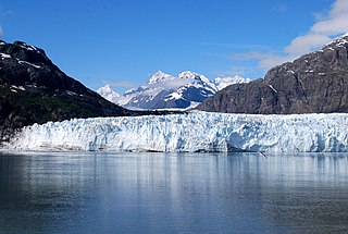
Margerie Glacier is a 21 mi (34 km) long tidewater glacier in Glacier Bay, Alaska, United States within the boundaries of Glacier Bay National Park and Preserve. The glacier begins on the southern slopes of Mount Root, elevation 12,860 feet (3,920 m), on the Alaska–Canada border flowing southeast down the valley, then turning to the northeast toward its terminus in Tarr Inlet. Margerie Glacier is one of the most active and frequently-visited glaciers in Glacier Bay, which was declared a National Monument in 1925, a National Park and Preserve in 1980, a UNESCO World Biosphere Reserve in 1986 and a World Heritage Site in 1992. While most of the tidewater glaciers in the park have been receding over the last several decades, Margerie Glacier has become stable, neither growing nor receding, while Johns Hopkins Glacier is advancing.

Juneau Icefield

The Juneau Icefield is an ice field located just north of Juneau, Alaska, continuing north through the border with British Columbia, extending through an area of 3,900 square kilometres (1,500 sq mi) in the Coast Range ranging 140 km (87 mi) north to south and 75 km (47 mi) east to west. The icefield is the source of many glaciers including the Mendenhall Glacier and the Taku Glacier. The icefield is home to over 40 large valley glaciers and 100 smaller ones. The Icefield serves as a tourist attraction with many travellers flown in by helicopter for quick walks on the 240-to-1,400-metre deep ice and the massive, awe-inspiring moist crevasses. The icefield, like many of its glaciers, reached its maximum glaciation point around 1700 and has been in retreat since. In fact, of the icefield's 19 notable glaciers, the Taku Glacier is the only one presently advancing. Much of the icefield is contained within the Tongass National Forest. Since 1948, the Juneau Icefield Research Program has monitored glaciers of the Juneau Icefield. On the west side of the icefield, from 1946-2009, the terminus of the Mendenhall Glacier has retreated over 700 metres (0.43 mi).

Glacier mass balance Difference between accumulation and melting on a glacier

Crucial to the survival of a glacier is its mass balance or surface mass balance (SMB), the difference between accumulation and ablation. Climate change may cause variations in both temperature and snowfall, causing changes in the surface mass balance. Changes in mass balance control a glacier's long-term behavior and are the most sensitive climate indicators on a glacier. From 1980 to 2012 the mean cumulative mass loss of glaciers reporting mass balance to the World Glacier Monitoring Service is −16 m. This includes 23 consecutive years of negative mass balances.
Jakobshavn Glacier Glacier in Greenland

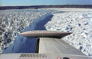
Jakobshavn Glacier, also known as Ilulissat Glacier, is a large outlet glacier in West Greenland. It is located near the Greenlandic town of Ilulissat and ends at the sea in the Ilulissat Icefjord.

Glacial surges are short-lived events where a glacier can advance substantially, moving at velocities up to 100 times faster than normal. Surging glaciers cluster around a few areas. High concentrations of surging glaciers occur in the Karakoram, Pamir Mountains, Svalbard, the Canadian Arctic islands, Alaska and Iceland, although overall it is estimated that only one percent of all the world's glaciers ever surge. In some glaciers, surges can occur in fairly regular cycles, with 15 to 100 or more surge events per year. In other glaciers, surging remains unpredictable. In some glaciers, however, the period of stagnation and build-up between two surges typically lasts 10 to 200 years and is called the quiescent phase. During this period the velocities of the glacier are significantly lower, and the glaciers can retreat substantially.

Retreat of glaciers since 1850 Shortening of glaciers by melting

The retreat of glaciers since 1850 affects the availability of fresh water for irrigation and domestic use, mountain recreation, animals and plants that depend on glacier-melt, and, in the longer term, the level of the oceans. Deglaciation occurs naturally at the end of ice ages, but glaciologists find the current glacier retreat is accelerated by the measured increase of atmospheric greenhouse gases—an effect of climate change. Mid-latitude mountain ranges such as the Himalayas, Rockies, Alps, Cascades, and the southern Andes, as well as isolated tropical summits such as Mount Kilimanjaro in Africa, are showing some of the largest proportionate glacial losses. Excluding peripheral glaciers of ice sheets, total global glacial losses were likely 5500 gigatons over 1993–2018.
Glacier morphology Geomorphology of glacier lakes

Glacier morphology, or the form a glacier takes, is influenced by temperature, precipitation, topography, and other factors. The goal of glacial morphology is to gain a better understanding of glaciated landscapes and the way they are shaped. Types of glaciers can range from massive ice sheets, such as the Greenland ice sheet, to small cirque glaciers found perched on mountain tops. Glaciers can be grouped into two main categories:

Jorge Montt Glacier

Jorge Montt Glacier is a tidewater glacier located in the Aisén Region of Chile, south of the town of Caleta Tortel. It lies at the north end of the Southern Patagonian Ice Field, within Bernardo O'Higgins National Park. The mouth of Pascua River is located in the vicinity of the glacier calving front.

Ice calving Breaking of ice chunks from the edge of a glacier

Ice calving, also known as glacier calving or iceberg calving, is the breaking of ice chunks from the edge of a glacier. It is a form of ice ablation or ice disruption. It is the sudden release and breaking away of a mass of ice from a glacier, iceberg, ice front, ice shelf, or crevasse. The ice that breaks away can be classified as an iceberg, but may also be a growler, bergy bit, or a crevasse wall breakaway.

Petermann Glacier

Petermann Glacier is a large glacier located in North-West Greenland to the east of Nares Strait. It connects the Greenland ice sheet to the Arctic Ocean at 81°10' north latitude, near Hans Island.

Nioghalvfjerdsbrae

Nioghalvfjerdsbrae, sometimes referred to as "79 N Glacier", is a large glacier located in King Frederick VIII Land, northeastern Greenland. It drains an area of 103,314 km2 (39,890 sq mi) of the Greenland Ice Sheet with a flux of 14.3 km3 (3.4 cu mi) per year, as measured for 1996. The glacier has two calving fronts where the glacier meets the ocean, separated by Hovgaard Island. In July 2020, the northern offshoot, the Spalte Glacier broke away from Nioghalvfjerdsbrae and completely disintegrated.

Ice mélange Mixture of sea ice types, icebergs, and snow without a clearly defined floe

Ice mélange refers to a mixture of sea ice types, icebergs, and snow without a clearly defined floe that forms from shearing and fracture at the ice front. Ice mélange is commonly the result of an ice calving event where ice breaks off the edge of a glacier. Ice mélange affects many of the Earth's processes including glacier calving, ocean wave generation and frequency, generation of seismic waves, atmosphere and ocean interactions, and tidewater glacier systems. Ice mélange is possibly the largest granular material on Earth, and is quasi-2-dimensional.

PTAAGMB

References

Footnotes

  1. Mercer, J.H. (1961). "The response of fjord glaciers to changes in the firn limit". Journal of Glaciology. 3/29 (29): 850–858. Bibcode:1961JGlac...3..850M. doi: 10.1017/S0022143000027222 .
  2. 1 2 3 4 Austen, Post (1975). "Preliminary hydrography and historical terminal changes of Columbia Glacier". U.S. Geological Survey Hydrologic Investigations Atlas HA-559.{{cite journal}}: Cite journal requires |journal= (help)
  3. 1 2 Vieli, A.; J. Jania; H. Blatter; M. Funk (2004). "Short-term velocity variations on Hansbreen, a tidewater glacier in Spitsbergen". Journal of Glaciology. 50 (170): 389–398. Bibcode:2004JGlac..50..389V. doi: 10.3189/172756504781829963 .
  4. 1 2 van der Veen, C.J. (2004). "Tidewater calving". Journal of Glaciology. 42: 375–386.
  5. Warren, C.R.; N.F. Glasser; A.R. Kerr; S. Harrison; V. Winchester; A. Rivera (1995). "Characteristics of tidewater calving activity at Glaciar San Rafael, Chile". Journal of Glaciology. 41 (138): 273–289. doi: 10.1017/S0022143000016178 .
  6. Hughes, Terence (1988). "Calving ice walls". Annals of Glaciology. 12: 74–80. doi: 10.1017/S0260305500006984 .
  7. 1 2 3 Brown, C.S.; M.F. Meier; and A. Post (1982). "Calving speed of Alaska tidewater glaciers, with application to Columbia Glacier". U.S. Geological Survey Professional Paper. United States Geological Survey. 1044–9612: C1–C13.
  8. 1 2 Pelto, M. S.; Warren, C. R. (1991). "Relationship between tidewater glacier calving velocity and water depth at the calving front". Annals of Glaciology. International Glaciological Society. 15: 115–118. Bibcode:1991AnGla..15..115P. doi: 10.1017/S0260305500009617 .
  9. Powell, R.D. (1991). "Grounding-line systems as second-order controls on fluctuations of tidewater termini of temperate glaciers". Glacial Marine Sedimentation; Paleoclimatic Significance. Geological Society of America Special Papers. 261: 75–93. doi:10.1130/SPE261-p75. ISBN   978-0-8137-2261-0.
  10. Funk, M.; Röthlisberger, F. (1989). "Forecasting the effects of a planned reservoir which will partially flood the tongue of Unteraargletscher in Switzerland". Annals of Glaciology. International Glaciological Society. 13: 76–81. Bibcode:1989AnGla..13...76F. doi: 10.1017/S0260305500007679 .
  11. 1 2 3 Pelto, M.S. (1987). "Mass balance of southeast Alaska and northwest British Columbia glaciers from 1976 to 1984: Methods and Results" (PDF). Annals of Glaciology. 9: 189–193. doi: 10.3189/S0260305500000598 .
  12. 1 2 Viens, R.J. (1995). "Dynamics and mass balance of tidewater calving glaciers of southern Alaska (Unpublished Masters thesis)". University of Washington.{{cite journal}}: Cite journal requires |journal= (help)
  13. Pelto, Mauri S.; Matt Beedle; Maynard M. Miller (2005). "Mass Balance Measurements of the Taku Glacier, Juneau Icefield, Alaska, 1946-2005". Juneau Icefield Research Program. Retrieved 2007-10-11.
  14. "Program Overview/Why Study Hubbard Glacier?". Hubbard Glacier, Alaska. U.S. Geological Survey. January 3, 2007. Retrieved 2007-10-11.
  15. 1 2 3 4 Pelto, M.; M.M. Miller (1990). "Mass Balance of the Taku Glacier, Alaska from 1946 to 1986". Northwest Science. 64 (3): 121–130.
  16. 1 2 Meier, M.F; A. Post; L. A. Rasmussen; W. G. Sikonia; L. R. Mayo (1980). "Retreat of Columbia Glacier, Alaska - A preliminary prediction". 80–10. USGS Open-File Report.{{cite journal}}: Cite journal requires |journal= (help)
  17. 1 2 Warren, C. R. (1993). "Rapid recent fluctuations of the calving San Rafael Glacier, Chilean Patagonia: Climatic or non-climatic?". Geografiska Annaler. 75A (3): 111–125. doi:10.1080/04353676.1993.11880389.
  18. Powell, R. D. (1991). "Grounding-line systems as second-order controls on fluctuations of tidewater termini of temperate glaciers". In J. B. Anderson, and G. M. Ashley (ed.). Glacial marine sedimentation: Paleoclimate significance; Special Paper 261. Denver: Geological Society of America. pp. 74–94.
  19. Field, W. O. (1975). "Glaciers of the Coast Mountains: Boundary Ranges (Alaska, British Columbia, and Yukon Territory". In W. O. Field (ed.). Mountain Glaciers of the Northern Hemisphere. Hanover, NH: Army Cold Regions Research and Engineering Laboratory. pp. 299–492.
  20. Molnia, B.F. (2006). "Late nineteenth to early twenty-first century behavior of Alaskan glaciers as indicators of changing regional climate". Global and Planetary Change. Elsevier B.V. 56 (1–2): 23–56. ASIN   B000PDTHNS. doi:10.1016/j.gloplacha.2006.07.011.
  21. Motyka, RJ; L Hunter; K Echelmeyer; C Connor (2003). "Submarine melting at the terminus of a temperate tidewater glacier, LeConte Glacier, Alaska" (PDF). Annals of Glaciology. International Glaciological Society. 36: 57. Bibcode:2003AnGla..36...57M. doi: 10.3189/172756403781816374 . Archived from the original (PDF) on July 8, 2008. Retrieved 2007-10-27.
  22. Motyka, R. J.; Beget, J. E. (1996). "Taku Glacier, southeast Alaska, U.S.A.: Late Holocene history of a tide-water glacier". Arctic and Alpine Research. 28 (1): 42–51. doi:10.2307/1552084. JSTOR   1552084.
  23. Muir, John (1915). Travels in Alaska. Boston: Houghton Mifflin. ISBN   0-87156-783-0.

Other references