Tigaon, Camarines Sur

Last updated
Tigaon
Municipality of Tigaon
Flag of Tigaon, Camarines Sur (New).png
Ph locator camarines sur tigaon.png
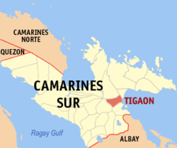
Map of Camarines Sur with Tigaon highlighted
OpenStreetMap
Tigaon, Camarines Sur
Philippines location map (square).svg
Red pog.svg
Tigaon
Location within the Philippines
Coordinates: 13°37′55″N123°29′51″E / 13.6319°N 123.4975°E / 13.6319; 123.4975
Country Philippines
Region Bicol Region
Province Camarines Sur
District 4th district
Barangays 23 (see Barangays)
Government
[1]
  Type Sangguniang Bayan
   Mayor Pamela Rinah B. Fuentebella
   Vice Mayor Claro F. Llaguno
   Representative Arnulf Bryan B. Fuentebella
   Municipal Council
Members
   Electorate 39,355 voters (2022)
Area
[2]
  Total72.35 km2 (27.93 sq mi)
Elevation
91 m (299 ft)
Highest elevation
388 m (1,273 ft)
Lowest elevation
6 m (20 ft)
Population
 (2020 census) [3]
  Total60,524
  Density840/km2 (2,200/sq mi)
   Households
13,324
Economy
   Income class 2nd municipal income class
   Poverty incidence
28.70
% (2018) [4]
   Revenue 217.1 million (2020)
   Assets 441.1 million (2020)
   Expenditure 159.8 million (2020)
   Liabilities 75.03 million (2020)
Service provider
  ElectricityCamarines Sur 4 Electric Cooperative (CASURECO 4)
Time zone UTC+8 (PST)
ZIP code
4420
PSGC
IDD : area code +63(0)54
Native languages Central Bikol
Tagalog
Website www.tigaon.gov.ph

Tigaon, officially the Municipality of Tigaon (Central Bikol : Banwaan kan Tigaon; Tagalog : Bayan ng Tigaon), is a 2nd class municipality in the province of Camarines Sur, Philippines. According to the 2020 census, it has a population of 60,524 people. [3]

Contents

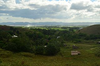
It is in the eastern part of the province of Camarines Sur, between Mount Isarog and Lagonoy Gulf, and occupies a total land area of 12,575 ha., 80% of which is flat. Of these, 1,045 hectare are irrigated riceland. [5]

Tigaon's economy is based on agricultural products like rice, corn, sugar cane, abaca fiber, fish, and pork. It is also known for its cottage industry, especially high-quality ships-in-bottles. The main tourist attractions are the Mt. Isarog Jungle Park at Barangay Concocep and several beach resorts.

History

According to a certain parish priest, Fr. Marcos de Lisboa, the name of the town was attributed to the word "tigaw", a shrub that grew in abundance on the riverbanks, and whose leaves when pounded produced extracts which were used as poison to catch fish in rivers and swamps.

Spanish Colonial Era

The Bicol Peninsula was first sighted by the Spaniards in August 1543 aboard the San Juan de Letran. In 1574, Captain Juan de Salcedo conquered the Bicol Region. In 1701, Tigaon was considered a sitio of Sagñay. In 1794, Tigaon was given her own parish under Fray Jose de Buensalida who carried the mission of St. Clare of Assisi, marking August 12 as her feast day.

Mayon Volcano's eruption in 1834 started a wave of migration from the neighboring province of Albay to the rich verdant slopes of Tigaon. As the Sword and the Cross became the bedrock of Spanish colonization in the Philippines, the parish priest symbolized the King of Spain and wielded immense power. This resulted in turmoil and continuous revolts against the atrocities of Spanish rule, thereby leading to the Philippine Revolution of 1898. For $20,000,000.00, Spain ceded the Philippines to the Americans.

In the early years of the 19th century, Camarines Sur was divided into four districts by the Spaniards. This division include the districts of Bikol, Rinconanda, Yraya and Mambulao. The mission of Tigaon in the part of Mount Isarog belonged to the Bikol district. The history of this town, according to written accounts, was considered to be confusing as there are conflicting records with regards to its establishment as a municipality.

World War II and Japanese Occupation

In 1941, the Second World War broke. The Japanese troops entered Tigaon during the term of Mayor Lino Cabaero. The guerrilla movement evolved as an offshoot of Japanese cruelty. Clashes were frequent and the church became a sanctuary of most guerrillas. Fr. Tomas Bernales was parish priest during the period 1941−1942. Fr. Florencio Gonzales took over in 1942. The infamous Death March propelled Doña Leonor Moll to rescue her son, Dr. Heriberto Moll and forty other Bicolanos from the clutches of death. Lt. Salvador Natividad died fighting the Japanese at Mabalodbalod. Captain Edmundo Cea and Majors Salvador and Tomas Garchitorena were at the forefront of the clashes with the Japanese. Don Pascual Leelin freely disposed his sacks of rice to fellow-Tigaoeños before enemies could confiscate them. In 1945, American forces came back to reclaim the Philippines, thus paving the way for the surrender of the beleaguered Japanese Imperial Army.

Independent Philippines

With the advent of independence, Tigaoeños found freedom of expression through the arts. An abundance of painters, poets, and actors emerged from this town. Luisita Venida was the first Tigaoeña child actress while Jesus ‘Og’ Ramos became the Tarzan of local cinema and acclaimed “Mr. Philippines”. In the late fifties, Batas Pambansa 129 made Tigaon the seat of the CFI in Partido District. Politics thrived. Don Mariano Garchitorena became Governor of Camarines Sur in 1945. Sebastian Caruso Moll was elected Congressman under the Quirino administration. The same administration chose Don Mariano Garchitorena Secretary of Agriculture. Edmundo Cea, the first Asian to be invited as guest speaker to the United Nations, gained fame as a congressman, then Senator during the sixties, as a delegate to the 1970 Constitutional Convention and as a member of the defunct Batasang Pambansa. Jose Fuentebella was Ambassador to Indonesia during the Garcia administration. Parish Priest Fr. Florencio Gonzales was succeeded by Fr. Pedro Oliva (1948−1967). Municipal mayors of Tigaon during these years: Heriberto R. Moll (1945-1957); Jose Bosito (1958-1964) and again Heriberto R. Moll (1964−1967).

There was a time when Tigaon was solely owned by 7 hacienderos namely P. Baduria, L. Cea, J. Jacob, M. Estela, A. Garchitorena and S. Moll. Now their lands were distributed to the people through the Agrarian Reform. [5]

Martial Law

The NPA Movement in the Bicol Region started in Tigaon which at best typified a feudal society. Brothers Romulo (Kumander Tangkad) and Ruben (Kumander Benjie) Jallores actively guided the growth of this movement. Agrarian unrest became the legitimate cause for the fuelling of socialist ideology. Tenants forcibly planted rice and corn within abaca lands. Eventually, abaca production declined.

In 1972, martial law was declared. Agrarian Reform was implemented. Felix Fuentebella was appointed governor in 1976, the same year Nelson Baduria Tria was ordained and became the first Tigaoeño priest. The Marcos dictatorship hunted down insurgents and tortured them. Senator Edmundo Cea took the cudgels for Ninoy Aquino's widow, Corazon. The church played an important role in the series of events that was to lead to the overthrow of Ferdinand Marcos in the EDSA Revolution of 1986. Tigaon's St. Clare of Assisi Parish became the rallying point of Cory Aquino's cause in Camarines Sur's third district. Parish priests in Tigaon were Fr. Jose Rey (1967−1984) and Fr. Felix Barela (1984−1985). In 1986, Fr. Gallardo Bombase, Jr. Dominican Priest was ordained. He became the first Filipino parish priest of Santisimo Rosario Parish, University of Santo Tomas, Sampaloc, Manila (1984-1993). Municipal Mayors during this time: Gualberto Cea Manlagñit (1968−1971); Lucio Palaypayon, Jr. (1972); Federico Moll (acting capacity, 1973–1974) Gallardo P. Bombase (acting capacity, 1974−1976); and Claudio Francisco (appointed 1976/ elected 1980−1986).

Sponsored by: Acting Mayor Bombase with Councilors Nolasco, Genio with other Municipal Employees Operation Linis '74.jpg
Sponsored by: Acting Mayor Bombase with Councilors Nolasco, Genio with other Municipal Employees

Gradually, order was restored. The Senate and Congress were once again part of the country's democratic process. Delfin Recto was appointed Mayor of Tigaon. Julian Cea Napal became Vice Governor of Camarines Sur. Francis Garchitorena occupied the position of SandiganBayan Justice. The crusade of the NPA Movement gained recognition from the ruling administration. Continuing peace talks were held to resolve the differences between government and the CPP/NPA.

The democratic form of government once more dominated the political scene. Municipal Mayors were: Roman de Leon, Jr. (OIC, 1987, Transitional Gov’t); and Eleanor R. Lelis (1988−1992). Arnulfo Fuentebella, elected in 1992, held the congressional seat for Camarines Sur's third district.

Parish priests were Fr. Alfonso Grageda (1985−1991) and Fr. Eutiquio Infante (1991−1997).

Recent years

Former flag of Tigaon Flag of Tigaon, Camarines Sur.png
Former flag of Tigaon

Once more, Tigaon is on the move. Municipal Mayor Mariano B. Llaguno (1992−1998) was succeeded by Mayor Elmo L. Bombase while Fr. Danilo Tuason became Parish Priest of Tigaon. The Sword and Cross have never been apart in the Tigaoeño way of life. Hand in hand with the construction of the Parish rectory was Tigaon's new municipal building. After a nine-year term, Mayor Bombase was succeeded by Mayor Arnie Fuentebella (2007–present). The Rev. Msgr. Juan Celzo, Fr. Rodolfo Sales and incumbent parish priest Fr. Noel Emmanuel Alforte were assigned successively to continue the church's mission in Tigaon. [6]

Geography

The west of the municipality is mountainous, and the east has a flat surface. It borders Goa and San Jose in the north and Ocampo to the west and Sagñay in the south and Lagonoy Gulf in the east. Tigaon is 30 kilometres (19 mi) from Pili and 480 kilometres (300 mi) from Manila.

Barangays

Tigaon is politically subdivided into 23 barangays. Each barangay consists of puroks and some have sitios.

  • Abo
  • Cabalinadan
  • Caraycayon
  • Casuna
  • Consocep
  • Coyaoyao
  • Gaao
  • Gingaroy
  • Gubat
  • Huyonhuyon
  • Libod
  • Mabalodbalod
  • May-Anao
  • Panagan
  • Poblacion
  • Salvacion
  • San Antonio
  • San Francisco
  • San Miguel
  • San Rafael
  • Talojongon
  • Tinawagan
  • Vinagre

Climate

Climate data for Tigaon, Camarines Sur
MonthJanFebMarAprMayJunJulAugSepOctNovDecYear
Mean daily maximum °C (°F)31
(88)
30
(86)
32
(90)
35
(95)
35
(95)
35
(95)
34
(93)
33
(91)
34
(93)
32
(90)
30
(86)
30
(86)
33
(91)
Mean daily minimum °C (°F)26
(79)
26
(79)
28
(82)
30
(86)
31
(88)
30
(86)
29
(84)
29
(84)
29
(84)
28
(82)
27
(81)
27
(81)
28
(83)
Average precipitation mm (inches)82.88
(3.26)
137.93
(5.43)
63.69
(2.51)
78.31
(3.08)
229.42
(9.03)
288.31
(11.35)
280.99
(11.06)
112.39
(4.42)
210.87
(8.30)
599.07
(23.59)
194.80
(7.67)
454.3
(17.89)
2,732.96
(107.59)
Average rainy days242818202429312727302931318
Source: World Weather Online [7]

Demographics

Tigaon municipal hall Tigaon mun. hall.jpg
Tigaon municipal hall
Population census of Tigaon
YearPop.±% p.a.
1903 5,711    
1918 7,418+1.76%
1939 10,039+1.45%
1948 16,912+5.97%
1960 20,337+1.55%
1970 20,224−0.06%
1975 25,282+4.58%
1980 26,504+0.95%
1990 33,650+2.42%
1995 39,186+2.89%
2000 40,210+0.55%
2007 45,509+1.72%
2010 48,611+2.43%
2015 55,272+2.48%
2020 60,524+1.80%
Source: Philippine Statistics Authority [8] [9] [10] [11]

In the 2020 census, the population of Tigaon was 60,524 people, [3] with a density of 840 inhabitants per square kilometre or 2,200 inhabitants per square mile.

Isarog Agta Language

In 2010, UNESCO released its 3rd world volume of Endangered Languages in the World, where 3 critically endangered languages were in the Philippines. One of these languages in the Isarog Agta language which has an estimated speaker of 5 people in the year 2000. The language was classified as Critically Endangered, meaning the youngest speakers are grandparents and older, and they speak the language partially and infrequently and hardly pass the language to their children and grandchildren anymore. If the remaining 150 people do not pass their native language to the next generation of Isarog Agta people, their indigenous language will be extinct within a period of 1 to 2 decades.

The Isarog Agta people live within the circumference of Mount Isarog, though only 5 of them still know their indigenous language. They are one of the original Negrito settlers in the entire Philippines. They belong to the Aeta people classification but have distinct language and belief systems unique to their own culture and heritage.

Religion

St. Claire of Assisi Parish Church Tigaon Church, Camarines Sur, June 2021.jpg
St. Claire of Assisi Parish Church

Roman Catholicism first emerged in 1794 with the birth of its town. Now, there are 4 parishes in Tigaon.

Presence of Protestant Churches are seen in Tigaon, particularly in the streets of Baranggay Talojongon,

Presently, the Protestant Churches in Tigaon are:

Economy

Poverty Incidence of Tigaon

10
20
30
40
50
2006
39.30
2009
41.86
2012
27.93
2015
34.28
2018
28.70
2021
40.22

Source: Philippine Statistics Authority [12] [13] [14] [15] [16] [17] [18] [19]

Commercial establishments include open market, banks, pawnshops, hardware stores, self-service supermarkets, drug stores, food chains and restaurants, pension house. Tigaon is also home to a slaughterhouse and information technology centers.

Local products include palay, corn, root crops, sugarcane, coconut, citrus, vegetables, fish and other marine products, livestock and poultry products are also available.

Despite being the administrative seat of Partido it still is one of the Top 5 poorest municipalities in Camarines Sur and is one of the slowest progressing too.

CASURECO IV with its main office in Tigaon supplies power requirement in all Partido towns.

Tourism

Tourist destinations include the Hibiscus, Consocep Mountain Resort, beach resorts in Barangays Casuna and Ranso, and the Kawa-kawa, Tumaguiti and Bulalakaw waterfalls.

Transportation

There is a total of 71.456 kilometres (44.401 mi) of road classified as National, Provincial, Municipal and Barangay roads.

Presence of a bus terminal where air-conditioned as well as ordinary buses have regular trips to Manila and other provincial key cities and other light air-conditioned vehicles available for hire.

Education

Tigaon has currently has 23 elementary schools, one for each barangay, 7 high schools and 4 colleges.

Elementary schools

  • Tigaon North Central School
  • Tigaon Central Pilot School
  • Abo Elementary School
  • Casuna Elementary School
  • Caraycayon Elementary School
  • Consosep Elementary School
  • Coyaoyao Elementary School
  • Don Tomas Garchitorena Elementary School
  • Eulalia Elementary School
  • Gaao Elementary School
  • Gingaroy Elementary School
  • Huyonhuyon Elementary School
  • Juanita Clerigo Elementary School
  • Libod Elementary School
  • Mabalodbalod Elementary School
  • May-Anao Elementary School
  • Panagan Elementary School
  • Salvacion Elementary School
  • San Antonio Elementary School
  • San Miguel Elementary School
  • San Rafael Elementary School
  • Tinawagan Elementary School
  • Vinagre Elementary School

High School and College

Colleges

Notable personalities

Related Research Articles

<span class="mw-page-title-main">Camarines Sur</span> Province in Bicol, Philippines

Camarines Sur, officially the Province of Camarines Sur, is a province in the Philippines located in the Bicol Region on Luzon. Its capital is Pili and the province borders Camarines Norte and Quezon to the northwest, and Albay to the south. To the east lies the island province of Catanduanes across the Maqueda Channel.

<span class="mw-page-title-main">Vinzons</span> Municipality in Camarines Norte, Philippines

Vinzons, officially the Municipality of Vinzons, is a 3rd class municipality in the province of Camarines Norte, Philippines. According to the 2020 census, it has a population of 43,485 people.

<span class="mw-page-title-main">Baao</span> Municipality in Camarines Sur, Philippines

Baao, officially the Municipality of Baao is 1st class municipality in the province of Camarines Sur, Philippines. According to the 2020 census, it has a population of 61,493 people.

<span class="mw-page-title-main">Bato, Camarines Sur</span> Municipality in Camarines Sur, Philippines

Bato, officially the Municipality of Bato, is a 3rd class municipality in the province of Camarines Sur, Philippines. According to the 2020 census, it has a population of 52,155 people.

<span class="mw-page-title-main">Bombon, Camarines Sur</span> Municipality in Camarines Sur, Philippines

Bombon, officially the Municipality of Bombon, is a 4th class municipality in the province of Camarines Sur, Philippines. According to the 2020 census, it has a population of 17,995 people.

<span class="mw-page-title-main">Bula, Camarines Sur</span> Municipality in Camarines Sur, Philippines

Bula, officially the Municipality of Bula, is a 1st class municipality in the province of Camarines Sur, Philippines. According to the 2020 census, it had a population of 73,143 people.

<span class="mw-page-title-main">Calabanga</span> Municipality in Camarines Sur, Philippines

Calabanga, officially the Municipality of Calabanga, is a 1st class municipality in the province of Camarines Sur, Philippines. According to the 2020 census, it has a population of 88,906 people.

<span class="mw-page-title-main">Cabusao</span> Municipality in Camarines Sur, Philippines

Cabusao, officially the Municipality of Cabusao, is a 5th class municipality in the province of Camarines Sur, Philippines. According to the 2020 census, it has a population of 19,257 people.

<span class="mw-page-title-main">Camaligan</span> Municipality in Camarines Sur, Philippines

Camaligan, officially the Municipality of Camaligan, is a 4th class municipality in the province of Camarines Sur, Philippines. According to the 2020 census, it has a population of 25,036 people. Camaligan rapidly became an urban town during the 1990s.

<span class="mw-page-title-main">Garchitorena</span> Municipality in Camarines Sur, Philippines

Garchitorena, officially the Municipality of Garchitorena, is a 4th class municipality in the province of Camarines Sur, Philippines. According to the 2020 census, it has a population of 29,436 people.

<span class="mw-page-title-main">Goa, Camarines Sur</span> Municipality in Camarines Sur, Philippines

Goa, officially the Municipality of Goa, is a 1st class municipality in the province of Camarines Sur, Philippines. According to the 2020 census, it has a population of 71,368 people.

<span class="mw-page-title-main">Lagonoy</span> Municipality in Camarines Sur, Philippines

Lagonoy, officially the Municipality of Lagonoy, is a 2nd class municipality in the province of Camarines Sur, Philippines. According to the 2020 census, it has a population of 56,714 people.

<span class="mw-page-title-main">Libmanan</span> Municipality in Camarines Sur, Philippines

Libmanan, officially the Municipality of Libmanan, is a 1st class municipality in the province of Camarines Sur, Philippines. According to the 2020 census, it has a population of 112,994 people. Libmanan is the largest municipality in Camarines Sur in terms of population, and the second largest in terms of land area.

<span class="mw-page-title-main">Milaor</span> Municipality in Camarines Sur, Philippines

Milaor, officially the Municipality of Milaor, is a 3rd class municipality in the province of Camarines Sur, Philippines. According to the 2020 census, it has a population of 33,963 people.

<span class="mw-page-title-main">Ocampo, Camarines Sur</span> Municipality in Camarines Sur, Philippines

Ocampo, officially the Municipality of Ocampo, is a 1st class municipality in the province of Camarines Sur, Philippines. According to the 2020 census, it has a population of 51,073 people.

<span class="mw-page-title-main">Pili, Camarines Sur</span> Capital of Camarines Sur, Philippines

Pili, officially the Municipality of Pili is a 1st class municipality and capital of the province of Camarines Sur, Philippines. According to the 2020 census, it has a population of 99,196 people.

<span class="mw-page-title-main">Sagñay</span> Municipality in Camarines Sur, Philippines

Sagñay,, officially the Municipality of Sagñay, is a 4th class municipality in the province of Camarines Sur in the Philippines. It has an land area of 154.76 sq kilometers. According to the 2020 census, it has a population of 36,841 people. Based of this information, there is a population density of 238 people per sq kilometer.

<span class="mw-page-title-main">San Fernando, Camarines Sur</span> Municipality in Camarines Sur, Philippines

San Fernando, officially the Municipality of San Fernando, is a 2nd class municipality in the province of Camarines Sur, Philippines. According to the 2020 census, it has a population of 38,626 people.

<span class="mw-page-title-main">Tinambac</span> Municipality in Camarines Sur, Philippines

Tinambac, officially the Municipality of Tinambac, is a 1st class municipality in the province of Camarines Sur, Philippines. According to the 2020 census, it has a population of 70,176 people.

Felix Abad Fuentebella was the Representative of the Second District of Camarines Sur in the Philippines from 1954 to 1972 and the Provincial Governor of Camarines Sur from 1976 until 1986. He is the son of former Ambos Camarines Governor Mariano Fuentebella and the half brother of Jose Fuentebella and Manuel Fuentebella.

References

  1. Municipality of Tigaon | (DILG)
  2. "2015 Census of Population, Report No. 3 – Population, Land Area, and Population Density" (PDF). Philippine Statistics Authority. Quezon City, Philippines. August 2016. ISSN   0117-1453. Archived (PDF) from the original on May 25, 2021. Retrieved July 16, 2021.
  3. 1 2 3 Census of Population (2020). "Region V (Bicol Region)". Total Population by Province, City, Municipality and Barangay. Philippine Statistics Authority . Retrieved 8 July 2021.
  4. "PSA Releases the 2018 Municipal and City Level Poverty Estimates". Philippine Statistics Authority. 15 December 2021. Retrieved 22 January 2022.
  5. 1 2 Malanyaon, Jaime (1991). Istorya Kan Kabikolan. Naga City, Philippines: AMS PRESS.
  6. Administrator. "HISTORY". www.tigaon.gov.ph. Retrieved 2015-08-08.
  7. "Tigaon, Camarines Sur: Average Temperatures and Rainfall". World Weather Online. Retrieved 29 October 2017.
  8. Census of Population (2015). "Region V (Bicol Region)". Total Population by Province, City, Municipality and Barangay. Philippine Statistics Authority . Retrieved 20 June 2016.
  9. Census of Population and Housing (2010). "Region V (Bicol Region)" (PDF). Total Population by Province, City, Municipality and Barangay. National Statistics Office . Retrieved 29 June 2016.
  10. Censuses of Population (1903–2007). "Region V (Bicol Region)". Table 1. Population Enumerated in Various Censuses by Province/Highly Urbanized City: 1903 to 2007. National Statistics Office.{{cite encyclopedia}}: CS1 maint: numeric names: authors list (link)
  11. "Province of Camarines Sur". Municipality Population Data. Local Water Utilities Administration Research Division. Retrieved 17 December 2016.
  12. "Poverty incidence (PI):". Philippine Statistics Authority. Retrieved December 28, 2020.
  13. "Estimation of Local Poverty in the Philippines" (PDF). Philippine Statistics Authority. 29 November 2005.
  14. "2003 City and Municipal Level Poverty Estimates" (PDF). Philippine Statistics Authority. 23 March 2009.
  15. "City and Municipal Level Poverty Estimates; 2006 and 2009" (PDF). Philippine Statistics Authority. 3 August 2012.
  16. "2012 Municipal and City Level Poverty Estimates" (PDF). Philippine Statistics Authority. 31 May 2016.
  17. "Municipal and City Level Small Area Poverty Estimates; 2009, 2012 and 2015". Philippine Statistics Authority. 10 July 2019.
  18. "PSA Releases the 2018 Municipal and City Level Poverty Estimates". Philippine Statistics Authority. 15 December 2021. Retrieved 22 January 2022.
  19. "PSA Releases the 2021 City and Municipal Level Poverty Estimates". Philippine Statistics Authority. 2 April 2024. Retrieved 28 April 2024.