Tillatoba, Mississippi

Last updated

Tillatoba, Mississippi
Yalobusha County Mississippi Incorporated and Unincorporated areas Tillatoba Highlighted.svg
Location of Tillatoba, Mississippi
Usa edcp location map.svg
Red pog.svg
Tillatoba, Mississippi
Location in the United States
Coordinates: 33°59′4″N89°53′49″W / 33.98444°N 89.89694°W / 33.98444; -89.89694
Country United States
State Mississippi
County Yalobusha
Area
[1]
  Total1.01 sq mi (2.63 km2)
  Land1.01 sq mi (2.63 km2)
  Water0.00 sq mi (0.00 km2)
Elevation
308 ft (94 m)
Population
 (2020)
  Total95
  Density93.69/sq mi (36.16/km2)
Time zone UTC-6 (Central (CST))
  Summer (DST) UTC-5 (CDT)
ZIP code
38961
Area code 662
FIPS code 28-73440
GNIS feature ID0694981

Tillatoba is a town in Yalobusha County, Mississippi, United States. The population was 91 at the 2010 census.

Contents

Agricultural products produced by the town include cotton, corn, poultry, cattle, and timber. Holly Springs National Forest is to the east.

History

The community was named after Tillatoba Creek. [2]

Geography

According to the United States Census Bureau, the town has a total area of 1.0 square mile (2.6 km2), all land.

Demographics

Historical population
CensusPop.Note
2020 95
U.S. Decennial Census [3]

2020 census

Tillatoba racial composition [4]
RaceNum.Perc.
White (non-Hispanic)7578.95%
Black or African American (non-Hispanic)1313.68%
Other/Mixed 44.21%
Hispanic or Latino 33.16%

As of the 2020 United States census, there were 95 people, 26 households, and 12 families residing in the town.

2000 census

As of the census [5] of 2000, there were 121 people, 49 households, and 32 families residing in the town. The population density was 119.2 inhabitants per square mile (46.0/km2). There were 54 housing units at an average density of 53.2 per square mile (20.5/km2). The racial makeup of the town was 78.51% White, and 21.49% African American.

There were 49 households, out of which 34.7% had children under the age of 18 living with them, 49.0% were married couples living together, 16.3% had a female householder with no husband present, and 32.7% were non-families. 28.6% of all households were made up of individuals, and 10.2% had someone living alone who was 65 years of age or older. The average household size was 2.47 and the average family size was 3.06.

In the town, the population was spread out, with 28.1% under the age of 18, 9.1% from 18 to 24, 28.1% from 25 to 44, 25.6% from 45 to 64, and 9.1% who were 65 years of age or older. The median age was 32 years. For every 100 females, there were 108.6 males. For every 100 females age 18 and over, there were 97.7 males.

The median income for a household in the town was $34,306, and the median income for a family was $51,458. Males had a median income of $42,917 versus $22,143 for females. The per capita income for the town was $20,746. There were 13.7% of families and 10.1% of the population living below the poverty line, including no under eighteens and none of those over 64.

Education

The Town of Tillatoba is served by the Coffeeville School District.

Notable person

Related Research Articles

<span class="mw-page-title-main">Tallahatchie County, Mississippi</span> County in Mississippi, United States

Tallahatchie County is a county in the U.S. state of Mississippi. At the 2020 census, the population was 12,715. Its county seats are Charleston and Sumner.

<span class="mw-page-title-main">Holton, Indiana</span> Town in Indiana, United States

Holton is a town in Otter Creek Township, Ripley County, in the U.S. state of Indiana. The population was 480 at the 2010 census.

<span class="mw-page-title-main">Eagle Lake, Maine</span> Town in the state of Maine, United States

Eagle Lake is a town in Aroostook County, Maine, United States. The population was 772 at the 2020 census. The town was named by a body of troops heading from Bangor to the Aroostook War for the many eagles that they saw around the lake. A total of 49.0% of the population speaks French, reflecting a trend in Northeastern Maine.

<span class="mw-page-title-main">Island Falls, Maine</span> Town in the state of Maine, United States

Island Falls is a town in Aroostook County, Maine, United States. The population was 758 at the 2020 census. The primary village of Island Falls in the town is situated at a falls in the West Branch Mattawamkeag River.

<span class="mw-page-title-main">Littleton, Maine</span> Town in the state of Maine, United States

Littleton is a town in Aroostook County, Maine, United States. The population was 997 at the 2020 census.

Alton is a town in Penobscot County, Maine, United States. It is part of the Bangor Metropolitan Statistical Area. The population was 829 at the 2020 census. The community is named after an Alton in England.

Bradley is a town in Penobscot County, Maine, United States. It is part of the Bangor Metropolitan Statistical Area. The population was 1,532 at the 2020 census. The village of Bradley is in the northwestern corner of the town.

Greenbush, officially the Town of Greenbush, is a town in Penobscot County, Maine, United States, on the Penobscot River. The town's population was 1,444 at the 2020 United States Census.

Plymouth is a town in Penobscot County, Maine, United States. The population was 1,325 at the 2020 census.

Northfield is a town in Washington County, Maine, United States. The population was 178 at the 2020 census.

<span class="mw-page-title-main">Waite, Maine</span> Town in the state of Maine, United States

Waite is a town in Washington County, Maine, United States. The town was named after Benjamin Waite, a lumberman and businessman from Calais, Maine. The population was 66 at the 2020 census.

<span class="mw-page-title-main">Lastrup, Minnesota</span> City in Minnesota, United States

Lastrup is a city in Morrison County, Minnesota, United States. The population was 120 at the 2020 census.

<span class="mw-page-title-main">Montrose, Mississippi</span> Town in Mississippi, United States

Montrose is a town in Jasper County, Mississippi, United States. The population was 140 at the 2010 census.

<span class="mw-page-title-main">Meridian Station, Mississippi</span> Census-designated place in Mississippi, United States

Meridian Station is a census-designated place (CDP) in Lauderdale County, Mississippi, United States, corresponding to the residential portions of Naval Air Station Meridian. The population was 1,090 at the 2010 census.

<span class="mw-page-title-main">Osyka, Mississippi</span> Town in Mississippi, United States

Osyka is a town in Pike County, Mississippi, United States. It is located on the Mississippi–Louisiana state line. The population was 440 at the 2010 census. It is part of the McComb, Mississippi Micropolitan Statistical Area. The peak of its population was in 1910.

<span class="mw-page-title-main">West Alton, Missouri</span> City in Missouri, United States

West Alton is a city in St. Charles County, Missouri, United States. The population was 359 at the 2020 census. It is located at the tip of the peninsula formed by the confluence of the Missouri and Mississippi Rivers and is directly across Alton, Illinois.

<span class="mw-page-title-main">Lula, Mississippi</span> Town in Mississippi, United States

Lula is a town in Coahoma County, Mississippi, United States. Per the 2020 census, the population was 204.

<span class="mw-page-title-main">Polkville, Mississippi</span> Town in Mississippi, United States

Polkville is a town in Smith County, Mississippi. The population is at 833 as of the 2010 census.

<span class="mw-page-title-main">New Haven, West Virginia</span> Town in West Virginia, United States

New Haven is a town in Mason County, West Virginia, United States, along the Ohio River. The population was 1,485 at the 2020 census. It is part of the Point Pleasant, WV–OH Micropolitan Statistical Area.

<span class="mw-page-title-main">Union, Mississippi</span> Town in Mississippi, United States

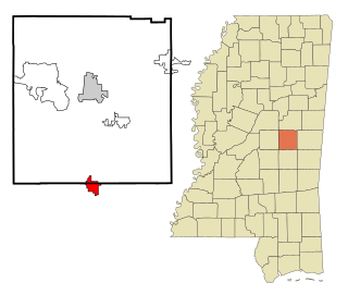
Union is a town in Neshoba and Newton counties, Mississippi. The population was 1,988 at the 2010 census.

References

  1. "2020 U.S. Gazetteer Files". United States Census Bureau. Retrieved July 24, 2022.
  2. Baca, Keith A. (2007). Native American Place Names in Mississippi. University Press of Mississippi. p. 112. ISBN   978-1-60473-483-6.
  3. "Census of Population and Housing". Census.gov. Retrieved June 4, 2016.
  4. "Explore Census Data". data.census.gov. Retrieved December 16, 2021.
  5. "U.S. Census website". United States Census Bureau . Retrieved January 31, 2008.
  6. "Jim Champion". Football Reference. Retrieved March 1, 2014.