Adair County is a county located in the U.S. state of Oklahoma. As of the 2020 census, the population was 19,495. Its county seat is Stilwell. Adair County was named after the Adair family of the Cherokee tribe. One source says that the county was specifically named for Watt Adair, one of the first Cherokees to settle in the area. Adair County is part of the Cherokee Nation reservation.

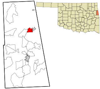
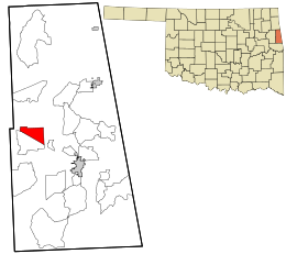
Fairfield is a census-designated place (CDP) in Adair County, Oklahoma, United States. The population was 584 at the 2010 census.

Briggs is an unincorporated community and census-designated place (CDP) in Cherokee County, Oklahoma, United States. The population was 303 at the 2010 census.

Eldon is an unincorporated community and census-designated place (CDP) in Cherokee County, Oklahoma, United States. The population was 368 at the 2010 census, a loss of 62.3 percent from 991 at the 2000 census, due largely to shrinkage of the CDP boundaries. It lies east of Tahlequah at the junction of U.S. Highway 62 and State Highway 51. The Eldon Post Office existed from March 20, 1911, until May 30, 1936. The community is said to have been named for Eldon, Illinois.

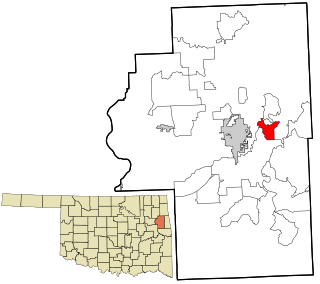
Park Hill is an unincorporated community and census-designated place (CDP) in southwestern Cherokee County, Oklahoma, United States. The population was 3,909 at the 2010 census. It lies near Tahlequah, east of the junction of U.S. Route 62 and State Highway 82.

Woodall is an unincorporated community and census-designated place (CDP) in Cherokee County, Oklahoma, United States. The population was 823 at the 2010 census.
Cayuga Springs is an unincorporated community and census-designated place (CDP) in Delaware County, Oklahoma, United States. The population was 140 at the 2010 census, a 33.3 percent increase over the figure of 105 recorded in 2000.

Cleora is an unincorporated community and census-designated place (CDP) in Delaware County, Oklahoma, United States, along State Highway 85. The population was 1,463 at the 2010 census, up from the figure of 1,113 recorded in 2000. The Cleora Post Office existed from November 28, 1900, until October 15, 1954. Cleora was established in District 2 of the old Indian Territory. It was named for Cleora Ann Lunday, sister of the postmaster, Ed Lunday.
Copeland is an unincorporated community and census-designated place (CDP) in Delaware County, Oklahoma, United States. The population was 1,629 at the 2010 census, a 12.5 percent increase from the figure of 1,448 recorded in 2000. Founded as a railroad community, it was named for local resident D.R. Copeland.

Dennis is an unincorporated community and census-designated place (CDP) in Delaware County, Oklahoma, near Grand Lake. The population was 195 at the 2010 census. The Dennis Post Office existed from March 25, 1914, until January 31, 1956. It is said to be named for a local resident, Peter Dennis.

Dodge is an unincorporated community and census-designated place (CDP) in Delaware County, Oklahoma, United States. The population was 115 at the 2010 census, up from the figure of 96 recorded in 2000.

Leach is an unincorporated community and census-designated place (CDP) in southwestern Delaware County, Oklahoma, United States, along U.S. Route 412 and 412 Alternate. The population was 237 at the 2010 census.
Rocky Ford is a census-designated place (CDP) in Delaware and Cherokee counties, Oklahoma, United States. The population was 61 at the 2010 census.

Sparrowhawk is an unincorporated community and census-designated place (CDP) in Cherokee County, Oklahoma, United States. The population was 191 as of the 2010 census, at which time the CDP was known as Scraper. The older name of the community was given for Captain Archibald Scraper of the 2nd Regiment, Indian Home Guard. Sparrowhawk takes its name from Sparrow Hawk Mountain, which occupies most of the CDP.

Elm Grove is a census-designated place (CDP) in Adair County, Oklahoma, United States. The population was 198 at the 2010 census.

Mulberry is a census-designated place (CDP) in Adair County, Oklahoma, United States. The population was 138 at the 2010 census.

Old Green is a census-designated place (CDP) in Adair County, Oklahoma, United States. The population was 315 at the 2010 census.

Proctor is a census-designated place (CDP) in Adair County, Oklahoma, United States. The population was 231 at the 2010 census.

Wauhillau is a census-designated place (CDP) in Adair County, Oklahoma, United States. The population was 345 at the 2010 census.
Indianola is an unincorporated area and census-designated place (CDP) in Delaware County, Oklahoma, United States. The population was 48 at the 2010 census.


