Toft, Cambridgeshire

Last updated

Toft
Toft village sign.JPG
Village sign at the entrance
Cambridgeshire UK location map.svg
Red pog.svg
Toft
Location within Cambridgeshire
Population503 (2011) [1]
OS grid reference TL355557
District
Shire county
Region
Country England
Sovereign state United Kingdom
Post town Cambridge
Postcode district CB23
Dialling code 01223
List of places
UK
England
Cambridgeshire
52°11′12″N0°00′47″W / 52.1866°N 0.0131°W / 52.1866; -0.0131

Toft is a village situated in Cambridgeshire, England. It is approximately six miles to the west of Cambridge, and is situated within four miles of the M11 motorway. It has approximately 600 residents and 200 homes. Comberton Village College and Comberton Sixth Form fall within the Toft Parish boundary. The village has two churches, St Andrew's Parish Church and Toft Methodist Church.

Contents

Meridian marker Meridian marker - geograph.org.uk - 108093.jpg
Meridian marker

Just to the east of the village is Cambridge Meridian Golf Club, which has the Prime Meridian running through the 14th fairway.

The name "Toft" is derived from an old Viking word meaning "curtilage" or "homestead". [2]

History

The ancient parish of Toft consisted of 1,285 acres between the villages of Comberton to the east and Caldecote to the west. At the time of the Domesday Book in 1086, the parish extended up to the CambridgeSt Neots road, and thus included modern-day Hardwick until it became a separate parish in 1815. [3]

The village probably sprang up during Saxon times, when the wooded area began to be cleared for farming. By the time of the Norman Conquest the lands were owned by the king, the Abbot of Ely and a woman named Eddeva. The Normans gave Eddeva's lands to Alan, Count of Brittany, who passed them to the manor of Swavesey. By 1109, the lands were all granted to the newly formed Bishopric of Ely. [4]

Toft has 23 listed buildings of special architectural or historic interest. [5] Among these is Toft Manor, formerly the Rectory, which was built in 1844 along with several cottages.

Toft is one of 54 Thankful Villages in England and Wales, where all those who served in World War One returned safely. [6]

Church

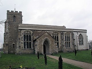
The parish church has been dedicated to Saint Andrew since at least the 13th century and stands on the site of an earlier church. The present building contains some structure from the late 14th century but was largely rebuilt in 1863, apparently repeating the layout of the medieval church. The medieval tower was rebuilt in 1894. [7]

In the 17th century, Toft became a centre of Puritanism. When the Archdeacon of Ely visited in 1685, he found that the church had been greatly neglected, with cracks in the walls and the building being used as a store for bricks and stones. The church was restored over the next few decades. [4]

The church is in the patronage of Christ's College, Cambridge.

John Wesley is believed to have preached in a barn in the village, and in 1862 a Primitive Methodist chapel was built in the High Street. [7]

Village life

Toft contains a village shop (specialising in South African cuisine), a hairdresser's, a Chinese takeaway, a fish and chip shop, a social club and a florists. A post office first opened in the village in the 1870s as part of the village shop. A library was opened in 1913, but has since closed. At the end of the 19th century there were two pubs in the village, the Black Bull and the Red Lion, Both have since closed, and the latter now houses the Chinese restaurant. [8] The Toft Historical Society holds regular exhibitions and is building a web-based archive of the history of the village. [9]

The village had a football club, Toft Lions, who play in the CDFL Cambridgeshire men's league. [10]

Related Research Articles

<span class="mw-page-title-main">Coton, Cambridgeshire</span> Human settlement in England

Coton is a small village and civil parish about three miles west of Cambridge in Cambridgeshire, England and about the same distance east of the Prime Meridian. It is in the district of South Cambridgeshire. The parish covers an area of 392 hectares. In the 2001 census it had a population of 773, with approximately 336 dwellings and 322 households. The population at the 2011 census was 910.
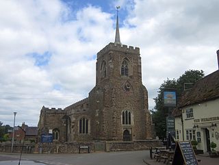
<span class="mw-page-title-main">Gamlingay</span> Human settlement in England

Gamlingay is a village and civil parish in the South Cambridgeshire district of Cambridgeshire, England about 14 miles (23 km) west southwest of Cambridge.

<span class="mw-page-title-main">Lakenheath</span> Human settlement in England

Lakenheath is a village and civil parish in the West Suffolk district of Suffolk in eastern England. It has a population of 4,691 according to the 2011 Census, and is situated close to the county boundaries of both Norfolk and Cambridgeshire, and at the meeting point of The Fens and the Breckland natural environments.

<span class="mw-page-title-main">Ickleton</span> Human settlement in England

Ickleton is a village and civil parish about 9 miles (14 km) south of Cambridge in Cambridgeshire, England. The village is beside the River Cam, close to where a southern branch of the Icknield Way crossed the river. The eastern and southern boundaries of the parish form part of the county boundary with Essex, and the Essex town of Saffron Walden is only about 4.5 miles (7 km) southeast of the village.

<span class="mw-page-title-main">Great Shelford</span> Village in Cambridgeshire, England

Great Shelford is a village located approximately 4 miles (6.4 km) to the south of Cambridge, in Cambridgeshire, in eastern England. In 1850 Great Shelford parish contained 1,900 acres (7.7 km2) bisected by the River Cam. The population in 1841 was 803 people. By 2001, this had grown to 3,949 and by the Census 2011 to 4,233. It was described as Britain's twenty-second richest village in 2011.
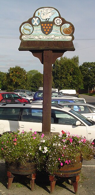
<span class="mw-page-title-main">Swavesey</span> Human settlement in England

Swavesey is a village lying on the Prime Meridian in Cambridgeshire, England, with a population of 2,463. The village is situated 9 miles to the north west of Cambridge and 3 miles south east of St Ives.

<span class="mw-page-title-main">Hemingford Grey</span> Human settlement in England

Hemingford Grey is a village and civil parish in Cambridgeshire, England. Hemingford Grey lies approximately 4 miles (6 km) east of Huntingdon. Hemingford Grey is situated within Huntingdonshire which is a non-metropolitan district of Cambridgeshire as well as being a historic county of England.
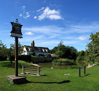
<span class="mw-page-title-main">Comberton</span> Village and civil parish in South Cambridgeshire, England

Comberton is a village and civil parish in South Cambridgeshire, England, just east of the Prime Meridian.

<span class="mw-page-title-main">Bluntisham</span> Village in Cambridgeshire, England

Bluntisham is a village and civil parish in Cambridgeshire, England. The population of the civil parish at the 2011 census was 2,003. Bluntisham lies approximately 8 miles (13 km) east of Huntingdon. Bluntisham is situated within Huntingdonshire which is a non-metropolitan district of Cambridgeshire as well as being a historic county of England. The villages of Earith, Colne, Woodhurst, and Somersham are all close by.

<span class="mw-page-title-main">Warboys</span> Human settlement in England

Warboys is a large village and civil parish in the Huntingdonshire district of Cambridgeshire, England, 7 miles (11 km) north-east of Huntingdon.

<span class="mw-page-title-main">Somersham</span> Human settlement in England

Somersham is a village and civil parish in Cambridgeshire, England. Somersham lies approximately 9 miles (14 km) east of Huntingdon and 4 miles (6 km) north of St Ives. Somersham is situated within Huntingdonshire which is a non-metropolitan district of Cambridgeshire as well as being a historic county of England.

<span class="mw-page-title-main">Chinnor</span> Human settlement in England

Chinnor is a large village and civil parish in South Oxfordshire about 4 miles (6.4 km) southeast of Thame, close to the border with Buckinghamshire. The village is a spring line settlement on the Icknield Way below the Chiltern escarpment. Since 1932 the civil parish has included the village of Emmington. The 2011 Census recorded the parish's population as 5,924.

Bassingbourn cum Kneesworth is a civil parish in the South Cambridgeshire district of Cambridgeshire, England, 14 miles south-west of Cambridge and just north of Royston, Hertfordshire. Since the 1960s the parish contains the villages of Bassingbourn and Kneesworth.

<span class="mw-page-title-main">Fen Ditton</span> Human settlement in England

Fen Ditton is a village and civil parish in the South Cambridgeshire district, on the northeast edge of Cambridge in Cambridgeshire, England. In 2011 the parish had a population of 760. The parish covers an area of 5.99 square kilometres (2 sq mi).

<span class="mw-page-title-main">Cassington</span> Human settlement in England

Cassington is a village and civil parish in Oxfordshire about 5 miles (8 km) northwest of Oxford. The village lies on gravel strata about 12 mile (800 m) from the confluence of the River Evenlode with the River Thames. The parish includes the hamlet of Worton northeast of the village and the site of the former hamlet of Somerford to the south. Somerford seems to have been abandoned early in the 14th century. Cassington is formed of two parts, "upper" and "lower", each with its own village green. The 2011 Census recorded the parish's population as 750.
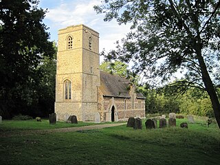
<span class="mw-page-title-main">Knapwell</span> Human settlement in Cambridgeshire, England

Knapwell is a hamlet in Cambridgeshire situated about 10 miles (16 km) west of Cambridge. It is within the diocese of Ely. Its population was estimated at 110 in 2001. At the 2011 census the population had fallen to fewer than 100.

<span class="mw-page-title-main">Bourn Brook, Cambridgeshire</span> River in Cambridgeshire, England

Bourn Brook is a minor tributary of the River Cam in Cambridgeshire, England.
<span class="mw-page-title-main">Harlton</span> Human settlement in England

Harlton is a village and civil parish in Cambridgeshire in the United Kingdom. The village is 5 miles (8.0 km) south-west of Cambridge and neighbours Haslingfield.

<span class="mw-page-title-main">Kingston, Cambridgeshire</span> Human settlement in England

Kingston is a small village and parish in the East of England region and the county Cambridgeshire in the United Kingdom. Situated 7 miles to the west of Cambridge, the population at the time of the 2001 census was 214, increasing to 238 at the 2011 Census.

<span class="mw-page-title-main">Hardwick, Cambridgeshire</span> Human settlement in England

Hardwick is a village and civil parish in the county of Cambridgeshire, England with a large housing estate located about 6 miles (9.7 km) west of the city of Cambridge, England. The village lies immediately south of the A428 road between Cambridge and St Neots. It is about 4 miles (6.4 km) east of the newly developed town of Cambourne. The village is nearly on the Greenwich Meridian. The northern border of the village is St Neots Road, now largely bypassed by the A428, with no houses or property on the north side of the road. In the 2001 census, the population was 2,630 in 946 households, increasing to 2,670 in 1,017 households at the 2011 Census.

References

  1. "Civil Parish population 2011". Neighbourhood Statistics. Office for National Statistics. Retrieved 25 July 2016.
  2. A. D. Mills (2003). A Dictionary of British Place-Names.
  3. "Parishes: Toft | British History Online".
  4. 1 2 "Toft, a brief history". Archived from the original on 5 April 2011.
  5. "Listed buildings in Toft".
  6. "HELLFIRE CORNER - the Thankful Villages".
  7. 1 2 "A History of the County of Cambridge and the Isle of Ely". 1973. pp. 127–136.
  8. Kelly's Directory, 1896
  9. Toft Historical Society Archived 2010-06-24 at the Wayback Machine
  10. "News - The Toft Lions" . Retrieved 10 February 2017.