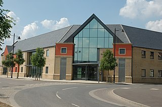
Cambourne is a new settlement and civil parish in Cambridgeshire, England, in the district of South Cambridgeshire. It lies on the A428 road between Cambridge, 9 miles (14 km) to the east, and St Neots and Bedford to the west. It comprises the three villages of Great Cambourne, Lower Cambourne and Upper Cambourne. The area is close to Bourn Airfield.
South Cambridgeshire is a local government district of Cambridgeshire, England, with a population of 162,119 at the 2021 census. It was formed on 1 April 1974 by the merger of Chesterton Rural District and South Cambridgeshire Rural District. It completely surrounds the city of Cambridge, which is administered separately from the district by Cambridge City Council.

Stilton is a village and civil parish in Cambridgeshire, England, about 12 miles (19 km) north of Huntingdon in Huntingdonshire, which is a non-metropolitan district of Cambridgeshire as well as a historic county of England.
Caxton is a small rural village and civil parish in the South Cambridgeshire district of Cambridgeshire, England. It is 9 miles west of the county town of Cambridge. In 2001, the population of Caxton parish was 480 people, increasing to 572 at the 2011 Census. Caxton is most famous for the Caxton Gibbet.
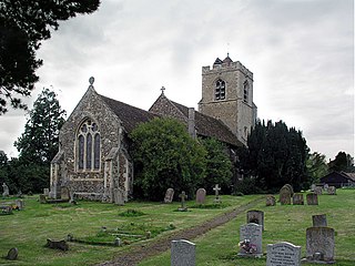
Comberton is a village and civil parish in South Cambridgeshire, England, just east of the Prime Meridian.
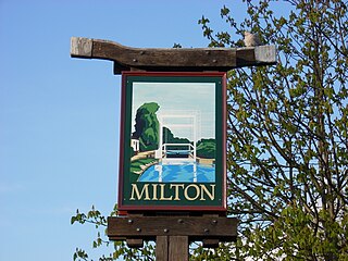
Milton is a village just north of Cambridge, England, with a population of 4,679 at the 2011 census.

South Cambridgeshire is a constituency represented in the House of Commons of the UK Parliament since 2019 by Anthony Browne, a Conservative.

Boxworth is a village in South Cambridgeshire, situated about eight miles to the north-west of Cambridge. It falls under the Papworth Everard and Caxton ward and lies within the diocese of Ely. The village covers an area of 1,053 ha. Boxworth is a relatively small village, with around 100 houses.

Babraham is a village and civil parish in the South Cambridgeshire district of Cambridgeshire, England, about 6 miles (9.7 km) south-east of Cambridge on the A1307 road.
Bassingbourn cum Kneesworth is a civil parish in the South Cambridgeshire district of Cambridgeshire, England, 14 miles south-west of Cambridge and just north of Royston, Hertfordshire. Since the 1960s the parish contains the villages of Bassingbourn and Kneesworth.

Croxton is a village and civil parish about 13 miles (21 km) west of Cambridge in South Cambridgeshire, England. In 2001, the resident population was 163 people, falling slightly to 160 at the 2011 Census. Croxton Park is to the south of the current village and contains a large house and parkland.
Longstowe is a civil parish and small rural village of nearly 200 residents in South Cambridgeshire, England, 12 miles (19 km) west of Cambridge. The population was measured at 205 at the 2011 census. It is situated on the western side of the A1198 road, running for about a mile along the B1046.

Northill is a village and civil parish in the Central Bedfordshire district of the county of Bedfordshire, England about 6.5 miles (10 km) southeast of the county town of Bedford.

Bourn Brook is a minor tributary of the River Cam in Cambridgeshire, England.

Eltisley is a village and civil parish in South Cambridgeshire, England, on the A428 road about 5.5 miles (8.9 km) east of St Neots and about 11 miles (18 km) west of the city of Cambridge. The population in 2001 was 421 people, falling slightly to 401 at the 2011 Census.
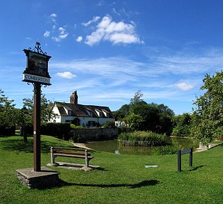
Bourn is a small village and civil parish in South Cambridgeshire, England. Surrounding villages include Caxton, Eltisley and Cambourne. It is 8 miles (12 km) from the county town of Cambridge. The population of the parish was 1,015 at the time of the 2011 census.

Caldecote is a village and former civil parish, now in the parish of Denton and Caldecote, in Cambridgeshire, England. Caldecote lies approximately 7 miles (11 km) south-west of Peterborough. Caldecote is situated within Huntingdonshire which is a non-metropolitan district of Cambridgeshire as well as being a historic county of England. In 1931 the parish had a population of 27.

Hardwick is a village and civil parish in the county of Cambridgeshire, England with a large housing estate located about 6 miles (9.7 km) west of the city of Cambridge, England. The village lies immediately south of the A428 road between Cambridge and St Neots. It is about 4 miles (6.4 km) east of the newly developed town of Cambourne. The village is nearly on the Greenwich Meridian. The northern border of the village is St Neots Road, now largely bypassed by the A428, with no houses or property on the north side of the road. In the 2001 census, the population was 2,630 in 946 households, increasing to 2,670 in 1,017 households at the 2011 Census.

Upper Caldecote is a village in the Central Bedfordshire district of Bedfordshire, England about 8 miles (13 km) south-east of Bedford.

