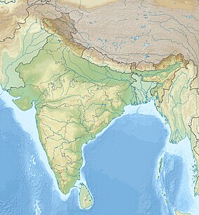
The Chota Nagpur Plateau is a plateau in eastern India, which covers much of Jharkhand state as well as adjacent parts of Chhattisgarh, Odisha, West Bengal and Bihar. The Indo-Gangetic plain lies to the north and east of the plateau, and the basin of the Mahanadi river lies to the south. The total area of the Chota Nagpur Plateau is approximately 65,000 square kilometres (25,000 sq mi).
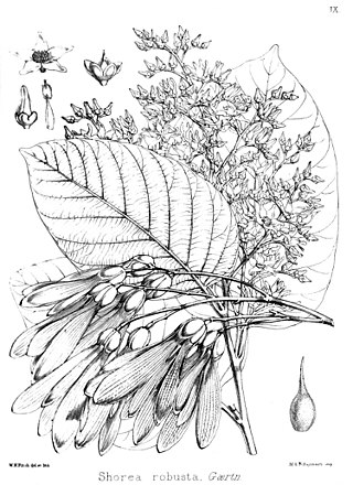
Shorea robusta, the sal tree, sāla, shala, sakhua, or sarai, is a species of tree in the family Dipterocarpaceae. The tree is native to India, Bangladesh, Nepal, Tibet and across the Himalayan regions.

Simdega is a city in the Indian state of Jharkhand. Simdega is the administrative headquarters of the eponymous district and Subdivision. The city stands at an elevation of approximately 418 metres (1371 feet) above sea level and covers an area of 3,750 km2 (1,450 sq mi). Bounded in the north by Gumla, on the east by Ranchi and West Singhbhum, on the west by Jashpur Nagar, Chhattisgarh and on the south by Rourkela, Odisha. The distance between Rourkela and Simdega is 83 km. It is accessible by road through National Highways from Rourkela and Ranchi. The nearest railway station is Rourkela railway station.
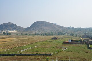
Betla National Park is a national park located on the Chota Nagpur Plateau in the Latehar and Palamu district of Jharkhand, India. The park hosts a wide variety of wildlife.

The Upper Gangetic Plains moist deciduous forests is a tropical and subtropical moist broadleaf forests ecoregion of northern India.

The Eastern Highlands moist deciduous forests, presently known as East Deccan moist deciduous forests, is a tropical and subtropical moist broadleaf forests ecoregion in east-central India. The ecoregion covers an area of 341,100 square kilometers (131,700 sq mi), extending across portions of Andhra Pradesh, Chhattisgarh, Jharkhand, Madhya Pradesh, Maharashtra, Odisha, and Telangana states.
Topchanchi is a census town in Topchanchi CD block in Dhanbad Sadar subdivision of Dhanbad district in the Indian state of Jharkhand.
Bihar is located in the eastern region of India, between latitudes 24°20'10"N and 27°31'15"N and longitudes 83°19'50"E and 88°17'40"E. It is an entirely land–locked state, in a subtropical region of the temperate zone. Bihar lies between the humid West Bengal in the east and the sub humid Uttar Pradesh in the west, which provides it with a transitional position in respect of climate, economy and culture. It is bounded by Nepal in the north and by Jharkhand in the south. Bihar plain is divided into two unequal halves by the river Ganges which flows through the middle from west to east. Bihar's land has average elevation above sea level of 173 feet.

Aralam Wildlife Sanctuary is the northernmost wildlife sanctuary of Kerala, southwest India. It is 55 km2 (21 sq mi) in area and located on the western slope of the Western Ghats. It was established in 1984. The headquarters of the sanctuary is near Iritty. Aralam Wildlife Sanctuary is situated in the southeast part of Kannur District. It lies between 11° 54′ and 11° 59′ north latitude and 75° 47′ and 75° 57′ east longitude.

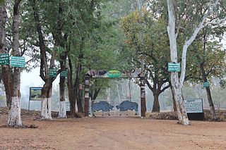
Dalma Wildlife Sanctuary is a wildlife sanctuary located 10 km from the city of Jamshedpur in the state of Jharkhand. Inaugurated in 1975 it contains significant population of Indian Elephants.
Kaimur Wildlife Sanctuary is situated in Kaimur District and Rohtas District of Bihar. It is the largest sanctuary in the state and extended in area of 1,504.96 km2 (581.07 sq mi) in plateaued landscape of Kaimur Range. It was established in 1979. The major forest types are Tropical Dry Mixed Deciduous, Dry Sal Forests, Boswellia Forests and Dry Bamboo Brakes. It is home to rare and endangered flora and fauna. Rohtasgarh Fort and Shergarh Fort are also located in these forests. It also have numerous Megaliths, Rock painting of prehistoric age and stone inscription from a bygone era. The Government of Bihar has planned to developed it into Tiger Reserve
Udhwa is a village in the Uddhwa CD block in the Rajmahal subdivision of the Sahibganj district in the Indian state of Jharkhand.
Tourism in Jharkhand refers to tourism in the Indian state of Jharkhand. Jharkhand is known for its waterfalls, hills and holy places.
Gautam Budha Wildlife Sanctuary is a wildlife sanctuary located in Gaya district of Bihar state and Koderma district of Jharkhand state in east-central India.
Topchanchi is a community development block that forms an administrative division in Dhanbad Sadar subdivision of Dhanbad district, Jharkhand state, India.
Gunghasa is a census town in Topchanchi CD block in Dhanbad Sadar subdivision of Dhanbad district in the Indian state of Jharkhand.
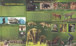
Palkot Wildlife Sanctuary is a wildlife sanctuary located near Palkot. It is spread over Gumla and Simdega districts of Jharkhand in India.
Koderma Wildlife Sactuary is located in the northern part of Koderma in the Koderma subdivision of the Koderma district in the state of Jharkhand, India.
Lawalong Wildlife Sactuary is located in the Lawalong CD block in the Chatra subdivision of the Chatra district in the state of Jharkhand, India.
 Hill
Hill Sunset
 Flower
 Bridge
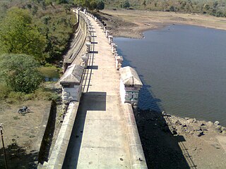