Tracy, Minnesota

Last updated

Tracy, Minnesota
Motto: 
"Come Along for the Ride" [1]
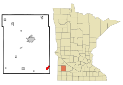
Lyon County Minnesota Incorporated and Unincorporated areas Tracy Highlighted.svg
Location of Tracy, Minnesota
Coordinates: 44°14′20″N95°36′55″W / 44.23889°N 95.61528°W / 44.23889; -95.61528
Country United States
State Minnesota
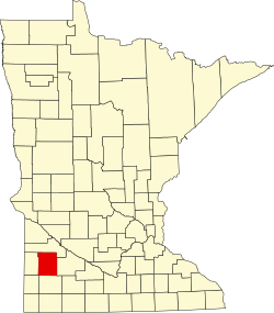
County Lyon
Government
  TypeMayor – Council
  MayorPamela Cooreman[ citation needed ]
Area
[2]
  Total2.44 sq mi (6.33 km2)
  Land2.40 sq mi (6.20 km2)
  Water0.05 sq mi (0.12 km2)
Elevation
[3]
1,375 ft (419 m)
Population
 (2020)
  Total2,076
  Density866.44/sq mi (334.57/km2)
Time zone UTC-6 (Central (CST))
  Summer (DST) UTC-5 (CDT)
ZIP code
56175
Area code 507
FIPS code 27-65308 [4]
GNIS feature ID2397044 [3]
Website www.tracymn.org

Tracy is a city in Lyon County, Minnesota, United States. The population was 2,163 at the 2010 census. [5]

Contents

U.S. Route 14 serves as a main arterial route in the community.

History

Tracy was platted in 1875. [6] It was named for John F. Tracy, a railroad official. [6] [7] A post office called Tracy has been in operation since 1877. [8] The city was incorporated in 1893. [9]

On June 13, 1968, Tracy was hit by an F5 tornado which killed nine people and injured 150. Until the 1960s, Tracy was a highly active railroad town on the Chicago & Northwestern Railway as a concentration point for numerous branchlines in the area serving heavy agriculture. Today, Tracy holds an annual summer festival called "Boxcar Days," which takes place Labor Day weekend as a sign of the railroad's influence on the town. [7] Tracy is a division point on the Canadian Pacific Railway (formerly the Dakota, Minnesota and Eastern Railroad), where railroad crews from both east and west exchange trains.[ citation needed ]

Geography

According to the United States Census Bureau, the city has a total area of 2.23 square miles (5.78 km2), of which 2.18 square miles (5.65 km2) is land and 0.05 square miles (0.13 km2) is water. [10]

Climate

Climate data for Tracy, Minnesota (1991−2020 normals, extremes 1912−present)
MonthJanFebMarAprMayJunJulAugSepOctNovDecYear
Record high °F (°C)65
(18)
65
(18)
83
(28)
94
(34)
107
(42)
105
(41)
108
(42)
105
(41)
105
(41)
93
(34)
79
(26)
69
(21)
108
(42)
Mean maximum °F (°C)43.5
(6.4)
49.2
(9.6)
65.0
(18.3)
79.0
(26.1)
88.9
(31.6)
93.6
(34.2)
93.2
(34.0)
91.5
(33.1)
88.1
(31.2)
81.8
(27.7)
63.7
(17.6)
47.5
(8.6)
96.1
(35.6)
Mean daily maximum °F (°C)22.8
(−5.1)
27.3
(−2.6)
39.0
(3.9)
54.4
(12.4)
68.1
(20.1)
78.9
(26.1)
82.2
(27.9)
79.6
(26.4)
72.9
(22.7)
58.4
(14.7)
41.4
(5.2)
27.8
(−2.3)
54.4
(12.4)
Daily mean °F (°C)14.1
(−9.9)
18.3
(−7.6)
30.3
(−0.9)
44.0
(6.7)
57.6
(14.2)
68.4
(20.2)
71.9
(22.2)
69.3
(20.7)
61.7
(16.5)
47.6
(8.7)
32.7
(0.4)
19.8
(−6.8)
44.6
(7.0)
Mean daily minimum °F (°C)5.3
(−14.8)
9.3
(−12.6)
21.5
(−5.8)
33.6
(0.9)
47.1
(8.4)
58.0
(14.4)
61.6
(16.4)
59.1
(15.1)
50.6
(10.3)
36.9
(2.7)
23.9
(−4.5)
11.8
(−11.2)
34.9
(1.6)
Mean minimum °F (°C)−15.8
(−26.6)
−11.0
(−23.9)
−0.9
(−18.3)
18.4
(−7.6)
32.5
(0.3)
46.2
(7.9)
51.3
(10.7)
48.0
(8.9)
34.3
(1.3)
20.5
(−6.4)
5.5
(−14.7)
−9.8
(−23.2)
−19.0
(−28.3)
Record low °F (°C)−33
(−36)
−30
(−34)
−22
(−30)
2
(−17)
18
(−8)
33
(1)
40
(4)
36
(2)
18
(−8)
2
(−17)
−16
(−27)
−30
(−34)
−33
(−36)
Average precipitation inches (mm)0.64
(16)
0.74
(19)
1.44
(37)
2.86
(73)
3.96
(101)
4.48
(114)
3.54
(90)
3.43
(87)
3.80
(97)
2.26
(57)
1.32
(34)
0.74
(19)
29.21
(742)
Average snowfall inches (cm)8.4
(21)
8.4
(21)
8.5
(22)
6.1
(15)
0.4
(1.0)
0.0
(0.0)
0.0
(0.0)
0.0
(0.0)
0.0
(0.0)
1.0
(2.5)
5.9
(15)
10.6
(27)
49.3
(125)
Average precipitation days (≥ 0.01 in)3.83.95.38.911.711.99.28.88.27.14.44.287.4
Average snowy days (≥ 0.1 in)3.73.92.61.20.10.00.00.00.00.52.24.118.3
Source: NOAA [11] [12]

Demographics

Historical population
CensusPop.Note
1880 322
1890 1,400334.8%
1900 1,91136.5%
1910 1,876−1.8%
1920 2,46331.3%
1930 2,5704.3%
1940 3,08520.0%
1950 3,020−2.1%
1960 2,862−5.2%
1970 2,516−12.1%
1980 2,478−1.5%
1990 2,059−16.9%
2000 2,26810.2%
2010 2,163−4.6%
2020 2,076−4.0%
U.S. Decennial Census

2010 census

As of the census [13] of 2010, there were 2,163 people, 876 households, and 549 families living in the city. The population density was 992.2 inhabitants per square mile (383.1/km2). There were 1,032 housing units at an average density of 473.4 per square mile (182.8/km2). The racial makeup of the city was 86.5% White, 0.1% African American, 0.3% Native American, 9.7% Asian, 0.1% Pacific Islander, 1.5% from other races, and 1.7% from two or more races. Hispanic or Latino people of any race were 5.4% of the population.

There were 876 households, of which 30.4% had children under the age of 18 living with them, 48.5% were married couples living together, 9.9% had a female householder with no husband present, 4.2% had a male householder with no wife present, and 37.3% were non-families. 34.7% of all households were made up of individuals, and 18.3% had someone living alone who was 65 years of age or older. The average household size was 2.39 and the average family size was 3.10.

The median age in the city was 38.7 years. 26.4% of residents were under the age of 18; 7.9% were between the ages of 18 and 24; 22.5% were from 25 to 44; 23% were from 45 to 64; and 20.2% were 65 years of age or older. The gender makeup of the city was 48.2% male and 51.8% female.

2000 census

As of the census [4] of 2000, there were 2,268 people, 922 households, and 533 families living in the city. The population density was 1,045.2 inhabitants per square mile (403.6/km2). There were 1,013 housing units at an average density of 466.8 per square mile (180.2/km2). The racial makeup of the city was 87.8% White, 0.3% African American, 0.5% Native American, 8.1% Asian, 0.04% Pacific Islander, 1.7% from other races, and 1.5% from two or more races. Hispanic or Latino people of any race were 2.3% of the population.

There were 922 households, out of which 28.2% had children under the age of 18 living with them, 49.2% were married couples living together, 6.8% had a female householder with no husband present, and 42.1% were non-families. 38.5% of all households were made up of individuals, and 23.2% had someone living alone who was 65 years of age or older. The average household size was 2.35 and the average family size was 3.20.

In the city, the population was spread out, with 27.6% under the age of 18, 6.4% from 18 to 24, 21.2% from 25 to 44, 19.0% from 45 to 64, and 25.9% who were 65 years of age or older. The median age was 41 years. For every 100 females, there were 82.9 males. For every 100 females age 18 and over, there were 75.5 males.

The median income for a household in the city was $31,356, and the median income for a family was $41,108. Males had a median income of $30,221 versus $19,281 for females. The per capita income for the city was $15,574. About 6.6% of families and 13.6% of the population were below the poverty line, including 23.9% of those under age 18 and 10.4% of those age 65 or over.
Notable people

Related Research Articles

<span class="mw-page-title-main">Evansville, Minnesota</span> City in Minnesota, United States

Evansville is a city in Douglas County, Minnesota, United States. The population was 603 at the 2020 census.

<span class="mw-page-title-main">Glenville, Minnesota</span> City in Minnesota, United States

Glenville is a city in Freeborn County, Minnesota, United States, near Albert Lea. It is along the Shell Rock River. The population was 643 at the 2010 census.

<span class="mw-page-title-main">Pennock, Minnesota</span> City in Minnesota, United States

Pennock is a city in Kandiyohi County, Minnesota, United States. The population was 508 at the 2010 census.

<span class="mw-page-title-main">Lancaster, Minnesota</span> City in Minnesota, United States

Lancaster is a city in Kittson County, Minnesota, United States. As of the 2020 census, the city population was 364.

<span class="mw-page-title-main">Garvin, Minnesota</span> City in Minnesota, United States

Garvin is a city in Lyon County, Minnesota, United States. The population was 135 at the 2010 census.

Ellsborough Township is a township in Murray County, Minnesota, United States. The population was 198 at the 2000 census.

<span class="mw-page-title-main">Richville, Minnesota</span> City in Minnesota, United States

Richville is a city in Otter Tail County, Minnesota, United States. The population was 77 as of the 2020 census.

<span class="mw-page-title-main">Vergas, Minnesota</span> City in Minnesota, United States

Vergas is a city in northern Otter Tail County, Minnesota, United States. The population was 348 at the 2020 census.

<span class="mw-page-title-main">Denham, Minnesota</span> City in Minnesota, United States

Denham is a city in Pine County, Minnesota, United States. The population was 37 at the 2020 census.

<span class="mw-page-title-main">Hinckley, Minnesota</span> City in Minnesota, United States

Hinckley is a city in Pine County, Minnesota, United States, located at the junction of Interstate 35 and Minnesota State Highway 48. The population was 1,800 at the 2010 census.

<span class="mw-page-title-main">Rutledge, Minnesota</span> City in Minnesota, United States

Rutledge is a city in Pine County, Minnesota, United States, at the confluence of the Kettle and Pine Rivers. The population was 229 at the 2010 census.

<span class="mw-page-title-main">Fisher, Minnesota</span> City in Minnesota, United States

Fisher is a town in Polk County, Minnesota, United States. It is part of the Grand Forks-ND-MN Metropolitan Statistical Area. The population was 422 at the 2020 census. Fisher has become a bedroom community for the nearby Greater Grand Forks Metropolitan Area.

<span class="mw-page-title-main">Nielsville, Minnesota</span> City in Minnesota, United States

Nielsville is a city in Polk County, Minnesota, United States. It is part of the Grand Forks, ND-MN Metropolitan Statistical Area. The population was 78 at the 2020 census.

<span class="mw-page-title-main">Big Lake, Minnesota</span> City in Minnesota, United States

Big Lake is a city in Sherburne County, Minnesota, United States. The population was 11,686 at the 2020 census.

<span class="mw-page-title-main">Burtrum, Minnesota</span> City in Minnesota, United States

Burtrum is a city in Todd County, Minnesota, United States. The population was 144 at the 2010 census. By the 2020 Decennial Census the population had declined to 123.

<span class="mw-page-title-main">Darfur, Minnesota</span> City in Minnesota, United States

Darfur is a city in Watonwan County, Minnesota, United States. The population was 108 at the 2010 census.

<span class="mw-page-title-main">Stockton, Minnesota</span> City in Minnesota, United States

Stockton is a city in Winona County, Minnesota, United States. The population was 809 at the 2020 census.

<span class="mw-page-title-main">Clarkfield, Minnesota</span> City in Minnesota, United States

Clarkfield is a city in Yellow Medicine County, Minnesota, United States, surrounded by Friendship Township. The population was 863 at the 2010 census.

<span class="mw-page-title-main">Tracy, Missouri</span> City in Missouri, United States

Tracy is a city in Platte County, Missouri within the United States, located along the Platte River. The population was 269 at the 2020 census. The city is part of the Kansas City metropolitan area.

<span class="mw-page-title-main">Brownsville, Minnesota</span> City in Minnesota, United States

Brownsville is a city in Houston County, Minnesota, United States. The population was 566 at the 2020 census.

References

  1. "Tracy Minnesota". City of Tracy, Minnesota. Retrieved March 25, 2020.
  2. "2020 U.S. Gazetteer Files". United States Census Bureau. Retrieved July 24, 2022.
  3. 1 2 U.S. Geological Survey Geographic Names Information System: Tracy, Minnesota
  4. 1 2 "U.S. Census website". United States Census Bureau . Retrieved January 31, 2008.
  5. "2010 Census Redistricting Data (Public Law 94-171) Summary File". American FactFinder. United States Census Bureau . Retrieved April 27, 2011.[ dead link ]
  6. 1 2 Chicago and North Western Railway Company (1908). A History of the Origin of the Place Names Connected with the Chicago & North Western and Chicago, St. Paul, Minneapolis & Omaha Railways. p. 131.
  7. 1 2 WPA Guide to Minnesota. Saint Paul, Minnesota: Minnesota Historical Society. 1985 [1938]. p. 406. ISBN   0873517121.
  8. "Lyon County". Jim Forte Postal History. Retrieved March 30, 2015.
  9. Upham, Warren (1920). Minnesota Geographic Names: Their Origin and Historic Significance. Minnesota Historical Society. p.  314.
  10. "US Gazetteer files 2010". United States Census Bureau. Archived from the original on January 12, 2012. Retrieved November 13, 2012.
  11. "NowData − NOAA Online Weather Data". National Oceanic and Atmospheric Administration. Retrieved October 16, 2021.
  12. "Station: Tracy, MN". U.S. Climate Normals 2020: U.S. Monthly Climate Normals (1991−2020). National Oceanic and Atmospheric Administration. Retrieved October 16, 2021.
  13. "U.S. Census website". United States Census Bureau . Retrieved November 13, 2012.