Transportation in Buffalo, New York

Last updated
Reddy bike share ReddyRackBuffalo.jpg
Reddy bike share

Transportation in Buffalo, New York is dominated by automobile use, but other modes of transportation exist in the city.

Contents

The Erie Canal made Buffalo a major port. Railroads including the New York Central confirmed its status.

Airports

Buffalo Niagara International Airport Buffalo Niagara International Airport.jpg
Buffalo Niagara International Airport

The Niagara Frontier Transportation Authority (NFTA) operates Buffalo Niagara International Airport and Niagara Falls International Airport. Buffalo is primarily served by the Buffalo Niagara International Airport, located in the nearby suburb of Cheektowaga. The airport, reconstructed in 1997, serves over 5 million passengers per year. Buffalo Niagara International Airport ranks among the five cheapest airports from which to fly in the country, according to U.S. Bureau of Transportation Statistics for 2013. The average round trip flight cost was $295.58. [1]

In the 2010s there was a surge in Canadians flying out of Buffalo, mainly due to much cheaper tax and airline surcharges as compared with Canadian airports and the ability to fly on some US based, discount carriers not available in Canada (for example, JetBlue Airways and Southwest Airlines). In 2006, plans were in the works by U.S. Senator Charles Schumer to make the under-used Niagara Falls International Airport into an international cargo hub for New York and Toronto, and for Canada as a whole. [2]

Public transit

The Buffalo Metro Rail, also operated by the NFTA, is a 6.4 miles (10.3 km) long, single-line light rail system that extends from Erie Canal Harbor in downtown Buffalo to the University Heights district (specifically, the South Campus of University at Buffalo) in the northeastern part of the city. The downtown section of the line runs above ground and is free of charge to passengers. North of Theater Station, at the northern end of downtown, the line moves underground, remaining underground until it reaches the northern terminus of the line at University Heights. Passengers pay a fare to ride this section of the rail.

A Buffalo Metro Rail train passes through Lafayette Square. Main Court Building, Buffalo.JPG
A Buffalo Metro Rail train passes through Lafayette Square.

A NFTA project underway, "Cars Sharing Main Street," will substantially revise the downtown portion of the Metro Rail. It will allow vehicular traffic and Metro Rail cars to share Main Street, in a manner similar to that of the trolleys of San Francisco. The design includes new stations and pedestrian-friendly improvements. The first phase of the project, restoring two-way traffic in the 700 block of Main Street between Edward and West Tupper Streets, was completed in 2009. The NFTA operates bus lines throughout the city, region and suburbs. The second, restoring two-way traffic in the 600 block of Main Street between West Tupper and West Chippewa Streets, was completed in January 2015.

Railroads

The city has a single Amtrak intercity train station, Buffalo–Exchange Street station, rebuilt in 2020. The city's eastern suburbs are also served by the Buffalo–Depew station in Depew, New York, built in 1979. Historically the city was a major stop on through routes between Chicago and New York City through the lower Ontario peninsula. [3] Additionally, the Pennsylvania Railroad ran trains between Buffalo and Washington, D.C., on the Buffalo Line through central Pennsylvania. [4] New York Central trains went through the Buffalo Central Terminal, Lackawanna trains went through its terminal on Main Street until the mid-1950s and the Lehigh Valley Railroad's trains went through its terminal until 1952. From 1935 the Erie Railroad used the Lehigh Valley facility. [5] [6]

Freight service for Buffalo is served by CSX Transportation and Norfolk Southern (NS), as well as Canadian National (CN) and Canadian Pacific (CP) railroads from across the border. The area has four large rail yards: Frontier (CSX), Bison (NS), SK (NS / CP) and Buffalo Creek (NS / CSX). A large amount of hazardous cargo crosses through the Buffalo area, such as liquid propane and anhydrous ammonia.

Waterways

The Buffalo Outer Harbor in 1992. Northeast of the city is the Niagara River. Buffalo New York aerial view.jpg
The Buffalo Outer Harbor in 1992. Northeast of the city is the Niagara River.

Buffalo is at the eastern end of one of the Great Lakes, Lake Erie, which boasts the greatest variety of freshwater sportfish in the country. The Lake serves as a playground for numerous personal yachts, sailboats, power boats and watercraft. The city has an extensive breakwall system protecting its inner and outer Lake Erie harbors, which are maintained at commercial navigation depths for Lake freighters. A Lake Erie tributary that flows through south Buffalo is the Buffalo River and Buffalo Creek.

Buffalo is historically linked to the fabled Erie Canal, which ended where the Black Rock Channel enters Lake Erie, at Buffalo Creek. When the Erie Canal was dedicated in 1825, its conceiver, New York State governor DeWitt Clinton, carried waters from Lake Erie at Buffalo's western terminus of the canal (now the Commercial Slip), and poured it into the Atlantic Ocean in New York City. He sailed to New York on the canal packet Seneca Chief. [7] A return trip of the Seneca Chief carried Atlantic Ocean seawater. The seawater was poured into the Lake by Judge and future Buffalo Mayor Samuel Wilkeson. Once a major route for passengers and cargo, the Erie Canal played a primary role in opening the American West to settlers from the east. The canal is now used primarily for pleasure craft and some light local freight, and in Buffalo it bypasses the swift upper reach of the Niagara River. A tributary of the Niagara River is Scajaquada Creek, which flows through Buffalo, via the Olmsted-designed Delaware Park–Front Park System.

Streets and highways

Eight New York State highways, one three-digit Interstate Highway and one U.S. Highway traverse the city of Buffalo. New York State Route 5, commonly referred to as Main Street within the city[ citation needed ], enters through Lackawanna as a limited-access highway and intersects with Interstate 190, a north–south highway connecting Interstate 90 in the southeastern suburb of Cheektowaga with Niagara Falls. NY 354 (Clinton Street) and NY 130 (Broadway) are east to west highways connecting south and downtown Buffalo to the eastern suburbs of West Seneca and Depew. NY 265 (Delaware Avenue) and NY 266 (Niagara Street and Military Road) both originate in downtown Buffalo and terminate in the city of Tonawanda. One of three U.S. highways in Erie County, the other two being U.S. 20 and U.S. 219, U.S. 62 (Bailey Avenue) is a north to south trunk road that enters the city through Lackawanna and exits at the Amherst town border at a junction with NY 5. Within the city, the route passes by light industrial developments and high density areas of the city. Bailey Avenue has major intersections with Interstate 190 and the Kensington Expressway.

I-190.svg

I-190 — Serves Much of southern Buffalo, and some of the first miles of the Erie Canal.

US 62.svg
NY-5.svg

US 62 (Bailey Avenue) — Serves the eastern side of Buffalo and some of the neighborhoods.

NY-33.svg

NY 5 (Buffalo Skyway, Main Street) — Serves the Buffalo Harbor, the downtown district, the Buffalo General Hospital, and

NY 33 (Kensington Expressway) — Serves Buffalo's east side, and also serves access to the Buffalo Niagara International Airport.

NY-198.svg NY 198 (Scajaquada Expressway) — Follows Scajaquada Creek and serves the Buffalo Zoo. Entirely within the Buffalo city limits.

Three major expressways serve the city of Buffalo. The Scajaquada Expressway (NY 198) is primarily a limited access highway connecting Interstate 190 near Unity Island to New York State Route 33. The Kensington Expressway (NY 33) begins at the edge of downtown and the city's East Side, continues through heavily populated areas of the city, intersects with Interstate 90 in Cheektowaga and ends shortly at the airport. The Peace Bridge is a major international crossing located near the Black Rock district of the city. The bridge connects Fort Erie, Ontario with the city.

Main Street

Main Street runs for 6.5 miles (5.2 miles are a part of NY 5) from Downtown to the University at Buffalo south campus.

Main street is the spine of the city dividing the city from east to west. Main street travels through many notable neighborhoods and areas of Buffalo. Areas of note include the Central Business District, the Theater District, Allentown, Central Park, and the University at Buffalo. It also for many decades has been the demarcation between racial and economic groups neighborhoods within the city, with the west side being generally wealthier and whiter and the east being generally poorer and with more people of color.

Just north of the city the street runs through the town of Amhurst, a large Buffalo suburb. The road then travels east through the localities of Harris Hill, Batavia, and Le Roy, until reaching its terminus in Caledonia.

See also

Related Research Articles

<span class="mw-page-title-main">Erie County, New York</span> County in New York, United States

Erie County is a county along the shore of Lake Erie in western New York State. As of the 2020 census, the population was 954,236. The county seat is Buffalo, which makes up about 28% of the county's population. Both the county and Lake Erie were named for the regional Iroquoian language-speaking Erie tribe of Native Americans, who lived in the area before 1654. They were later pushed out by the more powerful Iroquoian nations tribes.

<span class="mw-page-title-main">Cheektowaga, New York</span> Town in New York, United States

Cheektowaga is a town in Erie County, New York, United States. As of the 2020 census, the town has grown to a population of 89,877. The town is in the north-central part of the county, and is an inner ring suburb of Buffalo. The town is the second-largest suburb of Buffalo, after the Town of Amherst.

<span class="mw-page-title-main">New York Central Railroad</span> American Class I railroad (1853–1968)

The New York Central Railroad was a railroad primarily operating in the Great Lakes and Mid-Atlantic regions of the United States. The railroad primarily connected greater New York and Boston in the east with Chicago and St. Louis in the Midwest, along with the intermediate cities of Albany, Buffalo, Cleveland, Cincinnati, Detroit, Rochester and Syracuse. New York Central was headquartered in New York City's New York Central Building, adjacent to its largest station, Grand Central Terminal.

<span class="mw-page-title-main">Niagara Frontier Transportation Authority</span> Public transit operator in Erie and Niagara Counties, New York

The Niagara Frontier Transportation Authority (NFTA) is the public agency responsible for operating most public transportation services in the Buffalo–Niagara Falls metropolitan area. The NFTA, as an authority, oversees a number of subsidiaries, including the NFTA Metro bus and rail system, the Buffalo-Niagara International Airport, the Niagara Falls International Airport and NFTA Small Boat Harbor. The NFTA Metro bus and rail system is a multi-modal agency, utilizing various vehicle modes, using the brand names: NFTA Metro Bus, NFTA Metro Rail, NFTA Metrolink and NFTA PAL. In 2022, the system had a ridership of 14,061,700 or about 53,200 per weekday as of the second quarter of 2023. In addition, the NFTA also owns and manages a number of properties, including the Buffalo Metropolitan Transportation Center in Downtown Buffalo ; the Niagara Falls Transportation Center on Factory Outlet Boulevard; the Portage Road Transit Center in Niagara Falls; and a number of strategically located bus loops and transit centers in the Buffalo Niagara region. Of note, many of the bus loops have been in continuous operation since the days of the International Railway Company, a predecessor to the NFTA. Agency-wide, the NFTA employs 1,500 full-time and part-time employees. There are three business centers that operate as the NFTA organization: Surface Transportation, which handles ground transportation throughout Erie and Niagara counties, Aviation, which handles air related business at the Buffalo-Niagara International Airport and Niagara Falls International Airport and Property Risk/Management, which operates the NFTA-Boat Harbor and handles other properties that are owned and/or operated by the NFTA.

<span class="mw-page-title-main">Interstate 190 (New York)</span> Highway in New York

Interstate 190 is a north–south auxiliary Interstate Highway in the United States that connects I-90 in Buffalo, New York, with the Canada–United States border at Lewiston, New York, near Niagara Falls. Officially, I-190 from I-90 north to New York State Route 384 (NY 384) is named the Niagara Thruway and is part of the New York State Thruway system. The remainder, from NY 384 to Lewiston, is known as the Niagara Expressway and is maintained by the New York State Department of Transportation (NYSDOT).

The Buffalo and Niagara Falls Railroad was a part of the New York Central Railroad system, connecting Buffalo, New York to Niagara Falls. It is still used by CSX for freight and Amtrak for passenger service.

<span class="mw-page-title-main">New York State Route 198</span> Highway in Buffalo, New York

New York State Route 198 (NY 198) is a state highway located entirely within the city of Buffalo, New York, in the United States. It is named the Scajaquada Expressway for Scajaquada Creek, which it covers as it heads across northern Buffalo. NY 198 connects the Niagara Thruway in the Black Rock neighborhood to the Kensington Expressway (NY 33) on Buffalo's east side, dividing the city's premier public park in half.

<span class="mw-page-title-main">New York State Route 33</span> State highway in western New York, US

New York State Route 33 (NY 33) is an east–west state highway in western New York in the United States. The route extends for just under 70 miles (113 km) from NY 5 in Buffalo in the west to NY 31 in Rochester in the east. It is, in fact, the only state highway that directly connects both cities, although it is rarely used today for that purpose. The westernmost 10 miles (16 km) of NY 33 in Buffalo and the neighboring town of Cheektowaga have been upgraded into the Kensington Expressway. This section of NY 33 is one of several expressways leading out of downtown and serves as a main route to the Buffalo Niagara International Airport.

<span class="mw-page-title-main">Buffalo–Depew station</span> Railroad station in Depew NY USA

Buffalo–Depew station is an Amtrak train station in Depew, New York, a suburb of Buffalo. It was built in 1979 to replace the Buffalo Central Terminal as Buffalo's main Amtrak station. It is located 10 miles (16 km) east of downtown Buffalo.

<span class="mw-page-title-main">New York State Route 78</span> State highway in western New York, US

New York State Route 78 (NY 78) is a 73.49-mile-long (118.27 km) state highway in western New York in the United States. While it is signed north–south, the southern portion runs in an east–west direction across Wyoming and Erie counties, from its beginning at a junction with NY 19 north of the village of Gainesville to the village of East Aurora. The part of the route north of East Aurora follows a generally north–south alignment to an intersection with NY 18 in the Niagara County town of Newfane, just south of the Lake Ontario shoreline. The route is most closely identified in the region with Transit Road, a major north–south trunk road through the center of Erie and Niagara counties; however, NY 78 does not follow Transit Road for its entire length, nor does Transit Road comprise more than half its length. The highway joins Transit Road north of East Aurora and stays with the road until nearly its end in the city of Lockport.

<span class="mw-page-title-main">Buffalo–Exchange Street station</span> Amtrak train station in Buffalo, New York, US

Buffalo–Exchange Street station is an Amtrak station in Buffalo, New York. The station serves six Amtrak trains daily: two daily Empire Service round trips between Niagara Falls and New York City and one Maple Leaf round trip between Toronto and New York City. There is also daily Amtrak Thruway bus service at the station, operating between the Buffalo Metropolitan Transportation Center and Jamestown station in Jamestown, New York, via Dunkirk and Fredonia, and serving the communities along the southeast shore of Lake Erie.

<span class="mw-page-title-main">New York State Route 265</span> State highway in western New York, US

New York State Route 265 (NY 265) is a 19.75-mile (31.78 km) long state highway located in the western part of New York in the United States. NY 265 is a north–south route that roughly parallels the western parts of the Niagara River in Erie County and Niagara County. For much of its southern course, it is more frequently referred to by its longtime name, Military Road, which dates back to 1801 as a road to connect the city of Black Rock and Fort Niagara near Lake Ontario.

<span class="mw-page-title-main">New York State Route 384</span> State highway in western New York, US

New York State Route 384 (NY 384) is a state highway in Western New York in the United States. It is a north–south route extending from the city of Buffalo, Erie County to the city of Niagara Falls, Niagara County, and is one of several routes directly connecting the two cities. The southern terminus of the route is at NY 5 in downtown Buffalo. NY 384's northern terminus is at the Rainbow Bridge in downtown Niagara Falls. Through its entire course in Erie County, it is known as Delaware Avenue for the street it follows in the city. In Niagara County, NY 384 follows the Niagara River and is named River Road and Buffalo Avenue.

The LaSalle Expressway is a 2.62-mile (4.22 km) freeway in Niagara County, New York, in the United States. It begins near the North Grand Island Bridge at an interchange with Interstate 190 (I-190) in Niagara Falls and ends just south of the Niagara Falls International Airport at Williams Road (NY 952V) in Wheatfield. The LaSalle Expressway is part of New York State Route 951A (NY 951A), an unsigned reference route; the other, 0.42-mile (0.68 km) portion is located along Niagara Street between the Rainbow Bridge and Fifth Street in downtown Niagara Falls. Most of this portion, which is not connected to the LaSalle Expressway, is also part of the signed NY 384.

<span class="mw-page-title-main">New York State Route 266</span> State highway in Erie County, New York, US

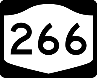
New York State Route 266 (NY 266) is a state highway in Erie County, New York, in the United States. It runs along the Niagara River from the city of Buffalo to the city of Tonawanda. The southern terminus of the route is at the ramps leading to Interstate 190 (I-190) exit 8 in Buffalo. Its northern terminus is at an intersection with NY 265 just south of North Tonawanda in Tonawanda.

<span class="mw-page-title-main">Proposed expansion of the Buffalo Metro Rail</span> Grass-roots organization in Buffalo, New York

Since the Buffalo Metro Rail light rail was proposed in the 1970s, there have been multiple proposals for expanding the system, which is currently a single 6.4-mile (10.3 km) long line. Public officials, agencies and advocacy groups have created plans, with the most recent and extensive being an extension to the town of Amherst. Groups have formed on both sides of the issue.

<span class="mw-page-title-main">Snyder, New York</span> Hamlet in New York, United States

Snyder is a hamlet within the town of Amherst in Erie County, New York, that is part of the Buffalo–Niagara Falls metropolitan area. The hamlet was established in 1837. It was named for Michael Snyder, its first postmaster, who also operated a store at the corner of Harlem Road, which is also known as New York State Route 240, and Main Street, which is also known as New York State Route 5. The hamlet blossomed due to retail activity demand created along the Main Street transportation route between Buffalo and points to the east in the 19th and early 20th century.

Transportation in New York is made up of some of the most extensive and one of the oldest transportation infrastructures in the country. Engineering difficulties because of the terrain of the State of New York and the unique issues of New York City brought on by urban crowding have had to be overcome since the state was young. Population expansion of the state generally followed the path of the early waterways, first the Hudson River and then the Erie Canal. Today, railroad lines and the New York State Thruway follow the same general route.

<span class="mw-page-title-main">International Railway (New York–Ontario)</span> Former urban transit company in Buffalo, NY

The International Railway Company (IRC) was a transportation company formed in a 1902 merger between several Buffalo-area interurban and street railways. The city railways that merged were the West Side Street Railway, the Crosstown Street Railway and the Buffalo Traction Company. The suburban railroads that merged included the Buffalo & Niagara Electric Street Railway, and its subsidiary the Buffalo, Lockport & Olcott Beach Railway; the Buffalo, Depew & Lancaster Railway; and the Niagara Falls Park & River Railway. Later the IRC acquired the Niagara Gorge Railroad (NGRR) as a subsidiary, which was sold in 1924 to the Niagara Falls Power Company. The NGRR also leased the Lewiston & Youngstown Frontier Railroad.

<span class="mw-page-title-main">Scajaquada Creek</span> River in New York, United States

Scajaquada Creek is a stream in Erie County, New York, United States. The name is derived from Philip Kenjockety, a Native American described as the oldest resident of the region upon his death in 1808.

References

  1. "Buffalo Niagara Region Shared Services Opportunities" (PDF). Buffaloniagra.org. Archived from the original (PDF) on March 13, 2014., Retrieved May 31, 2013.
  2. Bill Michelmore (June 26, 2006). "Niagara airport pushed as trade hub; Schumer joins effort to bring global cargo". Buffalo News. p. B1.
  3. Drury, George H. (1994). The Historical Guide to North American Railroads: Histories, Figures, and Features of more than 160 Railroads Abandoned or Merged since 1930. Waukesha, Wisconsin: Kalmbach Publishing. pp. 91, 229–231. ISBN   978-0-89024-072-4.
  4. 1957 Pennsylvania Railroad schedules reprinted at http://www.therailwire.net/forum/index.php?topic=17913.15 [ dead link ]
  5. The New York Central Terminal of Buffalo, New York History, 1842–1945 "History of the Central Terminal: 1842-1945". Archived from the original on 2009-04-20. Retrieved 2009-09-07.
  6. Buffalo Central Terminal, Decline, 1945–1960 "Buffalo Central Terminal -- Decline & Abandonment, 1945 - 1990". Archived from the original on 2012-04-04. Retrieved 2009-09-07.
  7. "Erie Canal Time Machine: 1825 Celebration". The New York State Archives. New York State Education Department. Archived from the original on October 11, 2014. Retrieved August 11, 2015.