Related Research Articles
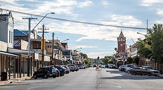
Broken Hill is an inland mining city in the far west of outback New South Wales, Australia. It is near the border with South Australia on the crossing of the Barrier Highway (A32) and the Silver City Highway (B79), in the Barrier Range. It is 315 m (1,033 ft) above sea level, with a hot desert climate, and an average rainfall of 235 mm (9 in). The closest major city is Adelaide, the capital of South Australia, which is more than 500 km (311 mi) to the southwest and linked via route A32.

The subtropics are geographic and climate zones located roughly between the tropics at latitude 23° 27' and the temperate zones, north and south of the Equator.

The Riverina is an agricultural region of South-Western New South Wales (NSW), Australia. The Riverina is distinguished from other Australian regions by the combination of flat plains, warm to hot climate and an ample supply of water for irrigation. This combination has allowed the Riverina to develop into one of the most productive and agriculturally diverse areas of Australia. Bordered on the south by the state of Victoria and on the east by the Great Dividing Range, the Riverina covers those areas of New South Wales in the Murray and Murrumbidgee drainage zones to their confluence in the west.

The Australian state of New South Wales has an extensive network of railways, which were integral to the growth and development of the state. The vast majority of railway lines were government built and operated, but there were also several private railways, some of which operate to this day.

Hillston is a township in western New South Wales, Australia, in Carrathool Shire, on the banks of the Lachlan River. It was founded in 1863 and at the 2016 census had a population of 1,465.

Temora is a town in the north-east of the Riverina area of New South Wales, 418 kilometres (260 mi) south-west of the state capital, Sydney. At the 2016 census the urban population of Temora was 4,054.

Ivanhoe is a very small township on the Cobb Highway between the Lachlan and Darling rivers in New South Wales, Australia. It is located within the Central Darling Shire local government area. Ivanhoe functions as a service centre for the surrounding area. The township is characterised by a particularly wide main street. At the 2016 census, Ivanhoe had a population of 196 people.

The South Coast refers to the narrow coastal belt from Shoalhaven district in the north to the border with Victoria in the south in the south-eastern part of the State of New South Wales, Australia. It is bordered to the west by the coastal escarpment of the Southern Tablelands, and is largely covered by a series of national parks, namely Jervis Bay National Park, Eurobodalla National Park, and Ben Boyd National Park. To the east is the coastline of the Pacific Ocean, which is characterised by rolling farmlands, small towns and villages along a rocky coastline, interspersed by numerous beaches and lakes.
The climate of Sydney is humid subtropical, shifting from mild and cool in winter to warm and hot in the summer, with no extreme seasonal differences as the weather is moderated by proximity to the ocean, although more contrasting temperatures are recorded in the inland western suburbs. Despite the fact that there is no distinct dry or wet season, rainfall peaks in the first half of the year and is at its lowest in the second half. Precipitation varies across the region, with areas adjacent to the coast being the wettest. The city receives around 20 thunderstorms per year.

The Main Southern Railway is a major railway in New South Wales, Australia. It runs from Sydney to Albury, near the Victorian border. The line passes through the Southern Highlands, Southern Tablelands, South West Slopes and Riverina regions.

Rankins Springs is a village in the Riverina region of New South Wales, Australia in Carrathool Shire and on the Mid-Western Highway. At the census, Rankins Springs had a population of 299. The settlement of Rankins Springs is strung out along the Mid-Western Highway and adjacent railway line.

The Broken Hill railway line is now part of the transcontinental railway from Sydney to Perth.

The Hay railway line is a partly closed railway line in New South Wales, Australia. The line branches from the Main South line at Junee, and passes in a westwards direction through the towns of Coolamon and Narrandera to Yanco. The first train arrived in Hay on 4 July 1882. The line beyond Yanco to Hay is now closed, although the section to Willbriggie remained open for grain haulage until 2004. At Yanco, the still-open Yanco to Griffith line branches off in a northwesterly direction to Griffith.
The Temora–Roto railway line is a partly closed railway line in the southwest of New South Wales, Australia. It branches from the Lake Cargelligo line at the town of Temora and travels west through the northern part of the Riverina to the towns of Griffith and Hillston. A connection to the Broken Hill line created a cross-country route, although this was never utilised to its full potential, and the line beyond Hillston was built to low grade 'pioneer' standards.

Bell is a small rural and residential village in the Blue Mountains region of New South Wales, Australia. It is the north-westernmost village in the City of Blue Mountains, located approximately 125 kilometres (78 mi) west of Sydney central business district by road or 137 kilometres (85 mi) by rail, approximately 20 kilometres (12 mi) east of Lithgow and 10 kilometres (6.2 mi) north of Mount Victoria. It is a locality on the junction of the Bells Line of Road, Chifley Road and the Darling Causeway, with an elevation of approximately 1,100 metres (3,600 ft) AHD .
The Adelaide-Port Augusta railway line is the primary rail corridor in South Australia for northbound rail traffic out of Adelaide. The line forms part of the Perth–Adelaide and Adelaide–Darwin rail route, and the portion south of Crystal Brook forms part of the Adelaide–Sydney rail route.
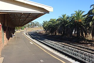
Condobolin railway station is located on the Broken Hill line in New South Wales, Australia. It serves the town of Condobolin.
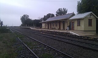
Ivanhoe railway station is located on the Broken Hill line in New South Wales, Australia. It serves the town of Ivanhoe.

Euabalong West railway station is located on the Broken Hill line in New South Wales, Australia. It serves the town of Euabalong West.
Conoble, New South Wales is a civil parish and a rural locality of Far West, New South Wales.
References
- ↑ "NSW-West Publicans Licences". 18 April 2004. Retrieved 14 May 2011.
- ↑ "Broken Hill Line" . Retrieved 14 May 2011.
- ↑ "Hot Dry Zone (with cooler winter)". Bureau of Meteorology. Archived from the original on 3 February 2007. Retrieved 29 January 2007.
Coordinates: 33°01′S145°01′E / 33.017°S 145.017°E
| This New South Wales geography article is a stub. You can help Wikipedia by expanding it. |