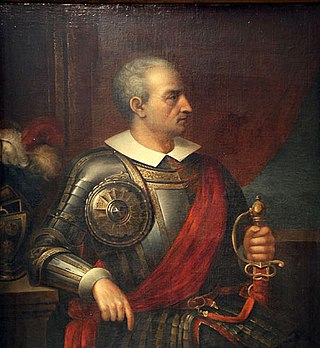
Diego de Almagro, also known as El Adelantado and El Viejo, was a Spanish conquistador known for his exploits in western South America. He participated with Francisco Pizarro in the Spanish conquest of Peru. While subduing the Inca Empire he laid the foundation for Quito and Trujillo as Spanish cities in present-day Ecuador and Peru, respectively. From Peru, Almagro led the first Spanish military expedition to central Chile. Back in Peru, a longstanding conflict with Pizarro over the control of the former Inca capital of Cuzco erupted into a civil war between the two bands of conquistadores. In the battle of Las Salinas in 1538, Almagro was defeated by the Pizarro brothers and months later he was executed.
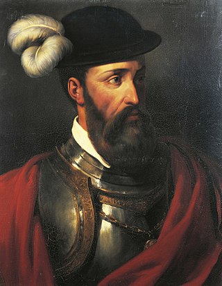
Francisco Pizarro, Marquess of the Atabillos was a Spanish conquistador, best known for his expeditions that led to the Spanish conquest of the Inca Empire.
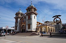
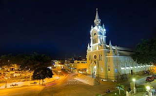
Cusco or Cuzco is a city in southeastern Peru, near the Sacred Valley of the Andes mountain range and the Huatanay river. It is the capital of the eponymous province and department. The city is the seventh most populous in Peru; in 2017, it had a population of 428,450. Its elevation is around 3,400 m (11,200 ft).

Atahualpa, also Atawallpa (Quechua), Atabalica, Atahuallpa, Atabalipa, was the last effective Inca emperor before his capture and execution during the Spanish conquest of the Inca Empire.

Piura is a city in northwestern Peru located north of the Sechura Desert on the Piura River. It is the capital of the Piura Region and the Piura Province. Its population was 484,475 as of 2017 and is the 7th most populous city in Peru. The city is located in the central eastern part of the Piura Region, 981 kilometers from the countrys capital, Lima and is near to the border with Ecuador.
Tumbes is a coastal department and region in northwestern Peru bordering Ecuador. Due to the region's location near the Equator it has a warm climate, with beaches that are considered among the finest in Peru. Despite its small area, the region contains a wide variety of ecosystems. It is the smallest department in Peru and its third least populous department after Moquegua and Madre de Dios, but it is also its third most densely populated department, after La Libertad and Lambayeque.

Ica is a city and the capital of the Department of Ica in southern Peru. While the area was long inhabited by varying cultures of indigenous peoples, the Spanish conquistador Jerónimo Luis de Cabrera claimed its founding in 1563.
The Battle of Puná, a peripheral engagement of Francisco Pizarro's conquest of Peru, was fought in April 1531 on the island of Puná in Ecuador. Pizarro's conquistadors, boasting superior weaponry and tactical skill, decisively defeated the island's indigenous inhabitants. The battle marked the beginning of Pizarro's third and final expedition before the fall of the Inca Empire.
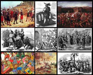
The Spanish conquest of the Inca Empire, also known as the Conquest of Peru, was one of the most important campaigns in the Spanish colonization of the Americas. After years of preliminary exploration and military skirmishes, 168 Spanish soldiers under conquistador Francisco Pizarro, along with his brothers in arms and their indigenous allies, captured the Sapa Inca Atahualpa in the 1532 Battle of Cajamarca. It was the first step in a long campaign that took decades of fighting but ended in Spanish victory in 1572 and colonization of the region as the Viceroyalty of Peru. The conquest of the Inca Empire, led to spin-off campaigns into present-day Chile and Colombia, as well as expeditions to the Amazon Basin and surrounding rainforest.
Moquegua is a city in southern Peru, located in the Department of Moquegua, of which it is the capital. It is also capital of Mariscal Nieto Province and Moquegua District. It is located 1144 kilometers south of the capital city of Lima.

Abancay, founded in 1572 as Santiago de los Reyes de Abancay, is a city in southern-central Peru. It is the capital of both the Apurímac Region and the Abancay Province, and serves an important cultural, economic, and political role in Apurímac.

Huánuco is a city in central Peru. It had a population of 196,627 as of 2017 and in 2015 it had a population of 175,068. It is the capital of the Huánuco Region and the Huánuco District. It is the seat of the diocese of Huánuco. The metropolitan city of Huanuco is 170,000 hab. It has three districts, Huanuco (head), Amarilis, and Pillco Marca. In this city, the Higueras river meets the Huallaga river, one of the largest rivers in the country.

Jaén, founded as San Leandro de Jaén and then known as Jerez de la Frontera and finally as Jaén de Bracamoros since April 1549, is a city which is the capital of the Jaén Province in the Cajamarca Region in Peru, located in the high jungle of northern Peru. It is the seat of the Catholic Apostolic Vicariate of St. Francis Xavier, also known as Apostolic Vicariate of Jaén en Peru.

Jauja is a city and capital of Jauja Province in Peru. It is situated in the fertile Mantaro Valley, 45 kilometres (28 mi) to the northwest of Huancayo, at an altitude of 3,400 metres (11,200 ft). Its population in 2015 was 15,432.
Sullana is a city in Peru and the capital of the Sullana Province, Piura, in the north-western coastal plains of Peru on the Chira valley. The city is home to 162,500 people and is one of the most important cities in the Department of Piura.

The Ecuadorian–Peruvian territorial dispute was a territorial dispute between Ecuador and Peru, which, until 1928, also included Colombia. The dispute had its origins on each country's interpretation of what Real Cedulas Spain used to precisely define its colonial territories in the Americas. After independence, all of Spain's colonial territories signed and agreed to proclaim their limits in the basis of the principle of uti possidetis juris, which regarded the Spanish borders of 1810 as the borders of the new republics. However, conflicting claims and disagreements between the newly formed countries eventually escalated to the point of armed conflicts on several occasions.

Andahuaylas, founded in 1533 as San Pedro de Andahuaylas «La Grande de la Corona», is a Peruvian city. It is the capital of the Andahuaylas Province in the Apurímac Region. It is known as the pradera de los celajes. Its approximate population of 42,268 inhabitants makes it the largest city in the region.

Illimo District is one of twelve districts of the province Lambayeque in Peru.
Pedro Pizarro was a Spanish chronicler and conquistador. He took part in most events of the Spanish conquest of Peru and wrote an extensive chronicle of them under the title Relación del descubrimiento y conquista de los reinos del Perú, which he finished in 1571.

Pedro de Candia was a Greek explorer and cartographer at the service of the Kingdom of Spain, an officer of the Royal Spanish Navy that under the Spanish Crown became a Conquistador, Grandee of Spain, Commander of the Royal Spanish Fleet of the Southern Sea, Colonial Ordinance of Cusco, and then Mayor of Lima between 1534 and 1535. Specialized in the use of firearms and artillery, he was one of the earliest explorers of Panama and the Pacific coastline of Colombia, and finally participated in the conquest of Peru. He was killed in the Battle of Chupas, (Peru), on 16 September 1542, by Diego de Almagro II.