Turin, New York

Last updated

Turin, New York
USA New York location map.svg
Red pog.svg
Turin
Usa edcp location map.svg
Red pog.svg
Turin
Coordinates: 43°37′42″N75°24′41″W / 43.62833°N 75.41139°W / 43.62833; -75.41139
Country United States
State New York
County Lewis
Settled1797
Established1800
Area
[1]
  Total31.38 sq mi (81.27 km2)
  Land31.18 sq mi (80.75 km2)
  Water0.20 sq mi (0.53 km2)
Population
 (2010) [2]
  Total761
  Estimate 
(2016) [3]
757
  Density24.28/sq mi (9.38/km2)
Time zone UTC-5 (Eastern (EST))
  Summer (DST) UTC-4 (EDT)
Area code 315
FIPS code 36-049-75693
GNIS feature ID979562 [4]

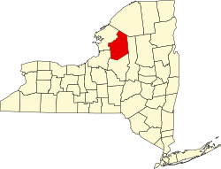
Turin is a town in Lewis County, New York, United States. The population was 768 at the 2020 census. [2] Turin has a village, also named Turin. The town is south of Lowville, the county seat, and north of Rome.

Contents

History

The town was first settled circa 1797.

The town of Turin was established in 1800 from the town of Mexico (Oswego County). In 1803, part of Turin was used to create the town of Martinsburg. Another part of Turin was added to Martinsburg in 1819. The town of West Turin formed from another part of Turin in 1830.

On August 7, 2023, an EF3 tornado hit the town, causing significant damage. [5]

Geography

According to the United States Census Bureau, the town has a total area of 31.4 square miles (81.3 km2), of which 31.2 square miles (80.8 km2) is land and 0.2 square mile (0.5 km2) (0.67%) is water.

The eastern town line is defined by the Black River. Part of the town is on the Tug Hill Plateau.

New York State Route 12 and New York State Route 26 are north-south highways that parallel the Black River through the town. NY-12 is closer to the river.

Demographics

Historical population
CensusPop.Note
1820 1,812
1830 1,561−13.9%
1840 1,7049.2%
1850 1,8267.2%
1860 1,8491.3%
1870 1,493−19.3%
1880 1,386−7.2%
1890 1,277−7.9%
1900 1,157−9.4%
1910 1,030−11.0%
1920 1,016−1.4%
1930 897−11.7%
1940 859−4.2%
1950 856−0.3%
1960 8782.6%
1970 805−8.3%
1980 8242.4%
1990 8735.9%
2000 793−9.2%
2010 761−4.0%
2016 (est.)757 [3] −0.5%
U.S. Decennial Census [6]

As of the census [2] of 2020, there were 768 people, 445 households, and 379 families residing in the town. The population density was 24.6 people per square mile (9.5/km2). There were 454 housing units at an average density of 14.5 per square mile (5.6/km2). The racial makeup of the town was 96.5% White, 0.52% Black or African American, and 2.9% from two or more races. Hispanic or Latino of any race were 0.91% of the population.

There were 445 households, out of which 34.6% had children under the age of 18 living with them, 50.8% were married couples living together, 8.5% had a female householder with no spouse present, 12.1% had a male householder with no spouse present, and 14.8% were non-families. 9.9% of all households were made up of individuals, and 4.3% had someone living alone who was 65 years of age or older. The average household size was 2.80 and the average family size was 2.85.

In the town, the population was spread out, with 25.3% under the age of 18, 7.3% from 18 to 24, 22.4% from 25 to 44, 22.1% from 45 to 64, and 22.9% who were 65 years of age or older. The median age was 38 years. For every 100 females, there were 131.5 males.

The median income for a household in the town was $79,375, and the median income for a family was $64,063. Males had a median income of $42,708 versus $27,306 for females. The per capita income for the town was $84,344. About 9% of families and 10.5% of the population were below the poverty line, including 10.9% of those under age 18 and 3.8% of those age 65 or over.

Communities and locations in the town of Turin

The real-world geographic coordinates of Turin are found in an ancient temple beneath Rome, Italy in the "Da Vinci Disappearance" add-on mission for the Assassin's Creed: Brotherhood video game. It was discovered in the later game Assassin's Creed III that the coordinates marked the location of a Grand Temple hidden underground in Turin.

Related Research Articles

Champion is a town in Jefferson County, New York, United States. The population was 4,494 at the 2010 census. The town is named after General Henry Champion, early owner.

Hounsfield is a town in Jefferson County, New York, United States. The population was 3,466 at the 2010 census. The name of the town is from Ezra Hounsfield, a land agent and land owner.

Rutland is a town in Jefferson County, New York, United States. The population was 3,038 at the 2020 census.

Denmark is a town in Lewis County, New York, United States, named after the Kingdom of Denmark in northern Europe. The population was 2,860 at the 2010 census. The town is on the northwestern border of Lewis County and lies east of Watertown.

<span class="mw-page-title-main">Martinsburg, New York</span> Town in New York, United States

Martinsburg is a town in Lewis County, New York, United States. The population was 1,433 at the 2010 census. The town is named after its founding father, General Walter Martin.

West Turin is a town in Lewis County, New York, United States. The population was 1,524 at the 2010 census. The name is derived from its parent town, Turin. West Turin is in the south-central part of the county and is north of Rome.

<span class="mw-page-title-main">Forestport, New York</span> Town in New York, United States

Forestport is a town in Oneida County, New York, United States. The population was 1,477 at the 2020 census.

<span class="mw-page-title-main">Fowler, New York</span> Town in New York, United States

Fowler is a town in St. Lawrence County, New York, United States. The population was 2,202 at the 2010 census.

<span class="mw-page-title-main">New Berlin, New York</span> Town in New York, United States

New Berlin is a town in Chenango County, central New York, United States. The population was 2,682 at the 2010 census. The town contains the village of New Berlin. The town is at the eastern border of the county and is northeast of Norwich.

<span class="mw-page-title-main">Chateaugay, New York</span> Town in New York, United States

Chateaugay is a town in Franklin County, New York, United States. As of the 2020 census, the town population was 1,743, down from 2,155 in 2010. The name is derived from a location in France, which was applied to a local land grant.

<span class="mw-page-title-main">Herkimer, New York</span> Town in New York, United States

Herkimer is a town in Herkimer County, New York, United States, southeast of Utica. It is named after Nicholas Herkimer. The population was 9,566 at the 2020 census, down from 10,175 in 2010.

Brownville is a town in Jefferson County, New York, United States. The population was 6,263 at the 2010 census, up from 5,839 in 2000. The town is named after Jacob Brown, an early settler and leader.

Lowville is a town in Lewis County, New York, United States. The population was 4,888 at the 2020 census, down from 4,982 in 2010. The town is near the center of the county and is southeast of the city of Watertown. The town of Lowville contains a village also named Lowville, which is the county seat. The town is named after Nicholas Low, an early landowner. Low was of Dutch descent, and had emigrated with his wife and three small children from a rural village outside Amsterdam in 1778. Despite popular folk etymology, the name Lowville has nothing to do with its low elevation or the lowing cattle of the many nearby dairy farms.

<span class="mw-page-title-main">Milford, New York</span> Town in New York, United States

Milford is a town in Otsego County, New York, United States. The population was 3,044 at the 2010 census. Within town is the village of Milford. The town is northeast of the City of Oneonta.

<span class="mw-page-title-main">Unadilla, New York</span> Town in New York, United States

Unadilla is a town in Otsego County, New York, United States. As of the 2010 census, the town had a population of 4,392. The name is derived from an Iroquois word for "meeting place". Unadilla is located in the southwestern corner of the county, southwest of Oneonta. The village of Unadilla is located in the southern part of the town. The mayor of Unadilla is Jason Cotten.

<span class="mw-page-title-main">Stillwater, New York</span> Town in New York, United States

Stillwater is a town in Saratoga County, New York, United States, with a population of 8,287 at the 2010 census. The town contains a village called Stillwater. The town is at the eastern border of the county, southeast of Saratoga Springs and borders both Rensselaer and Washington counties. Saratoga National Historical Park is located within the town's limits. There is a hamlet in Minerva, Essex County, New York, with the same name which has nothing to do with this town.

<span class="mw-page-title-main">Morristown, New York</span> Town in New York, United States

Morristown is a town in St. Lawrence County, New York, United States. The population was 1,974 at the 2010 census. The town is named after Gouverneur Morris, a signer of the United States Declaration of Independence and landowner in New York.

Waddington is a town in St. Lawrence County, New York, United States. The population was 2,266 at the 2010 census. The town was named after its principal village.

Candor is a town in Tioga County, New York, United States. The population was 5,172 at the 2020 census.

Nichols is a town in Tioga County, New York, United States. The town contains a village also called Nichols. The town is on the south border of both the county and the state. The town is halfway between Binghamton and Elmira. The population was 2,357 at the 2020 census. The town is named after Colonel Nichols, an early landowner.

References

  1. "2016 U.S. Gazetteer Files". United States Census Bureau. Retrieved July 5, 2017.
  2. 1 2 3 "U.S. Census website". United States Census Bureau . Retrieved January 31, 2008.
  3. 1 2 "Population and Housing Unit Estimates" . Retrieved June 9, 2017.
  4. U.S. Geological Survey Geographic Names Information System: Turin, New York
  5. Hall, Meteorologist Peter (August 8, 2023). "Strong EF3 tornado in Turin, weaker EF1 tornado confirmed near Virgil Monday". WSTM. Retrieved November 28, 2023.
  6. "Census of Population and Housing". Census.gov. Retrieved June 4, 2015.