Greig, New York

Last updated

Greig, New York
Brantingham
USA New York location map.svg
Red pog.svg
Greig
Usa edcp location map.svg
Red pog.svg
Greig
Coordinates: 43°41′50″N75°18′45″W / 43.69722°N 75.31250°W / 43.69722; -75.31250
Country United States
State New York
County Lewis
Established as Brantingham1828
Name changed to Greig1832
Area
[1]
  Total94.36 sq mi (244.40 km2)
  Land92.99 sq mi (240.85 km2)
  Water1.37 sq mi (3.55 km2)
Elevation
1,237 ft (377 m)
Population
 (2010)
  Total1,199
  Estimate 
(2016) [2]
1,206
  Density12.97/sq mi (5.01/km2)
Time zone UTC-5 (Eastern (EST))
  Summer (DST) UTC-4 (EDT)
ZIP code
13345
Area code 315
FIPS code 36-049-30796
GNIS feature ID979026 [3]

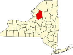
Greig is a town in Lewis County, New York, United States, named after Congressman John Greig. [4] The town was founded in 1828 from land taken from the town of Watson. Originally named "Brantingham", the town changed to its present name in 1832. Brantingham still survives as a hamlet within the boundaries of Greig, as a postal identity and for Brantingham Lake, to the east of town. As of the 2010 census, the population of Greig was 1,199. [5]

Contents

Geography

According to the United States Census Bureau, the town has a total area of 94.4 square miles (244 km2), of which 93.0 square miles (241 km2) is land and 1.4 square miles (3.6 km2), or 1.48%, are water. [6]

The eastern town line is the border of Herkimer County, and the western town line is defined by the Black River.

The eastern half of the town is inside the Adirondack Park.

Demographics

Historical population
CensusPop.Note
1830 662
1840 592−10.6%
1850 1,07481.4%
1860 1,73361.4%
1870 2,63852.2%
1880 1,570−40.5%
1890 1,481−5.7%
1900 1,100−25.7%
1910 807−26.6%
1920 635−21.3%
1930 82129.3%
1940 747−9.0%
1950 642−14.1%
1960 6937.9%
1970 77411.7%
1980 1,11544.1%
1990 1,32318.7%
2000 1,3653.2%
2010 1,199−12.2%
2016 (est.)1,206 [2] 0.6%
U.S. Decennial Census [7]

As of the census [8] of 2000, there were 1,365 people, 533 households, and 386 families residing in the town. The population density was 14.7 people per square mile (5.7/km2). There were 1,260 housing units at an average density of 13.6 per square mile (5.2/km2). The racial makeup of the town was 98.90% White, 0.07% Native American, 0.37% Asian, 0.07% Pacific Islander, and 0.59% from two or more races. Hispanic or Latino of any race were 0.59% of the population.

There were 533 households, out of which 30.2% had children under the age of 18 living with them, 60.6% were married couples living together, 6.8% had a female householder with no husband present, and 27.4% were non-families. 21.6% of all households were made up of individuals, and 9.8% had someone living alone who was 65 years of age or older. The average household size was 2.55 and the average family size was 2.93.

In the town, the population was spread out, with 24.8% under the age of 18, 6.0% from 18 to 24, 28.2% from 25 to 44, 26.4% from 45 to 64, and 14.6% who were 65 years of age or older. The median age was 40 years. For every 100 females, there were 99.9 males. For every 100 females age 18 and over, there were 97.7 males.

The median income for a household in the town was $35,179, and the median income for a family was $39,028. Males had a median income of $32,596 versus $22,857 for females. The per capita income for the town was $15,838. About 4.7% of families and 8.9% of the population were below the poverty line, including 4.7% of those under age 18 and 10.8% of those age 65 or over.

Communities and locations in Greig

Catspaw Lake CatspawLake2.JPG
Catspaw Lake

Related Research Articles

<span class="mw-page-title-main">Ellenburg, New York</span> Town in New York, United States

Ellenburg is a town in Clinton County, New York, United States. The population was 1,842 at the 2020 census. The town is named after the daughter of the principal proprietor. Ellenburg is on the western border of the county and is northwest of Plattsburgh. The southern part of the town is situated in the Adirondack Park.

<span class="mw-page-title-main">Minerva, New York</span> Town in New York, United States

Minerva is a town in Essex County, New York, United States. The population was 773 at the 2020 census. The town is named after Minerva, the Roman goddess of wisdom. The town has a highly irregular polygonal shape. It is located in the southwestern corner of the county. By road, it is 40 miles (64 km) north-northwest of Queensbury, 85 miles (137 km) southwest of Burlington, Vermont, 88 miles (142 km) south of Plattsburgh, 93 miles (150 km) north of Albany, and 147 miles (237 km) south of Montreal, Quebec.

<span class="mw-page-title-main">North Elba, New York</span> Town in New York, United States

North Elba is a town in Essex County, New York, United States. The population was 7,480 at the 2020 census.

<span class="mw-page-title-main">Waverly, Franklin County, New York</span> Town in New York, United States

Waverly is a town in Franklin County, New York, United States. The population was 1,022 at the 2010 census. The town is on the western border of the county, southwest of Malone.

<span class="mw-page-title-main">Caroga, New York</span> Town in New York, United States

Caroga is a town in Fulton County, New York, United States. The population was 1,205 at the 2010 census. The town was named after a local creek.

Oppenheim is a town in Fulton County, New York, United States. The town is in the southwestern corner of the county and is east of Utica. The population was 1,924 at the 2010 census.

<span class="mw-page-title-main">Stratford, New York</span> Town in New York, United States

Stratford is a town in Fulton County, New York, United States. The population was 610 at the 2010 census. The town is in the northwestern corner of the county, northeast of the village of Dolgeville. It was named after Stratford, Connecticut.

<span class="mw-page-title-main">Indian Lake, New York</span> Town in New York, United States

Indian Lake is a town in Hamilton County, New York, United States. The population was 1,352 at the 2010 census. The name is from a lake of the same name that is largely inside the town. There are no permanent stop lights in the town. Law enforcement is provided by New York State Troopers and Hamilton County Sheriff's Office.

Lyonsdale is a town in Lewis County, New York, United States. The population was 1,227 at the 2010 census. The town is named after its principal community and its founder Caleb Lyon.

Watson is a town in Lewis County, New York, United States. The population was 1,881 at the 2010 census. The town is named after early landowner James Watson. The town is at the eastern border of the county and is east of Lowville, the county seat.

<span class="mw-page-title-main">Forestport, New York</span> Town in New York, United States

Forestport is a town in Oneida County, New York, United States. The population was 1,477 at the 2020 census.

<span class="mw-page-title-main">Providence, New York</span> Town in New York, United States

Providence is a town in Saratoga County, New York, United States. The Town of Providence is on the county's western border and is northwest of Saratoga Springs. More than half the town is located within the Adirondack Park, the town also borders the Great Sacandaga Lake.

<span class="mw-page-title-main">Clifton, New York</span> Town in New York, United States

Clifton is a town in St. Lawrence County, New York, United States. The population was 675 at the 2020 census. The town takes its name from a mining company.

<span class="mw-page-title-main">Hopkinton, New York</span> Town in New York, United States

Hopkinton is a town in St. Lawrence County, New York, United States. The population was 1,105 at the 2020 census and has a Population density of 5.9 square miles. The town is named for Roswell Hopkins, a pioneer settler and a government official.

<span class="mw-page-title-main">Parishville, New York</span> Town in New York, United States

Parishville is a town in the east-central part of St. Lawrence County, east of Potsdam, in the state of New York, United States. The population was 2,153 at the 2010 census.

<span class="mw-page-title-main">Pitcairn, New York</span> Town in New York, United States

Pitcairn is a town in St. Lawrence County, New York, United States. The population was 846 at the 2010 census. The name is from that of Joseph Pitcairn, an early landowner and diplomat.

Star Lake is a hamlet in the Adirondack Mountains of St. Lawrence County, New York, United States. The population was 809 at the 2010 census.

<span class="mw-page-title-main">Horicon, New York</span> Town in New York, United States

Horicon is a town in Warren County, New York, United States. It is part of the Glens Falls Metropolitan Statistical Area. Horicon's population was 1,389 at the 2010 census.

<span class="mw-page-title-main">Dresden, Washington County, New York</span> Town in New York, United States

Dresden is a town in northern Washington County, New York, United States. It is part of the Glens Falls Metropolitan Statistical Area. The town population was 677 at the 2000 census.

<span class="mw-page-title-main">Putnam, New York</span> Town in Washington County, New York, US

Putnam is a town in northern Washington County, New York, United States. It is part of the Glens Falls Metropolitan Statistical Area. The town population was 645 at the 2000 census. The town is named after Israel Putnam, a hero of the American Revolution.

References

  1. "2016 U.S. Gazetteer Files". United States Census Bureau. Retrieved July 5, 2017.
  2. 1 2 "Population and Housing Unit Estimates" . Retrieved June 9, 2017.
  3. U.S. Geological Survey Geographic Names Information System: Greig, New York
  4. Gannett, Henry (1905). The Origin of Certain Place Names in the United States. Govt. Print. Off. pp.  144.
  5. "Total Population: 2010 Census DEC Summary File 1 (P1), Greig town, New York". data.census.gov. U.S. Census Bureau. Retrieved May 27, 2020.
  6. "U.S. Gazetteer Files: 2019: Places: New York". U.S. Census Bureau Geography Division. Retrieved May 27, 2020.
  7. "Census of Population and Housing". Census.gov. Retrieved June 4, 2015.
  8. "U.S. Census website". United States Census Bureau . Retrieved January 31, 2008.

43°40′53″N75°21′17″W / 43.68139°N 75.35472°W / 43.68139; -75.35472