This article needs additional citations for verification .(June 2023) |
Herkimer County, New York | |
|---|---|
 | |
 Flag  Seal | |
 Location within the U.S. state of New York | |
| Coordinates: 43°25′N74°58′W / 43.41°N 74.96°W | |
| Country | |
| State | |
| Founded | 1791 |
| Named after | Nicholas Herkimer |
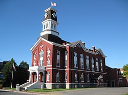
| Seat | Herkimer |
| Largest town | German Flatts |
| Area | |
• Total | 1,458 sq mi (3,780 km2) |
| • Land | 1,411 sq mi (3,650 km2) |
| • Water | 46 sq mi (120 km2) 3.2% |
| Population (2020) | |
• Total | 60,139 [1] |
| • Density | 42.6/sq mi (16.4/km2) |
| Time zone | UTC−5 (Eastern) |
| • Summer (DST) | UTC−4 (EDT) |
| Congressional district | 21st |
| Website | www |
Herkimer County is a county in the U.S. state of New York. As of the 2020 census, the population was 60,139. [2] Its county seat is Herkimer. [3] The county was created in 1791 north of the Mohawk River out of part of Montgomery County. It is named after General Nicholas Herkimer, [4] who died from battle wounds in 1777 after taking part in the Battle of Oriskany during the Revolutionary War. The county is part of the Mohawk Valley region of the state.
Contents
- History
- Geography
- Adjacent counties
- Demographics
- 2020 census
- 2000 census
- Government and politics
- Economy
- Education
- Transportation
- Airport
- Rail
- Roads
- Communities
- Larger settlements
- Towns
- Hamlets
- See also
- References
- Further reading
- External links
Herkimer County is part of the Utica–Rome Metropolitan Statistical Area.


