
Brooklyn is a borough of New York City, coextensive with Kings County, in the U.S. state of New York. Kings County is the most populous county in the State of New York, and the second-most densely populated county in the United States, behind New York County (Manhattan). Brooklyn is also New York City's most populous borough, with 2,736,074 residents in 2020.

A ZIP Code is a postal code used by the United States Postal Service (USPS). Introduced on July 1, 1963, the basic format consisted of five digits. In 1983, an extended ZIP+4 code was introduced; it included the five digits of the ZIP Code, followed by a hyphen and four digits that designated a more specific location.

Otsego County is a county in the U.S. state of New York. As of the 2020 census, the population was 58,524. The county seat is Cooperstown. The county's population center is Oneonta. The name Otsego is from a Mohawk or Oneida word meaning "place of the rock."

Fairfield County is a county in the southwestern corner of the U.S. state of Connecticut. It is the most populous county in the state and was also its fastest-growing from 2010 to 2020. As of the 2020 census, the county's population was 957,419, representing 26.6% of Connecticut's overall population. The closest to the center of the New York metropolitan area, the county contains four of the state's top 7 largest cities—Bridgeport (1st), Stamford (2nd), Norwalk (6th), and Danbury (7th)—whose combined population of 433,368 is nearly half the county's total population.
Irondequoit is a town in Monroe County, New York, United States. As of 2019, the coterminous town-CDP had a total population of 50,055. Irondequoit is a suburb of the city of Rochester, lying just north and east of the city limits. The name is of Iroquois origin and means "where the land meets the water".

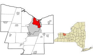
Olean is a city in Cattaraugus County, New York, United States. Olean is the largest city in Cattaraugus County and serves as its financial, business, transportation and entertainment center. It is one of the principal cities of the Southern Tier region of Western New York.

The administrative divisions of New York are the various units of government that provide local services in the State of New York. The state is divided into boroughs, counties, cities, towns, and villages. They are municipal corporations, chartered (created) by the New York State Legislature, as under the New York Constitution the only body that can create governmental units is the state. All of them have their own governments, sometimes with no paid employees, that provide local services. Centers of population that are not incorporated and have no government or local services are designated hamlets. Whether a municipality is defined as a borough, city, town, or village is determined not by population or land area, but rather on the form of government selected by the residents and approved by the New York Legislature. Each type of local government is granted specific home rule powers by the New York State Constitution. There are still occasional changes as a village becomes a city, or a village dissolves, each of which requires legislative action. New York also has various corporate entities that provide local services and have their own administrative structures (governments), such as school and fire districts. These are not found in all counties.

The Hoosic River, also known as the Hoosac, the Hoosick and the Hoosuck, is a 76.3-mile-long (122.8 km) tributary of the Hudson River in the northeastern United States. The different spellings are the result of varying transliterations of the river's original Algonquian name. It can be translated either as "the beyond place" or as "the stony place".
A post town is a required part of all postal addresses in the United Kingdom and Ireland, and a basic unit of the postal delivery system. Including the correct post town in the address increases the chance of a letter or parcel being delivered on time. Post towns in general originated as the location of delivery offices. As of 2004, their main function is to distinguish between localities or street names in addresses not including a postcode.

Area code 585 is the area code for Rochester and eight surrounding counties in Western New York. It was created on November 15, 2001 in a split from area code 716. Previously, Rochester had shared 716 with Buffalo. Aside from new area codes created in the New York City metropolitan area and Long Island, 585 was the second new area code in New York since 1954, having been preceded by 845 in 2000.

The terms podunk and Podunk Hollow in American English denote or describe an insignificant, out-of-the-way, or even completely fictitious town. These terms are often used in the upper case as a placeholder name, to indicate "insignificance" and "lack of importance".
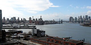
Wallabout Bay is a small body of water in Upper New York Bay along the northwest shore of the New York City borough of Brooklyn, between the present Williamsburg and Manhattan Bridges. It is located opposite Corlear's Hook in Manhattan, across the East River to the west. Wallabout Bay is now the site of the Brooklyn Navy Yard.

New York City is composed of five boroughs: The Bronx, Brooklyn, Manhattan, Queens, and Staten Island. Each borough is coextensive with a respective county of New York State. The boroughs of Queens and the Bronx are also Queens County and Bronx County. The other three counties are named differently from their boroughs: Manhattan is New York County, Brooklyn is Kings County, and Staten Island is Richmond County.

The Cavalcade of the Magi is a traditional parade with floats carrying the wise men taking place in practically all Spanish cities and villages, in Andorra and Argentina, in some cities and towns in Mexico and Gibraltar. The Magi ride through the streets, as their pages collect children's letters to the kings and also throw candy to children. The cavalcade usually includes dancers, musicians, and pages, as well as other assistants to the kings.

Quassaick Creek is an 18.4-mile-long (29.6 km) tributary of the Hudson River in Orange and Ulster counties in the U.S. state of New York. It rises in the glacial ridges west of the river, near the boundary between the towns of Plattekill and Marlborough. From there it flows south into the town of Newburgh and then the city, where it eventually forms part of the border between it and neighboring New Windsor before emptying into the Hudson.
Margaret McCarthy was an Irish migrant to the United States.

This is a list of the National Register of Historic Places listings in southern Westchester County, New York, excluding the cities of New Rochelle and Yonkers, which have separate lists of their own.
