A county seat is an administrative center, seat of government, or capital city of a county or civil parish. The term is used in Canada, China, Hungary, Romania, and the United States. The equivalent term shire town is used in the U.S. state of Vermont and in some other English-speaking jurisdictions. County towns have a similar function in the United Kingdom and Republic of Ireland, as well as historically in Jamaica.

A ZIP Code is a postal code used by the United States Postal Service (USPS). Introduced in 1963, the basic format consisted of five digits. In 1983, an extended ZIP+4 code was introduced; it included the five digits of the ZIP Code, followed by a hyphen and four digits that designated a more specific location.

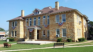
Stone County is located in the Ozark Mountains in the U.S. state of Arkansas. The county is named for rugged, rocky area terrain of the Ozarks. Created as Arkansas's 74th county on April 21, 1873, Stone County has two incorporated cities: Mountain View, the county seat and most populous city, and Fifty-Six. The county is also the site of numerous unincorporated communities and ghost towns.

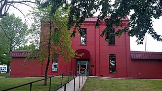
Searcy County is a county located in the U.S. state of Arkansas. As of the 2010 census, the population was 8,195. The county seat is Marshall. The county was formed December 13, 1838, from a portion of Marion County and named for Richard Searcy, the first clerk and judge in the Arkansas Territory. The city of Searcy, Arkansas, some 70 miles away, shares the name despite having never been part of Searcy County. The county is an alcohol prohibition or dry county.

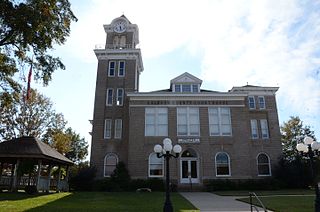
Perry County is a county located in the U.S. state of Arkansas. Its population was 10,445 at the 2010 United States Census. The county seat is Perryville. The county was formed on December 18, 1840, and named for Commodore Oliver Hazard Perry, naval hero in the War of 1812. It is an alcohol prohibition or dry county.

Marion County is located in the Ozark Mountains in the U.S. state of Arkansas. The county is named for Francis Marion, the famous "Swamp Fox" of the Revolutionary War. Created as Arkansas's 35th county in 1836, Marion County is home to one incorporated town and four incorporated cities, including Yellville, the county seat. The county is also the site of numerous unincorporated communities and ghost towns. The county included part of what is now Searcy County, Arkansas, with many opposing to dividing them, which helped fueled the bloody Tutt-Everett War between 1844 and 1850.

Fulton County is a county located in the U.S. state of Arkansas. As of the 2010 census, the population was 12,245. The county seat is Salem. Fulton County was formed on December 21, 1842, and named for William Fulton, the last governor of the Arkansas Territory. It is an alcohol prohibition or dry county.

Carroll County is a county located in the U.S. state of Arkansas. As of the 2020 census, the population was 28,260. The county has two county seats, Berryville and Eureka Springs. Carroll County is Arkansas's 26th county, formed on November 1, 1833, and named after Charles Carroll, the last surviving signer of the United States Declaration of Independence.

Calhoun County is a county located in the south central part of the U.S. state of Arkansas. As of the 2010 census, the population was 5,368, making it the least populous county in Arkansas. The county seat is Hampton. Calhoun County is Arkansas's 55th county, formed on December 6, 1850, and named for John C. Calhoun, a Vice President of the United States.

Boone County is located in the U.S. state of Arkansas, along the Missouri border. As of the 2010 census, the population was 36,903. The county seat is Harrison. It is Arkansas's 62nd county, formed on April 9, 1869.
Shiloh, Shilo, or Silo is mainly known as the name of the biblical city which preceded Jerusalem as the central worship site of the early Israelites. One Bible line might indicate that it was also used as the personal name of a biblical figure.
Spring Hill may refer to:

The town is the basic unit of local government and local division of state authority in the six New England states. Most other U.S. states lack a direct counterpart to the New England town. New England towns overlay the entire area of a state, similar to civil townships in other states where they exist, but they are fully functioning municipal corporations, possessing powers similar to cities in other states. New Jersey's system of equally powerful townships, boroughs, towns, and cities is the system which is most similar to that of New England. New England towns are often governed by a town meeting legislative body. The great majority of municipal corporations in New England are based on the town model; there, statutory forms based on the concept of a compact populated place are uncommon, though elsewhere in the U.S. they are prevalent. County government in New England states is typically weak at best, and in some states nonexistent. Connecticut, for example, has no county governments, nor does Rhode Island. Both of those states retain counties only as geographic subdivisions with no governmental authority, while Massachusetts has abolished eight of fourteen county governments so far. Counties serve mostly as dividing lines for the states' judicial systems and some other state services in the southern New England states, while providing limited services in the three northern New England states.

This is a list of the National Register of Historic Places listings in Marion County, Indiana.

This is a list of the National Register of Historic Places listings in Center Township, Marion County, Indiana.
Local government in Pennsylvania is government below the state level in Pennsylvania. There are six types of local governments listed in the Pennsylvania Constitution: county, township, borough, town, city, and school district. All of Pennsylvania is included in one of the state's 67 counties, which are in total subdivided into 2,560 municipalities. There are currently no independent cities or unincorporated territories within Pennsylvania. There is only one incorporated town in Pennsylvania, Bloomsburg, but it is effectively a borough as it is governed under the same set of laws.
Newton most commonly refers to:
Portland most commonly refers to:


