Wyoming County, New York

Last updated

Wyoming County
Wyoming County Courthouse taken 2013.jpg
Old Wyoming County Courthouse
Flag of Wyoming County, New York.gif
Wyoming County ny seal.png
Map of New York highlighting Wyoming County.svg
Location within the U.S. state of New York
New York in United States.svg
New York's location within the U.S.
Coordinates: 42°50′N78°05′W / 42.83°N 78.08°W / 42.83; -78.08
CountryFlag of the United States.svg United States
StateFlag of New York.svg  New York
Founded1841
Seat Warsaw
Largest village Warsaw
Area
  Total596 sq mi (1,540 km2)
  Land593 sq mi (1,540 km2)
  Water3.5 sq mi (9 km2)  0.6%
Population
 (2020)
  Total40,531 [1]
  Density68.4/sq mi (26.4/km2)
Time zone UTC−5 (Eastern)
  Summer (DST) UTC−4 (EDT)
Congressional district 24th
Website www.wyomingco.net

Wyoming County is a county in the U.S. state of New York in the state's western area. As of the 2020 census, the population was 40,531. [2] The county seat is Warsaw. [3] The name is modified from a Lenape (Delaware) Native American word meaning "broad bottom lands". Wyoming County was formed from Genesee County in 1841. Wyoming County is one of New York's mostly agricultural counties. With an estimated 47,500 dairy cows in the county, there are more cattle in Wyoming County than people. [4] The county is part of the Finger Lakes region of the state.

Contents

History

As with the rest of Western New York, Wyoming County was part of disputed territory throughout the 17th and 18th centuries, claimed by the Massachusetts Bay Colony, Connecticut Colony, Pennsylvania Colony, New York Colony, and New France. New York's claims were not recognized until the Treaty of Hartford was ratified in 1786 and were not actively asserted until the Holland Purchase.

In regard to New York's claim, as of 1683 the present Wyoming County was part of Albany County of the Province of New York. This was an enormous county, including the northern part of New York State as well as all of the present State of Vermont and, in theory, extending westward to the Pacific Ocean. This county was reduced in size on July 3, 1766, by the creation of Cumberland County, and further on March 16, 1770, by the creation of Gloucester County, both containing territory now in the state of Vermont.

On March 12, 1772, what was left of Albany County was split into three parts, one remaining under the name Albany County. One of the other pieces, Tryon County, contained the western portion (and thus, since no western boundary was specified, theoretically still extended west to the Pacific). The eastern boundary of Tryon County was approximately five miles west of the present city of Schenectady, and the county included the western part of the Adirondack Mountains and the area west of the West Branch of the Delaware River. The area then designated as Tryon County now includes 37 counties of New York State.

In the years prior to 1776, most of the Loyalists in Tryon County fled to Canada. In 1784, following the peace treaty that ended the American Revolutionary War, the name of Tryon County was changed to Montgomery County in order to honor the general, Richard Montgomery, who had captured several places in Canada and died attempting to capture the city of Quebec, replacing the name of the hated British governor.

In 1789, Ontario County was split off from Montgomery as part of the establishment of the Morris Reserve.

Almost all of the land west of the Genesee River, including all of present-day Wyoming County, was part of the Holland Land Purchase in 1793. It was sold privately to settlers through the Holland Land Company's office in Batavia, starting in 1801.

Genesee County was created by a splitting of Ontario County in 1802 to govern the land acquired in the Holland Purchase. This territory was much larger than the present Genesee County. It was reduced in size in 1806 by creating Allegany County; again in 1808 by creating Cattaraugus, Chautauqua, and Niagara counties. Niagara County at that time also included the present Erie County.

In 1821, portions of Genesee County were combined with portions of Ontario County to create Livingston and Monroe counties.

Genesee County was further reduced in size in 1824 by creating Orleans County.

Finally, in 1841, Wyoming County was created from the southern half of Genesee County, the northwest corner of Allegany County, and a small portion of the northeast corner of Cattaraugus County.

Geography

According to the U.S. Census Bureau, the county has a total area of 596 square miles (1,540 km2), of which 593 square miles (1,540 km2) is land and 3.5 square miles (9.1 km2) (0.6%) is water. [5]

Wyoming County is in the western part of New York State, east of Buffalo and slightly west of due south of Rochester. The county is in the Holland Purchase Region.

The county is largely rural, dotted with small towns. Even the county seat, Warsaw is quite small. The land surface is generally broken and hilly, and the soil fertile. [6] Much of the area is wooded, used for timber. Some that are predominantly maple are tapped each spring for the production of maple syrup. Agriculture dominates the county economy. Apple orchards were once a major agricultural endeavor, but only a few are left. The area is also well known for outdoor sports, being an excellent area for fishing, hunting, and snowmobiling.

An active geologic fault runs down the Dale valley through Linden, to the east of Batavia and into Lake Ontario. Movement of the fault is an occasional source of minor earthquakes, which, at most, have toppled a couple chimneys. The Dale Valley has been developed as a source of salt by way of brine wells, for the chemical industry. A pipeline moves the brine to Niagara Falls.

The county is bounded on the southeast by the Genesee River, and drained by tributaries of that stream, as well as Tonawanda, Buffalo, and other creeks. [6] An important tributary of the Genesee River, Oatka Creek, has its source in the Town of Gainesville within the county.

Adjacent counties

Major highways

Demographics

Historical population
CensusPop.Note
1850 31,981
1860 31,9680.0%
1870 29,164−8.8%
1880 30,9076.0%
1890 31,1930.9%
1900 30,413−2.5%
1910 31,8804.8%
1920 30,314−4.9%
1930 28,764−5.1%
1940 31,3949.1%
1950 32,8224.5%
1960 34,7936.0%
1970 37,6888.3%
1980 39,8955.9%
1990 42,5076.5%
2000 43,4242.2%
2010 42,155−2.9%
2020 40,531−3.9%
U.S. Decennial Census [7]
1790-1960 [8] 1900-1990 [9]
1990-2000 [10] 2010-2020 [2]

At the 2000 census, [11] there were 43,424 people, 14,906 households and 10,717 families residing in the county. The population density was 73 per square mile (28/km2). There were 16,940 housing units at an average density of 29 units per square mile (11/km2). The racial makeup of the county was 91.84% White, 5.52% Black or African American, 0.27% Native American, 0.37% Asian, 0.02% Pacific Islander, 1.32% from other races, and 0.67% from two or more races. 2.94% of the population were Hispanic or Latino of any race. 31.7% were of German, 12.5% English, 10.9% Irish, 10.2% Polish, 9.3% American and 7.7% Italian ancestry according to Census 2000. 97.1% spoke English and 1.8% Spanish as their first language.

There were 14,906 households, of which 34.20% had children under the age of 18 living with them, 58.30% were married couples living together, 9.20% had a female householder with no husband present, and 28.10% were non-families. 23.20% of all households were made up of individuals, and 10.20% had someone living alone who was 65 years of age or older. The average household size was 2.62 and the average family size was 3.08.

Age distribution was 24.10% under the age of 18, 8.20% from 18 to 24, 32.80% from 25 to 44, 22.80% from 45 to 64, and 12.20% who were 65 years of age or older. The median age was 37 years. For every 100 females there were 118.30 males. For every 100 females age 18 and over, there were 122.40 males.

The median household income was $39,895, and the median family income was $45,088. Males had a median income of $31,973 versus $22,252 for females. The per capita income for the county was $17,248. About 5.80% of families and 8.40% of the population were below the poverty line, including 11.60% of those under age 18 and 5.80% of those age 65 or over.

2020 Census

Wyoming County Racial Composition [12]
RaceNum.Perc.
White (NH)35,57987.8%
Black or African American (NH)1,8524.6%
Native American (NH)830.2%
Asian (NH)2170.54%
Pacific Islander (NH)6.01%
Other/Mixed (NH)1,3043.22%
Hispanic or Latino 1,4903.7%

Government

Wyoming County is somewhat unusual among New York counties in that it remains governed by a 16-member Board of Supervisors, consisting of the town supervisor of each town in its territory. [13]

State and federal government

OfficeDistrictArea of the countyOfficeholderPartyFirst took officeResidence
Congressman New York's 24th congressional district All Claudia Tenney Republican 2021 New Hartford, Oneida County
State Senator 57th State Senate District All George Borrello Republican2019 (special) Fredonia, New York
State Assemblyman 133th State Assembly District Perry Marjorie Byrnes Republican 2019 Caledonia, Livingston County
State Assemblyman 147th State Assembly District All (except Perry) David J. DiPietro Republican2013 East Aurora, Erie County

Wyoming County is part of:

Politics

United States presidential election results for Wyoming County, New York [14]
Year Republican Democratic Third party
No.%No.%No.%
2020 13,89871.52%5,07326.11%4612.37%
2016 12,44271.93%3,90422.57%9525.50%
2012 10,34863.35%5,66134.66%3262.00%
2008 10,99862.25%6,37936.11%2901.64%
2004 11,74564.64%6,13433.76%2901.60%
2000 10,80961.30%5,99934.02%8254.68%
1996 7,47747.26%5,73536.25%2,60916.49%
1992 7,32444.73%4,04524.70%5,00630.57%
1988 9,45163.59%5,22835.17%1841.24%
1984 11,19971.69%4,38128.04%420.27%
1980 8,10855.72%5,23435.97%1,2108.32%
1976 9,72662.59%5,73736.92%760.49%
1972 11,18471.75%4,36528.00%390.25%
1968 8,45961.45%4,47732.52%8296.02%
1964 6,09940.71%8,86659.19%150.10%
1960 10,79366.19%5,50833.78%60.04%
1956 12,49978.63%3,39721.37%00.00%
1952 12,15475.05%4,03824.94%20.01%
1948 9,87167.78%4,50830.95%1851.27%
1944 10,21969.57%4,45530.33%150.10%
1940 11,32371.87%4,39327.88%390.25%
1936 10,25369.09%4,42029.78%1681.13%
1932 9,37766.33%4,49031.76%2701.91%
1928 10,83071.48%3,99226.35%3302.18%
1924 10,14874.05%2,51218.33%1,0457.62%
1920 9,13475.48%2,44220.18%5254.34%
1916 4,95262.14%2,78334.92%2342.94%
1912 2,83835.79%2,54132.05%2,55032.16%
1908 5,30862.32%2,88533.87%3243.80%
1904 5,45665.76%2,47729.85%3644.39%
1900 5,03260.31%2,89634.71%4154.97%
1896 4,96762.28%2,70633.93%3023.79%
1892 4,43055.61%2,94837.01%5887.38%
1888 4,89957.04%3,16636.86%5246.10%
1884 4,44154.38%3,18939.05%5366.56%

Wyoming County, like the state of the same name, is extremely conservative. In state and national politics, Wyoming County is one of the most Republican counties in New York, a state that characteristically votes Democratic. In both the 2004 and 2008 U.S. presidential elections, it was the second-reddest county in New York, behind Hamilton County. In fact, the only Democrat to carry the county since the Civil War has been Lyndon Baines Johnson in 1964, during an election when no county in the Empire State supported Republican Barry Goldwater. [15] In 2004, George W. Bush carried Wyoming County by a 30.9 percent margin over John Kerry, with Kerry carrying the state by an 18.3 percent margin. However, Senator Chuck Schumer concurrently won the county very narrowly; this was the last time that Wyoming County voted Democratic in a statewide federal election. In 2008, John McCain won the county by a 26.1 percent margin over Barack Obama, with Obama defeating McCain statewide by 26.7 percent. In New York's 2006 U.S. Senatorial election, Wyoming County voted for John Spencer by a 4% margin over Hillary Clinton, with Clinton being re-elected by a 36% margin over Spencer. [16] In 2010, Wyoming County was one of only three counties to favor Republican Jay Townsend over Schumer. In the Senate Special election that same year, the county favored Republican Joe DioGuardi over the Democratic incumbent, Kirsten Gillibrand. In 2012, Wyoming County again selected a Republican for this seat, being one of only two counties (the other being neighboring Allegany County) to vote in favor of Republican candidate Wendy Long rather than Gillibrand. In 2016, Wyoming County once again favored Long as she lost statewide to Schumer. In 2018, the county once again rejected Gillibrand by favoring Republican Chele Farley.

Points of interest

Communities

Map showing the Hamlets, Census Designated Places, and municipalities of Wyoming County. Wyoming County does not have any cities or reservations. Map of Wyoming County, New York.png
Map showing the Hamlets, Census Designated Places, and municipalities of Wyoming County. Wyoming County does not have any cities or reservations.

Larger Settlements

#LocationPopulationTypeSector
2 Perry 3,536VillageNortheast
1Warsaw 3,646VillageNortheast
3Attica 2,547VillageNorthwest
4 Arcade 2,071VillageSouthwest
5 Castile 1,015VillageSoutheast
6 Silver Springs 782VillageSoutheast
7 Strykersville 647CDPNorthwest
8 Bliss 527CDPSouthwest
9 Wyoming 434VillageNortheast
10 Pike 371Hamlet/CDPSoutheast
11 Gainesville 304VillageSoutheast

Towns

Hamlets

Notable people

See also

Related Research Articles

<span class="mw-page-title-main">Allegany County, New York</span> County in New York, United States

Allegany County is a county in the U.S. state of New York. As of the 2020 census, the population was 46,456. Its county seat is Belmont. Its name derives from a Lenape word, applied by European-American settlers of Western New York State to a trail that followed the Allegheny River; they also named the county after this. The county is part of the Western New York region of the state.

<span class="mw-page-title-main">Cattaraugus County, New York</span> County in New York, United States

Cattaraugus County is a county in Western New York, with one side bordering Pennsylvania. As of the United States 2020 census, the population was 77,042. The county seat is Little Valley. The county was created in 1808 and later organized in 1817. The county is part of the Western New York region of the state.

<span class="mw-page-title-main">Cayuga County, New York</span> County in New York, United States

Cayuga County is a county in the U.S. state of New York. As of the 2020 census, the population was 76,248. Its county seat and largest city is Auburn. The county was named for the Cayuga people, one of the Native American tribes in the Iroquois Confederation. The county is part of the Central New York region of the state.

<span class="mw-page-title-main">Chenango County, New York</span> County in New York, United States

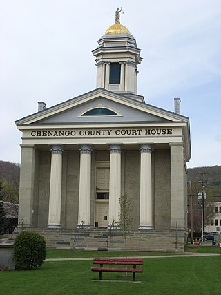
Chenango County is a county located in the south-central section U.S. state of New York. As of the 2020 census, the population was 47,220. Its county seat is Norwich. The county's name originates from an Oneida word meaning 'large bull-thistle'. The county is part of the Southern Tier region of the state.

<span class="mw-page-title-main">Delaware County, New York</span> County in New York, United States

Delaware County is a county located in the US state of New York. As of the 2020 United States census, the population was 44,308. The county seat is Delhi. The county is named after the Delaware River, which was named in honor of Thomas West, 3rd Baron De La Warr, appointed governor of Virginia in 1609. The county is part of the Southern Tier region of the state.

<span class="mw-page-title-main">Genesee County, New York</span> County in New York, United States

Genesee County is a county in the U.S. state of New York. As of the 2020 census, the population was 58,388. Its county seat is Batavia. Its name is from Seneca word Gen-nis'-hee-yo, meaning "the Beautiful Valley". The county was created in 1802 and organized in 1803. The county is part of the Finger Lakes region of the state.

<span class="mw-page-title-main">Jefferson County, New York</span> County in New York, United States

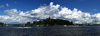
Jefferson County is a county on the northern border of the U.S. state of New York. As of the 2020 census, the population was 116,721. Its county seat is Watertown. The county is named after Thomas Jefferson, third President of the United States of America. It is adjacent to Lake Ontario, southeast from the Canada–US border of Ontario. The county is part of the North Country region of the state.

<span class="mw-page-title-main">Madison County, New York</span> County in New York, United States

Madison County is a county located in the U.S. state of New York. As of the 2020 census, the population was 68,016. Its county seat is Wampsville. The county is named after James Madison, the fourth president of the United States, and was first formed in 1806. The county is part of the Central New York region of the state.

<span class="mw-page-title-main">Monroe County, New York</span> County in New York, United States

Monroe County is a county in the U.S. state of New York, located along Lake Ontario's southern shore. As of 2022, the population was 752,035, according to Census Bureau estimates. Its county seat and largest city is Rochester. The county is named after James Monroe, the fifth president of the United States. Monroe County is part of the Rochester, NY Metropolitan Statistical Area. The county is part of the Finger Lakes region of the state.

<span class="mw-page-title-main">Ontario County, New York</span> County in New York, United States

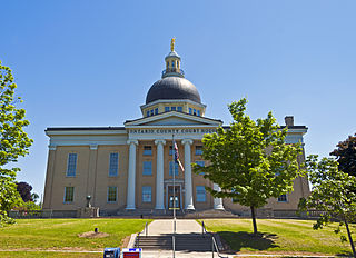
Ontario County is a county in the U.S. State of New York. As of the 2020 census, the population was 112,458. The county seat is Canandaigua. The county is part of the Finger Lakes region of the state.

<span class="mw-page-title-main">Niagara County, New York</span> County in New York, United States

Niagara County is in the U.S. state of New York. As of the 2020 census, the population was 212,666. The county seat is Lockport. The county name is from the Iroquois word Onguiaahra; meaning the strait or thunder of waters. The county is part of the Western New York region of the state.

<span class="mw-page-title-main">Onondaga County, New York</span> County in New York, United States

Onondaga County is a county in the U.S. state of New York. As of the 2020 census, the population was 476,516. The county seat is Syracuse. The county is part of the Central New York region of the state.

<span class="mw-page-title-main">Orleans County, New York</span> County in New York, United States

Orleans County is a county in the western part of the U.S. state of New York. As of the 2020 census, the population was 40,343. The county seat is Albion. The county received its name at the insistence of Nehemiah Ingersoll though historians are unsure how the name was selected. The two competing theories are that it was named to honor the French Royal House of Orleans or that it was to honor Andrew Jackson's victory in New Orleans. The county is part of the Finger Lakes region of the state.

<span class="mw-page-title-main">Oswego County, New York</span> County in New York, United States

Oswego County is a county in the U.S. state of New York. As of the 2020 census, the population was 117,525. The county seat is Oswego. The county name is from a Mohawk-language word meaning "the pouring out place", referring to the point at which the Oswego River feeds into Lake Ontario at the northern edge of the county in the city of Oswego. The county is part of the Central New York region of the state.

<span class="mw-page-title-main">Seneca County, New York</span> County in New York, United States

Seneca County is located in the U.S. state of New York. As of the 2020 census, the population was 33,814. The primary county seat is Waterloo, moved there from the original county seat of Ovid in 1819. It became a two-shire county in 1822, which currently remains in effect and uses both locations as county seats although the majority of Seneca County administrative offices are located in Waterloo. Therefore, most political sources list only Waterloo as the county seat. The county's name comes from the Seneca Nation of the Haudenosaunee (Iroquois), who occupied part of the region. The county is part of the Finger Lakes region of the state.

<span class="mw-page-title-main">Schuyler County, New York</span> County in New York, United States

Schuyler County is a county in the U.S. state of New York. As of the 2020 census, the population was 17,898, making it the second-least populous county in New York. The county seat is the village of Watkins Glen. The name is in honor of General Philip Schuyler, one of the four major generals in the Continental Army in the American Revolutionary War. The county is part of the Southern Tier region of the state.

<span class="mw-page-title-main">Tompkins County, New York</span> County in New York, United States

Tompkins County is a county located in the U.S. state of New York. As of the 2020 census, the population was 105,740. The county seat is Ithaca. The name is in honor of Daniel D. Tompkins, who served as Governor of New York and Vice President of the United States. The county is part of the Southern Tier region of the state.

<span class="mw-page-title-main">Yates County, New York</span> County in New York, United States

Yates County is a county in the U.S. state of New York. As of the 2020 Census, the population was 24,774, making it the third-least populous county in New York. The county seat is Penn Yan. The name is in honor of Joseph C. Yates, who as Governor of New York signed the act establishing the county. The county is part of the Finger Lakes region of the state.

<span class="mw-page-title-main">St. Lawrence County, New York</span> County in New York, United States

St. Lawrence County is a county in the U.S. state of New York. As of the 2020 census, the population was 108,505. The county seat is Canton. The county is named for the Saint Lawrence River. This was as named by early French explorer Jacques Cartier for the Christian saint Lawrence of Rome, as he visited the river on the saint's feast day. The county is part of the North Country region of the state.

Freedom is a town in Cattaraugus County, New York, United States. The population was 2,244 at the 2021 census. The town is in the northeast corner of Cattaraugus County.

References

  1. "US Census 2020 Population Dataset Tables for New York". United States Census Bureau. Retrieved January 2, 2022.
  2. 1 2 "U.S. Census Bureau QuickFacts: Wyoming County, New York". United States Census Bureau. Retrieved January 2, 2022.
  3. "Find a County". National Association of Counties. Archived from the original on May 31, 2011. Retrieved June 7, 2011.
  4. Paybarah, Azi [@Azi] (July 1, 2019). ""Assemblyman David DiPietro & Sen. Pat Gallivan noted that Wyoming County has more cows (47,500 dairy cows in 2017, according to the state Department of Agriculture and Markets) than people (40,493 in 2017, per the U.S. Census Bureau)" via @JimmyVielkind" (Tweet) via Twitter.
  5. "2010 Census Gazetteer Files". United States Census Bureau. August 22, 2012. Archived from the original on May 19, 2014. Retrieved January 8, 2015.
  6. 1 2 Ripley, George; Dana, Charles A., eds. (1879). "Wyoming. I. A W. county of New York"  . The American Cyclopædia .
  7. "U.S. Decennial Census". United States Census Bureau. Retrieved January 8, 2015.
  8. "Historical Census Browser". University of Virginia Library. Retrieved January 8, 2015.
  9. Forstall, Richard L., ed. (March 27, 1995). "Population of Counties by Decennial Census: 1900 to 1990". United States Census Bureau. Retrieved January 8, 2015.
  10. "Census 2000 PHC-T-4. Ranking Tables for Counties: 1990 and 2000" (PDF). United States Census Bureau. Retrieved January 8, 2015.
  11. "U.S. Census website". United States Census Bureau . Retrieved January 31, 2008.
  12. "P2 HISPANIC OR LATINO, AND NOT HISPANIC OR LATINO BY RACE – 2020: DEC Redistricting Data (PL 94-171) – Wyoming County, New York".
  13. McKinley, Dave (February 13, 2013). Wyoming Co. Supervisors Call On NYS To Repeal SAFE Act. WGRZ. Retrieved February 13, 2013.
  14. Leip, David. "Dave Leip's Atlas of U.S. Presidential Elections". uselectionatlas.org. Retrieved February 22, 2021.
  15. Menendez, Albert J.; The Geography of Presidential Elections in the United States, 1868-2004, pp. 90, 263 ISBN   0786422173
  16. U.S. Election Atlas
  17. Who Was Who in America, Historical Volume, 1607-1896. Chicago: Marquis Who's Who. 1963.

Further reading

42°50′N78°5′W / 42.833°N 78.083°W / 42.833; -78.083