Niagara Frontier

Last updated
Niagara Frontier
NiagaraRiverNASA.jpg
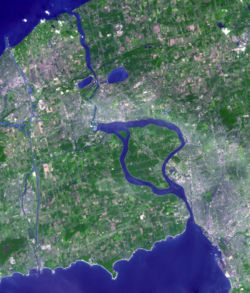
Niagara Frontier from space
New York State Wikivoyage locator maps - The Niagara Frontier.png
Location of the Niagara Frontier in New York.
██ Niagara Frontier ██ Rest of New York State
CountryFlag of the United States.svg  United States
StateFlag of New York.svg  New York
Largest CityFlag of Buffalo, New York.svg Buffalo

The Niagara Frontier refers to the stretch of land in the United States that is south of Lake Ontario and north of Lake Erie, and extends westward to Cleveland, Ohio. The term dates to the War of 1812, when the northern border was in contention between the United States and British forces in Canada. It refers only to the land east of the Niagara River and north of Lake Erie within the United States. The western side of the Niagara River, on the Canada/Ontario side, is the Niagara Peninsula; it is considered part of the Golden Horseshoe.

Contents

The Niagara Frontier is part of the region known as Western New York State. The Niagara Frontier also forms the eastern part of the Great Lakes North Coast. Its southeastern boundary forms what is known as ski country, as it includes the northernmost area of the Appalachian Mountain foothills.

The National Weather Service office in Buffalo, New York defines the Niagara Frontier as the following:

Other, less common, definitions may include the following areas:

History

The 17th-century Jesuit Relations recorded numerous now-obscure Iroquoian groups living along the Niagara Frontier. Even at that time it was a frontier zone, albeit between the Neutral, Erie, and Five Nations Iroquois confederacies, which were located to the west, south, and east respectively. One of the few well-attested Niagara Iroquoian groups, the Wenro, has never had its homeland concretely located by scholars, though some sites on the south shore of Lake Ontario have been identified with them. [1] There is some historiographical confusion as to which groups were distinct from each other and which may simply have been the same groups known by different names recorded by different chroniclers. [2] One example, the Kakouagoga or Kahkwa people, are only mentioned in a handful of written sources, but may have had their territory near the modern city of Buffalo. [3]

See also

Related Research Articles

<span class="mw-page-title-main">Niagara River</span> River in New York, United States and Ontario, Canada

The Niagara River is a river that flows north from Lake Erie to Lake Ontario. It forms part of the border between the province of Ontario in Canada and the state of New York in the United States. There are differing theories as to the origin of the river's name. According to Iroquoian scholar Bruce Trigger, Niagara is derived from the name given to a branch of the locally residing native Neutral Confederacy, who are described as being called the Niagagarega people on several late-17th-century French maps of the area. According to George R. Stewart, it comes from the name of an Iroquois town called Ongniaahra, meaning "point of land cut in two".

<span class="mw-page-title-main">Chautauqua County, New York</span> County in New York

Chautauqua County is the westernmost county in the U.S. state of New York. As of the 2020 census, the population was 127,657. Its county seat is Mayville, and its largest city is Jamestown. Its name is believed to be the lone surviving remnant of the Erie language, a tongue lost in the 17th century Beaver Wars; its meaning is unknown and a subject of speculation. The county was created in 1808 and organized in 1811.

<span class="mw-page-title-main">Erie County, New York</span> County in New York, United States

Erie County is a county along the shore of Lake Erie in western New York State. As of the 2020 census, the population was 954,236. The county seat is Buffalo, which makes up about 28% of the county's population. Both the county and Lake Erie were named for the regional Iroquoian language-speaking Erie tribe of Native Americans, who lived in the area before 1654. They were later pushed out by the more powerful Iroquoian nations tribes.

<span class="mw-page-title-main">Cattaraugus Reservation</span> Indian reservation in New York, United States

Cattaraugus Reservation is an Indian reservation of the federally recognized Seneca Nation of Indians, formerly part of the Iroquois Confederacy located in New York. As of the 2000 census, the Indian reservation had a total population of 2,412. Its total area is about 34.4 mi² (89.1 km²). The reservation stretches from Lake Erie inward along Cattaraugus Creek, along either side of NY 438. It is divided among three counties for census purposes:

<span class="mw-page-title-main">Great Lakes region</span> Binational region of the United States and Canada

The Great Lakes region of North America is a binational Canadian–American region that includes portions of eight U.S. states: Illinois, Indiana, Michigan, Minnesota, New York, Ohio, Pennsylvania, and Wisconsin along with the Canadian province of Ontario. Quebec is at times included as part of the region because, although it is not in a Great Lake watershed, it encompasses most of the St. Lawrence River watershed, part of a continuous hydrologic system that includes the Great Lakes. The region centers on the Great Lakes and forms a distinctive historical, economic, and cultural identity. A portion of the region also encompasses the Great Lakes megalopolis.

<span class="mw-page-title-main">Upstate New York</span> Region of New York State, U.S.

Upstate New York is a geographic region consisting of the area of New York State that lies north and northwest of the New York City metropolitan area. Although the precise boundary is debated, Upstate New York excludes New York City and Long Island, and most definitions of the region also exclude all or part of Westchester and Rockland counties, which are typically included in Downstate New York. Major cities across Upstate New York from east to west include Albany, Utica, Binghamton, Syracuse, Rochester, and Buffalo.

<span class="mw-page-title-main">Western New York</span> Region in New York, United States

Western New York (WNY) is the westernmost region of the U.S. state of New York. The eastern boundary of the region is not consistently defined by state agencies or those who call themselves "Western New Yorkers". Almost all sources agree WNY includes the cities of Buffalo, Niagara Falls, Jamestown, and the surrounding suburbs, as well as the outlying rural areas of the Great Lakes lowlands and Niagara Frontier, and Chautauqua-Alleghany. Many would also place Rochester and the Genesee Valley in the region while some would also include the western Finger Lakes within the region. Others would describe the latter three areas as being in a separate Finger Lakes region.

<span class="mw-page-title-main">Snowbelt</span> Region in North America where heavy snowfall is common

The Snowbelt is the region near the Great Lakes in North America where heavy snowfall in the form of lake-effect snow is particularly common. Snowbelts are typically found downwind of the lakes, principally off the eastern and southern shores.

<span class="mw-page-title-main">Erie people</span>

The Erie people were Indigenous people historically living on the south shore of Lake Erie. An Iroquoian group, they lived in what is now western New York, northwestern Pennsylvania, and northern Ohio before 1658. Their nation was decimated in the mid-17th century by five years of prolonged warfare with the powerful neighboring Iroquois for helping the Huron in the Beaver Wars for control of the fur trade.

<span class="mw-page-title-main">Seaway Trail</span>

The Great Lakes Seaway Trail, formerly named and commonly known as the Seaway Trail, is a 518-mile (834 km) National Scenic Byway in the northeastern United States, mostly contained in New York but with a small segment in Pennsylvania. The trail consists of a series of designated roads and highways that travel along the Saint Lawrence Seaway—specifically, Lake Erie, the Niagara River, Lake Ontario, and the Saint Lawrence River. It begins at the Ohio state line in rural Erie County, Pennsylvania, and travels through several cities and villages before ending at the Seaway International Bridge northeast of the village of Massena in St. Lawrence County, New York. It is maintained by the non-profit Seaway Trail, Inc.

<span class="mw-page-title-main">International Railway (New York–Ontario)</span> Former urban transit company in Buffalo, NY

The International Railway Company (IRC) was a transportation company formed in a 1902 merger between several Buffalo-area interurban and street railways. The city railways that merged were the West Side Street Railway, the Crosstown Street Railway and the Buffalo Traction Company. The suburban railroads that merged included the Buffalo & Niagara Electric Street Railway, and its subsidiary the Buffalo, Lockport & Olcott Beach Railway; the Buffalo, Depew & Lancaster Railway; and the Niagara Falls Park & River Railway. Later the IRC acquired the Niagara Gorge Railroad (NGRR) as a subsidiary, which was sold in 1924 to the Niagara Falls Power Company. The NGRR also leased the Lewiston & Youngstown Frontier Railroad.

<span class="mw-page-title-main">History of Buffalo, New York</span>

Buffalo is the county seat of Erie County, and the second most populous city in the U.S. state of New York, after New York City. Originating around 1789 as a small trading community inhabited by the Neutral Nation near the mouth of Buffalo Creek, the city, then a town, grew quickly after the opening of the Erie Canal in 1825, with the city at its western terminus. Its position at the eastern end of Lake Erie strengthened the economy, based on grain milling and steel production along the southern shores and in nearby Lackawanna.

<span class="mw-page-title-main">Geography of New York (state)</span> State of the United States

The geography of New York (state) varies widely. Most of New York is dominated by farms, forests, rivers, mountains, and lakes. New York's Adirondack Park is larger than any U.S. National Park in the contiguous United States. Niagara Falls, on the Niagara River as it flows from Lake Erie to Lake Ontario, is a popular attraction. The Hudson River begins near Lake Tear of the Clouds and flows south through the eastern part of the state without draining lakes George or Champlain. Lake George empties at its north end into Lake Champlain, whose northern end extends into Canada, where it drains into the Richelieu River and then the St. Lawrence. Four of New York City's five boroughs are on the three islands at the mouth of the Hudson River: Manhattan Island, Staten Island, and Brooklyn and Queens on Long Island.

<span class="mw-page-title-main">Great Lakes Basin</span> Large drainage basin around the Great Lakes

The Great Lakes Basin consists of the Great Lakes and the surrounding lands of the states of Illinois, Indiana, Michigan, Minnesota, New York, Ohio, Pennsylvania, and Wisconsin in the United States, and the province of Ontario in Canada, whose direct surface runoff and watersheds form a large drainage basin that feeds into the lakes. It is generally considered to also include a small area around and beyond Wolfe Island, Ontario, at the east end of Lake Ontario, which does not directly drain into the Great Lakes, but into the Saint Lawrence River.

<span class="mw-page-title-main">Lake Erie Basin</span>

Lake Erie Basin consists of Lake Erie and surrounding watersheds, which are typically named after the river, creek, or stream that provides drainage into the lake. The watersheds are located in the states of Indiana, Michigan, New York, Ohio, and Pennsylvania in the United States, and in the province of Ontario in Canada. The basin is part of the Great Lakes Basin and Saint Lawrence River Watershed, which feeds into the Atlantic Ocean. 80% of the lake's water flows in from the Detroit River, with only 9% coming from all of the remaining watersheds combined. A littoral zone serves as the interface between land and lake, being that portion of the basin where the lake is less than 15 feet (4.6 m) in depth.

<span class="mw-page-title-main">Buffalo Niagara Region</span> Eight-county region in New York, United States

The Buffalo Niagara Region is an economic region that is part of the Great Lakes region of North America, comprising much of Western New York in the United States. The Regional Institute of the University at Buffalo has defined the region as including the eight westernmost counties in New York.

<span class="mw-page-title-main">Southtowns</span> Term for southern suburbs of Buffalo, NY

The Southtowns is a region of Western New York, United States, that lies within the snowbelt or ski country. It includes the southern suburbs of Buffalo, New York. This is the common name for the southern part of Erie County, New York.

<span class="mw-page-title-main">Wenrohronon</span> Iroquoian indigenous nation of North America

The Wenrohronon or Wenro people were an Iroquoian indigenous nation of North America, originally residing in present-day western New York, who were conquered by the Confederation of the Five Nations of the Iroquois in two decisive wars between 1638–1639 and 1643. This was likely part of the Iroquois Confederacy campaign against the Neutral people, another Iroquoian-speaking tribe, which lived across the Niagara River. This warfare was part of what was known as the Beaver Wars, as the Iroquois worked to dominate the lucrative fur trade. They used winter attacks, which were not usual among Native Americans, and their campaigns resulted in attrition of both the larger Iroquoian confederacies, as it had against the numerous Huron.

<span class="mw-page-title-main">Erie language</span> Iroquoian language

Erie was believed to have been an Iroquoian language spoken by the Erie people, similar to Wyandot. But it was poorly documented, and linguists are not certain that this conclusion is correct. There have been no known connections between the Erie People and Europeans, besides the French.

<span class="mw-page-title-main">Transportation in Buffalo, New York</span>

Transportation in Buffalo, New York is dominated by automobile use, but other modes of transportation exist in the city.

References

Citations

Sources

  • Pendergast, James F. (March 1994). "The Kakouagoga or Kahkwas: An Iroquoian Nation Destroyed in the Niagara Region". Proceedings of the American Philosophical Society. American Philosophical Society. 138 (1): 96–144. JSTOR   986707.
  • "Niagara River – The Old Niagara Frontier", Old and Sold