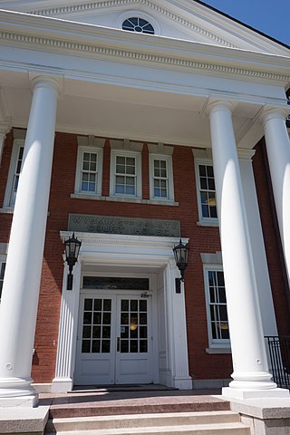
Wyoming County is a county in the U.S. state of New York in the state's western area. As of the 2020 census, the population was 40,531. The county seat is Warsaw. The name is modified from a Lenape (Delaware) Native American word meaning "broad bottom lands". Wyoming County was formed from Genesee County in 1841. Wyoming County is one of New York's mostly agricultural counties. With an estimated 47,500 dairy cows in the county, there are more cattle in Wyoming County than people. The county is part of the Finger Lakes region of the state.

Edwards is an unincorporated town, a post office, and a census-designated place (CDP) located in and governed by Eagle County, Colorado, United States. Edwards is the principal town of the Edwards, CO Micropolitan Statistical Area. The Edwards post office has the ZIP Code 81632. At the United States Census 2020, the population of the Edwards CDP was 11,246. The Edwards Metropolitan District provides services.

Trenton is a town in Oneida County, New York, United States. The population was 4,297 at the 2020 census.

Eagle is an incorporated town in Wyoming County, New York. The population was 1,194 at the 2000 census. The town is on the south border of the county.
Owego is a town in Tioga County, New York, United States. The population was 18,728 at the 2020 census. The name is derived from the Iroquois word Ahwaga, meaning "where the valley widens".

New York State Route 98 (NY 98) is a state highway in the western part of New York in the United States. The southern terminus of the route is at an intersection with U.S. Route 219 (US 219) in the town of Great Valley in Cattaraugus County. The northern end is at an interchange with the Lake Ontario State Parkway in the town of Carlton in Orleans County, near the southern shore of Lake Ontario. In between, NY 98 serves the city of Batavia, connects to the New York State Thruway, and passes by the Attica Correctional Facility. Most of the route passes through rural, undeveloped areas; however, in southern Genesee County, it traverses more urbanized areas that lie in and around Batavia.

New York State Route 362 (NY 362) is a state highway located entirely in Wyoming County, New York, in the United States. It runs north–south for 3.68 miles (5.92 km) between an intersection with NY 39 in the town of Eagle and a junction with NY 78 in the town of Wethersfield. The two-lane route begins in the hamlet of Bliss, and heads across gradually less developed areas as it heads north from the community. NY 362 was assigned to its current routing as part of the 1930 renumbering of state highways in New York.
Central Bridge is a hamlet and census-designated place (CDP) within the towns of Schoharie and Esperance in Schoharie County, New York, United States. As of the 2020 census, the population was 740.
Kennedy is a hamlet and census-designated place (CDP) in the town of Poland in Chautauqua County, New York, United States. The population was 465 at the 2010 census. From 1805–1841, the hamlet was known as Kennedy Mills, in honor of Thomas Ruston Kennedy, the founder of the local mills. The name was changed in 1841 to Kennedyville. Eleven years later, the name changed again, this time to Falconer in honor of Robert and William Falconer. In 1860, on the request of an Erie Railroad official, the hamlet became Kennedy. The name was promptly placed on the railroad station constructed in 1861.
Wakefield is an unincorporated community and census-designated place (CDP) within Fulton Township, Lancaster County, Pennsylvania, United States. As of the 2010 census, the population was 609. It is the largest community within the "Peach Bottom" ZIP code, with the area post office on Pennsylvania Route 272, just north of town.

Wiscoy Creek is a stream, approximately 15 miles (24 km) long, in western New York in the United States. It is a tributary of the Genesee River. The creek was known to Native Americans as O-wa-is-ki, meaning "under the banks".
Coopers Plains is a hamlet and census-designated place (CDP) in the towns of Erwin and Campbell in Steuben County, New York, United States. As of the 2010 census, it had a population of 598.
Pine Valley is a hamlet and census-designated place in the towns of Catlin and Veteran in Chemung County, New York, United States. The population was 813 at the 2010 census.
Pavilion is a hamlet and census-designated place within the town of Pavilion in Genesee County, New York, United States. As of the 2010 census, the population of the CDP was 646, out of a total of 2,495 people in the town as a whole.
Rodman is a hamlet and census-designated place (CDP) in the town of Rodman, Jefferson County, New York, United States. As of the 2010 census, the CDP population was 153, out of 1,176 in the entire town of Rodman.
Prattsburgh is the primary hamlet and a census-designated place (CDP) in the town of Prattsburgh in Steuben County, New York, United States. As of the 2010 census, it had a population of 656, out of 2,085 in the entire town of Prattsburgh. The community was incorporated as a village in 1848 but was disincorporated in 1972.
Conesus is a hamlet in the town of Conesus, Livingston County, New York, United States. The population of the CDP was 308 at the 2010 census, out of 2,473 in the entire town of Conesus. In 2010 the CDP was listed as "Conesus Hamlet".
York is a hamlet and census-designated place (CDP) in the town of York, Livingston County, New York, United States. Its population was 544 as of the 2010 census. New York State Route 36 passes through the community.
South Ilion is a hamlet and census-designated place (CDP) in the town of German Flatts in Herkimer County, New York, United States. It was first listed as a CDP prior to the 2020 census.
Eagle Creek is a census-designated place (CDP) in Centre County, Pennsylvania, United States. It was first listed as a CDP prior to the 2020 census.


