Warsaw (village), New York

Last updated

Village of Warsaw
Village
NY 19 through Warsaw.jpg
Downtown Warsaw along NY 19 in June 2015.
USA New York location map.svg
Red pog.svg
Village of Warsaw
Coordinates: 42°44′28″N78°8′8″W / 42.74111°N 78.13556°W / 42.74111; -78.13556
Country United States
State New York
County Wyoming
Town Warsaw
Settled1803 (1803)
IncorporatedApril 17, 1843 (1843-04-17)
Named for Likely Warsaw, Poland
Area
[1]
  Total4.11 sq mi (10.63 km2)
  Land4.11 sq mi (10.63 km2)
  Water0.00 sq mi (0.00 km2)
Elevation
1,014 ft (309 m)
Population
 (2020)
  Total3,646
  Density887.97/sq mi (342.86/km2)
Time zone UTC-5 (EST)
  Summer (DST) UTC-4 (EDT)
ZIP code
14569
Area code 585
FIPS code 36-78333 [2]
GNIS feature ID0968827 [3]
Website www.villageofwarsaw.org

Warsaw is a village and the county seat of Wyoming County, New York, United States. It lies inside the Town of Warsaw. The village of Warsaw is near the center of the town in a valley. The population was 3,473 at the 2010 census. A branch of Genesee Community College is in Warsaw.

Contents

History

The village of Warsaw was incorporated in 1843. The central core of the village is known as the Monument Circle Historic District and was listed on the National Register of Historic Places in 1992. [4] Also on the National Register of Historic Places are the Warsaw Downtown Historic District, Seth M. Gates House, Trinity Church, U.S. Post Office, and Warsaw Academy. [4] [5]

Abolitionism

In the decades before the American Civil War, Warsaw was a center of abolitionist sentiment and activity. Warsaw's local anti-slavery society was formed in 1833, the same year as the American Anti-Slavery Society. Several homes and churches are documented to have participated in the Underground Railroad. [6] [7] In November 1839 the anti-slavery Liberty Party was formed in a meeting at Warsaw's Presbyterian Church. [6] The area sent abolitionists Seth M. Gates and Augustus Frank to serve in the United States Congress. [6] [7] An anti-slavery newspaper called The American Citizen was published in Warsaw. [7]

Geography

According to the United States Census Bureau, the village has a total area of 4.1 square miles (10.7 km2), all land.

The Oatka Creek flows northward through the village, which is located in the Wyoming Valley.

Demographics

Historical population
CensusPop.Note
1870 1,631
1880 1,91017.1%
1890 3,12063.4%
1900 3,048−2.3%
1910 3,2065.2%
1920 3,62213.0%
1930 3,477−4.0%
1940 3,5542.2%
1950 3,7134.5%
1960 3,653−1.6%
1970 3,619−0.9%
1980 3,6190.0%
1990 3,8305.8%
2000 3,814−0.4%
2010 3,473−8.9%
2020 3,6465.0%
U.S. Decennial Census [8]

As of the census [2] of 2000, there were 3,814 people, 1,484 households, and 887 families residing in the village. The population density was 924.9 inhabitants per square mile (357.1/km2). There were 1,575 housing units at an average density of 381.9 per square mile (147.5/km2). The racial makeup of the village was 96.96% White, 0.52% Black or African American, 0.39% Native American, 1.07% Asian, 0.10% from other races, and 0.94% from two or more races. Hispanic or Latino of any race were 0.87% of the population.

There were 1,484 households, out of which 32.0% had children under the age of 18 living with them, 44.3% were married couples living together, 12.0% had a female householder with no husband present, and 40.2% were non-families. 34.1% of all households were made up of individuals, and 17.3% had someone living alone who was 65 years of age or older. The average household size was 2.32 and the average family size was 3.01.

Warsaw station site for the Erie Railroad in June 2015 Warsaw Station - June 2015.jpg
Warsaw station site for the Erie Railroad in June 2015

In the village, the population was spread out, with 23.8% under the age of 18, 7.9% from 18 to 24, 27.4% from 25 to 44, 19.2% from 45 to 64, and 21.7% who were 65 years of age or older. The median age was 39 years. For every 100 females, there were 85.0 males. For every 100 females age 18 and over, there were 78.6 males.

The median income for a household in the village was $35,592, and the median income for a family was $42,540. Males had a median income of $33,682 versus $21,540 for females. The per capita income for the village was $17,483. About 9.8% of families and 11.0% of the population were below the poverty line, including 17.2% of those under age 18 and 8.7% of those age 65 or over.

Related Research Articles

<span class="mw-page-title-main">Hampton, Connecticut</span> Town in Connecticut, United States

Hampton is a town in Windham County, Connecticut, United States. The town is part of the Northeastern Connecticut Planning Region. The population was 1,728 at the 2020 census.

<span class="mw-page-title-main">Salem, Iowa</span> City in Iowa, United States

Salem is a city in Henry County, Iowa, United States. The population was 394 at the time of the 2020 census.

Cayuga is a village in Cayuga County, New York, United States. The population was 549 at the 2010 census. The village derives its name from the indigenous Cayuga people and the lake named after them.

<span class="mw-page-title-main">Java, New York</span> Town in New York, United States

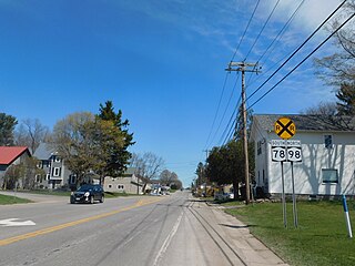
Java is an incorporated town in Wyoming County, New York. The population was 2,057 at the 2010 census. The Town of Java is on the western border of Wyoming County.

Wyoming is a village in Wyoming County, New York, United States. As of the 2010 census, the village has a total population of 434.

<span class="mw-page-title-main">Ripley, Ohio</span> Village in Ohio, United States

Ripley is a village in Union Township, Brown County, Ohio, United States, along the Ohio River 50 miles southeast of Cincinnati. The population was 1,591 at the 2020 census.

<span class="mw-page-title-main">Salem, Ohio</span> City in Ohio, United States

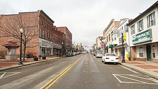
Salem is a city in northern Columbiana County, Ohio, United States. At the 2020 census, the city's population was 11,915. Extending into southern Mahoning County, it is the principal city of the Salem micropolitan area, which includes all of Columbiana County. It lies about 18 miles (29 km) southwest of Youngstown, 28 miles (45 km) east of Canton, and 60 miles (97 km) southeast of Cleveland.

<span class="mw-page-title-main">Rushville, Ohio</span> Village in Ohio, United States

Rushville is a village in Fairfield County, Ohio, United States. The population was 304 at the 2020 census. Much of the village is listed on the National Register of Historic Places as the Rushville Historic District.

<span class="mw-page-title-main">Wyoming, Ohio</span> City in Ohio, United States

Wyoming is a city in Hamilton County, Ohio; located approximately 12 miles north of downtown Cincinnati and part of the Cincinnati metropolitan area. The population was 8,756 at the 2020 census.

<span class="mw-page-title-main">Mount Pleasant, Ohio</span> Village in Ohio, United States

Mount Pleasant is a village in southern Jefferson County, Ohio, United States. The population was 394 at the 2020 census. It is part of the Weirton–Steubenville metropolitan area. Founded in 1803 by anti-slavery Quakers, the village was an early center of abolitionist activity and a well-known haven for fugitive slaves on the Underground Railroad.

<span class="mw-page-title-main">Richmond Township, Berks County, Pennsylvania</span> Township in Pennsylvania, United States

Richmond Township is a township in Berks County, Pennsylvania, United States. The population was 3,397 at the 2010 census.

<span class="mw-page-title-main">Lima, Pennsylvania</span> Census-designated place in Pennsylvania, United States

Lima is an unincorporated community and census-designated place (CDP) in Middletown Township, Delaware County, Pennsylvania, United States. The population was 2,735 at the 2010 census, down from 3,225 at the 2000 census.

<span class="mw-page-title-main">Colley Township, Sullivan County, Pennsylvania</span> Township in Pennsylvania, United States

Colley Township is a township in Sullivan County, Pennsylvania, United States. The population was 626 at the 2020 census. The village of Lopez is located in the township.

<span class="mw-page-title-main">Nicholson Township, Wyoming County, Pennsylvania</span> Township in Pennsylvania, United States

Nicholson Township is a township in Wyoming County, Pennsylvania, United States. The population was 1,259 at the 2020 census.

<span class="mw-page-title-main">Powder River, Wyoming</span> Census-designated place in Wyoming, United States

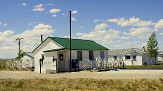
Powder River is a census-designated place (CDP) in Natrona County, Wyoming, United States. It is part of the Casper, Wyoming Metropolitan Statistical Area. The population was 30 in the 2020 census and 44 in the 2010 census.

<span class="mw-page-title-main">Newcastle, Wyoming</span> City in Wyoming, United States

Newcastle is a city in and the county seat of Weston County, Wyoming, United States. The population was 3,374 at the 2020 census.

<span class="mw-page-title-main">Tabor, Iowa</span> City in Iowa, United States

Tabor is a city in Fremont County and extends northward into Mills County in the U.S. state of Iowa. The population was 928 at the time of the 2020 census.

<span class="mw-page-title-main">Le Roy (village), New York</span> Village in New York, United States

Le Roy is a village in Genesee County, New York, United States. The population was 4,391 at the 2010 census. The village lies in the center of the town of Le Roy at the intersection of State Routes 5 and 19.

<span class="mw-page-title-main">Warsaw, New York</span> Town in New York, United States

Warsaw is a town in Wyoming County, in the U.S. state of New York. The population was 5,316 at the 2020 census. It is located approximately 37 miles east southeast of Buffalo and approximately 37 miles southwest of Rochester. The town may have been named after Warsaw, Poland.

<span class="mw-page-title-main">Wyoming, Rhode Island</span> United States historic place

Wyoming is a village and census-designated place on the Wood River in southern Rhode Island, primarily in the town of Richmond, Rhode Island, but extending north across the river into the town of Hopkinton, Rhode Island. The population was 270 at the 2010 census. It is the site of the Wyoming Village Historic District and a post office assigned ZIP code 02898.

References

  1. "ArcGIS REST Services Directory". United States Census Bureau. Retrieved September 20, 2022.
  2. 1 2 "U.S. Census website". United States Census Bureau . Retrieved January 31, 2008.
  3. "US Board on Geographic Names". United States Geological Survey. October 25, 2007. Retrieved January 31, 2008.
  4. 1 2 "National Register Information System". National Register of Historic Places . National Park Service. March 13, 2009.
  5. "National Register of Historic Places Listings". Weekly List of Actions Taken on Properties: 12/03/12 through 12/07/12. National Park Service. December 14, 2012.
  6. 1 2 3 "The Abolitionist Tour". Warsaw NY History. Archived from the original on April 9, 2022. Retrieved November 30, 2022.
  7. 1 2 3 "The Underground Railroad". Go Wyoming. Wyoming, NY Chamber of Commerce. Retrieved November 30, 2022.
  8. "Census of Population and Housing". Census.gov. Retrieved June 4, 2015.