Norwich, New York

Last updated

Norwich
City of Norwich in New York State 41 downtown green.jpg
Chenango County NY Norwich city highlighted.svg
Location in Chenango County and the state of New York.
Coordinates: 42°31′55″N75°31′18″W / 42.53194°N 75.52167°W / 42.53194; -75.52167
Country United States
State New York
County Chenango
Government
  Type Mayor-Council
   Mayor Elect Brian Doliver (R)
   Common Council
Members' List
Area
[1]
  Total2.12 sq mi (5.50 km2)
  Land2.12 sq mi (5.50 km2)
  Water0.00 sq mi (0.00 km2)
Elevation
1,014 ft (309 m)
Population
 (2020)
  Total7,051
  Density3,319.68/sq mi (1,281.50/km2)
Time zone UTC-5 (Eastern (EST))
  Summer (DST) UTC-4 (EDT)
ZIP Code
13815
Area code 607
FIPS code 36-017-53979
GNIS feature ID0959025
Website www.norwichnewyork.net

Norwich is a city and county seat of Chenango County, New York, United States. Surrounded on all sides by the Town of Norwich, [2] the city's name is taken from Norwich, England. [3] Its population was 7,190 at the 2010 census. [4]

Contents

Lt. Warren Eaton Airport (OIC), serving the area, is located north of the city in the town of North Norwich.

History

The first log cabin was built in 1788 by Col. William Monroe, who served as a drummer boy during the Revolutionary War. The town of Norwich was formed in 1793 from the towns of Union (now in Broome County) and Bainbridge. Afterwards, Norwich, as a "mother town" of the county, lost substantial territory in the formation of new towns. In 1806, Norwich gave up territory to form the towns of Pharsalia, Plymouth and Preston. More of Norwich was lost in 1807 to form parts of the towns of New Berlin and Columbus. In 1808 and 1820, Norwich exchanged territory with the town of Preston.

The central community of Norwich set itself off from the town in 1816 by incorporating as a village, and later becoming the city of Norwich in 1914.

Geography

According to the United States Census Bureau, the city has a total area of 2.1 square miles (5.5 km2), all land. [4] Unlike many upstate cities, there are few, if any, defined neighborhoods or districts. Although the city is divided into six wards for political purposes, neighborhoods are seldom referred to in this manner.

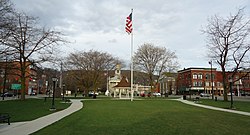
Downtown is the main commercial district of Norwich, consisting of North and South Broad streets, East and West Main streets, and lesser side streets, including American Avenue, Lackawanna Avenue, and parts of Mechanic, Fair, and Hayes streets. The downtown district is bordered on the north by Cortland and Mitchell streets, and to the south by Front Street and Eaton Avenue.

Norwich is located in upstate New York, in the Chenango River valley. The river, a tributary of the Susquehanna, winds south along the eastern edge of the city. Along the western border, Canasawacta Creek flows south, until it unites with the Chenango River at the southern city limits.

Location

Norwich lies near the center of the triangle that can be drawn connecting the cities of Syracuse, Albany, and Binghamton, along Interstates 90, 88, and 81, respectively. The city is located at the intersection of New York State Route 12 and New York State Route 23. On Route 12, Utica and access to Interstate 90 is 48 miles (77 km) to the north, while Binghamton (and the Triple Cities) and access to Interstate 81 and Interstate 86 (currently New York State Route 17, known as the Southern Tier Expressway), is 40 miles (64 km) to the south. State Highway 23, which cuts laterally through the northern side of the city, leads east 32 miles (51 km) to the city of Oneonta and access to Interstate 88, while to the west NY 23 leads in the direction of Cortland and Interstate 81, 42 miles (68 km) away.

Climate

Climate data for Norwich, New York (1991–2020 normals, extremes 1906–present)
MonthJanFebMarAprMayJunJulAugSepOctNovDecYear
Record high °F (°C)66
(19)
74
(23)
86
(30)
92
(33)
94
(34)
98
(37)
101
(38)
100
(38)
99
(37)
88
(31)
80
(27)
66
(19)
101
(38)
Mean maximum °F (°C)54.3
(12.4)
54.0
(12.2)
65.7
(18.7)
79.2
(26.2)
86.7
(30.4)
90.2
(32.3)
90.5
(32.5)
88.8
(31.6)
86.3
(30.2)
77.9
(25.5)
67.9
(19.9)
56.8
(13.8)
92.5
(33.6)
Mean daily maximum °F (°C)31.5
(−0.3)
33.9
(1.1)
42.7
(5.9)
56.5
(13.6)
68.9
(20.5)
77.1
(25.1)
81.1
(27.3)
79.4
(26.3)
72.5
(22.5)
60.1
(15.6)
47.4
(8.6)
36.5
(2.5)
57.3
(14.1)
Daily mean °F (°C)21.7
(−5.7)
22.8
(−5.1)
31.3
(−0.4)
44.2
(6.8)
55.7
(13.2)
64.7
(18.2)
68.8
(20.4)
67.4
(19.7)
60.2
(15.7)
48.6
(9.2)
37.4
(3.0)
28.2
(−2.1)
45.9
(7.7)
Mean daily minimum °F (°C)11.8
(−11.2)
11.7
(−11.3)
19.9
(−6.7)
31.9
(−0.1)
42.5
(5.8)
52.3
(11.3)
56.6
(13.7)
55.3
(12.9)
47.9
(8.8)
37.1
(2.8)
27.4
(−2.6)
19.9
(−6.7)
34.5
(1.4)
Mean minimum °F (°C)−10.7
(−23.7)
−7.4
(−21.9)
0.4
(−17.6)
18.9
(−7.3)
29.0
(−1.7)
38.4
(3.6)
46.2
(7.9)
44.6
(7.0)
34.6
(1.4)
24.9
(−3.9)
13.5
(−10.3)
0.9
(−17.3)
−13.4
(−25.2)
Record low °F (°C)−32
(−36)
−29
(−34)
−19
(−28)
3
(−16)
20
(−7)
29
(−2)
35
(2)
27
(−3)
20
(−7)
11
(−12)
−8
(−22)
−31
(−35)
−32
(−36)
Average precipitation inches (mm)3.18
(81)
2.73
(69)
3.51
(89)
3.80
(97)
3.59
(91)
4.95
(126)
4.38
(111)
4.42
(112)
4.02
(102)
3.88
(99)
3.22
(82)
3.59
(91)
45.27
(1,150)
Average snowfall inches (cm)17.8
(45)
17.4
(44)
14.7
(37)
2.3
(5.8)
0.0
(0.0)
0.0
(0.0)
0.0
(0.0)
0.0
(0.0)
0.0
(0.0)
0.3
(0.76)
5.6
(14)
16.7
(42)
74.8
(190)
Average precipitation days (≥ 0.01 in)17.514.414.914.914.312.913.212.511.814.515.017.3173.2
Average snowy days (≥ 0.1 in)12.69.97.61.90.00.00.00.00.00.54.610.147.2
Source: NOAA [5] [6]

Economy

Chenango Memorial Hospital is a major employer in the city. City of Norwich in New York State 17 hospital.jpg
Chenango Memorial Hospital is a major employer in the city.

For nearly a century, the city had important manufacturing firms. It was the corporate headquarters of the Norwich Pharmacal Company. Formed in 1887 as a partnership between Reverend Lafayette Moore and Oscar G. Bell, a drug store employee, the company grew to become a major developer and manufacturer of medicines and veterinary products, known for its Unguentine antiseptic dressing (introduced in 1893) and Pepto-Bismol, an upset-stomach and anti-diarrhea medication (introduced in 1901 under a different name).

The company merged with Morton International, Inc. in 1969 and later became a subsidiary of Procter & Gamble in 1982. Under corporate restructuring, Procter & Gamble divided the company into several units, each of which was subsequently sold. This caused the loss of many jobs in Norwich, resulting in the city struggling to figure out a new economic model.

Chenango County Courthouse City of Norwich in New York State 43 courthouse.jpg
Chenango County Courthouse

In 1996, a new plant of Dan Wesson Firearms was built in Norwich and the company moved there from Massachusetts; It became a subsidiary of CZ-USA in 2005 and therefore a Colt CZ Group subsidiary since 2022.

From 1845 until 1961, Norwich was also the home of the Maydole Hammer Factory. The founder, David Maydole, was an enterprising blacksmith who set out to create a hammer with a safely attached head. His hammers proved so successful that Maydole had become the largest hammer manufacturer in the United States by the time of its founder's death in 1892.

The Chenango Canal, the New York, Ontario and Western Railway, and the Delaware, Lackawanna and Western Railroad (later Erie-Lackawanna) once served most of the city's transportation needs. Norwich was the NYO&W's Northern Division point until operations ceased on March 29, 1957. Until June 2006, the community was served by the New York, Susquehanna and Western Railroad, which operated trains on the old DL&W line between Binghamton and Utica. That service ended as a result of flood damage in 2011 to the portion of the line between Sangerfield and Chenango Forks. Following a major renovation, the line resumed freight service in May, 2017.

Broad Street United Methodist Church City of Norwich in New York State 3.jpg
Broad Street United Methodist Church
Retired train caboose converted into a diner City of Norwich in New York State 36 caboose diner.jpg
Retired train caboose converted into a diner

A new $8 million campus was constructed for the city's small extension of Morrisville State College. Due to loss of jobs in the area, population has declined, affecting both admissions and attendance at the college in recent years.

NBT Bancorp and Chobani are both headquartered in Norwich.

Route 12 bisects the city on a north-south axis, becoming North and South Broad Street within city limits. A community of downtown businesses is found along it. On the north side of town lies the North Plaza, desolate since the departure of anchor tenant Jamesway, and a commercial strip of gas stations and fast food outlets. To the south are three plazas just outside city limits, featuring supermarkets, gas stations, fast food, Lowe's and Walmart.

Norwich residents usually travel to the larger nearby cities of Oneonta, Binghamton, Utica, sometimes Cortland, and occasionally the much larger metropolitan areas of Syracuse and Albany, for goods and services unobtainable locally.

Demographics

Historical population
CensusPop.Note
1890 5,212
1900 5,76610.6%
1910 7,42228.7%
1920 8,26811.4%
1930 8,3781.3%
1940 8,6943.8%
1950 8,8161.4%
1960 9,1754.1%
1970 8,843−3.6%
1980 8,082−8.6%
1990 7,613−5.8%
2000 7,355−3.4%
2010 7,190−2.2%
2020 7,051−1.9%
U.S. Decennial Census [7]
A house along a main street City of Norwich in New York State 11 house.jpg
A house along a main street

As of the census of 2000, there were 7,355 people, 3,131 households, and 1,671 families residing in the city. The population density was 3,609.0 inhabitants per square mile (1,393.4/km2). There were 3,500 housing units at an average density of 1,717.4 per square mile (663.1/km2). The racial makeup of the city was 96.48% White, 1.39% Black or African American, 0.27% Native American, 0.69% Asian, 0.19% from other races, and 0.98% from two or more races. Hispanic or Latino of any race were 0.68% of the population. [3]

There were 3,131 households, out of which 28.6% had children under the age of 18 living with them, 35.6% were married couples living together, 13.4% had a female householder with no husband present, and 46.6% were non-families. 40.2% of all households were made up of individuals, and 19.0% had someone living alone who was 65 years of age or older. The average household size was 2.19 and the average family size was 2.95. [3]

In the city, the population was spread out, with 24.6% under the age of 18, 8.2% from 18 to 24, 26.1% from 25 to 44, 20.0% from 45 to 64, and 21.2% who were 65 years of age or older. The median age was 39 years. For every 100 females, there were 78.9 males. For every 100 females age 18 and over, there were 75.0 males. [3]

The median income for a household in the city was $28,485, and the median income for a family was $39,808. Males had a median income of $33,537 versus $24,430 for females. The per capita income for the city was $17,339. About 14.7% of families and 18.7% of the population were below the poverty line, including 28.5% of those under age 18 and 9.2% of those age 65 or over. [3]

Culture

The Chenango Arts Council serves as a year-round arts and entertainment hub for the Norwich community and surrounding counties. Located in the former Norwich High School building on the city's west side, the Council includes a unique two-level art gallery, art instruction classrooms and the circa 1922 515-seat Martin Kappel Theater. The broadroom-style auditorium was listed in the League of Historic Theaters in 1989, and underwent an extensive renovation in 1995 after years of abandonment with contributions from local government, corporate donors and hundreds of former alumni of the high school. Each year, the stage hosts the Chenango Arts Council's Annual Performance Series, regular performances by the Norwich Theater Company and serves as a venue for many community organizations and businesses. The Martin Kappel Theater hosted the Twin Tiers International Film Festival in September 2018.

The Chenango Arts Council serves as a New York State Council on the Arts (NYSCA) multi-county DEC site, administering and re-granting more than $100,000 of funding annually directly to artists and community arts initiatives in Broome, Chenango and Otsego counties.

Numerous festivals and events mark the Norwich calendar, with residents looking forward to several annual cultural traditions. These include the Colorscape Chenango Arts Festival, a two-day event in early September that features regional musicians and artists, and the Chenango Blues Festival, held at the Chenango County Fairgrounds each August-attracting thousands and featured nationally renowned artists such as Koko Taylor, Luther Allison, and The Fabulous Thunderbirds. Since the early 1990s, the nationally known Gus Macker organization has hosted a 3-on-3 basketball tournament in early July, with hundreds of teams participating each year.

Museums include the Chenango County Historical Society and the Northeast Classic Car Museum, which houses over 160 classic cars, [8] including the world's largest collection of Franklin automobiles.

Notable people

Related Research Articles

<span class="mw-page-title-main">Broome County, New York</span> County in New York, United States

Broome County is a county in the U.S. state of New York. As of the 2020 United States census, the county had a population of 198,683. Its county seat is Binghamton. The county was named for John Broome, the state's lieutenant governor when Broome County was created.

<span class="mw-page-title-main">Chenango County, New York</span> County in New York, United States

Chenango County is a county located in the south-central section U.S. state of New York. As of the 2020 census, the population was 47,220. Its county seat is Norwich. The county's name originates from an Oneida word meaning 'large bull-thistle'.

<span class="mw-page-title-main">Cortland County, New York</span> County in New York, United States

Cortland County is a county located in the U.S. state of New York. As of the 2020 census, the population of Cortland County was 46,809. The county seat is Cortland. The county is named after Pierre Van Cortlandt, president of the convention at Kingston that wrote the first New York State Constitution in 1777, and first lieutenant governor of the state.

<span class="mw-page-title-main">Binghamton, New York</span> City in New York, United States

Binghamton is a city in the U.S. state of New York, and serves as the county seat of Broome County. Surrounded by rolling hills, it lies in the state's Southern Tier region near the Pennsylvania border, in a bowl-shaped valley at the confluence of the Susquehanna and Chenango Rivers. Binghamton is the principal city and cultural center of the Binghamton metropolitan area, home to a quarter million people. The city's population, according to the 2020 census, is 47,969.

<span class="mw-page-title-main">Barker, Broome County, New York</span> Town in New York, United States

Barker is a town in Broome County, New York, United States. The population was 2,516 at the 2020 census. The town is named after John Barker, an early settler. The town is in the northern part of Broome County and is north of Binghamton.

<span class="mw-page-title-main">Chenango, New York</span> Town in New York, United States

Chenango is a town in Broome County, New York, United States. The population was 10,983 at the 2020 census.

<span class="mw-page-title-main">Dickinson, Broome County, New York</span> Town in New York, United States

Dickinson is a town in Broome County, New York, United States. The population was 5,083 at the 2020 census. The town was named after Daniel S. Dickinson.

<span class="mw-page-title-main">Port Dickinson, New York</span> Village in New York, United States

Port Dickinson is a village in Broome County, New York, United States. The population was 1,641 at the 2010 census. It is part of the Binghamton Metropolitan Statistical Area.

<span class="mw-page-title-main">Smithville, New York</span> Town in New York, United States

Smithville is a town in Chenango County, New York, United States. The population was 1,330 at the 2010 census. The town is at the western border of Chenango County, west of the city of Norwich.

<span class="mw-page-title-main">Cortland, New York</span> City in New York, United States

Cortland is a city and the county seat of Cortland County, New York, United States. Known as the Crown City, Cortland is in New York's Southern Tier region. As of the 2020 census it had a population of 17,556.

<span class="mw-page-title-main">Binghamton (town), New York</span> Town in New York, United States

Binghamton is a town in Broome County, New York, United States. The population was 4,623 at the 2020 census. The town is named after an early developer, William Bingham.

<span class="mw-page-title-main">Bainbridge (village), New York</span> Village in New York, United States

Bainbridge is a village in Chenango County, New York, United States. The population was 1,355 at the 2010 census. The village is at the center of the town of Bainbridge and lies between Binghamton and Oneonta.

<span class="mw-page-title-main">Norwich (town), New York</span> Town in New York, United States

Norwich is a town in Chenango County, New York, United States. The population was 3,998 at the 2010 census.

<span class="mw-page-title-main">Oxford (village), New York</span> Village in New York, United States

Oxford is a village in Chenango County, New York, United States. The population was 1,450 at the 2010 census. The village is named after Oxford, Massachusetts, the hometown of the landowner.

<span class="mw-page-title-main">Chenango Canal</span> Manmade waterway in New York State, U.S.

The Chenango Canal was a towpath canal in central New York in the United States which linked the Susquehanna River to the Erie Canal. Built and operated in the mid-19th century, it was 97 miles long and for much of its course followed the Chenango River, along New York State Route 12 from Binghamton on the south end to Utica on the north. It operated from 1834 to 1878 and provided a significant link in the water transportation system of the northeastern U.S. until supplanted by the region's developing railroad network.

<span class="mw-page-title-main">Delaware, Lackawanna and Western Railroad</span> Former U.S. Class 1 railroad

The Delaware, Lackawanna and Western Railroad, also known as the DL&W or Lackawanna Railroad, was a U.S. Class 1 railroad that connected Buffalo, New York, and Hoboken, New Jersey, and by ferry with New York City, a distance of 395 miles (636 km). The railroad was incorporated in Pennsylvania in 1853, and created primarily to provide a means of transport of anthracite coal from the Coal Region in Northeast Pennsylvania to large coal markets in New York City. The railroad gradually expanded both east and west, and eventually linked Buffalo with New York City.

<span class="mw-page-title-main">New York State Route 12</span> New York state highway

New York State Route 12 (NY 12) is a state highway extending for 222.27 miles (357.71 km) through central and northern New York in the United States. The southern terminus of the route is at U.S. Route 11 (US 11) in the town of Chenango in the Southern Tier. The northern terminus is at NY 37 near the village of Morristown in the North Country. In between, the route serves three cities of varying size: Norwich, Utica, and Watertown. NY 12 intersects several primary routes, including US 20 in Sangerfield, New York State Thruway via Interstate 790 (I-790) in Utica, overlaps NY 28 from Barneveld to the town of Remsen, NY 3 in Watertown, and I-81 in Pamelia and Orleans.

<span class="mw-page-title-main">Binghamton metropolitan area</span> Metropolitan statistical area in New York, United States

The Binghamton Metropolitan Statistical Area, also called Greater Binghamton or the Triple Cities, is a region of southern Upstate New York in the Northeastern United States, anchored by Binghamton. The MSA encompasses Broome and Tioga counties, which together had a population of 247,138 as of the 2020 census. From 1963 to 1983, the MSA also included neighboring Susquehanna County in Pennsylvania, part of which still falls in the Binghamton, NY–PA Urban Area. In addition to these three counties, the greater region includes parts of Delaware and Chenango counties in New York; portions of Cortland and Otsego counties in New York and Wayne County, Pennsylvania are sometimes considered part of the region as well. Using the definition of a 30-mile radius from Binghamton, the population as of the 2010 census is 317,331.

<span class="mw-page-title-main">U.S. Route 11 in New York</span> Highway in New York, U.S.

U.S. Route 11 (US 11) is a part of the United States Numbered Highway System that runs from New Orleans, Louisiana, to the Canada–United States border at Rouses Point, New York. In the state of New York, US 11 extends for 318.66 miles (512.83 km) from the Pennsylvania state line south of the Southern Tier city of Binghamton to the Canada–United States border at the North Country village of Rouses Point, where it becomes Route 223 upon entering Quebec. The portion of US 11 south of Watertown follows a mostly north–south alignment and is paralleled by Interstate 81 (I-81) while the part of the route north of Watertown follows a more east–west routing, parallel to but not directly on the St. Lawrence River.

<span class="mw-page-title-main">Railroad Terminal Historic District (Binghamton, New York)</span> Historic district in New York, United States

Railroad Terminal Historic District is a national historic district in Binghamton in Broome County, New York. The district includes 19 contributing buildings. Four of the buildings were directly related to Binghamton's rail passenger and freight operations, including the passenger station. Five buildings were built as warehouses, and ten were built to house retail activities with residential or office uses on the upper floors. The buildings were built between 1876 and 1910, with a major addition to one of them completed in 1932. This Delaware, Lackawanna and Western Railroad passenger station, with its Italian Renaissance campanile, was built in 1901. For most years of passenger service to Binghamton, Delaware and Hudson Railway and Erie Railroad trains used a different station 150 yards away.

References

  1. "ArcGIS REST Services Directory". United States Census Bureau. Retrieved September 20, 2022.
  2. Norwich city (Map). Acme Mapper 2.0. Retrieved February 14, 2010.
  3. 1 2 3 4 5 "U.S. Census website". United States Census Bureau . Retrieved January 31, 2008.
  4. 1 2 "Geographic Identifiers: 2010 Demographic Profile Data (G001): Norwich city, New York". U.S. Census Bureau, American Factfinder. Archived from the original on February 12, 2020. Retrieved November 18, 2014.
  5. "NOWData NOAA Online Weather Data". National Oceanic and Atmospheric Administration. Retrieved May 3, 2023.
  6. "Summary of Monthly Normals 19912020". National Oceanic and Atmospheric Administration. Retrieved May 3, 2023.
  7. "Census of Population and Housing". Census.gov. Retrieved June 4, 2016.
  8. Naperstack, Martin (May 26, 2013). "Northeast Classic Car Museum has a fine collection of autos". The Buffalo News. Buffalo, New York. Archived from the original on March 7, 2016. Retrieved August 18, 2020.
  9. "Ruth Benedict". obo. Retrieved July 30, 2020.
  10. "Ruth Benedict - Vassar College Encyclopedia - Vassar College". vcencyclopedia.vassar.edu. Retrieved July 30, 2020.
  11. "Hamdi Ulukaya". Forbes. Retrieved August 1, 2019.