Guilford, New York

Last updated

Guilford, New York
Guilford Center, NY, Presbyterian Church.jpg
Guilford Center Presbyterian Church
Motto: 
"In the heart of NY"
Chenango County NY Guilford town highlighted.svg
Location within Chenango County
USA New York location map.svg
Red pog.svg
Guilford
Location within the state of New York
Coordinates: 42°24′11″N75°27′8″W / 42.40306°N 75.45222°W / 42.40306; -75.45222
Country United States
State New York
County Chenango
Government
  Type Town Council
   Town Supervisor George J. Seneck (R)
   Town Council
Members' List
Area
[1]
  Total61.96 sq mi (160.47 km2)
  Land61.72 sq mi (159.84 km2)
  Water0.24 sq mi (0.63 km2)
Elevation
1,362 ft (415 m)
Population
 (2010)
  Total2,922
  Estimate 
(2016) [2]
2,839
  Density46.00/sq mi (17.76/km2)
Time zone UTC-5 (Eastern (EST))
  Summer (DST) UTC-4 (EDT)
ZIP code
13780
Area code 607
FIPS code 36-017-31148
GNIS feature ID0979031
Website www.guilfordny.com

Guilford is a town in Chenango County, New York, United States. The town is on the eastern border of the county. The population was 2,922 at the 2010 census. [3]

Contents

History

The land was purchased from the Oneida people in 1785. The town was first settled circa 1787. One of the first settlements was in what is now known as East Guilford, by the Mercereau brothers (who were Revolutionary War spies for George Washington). They built a mill on Guilford Creek at Indian Orchard Falls, along the Catskill Turnpike.

Guilford was formed from the town of Oxford in 1813 as "Eastern". The name became "Guilford" in 1817. The town was called by an older name, "Fayette", for the early part of its history during the time it was in Tioga County.

Geography

According to the United States Census Bureau, the town has a total area of 62.0 square miles (160.5 km2), of which 61.7 square miles (159.8 km2) is land and 0.23 square miles (0.6 km2), or 0.39%, is water. [3]

The eastern town line is the border of Otsego County. The border is marked by the Unadilla River, a southward-flowing tributary of the Susquehanna River.

New York State Route 8 is a north–south highway paralleling the Unadilla River.

Demographics

Historical population
CensusPop.Note
1820 2,175
1830 2,63421.1%
1840 2,8277.3%
1850 2,600−8.0%
1860 2,7435.5%
1870 2,8062.3%
1880 2,441−13.0%
1890 2,236−8.4%
1900 2,208−1.3%
1910 2,013−8.8%
1920 1,818−9.7%
1930 1,719−5.4%
1940 1,8849.6%
1950 2,28321.2%
1960 2,3683.7%
1970 2,358−0.4%
1980 2,4423.6%
1990 2,87517.7%
2000 3,0465.9%
2010 2,922−4.1%
2016 (est.)2,839 [2] −2.8%
U.S. Decennial Census [4]

As of the census [5] of 2000, there were 3,046 people, 1,181 households, and 838 families residing in the town. The population density was 49.4 inhabitants per square mile (19.1/km2). There were 1,462 housing units at an average density of 23.7 per square mile (9.2/km2). The racial makeup of the town was 97.64% White, 0.66% African American, 0.16% Native American, 0.23% Asian, 0.23% from other races, and 1.08% from two or more races. Hispanic or Latino of any race were 0.89% of the population.

There were 1,181 households, out of which 31.4% had children under the age of 18 living with them, 56.2% were married couples living together, 8.9% had a female householder with no husband present, and 29.0% were non-families. 22.7% of all households were made up of individuals, and 9.9% had someone living alone who was 65 years of age or older. The average household size was 2.58 and the average family size was 3.00.

In the town, the population was spread out, with 26.0% under the age of 18, 6.5% from 18 to 24, 27.3% from 25 to 44, 26.5% from 45 to 64, and 13.7% who were 65 years of age or older. The median age was 38 years. For every 100 females, there were 102.7 males. For every 100 females age 18 and over, there were 97.8 males.

The median income for a household in the town was $36,681, and the median income for a family was $40,801. Males had a median income of $31,528 versus $24,742 for females. The per capita income for the town was $15,536. About 10.7% of families and 12.0% of the population were below the poverty line, including 15.2% of those under age 18 and 8.6% of those age 65 or over.

Notable person

Communities and locations in Guilford

Related Research Articles

<span class="mw-page-title-main">Dayton, New York</span> Town in New York, United States

Dayton is a town in Cattaraugus County, New York, United States. The population was 1,689 at the 2020 census. The town is on the western border of Cattaraugus County.
<span class="mw-page-title-main">Columbia, New York</span> Town in New York, United States

Columbia is a town in Herkimer County, New York, United States. As of the 2020 census, the town population was 1,569. The town is at the southern border of the county and is southeast of Utica.

<span class="mw-page-title-main">Winfield (town), New York</span> Town in New York, United States

Winfield is a town in Herkimer County, New York, United States. The population was 2,086 at the 2010 census. The town is named after General Winfield Scott and is in the southwestern corner of the county, south of Utica.

York is a town in western Livingston County, New York, United States. Its population was 3,182 at the 2020 census.

<span class="mw-page-title-main">Charleston, New York</span> Town in Montgomery County, NY

Charleston is a town in Montgomery County, New York, United States. The population was 1,373 at the 2010 census. The town was named for Charles Van Epps, an early settler.

<span class="mw-page-title-main">Butternuts, New York</span> Town in New York, United States

Butternuts is a town located in Otsego County, New York, United States. As of the 2010 census, the town had a population of 1,786. The Town of Butternuts is located in the southwestern part of the county, and is west of Oneonta.
<span class="mw-page-title-main">Pittsfield, New York</span> Town in New York, United States

Pittsfield is a town in Otsego County, New York, United States. The population was 1,366 at the 2010 census.

<span class="mw-page-title-main">Plainfield, New York</span> Town in New York, United States

Plainfield is a town in Otsego County, New York, United States. The population was 915 at the 2010 census.

<span class="mw-page-title-main">Roseboom, New York</span> Town in New York, United States

Roseboom is a town in Otsego County, New York, United States. The population was 711 at the 2010 census. The name of the town is taken from those of early landowners and settlers Abram and John Roseboom.

<span class="mw-page-title-main">Sharon, New York</span> Town in New York, United States

Sharon is a town in Schoharie County, New York, United States. The population was 1,697 at the 2020 census. The town is named after a location in Connecticut, whence some early settlers came. The town of Sharon is in the northwestern corner of the county and is southwest of Amsterdam.

Hector is a town in the northeastern corner of Schuyler County, New York, United States. The population was 4,916 at the 2020 census. The town is named after Hector Ely, who at the time was the firstborn son of the town founders. Hector is west of Ithaca.

Lawrence is a town in St. Lawrence County, New York, United States. The population was 1,715 at the 2020 census. The town is named after William Lawrence, an early land owner.
<span class="mw-page-title-main">Russell, New York</span> Town in New York, United States

Russell is a town in St. Lawrence County, New York, United States. The population was 1,856 at the 2010 census. The town is named after Russell Attwater, the pioneer land owner.

Newfield is a town in Tompkins County, New York, United States. The population was 5,184 at the 2020 census. The town's name is derived from the many unoccupied tracts of land that were once in the town.

<span class="mw-page-title-main">Milo, New York</span> Town in New York, United States

Milo is a town in Yates County, New York, United States. The population was 7,006 at the 2010 census. The town was named after Milo of Croton, a famous athlete from Ancient Greece.
<span class="mw-page-title-main">Norwich (town), New York</span> Town in New York, United States

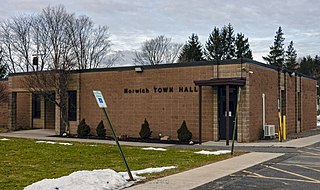
Norwich is a town in Chenango County, New York, United States. The population was 3,998 at the 2010 census.
<span class="mw-page-title-main">Phelps, New York</span> Town in New York, United States

Phelps is a town in Ontario County, New York, United States. The population was 6,637 at the 2020 census. The Town of Phelps contains a village called Phelps. Both are north of Geneva.

<span class="mw-page-title-main">Milford, New York</span> Town in New York, United States

Milford is a town in Otsego County, New York, United States. The population was 3,044 at the 2010 census. Within town is the village of Milford. The town is northeast of the City of Oneonta.

<span class="mw-page-title-main">Unadilla, New York</span> Town in New York, United States

Unadilla is a town in Otsego County, New York, United States. As of the 2010 census, the town had a population of 4,392. The name is derived from an Iroquois word for "meeting place". Unadilla is located in the southwestern corner of the county, southwest of Oneonta. The village of Unadilla is located in the southern part of the town. The mayor of Unadilla is Jason Cotten.

Waddington is a town in St. Lawrence County, New York, United States. The population was 2,266 at the 2010 census. The town was named after its principal village.

References

  1. "2016 U.S. Gazetteer Files". United States Census Bureau. Retrieved July 4, 2017.
  2. 1 2 "Population and Housing Unit Estimates" . Retrieved June 9, 2017.
  3. 1 2 "Geographic Identifiers: 2010 Demographic Profile Data (G001): Guilford town, Chenango County, New York". U.S. Census Bureau, American Factfinder. Archived from the original on February 12, 2020. Retrieved November 20, 2014.
  4. "Census of Population and Housing". Census.gov. Retrieved June 4, 2015.
  5. "U.S. Census website". United States Census Bureau . Retrieved January 31, 2008.
  6. 1 2 "National Register Information System". National Register of Historic Places . National Park Service. March 13, 2009.
  7. "National Register of Historic Places". WEEKLY LIST OF ACTIONS TAKEN ON PROPERTIES: 8/30/10 THROUGH 9/03/10. National Park Service. September 10, 2010.